
Here is the first part of our 158 mile section from Oroville to Ross Lake. It was a few long exhausting days…
Aug 7We both slept in as usual in town. We slowly made our way to a restaurant for breakfast then packed up our things. We began walking out of town a bit before 11. We really enjoyed our time in Oroville and the kindness from the owners at The Camary Motel.
We walked a short bit on pavement to reach the Similkameen Trail which follows an old railroad bed. It was a nice flat grade along the river. After 1.5 miles, you come to a paved road junction, but we just kept walking along the rail trail. We crossed over the river and admired a huge log home on the other side. We saw 3 bald eagles soaring above and had stunning views looking down the canyon at the water. When we came to the end of the trail trail, we were greeted with a gate and no trespassing sign. We had screwed up as we were supposed to begin the paved road walk at that previous road junction. So we added an extra 4 miles round trip. We knew better and should of been looking at our maps. But we both enjoyed our detour taking a break in the shade to cool off before walking the road.
We both have 8 full days of food and an extra half day in our packs. My pack has not been this heavy in some time as I’d guess it weighs over 40 pounds with food and 2 liters of water. The paved road led us past a golf course, lots of sage fields, a few homes, and lots of activity on the water. We have never seen people searching for gold along the river banks. We could hear motors roaring from below and walked past many RV and tent sites right off the road. The sun was brutal and in the 90s. We had to take 3 or more breaks just to cool off. These road walks are tough at around 1,000 feet elevation. But this is what makes this trail so difficult. It is mental at this point. You focus on the steps and ignore the heat. Many hikers hitch hike this section missing one of the many reasons this is a difficult trail to thru hike. I was so happy when we found a piped water source right near a barbed wire fence where we grabbed a bit of cold water.

We passed more cow land and alfalfa fields. There were not many cars on this road either, but the ones that passed always waved. We still see border patrol cars on our road walks. There were also lots of dead snakes on the road. We walked through the small town of Nighthawk. There is a population of 7 people here, but it was a much bigger town during the mining era. We crossed the bridge after reading about the town on an informational site. A man from the first house on the right stopped us to have some cold water. Scott told us all about the town and his partners family that has lived here for many generations. The cold bottled water, comfy chairs, and two dogs made my afternoon. Scott was wonderful and his kindness made me so happy. All I needed was some cold water a little break to feel much better. We bid our farewells and keep walking. Thanks Scott and I’m sorry we didn’t get to meet Wendy.
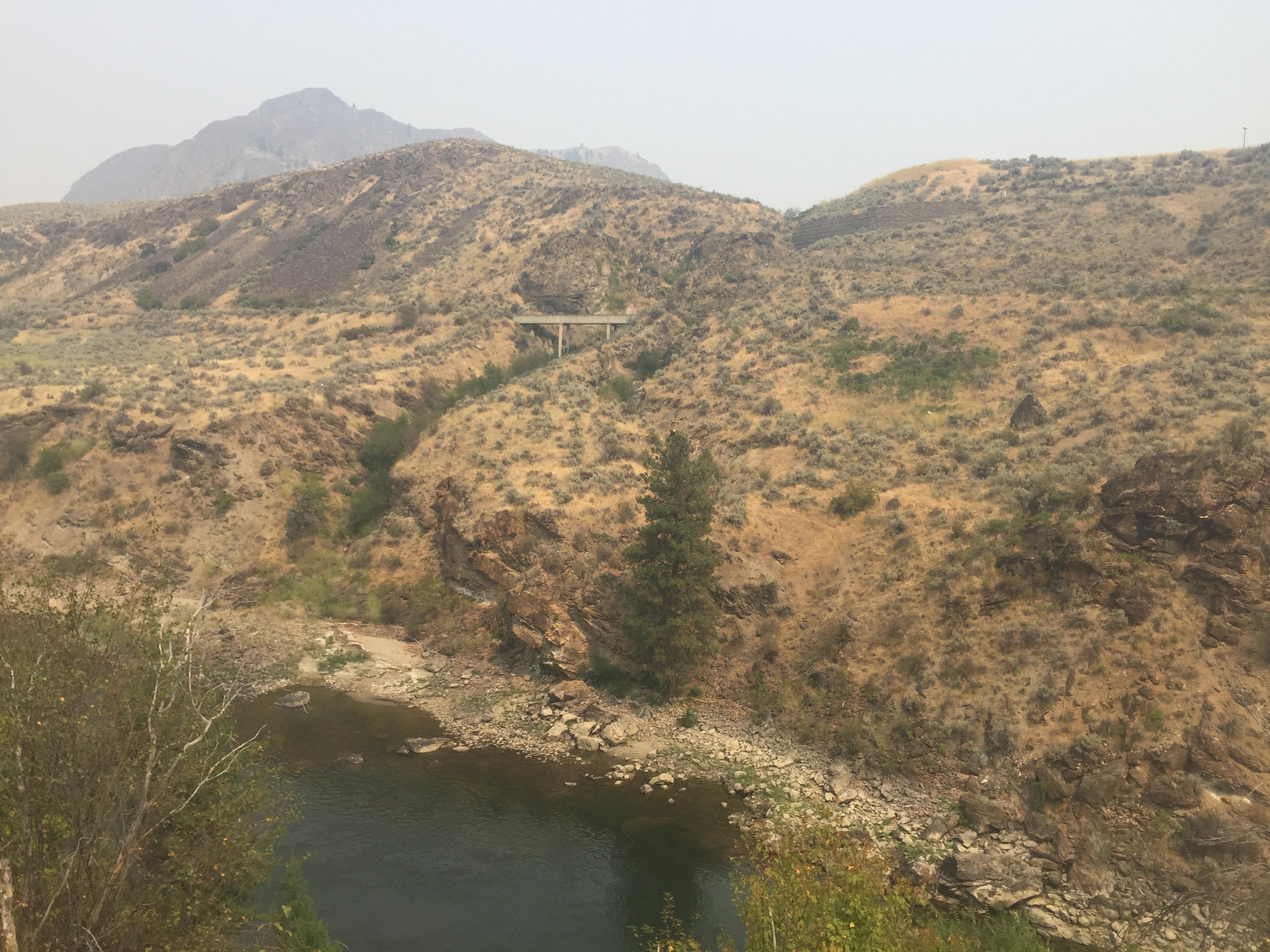
The evening miles led us past a mine and high desert landscape. We passed an old mine sight and a few abandoned buildings. We saw over 40 deer including some gorgeous bucks. As we walked close to the river, he pointed out a large black bear. What an eventful evening!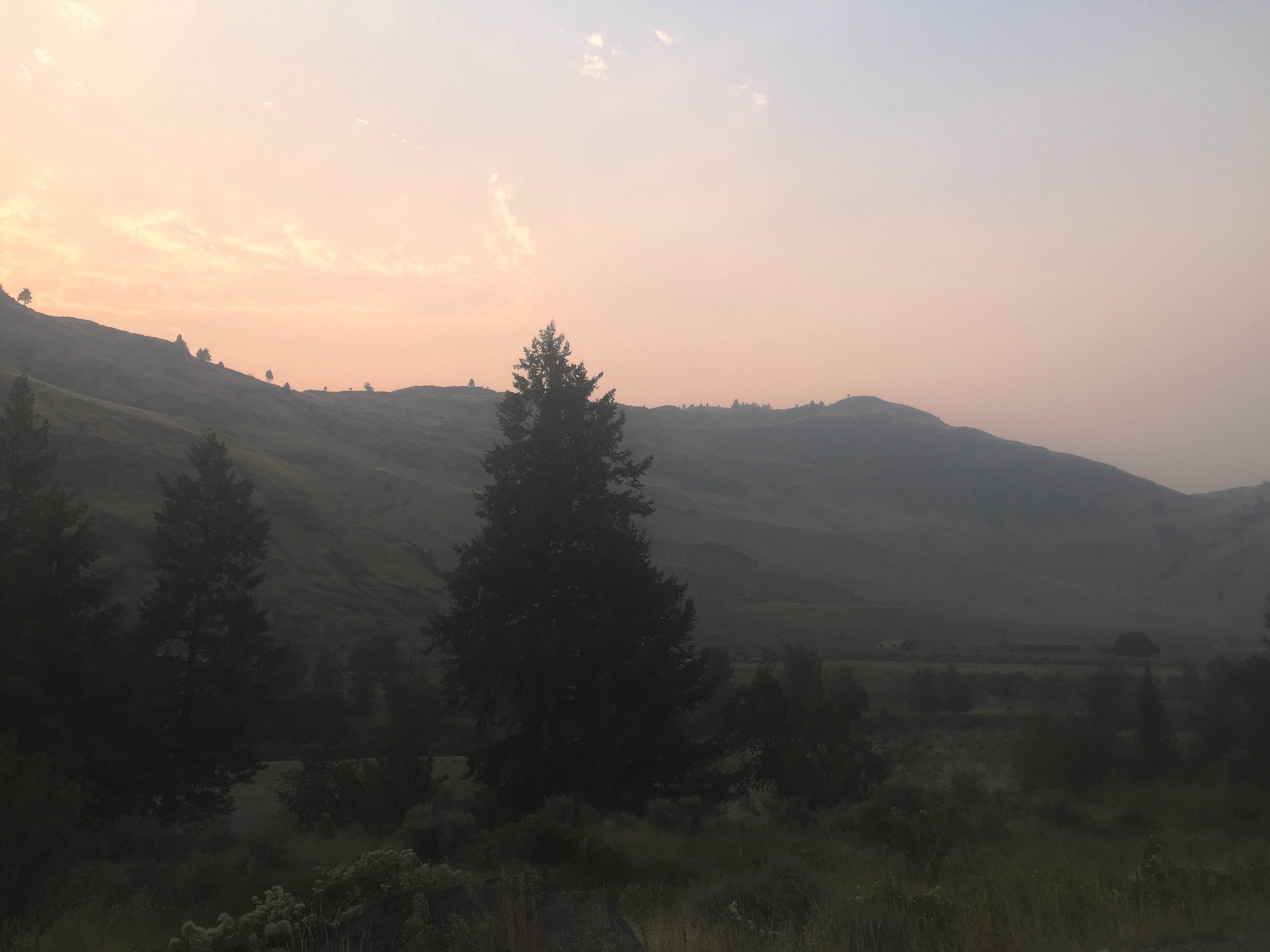

We had hiked 22 miles total by the time we arrived at camp and remember 4 were bonus miles. Our backs were very sore, we were sweaty, thirsty, and hungry. It was grueling and exposed road walk. We came to Palmer Lake and set up near the water. People were riding boats by the lake and an RV had a generator roaring until 10pm. We rinsed off a bit in the warm water before eating dinner. The sun appears to be on fire since there is smoke in the air. It wasn’t the most ideal campsite, but it worked out fine being right off the road. We were both exhausted today after 22 miles after 11.
Aug 8
We woke up at 5 this morning in hopes of beating the heat. We crushed some pavement miles walking along the quiet road in the morning hours. On older man putting mail in the box said “you two are up early” as we walked by him before 7. We passed a mile or more of orchards. I couldn’t even identify some of the fruit, but I was craving a few of those apples. We hit 600 miles before stopping at the boat ramp area. We filtered more lake water, ate a snack, and used the privy before more road walking. The sun peaked over the mountain and our time of sweat free road walking ended. We passed more ran land before turning down Toates-Coulee Rd. We had to climb over a barbed wire fence and get down to the stream. It is likely contained with fertilizer run off, but we needed water. It didn’t taste too awful. We walked another two miles to the point where we turned off of a paved road. By the time we reached this point, we had hiked 27ish miles of pavement. Ouch! 
We turned onto Chopaka Grade Road which Scott had warned us about. We climbed a very steep and steady grade uphill in the hot sun. We kept saying “look how far up we came.” The smoke in the sky affected the view back to the valley and we couldn’t make out Palmer Lake, but we knew where it was. We passed lots of cattle in this area. The trail guide tells us we climb over a gate marked “no trespassing” but it is DNR land. We simply opened the gate and passed many new signs as well as a recent gate. We just continued onward hoping this is still DNR land.
We had a long lunch break before beginning a climb. The trail was steep up to the cow trough which had bones of some small animal in it. Luckily, we got filter water from the pipe flowing into it. After this water break, I managed to get us off the trail. The guidebook warned that there were many cow trails and we sure took one. It took us a long time and some thorny plants to get back on the trail. The trail climbed steeply on loose sand as we were both exhausted from all the climbing and 7 days worth of food on our back. We came to the gravel road and wished we would of just walked the road instead of the “trail.”
The road lead uphill to the Cold Springs Campground. We even passed a Christmas tree decorated with lots of found objects from the woods. We finally made it to the highpoint of the day and onto a trail. We crossed two newly built bridges of streams and dipped into a burn section. We ran into some forest service crew out with horses and doing some trail work. We found a campsite near a stream surrounded by small dead trees. We hiked about 22 miles today and our bodies are sore again.
Aug 9
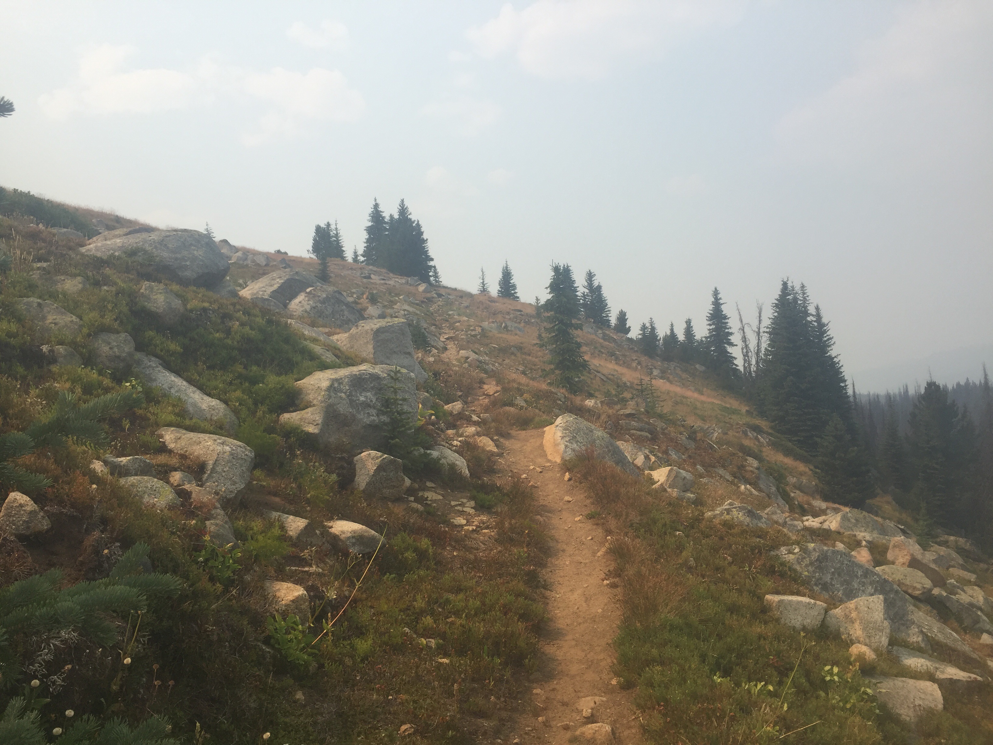
This morning we were treated to a recently groomed trail. It was steep to start and led towards Goodenough mountain. Yes, I love that name. The trail followed what seemed like cow paths along sage brush. We even scared a few cows in the sage brush fields, but most didn’t seem to mind us. The suns is a bright orange today due to the smoke in the air. 
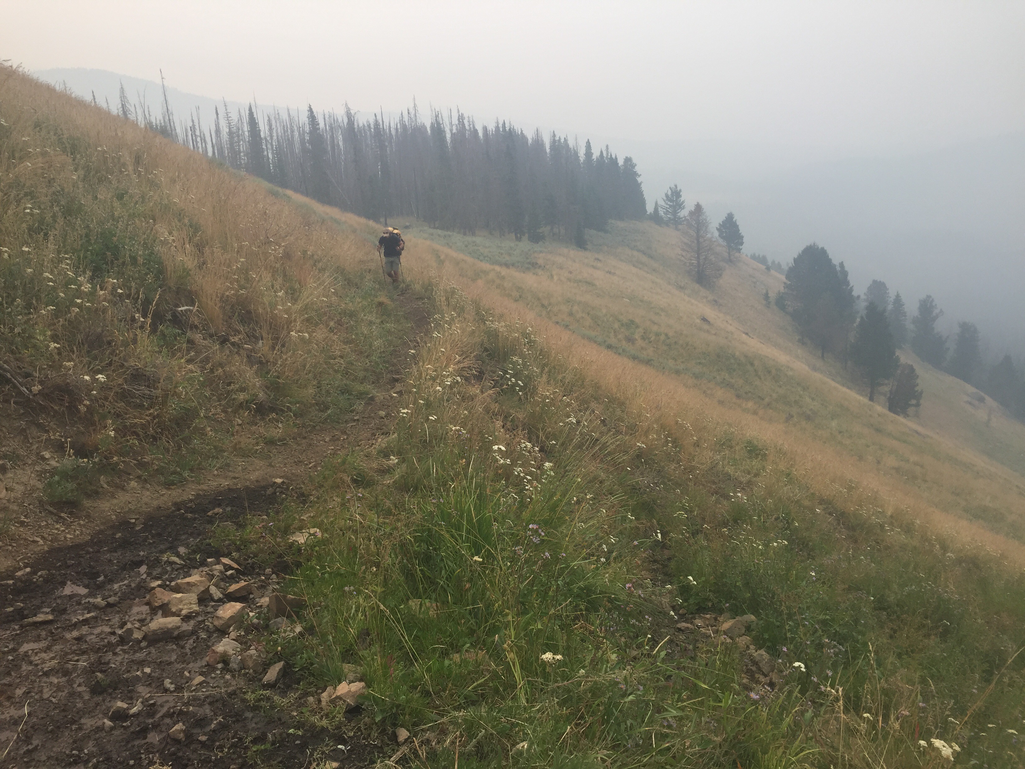
We crossed into the Pasayten Wilderness. We found where the trail crew had stopped working. They appear to be building fences soon to keep the cows out of the wilderness area. We are in a large burn section so we had to jump a few down trees. We were pleased to find a maintained trail again a bit after this point so it was smooth walking. It is eerie to see hundreds of dead trees standing all around and know at one point they will all fall down. The crew even chopped down a few big ones that hadn’t fallen yet. Thank you!! 

We came to Horseshoe Pass after some beautiful high elevation field and meadows. I feel like I’m on the PCT again as we were surrounded by big mountains that are unfortunately burned. We passed Rock mountain, Hagie Mountain, and Teapot Dome along the way. Cruising at a good rate thanks to the recently groomed trail. Scheelite Pass was unimpressive as we began dipping a bit lower. The black flies have been awful today as I killed at least thirty at each break. Have you ever taken the time to really examine bugs? I’ve been doing this a lot on the past few trails. There are so many species and strange looking ones. I watched a hornet tear up and eat a horse fly that I killed. I’ve watched hornets fight each other over dead bugs. Sometimes we get too busy looking at the mountains to examine the ground creatures.
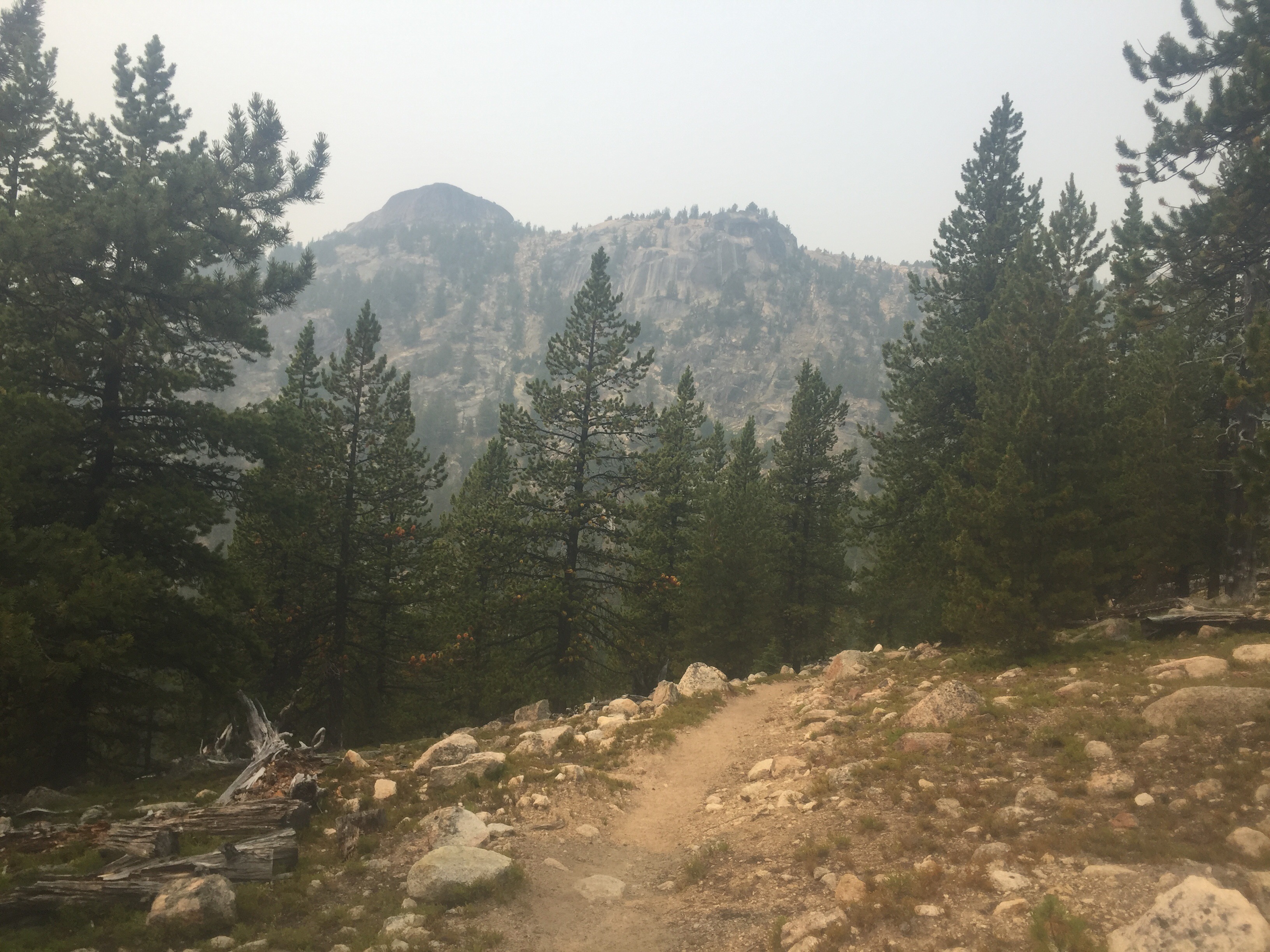
We made our way to the location of the Tungsten Mine. There is a small cabin and a large living quarters still standing. Wolframite Mountain peaks out behind the camps. We spent time some time reading a few typed pages about the history of this mine from a personal account. It is difficult to imagine the struggles the men endured simply getting up to the mine from town. We tossed a few horseshoes, toured the old bunnies that are infested with mice and a big bunny. We decided to back track and camp at a nice site near a stream a bit before the mining junction. We are hoping the smoke clears us soon. 


Aug 10
The smell of smoke still catches me off guard every morning. We stopped by the mine site to use the privy and toss a few horseshoes. The morning started with a climb towards the pass. We hiked together talking about our options for next summer. There is so much left to see and a few more hikes we would like to conquer, but who knows where life will take us.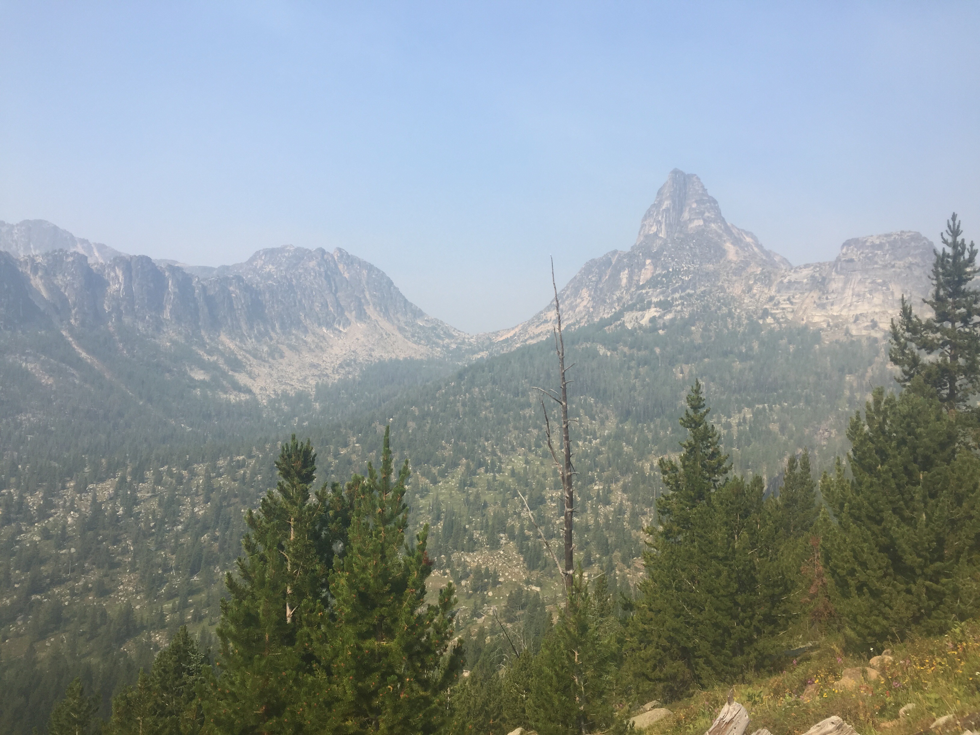
The sky was beginning to clear out as we climbed higher towards Amphitheater mountain and Cathedral Peak where we watched two rock climbers scaling the peak. We neared closer to Cathedral Pass and was rewarded with stunning views including looking down towards Upper Cathedral Lake. Now this is my type of hiking! We took a short break at the top before crossing to the other side of the pass. Beautiful!


We passed by the lake and enjoyed walking a nicely constructed trail with little elevation change for the first bit. Pieces of ash from the fire were floating about in the sky landing on the flowers and the many berries. It seemed like a slight snow storm, but was actually ash. We dipped downhill for miles and miles as my knees began to ache a bit.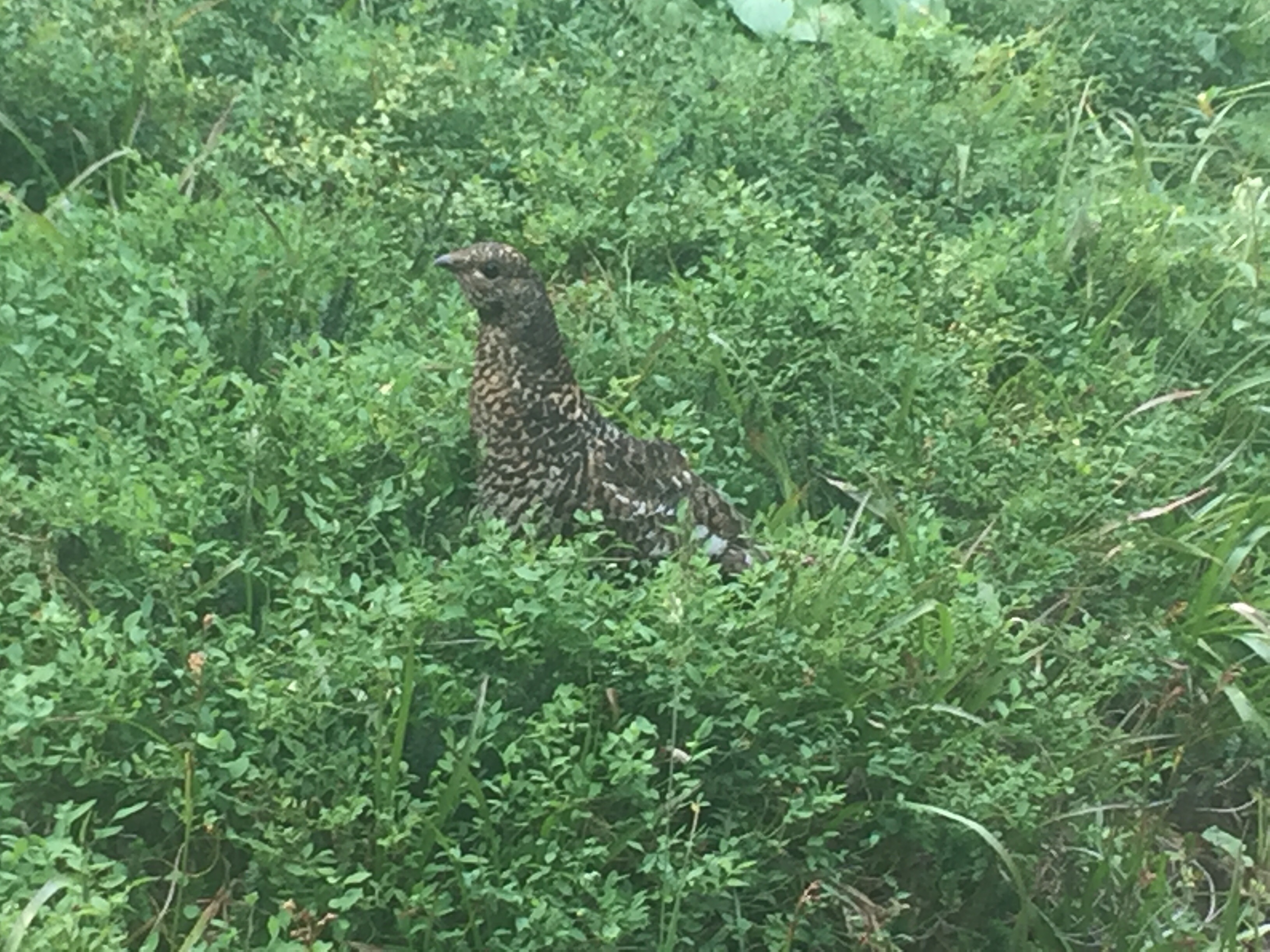
We came to the old shelter that has a white Blaze on it. The only way it resembles an AT hiker is that is similar in design, but trust me all the AT shelters are much better maintained. I certainly wouldn’t sleep in there. There we some night campsites here, but we thought we could ford the Ashnola River tonight and camp on the other side. I put on my crocs crossed the water and searched for a campsite. Nothing looked as nice as the other side. So we forded again and set up away from the shelter.
We went down to the river to take a bath. Before I lost my nerve, I was in the water past my stomach. Our clothes are drenched in sweat making them crusty. My legs were filthy and a bath felt wonderful. I rinsed off cleaning my clothes and myself. I also think someone will walk by as I’m naked on the river bank, but not this time. I put on my sleep clothes and returned to the tent to dry out. The bugs were awful so we both jumped in the tent to review the maps. It was still early so we waited a bit to cook. The flies didn’t get any better so he let me eat in the tent. Today was a nice 15.5 miles of hiking, sleeping in, and having time to relax at the end of the day.
Aug 11
This morning may have been the coldest yet. It still smells like smoke and our tent was covered in fine ash. We are in the canyon near a river so that had something to do with it. I actually got some use out of my down jacket. We ate then headed down to ford the Ashnola river. It was cold, but I expected worse. My toes were numb as I struggled to put on my socks and shoes. I threw off my jacket and began the uphill with goosebumps and little feeling in my toes. Thankfully I was sweaty and thawed out quickly thanks to the uphill towards Pevee Pass. Part way up the climb we came to a sign that said “Bridge is out” as we took the steep downhill and did a short rock hop. The former bridge was evident as it hung above the water. The note on the other side said “bridge is gone.” The uphill continued as I forced him to go first to clean out the spiderwebs. 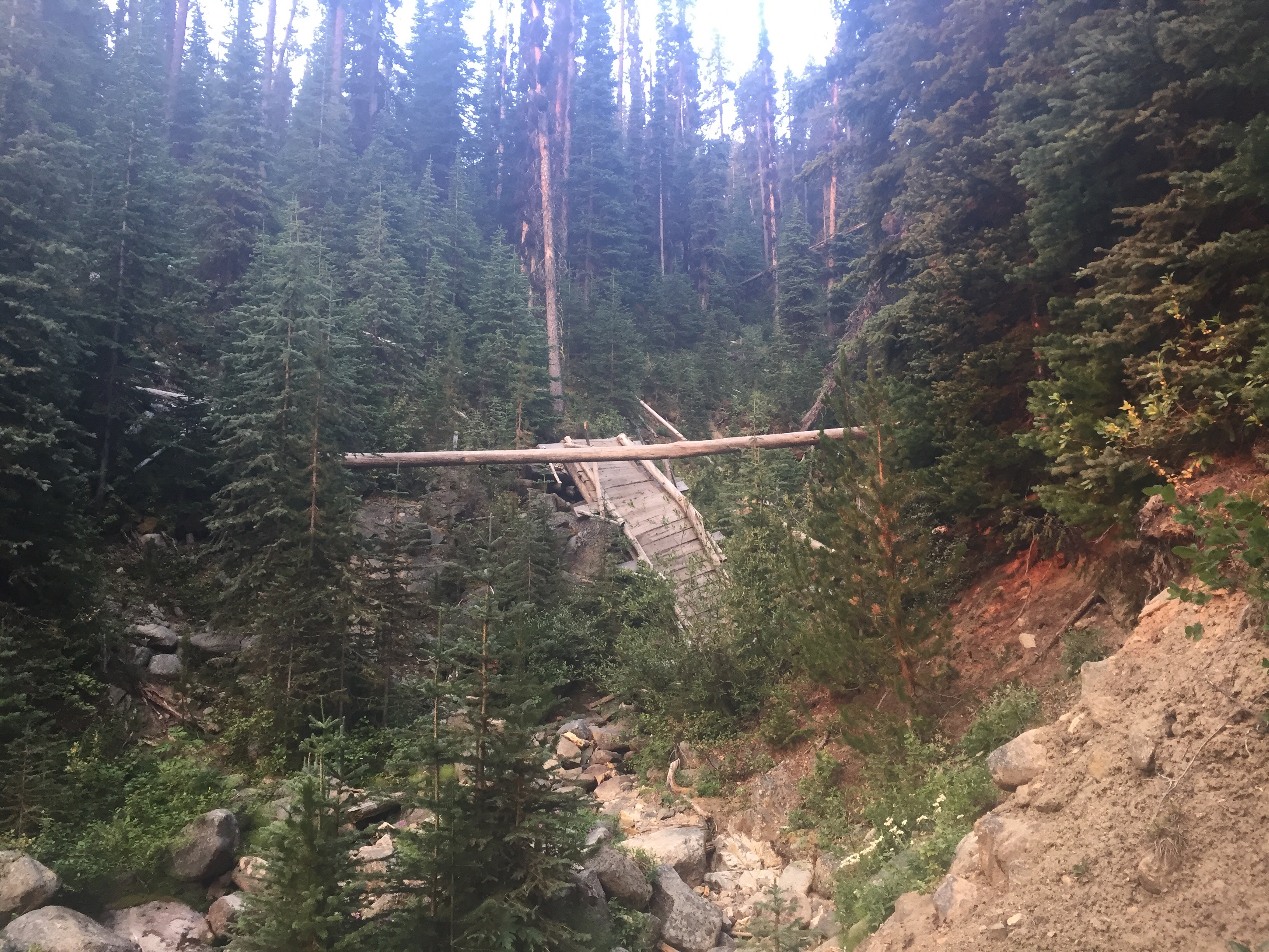
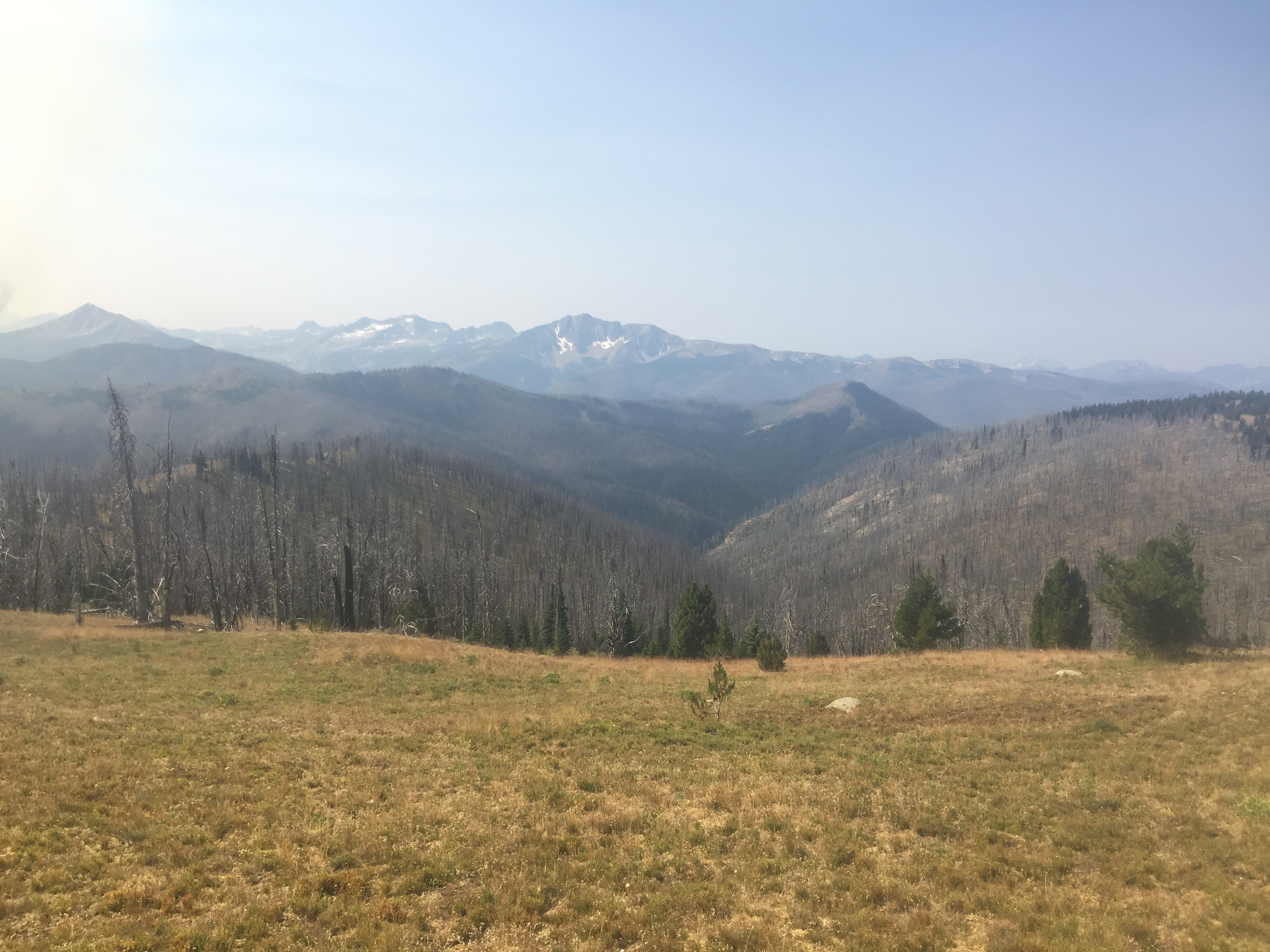
The packs are feeling lighter, but those few long days still have me a bit tired. I zoned out to a podcast as we climbed. Once we reached above tree line we could see smoky mountains in the distance. After another turn, we could see a clear mountain. We could watch the smoke moving over one of the peaks and looked ahead to clear blue skies. We may be escaping the smoke soon. 

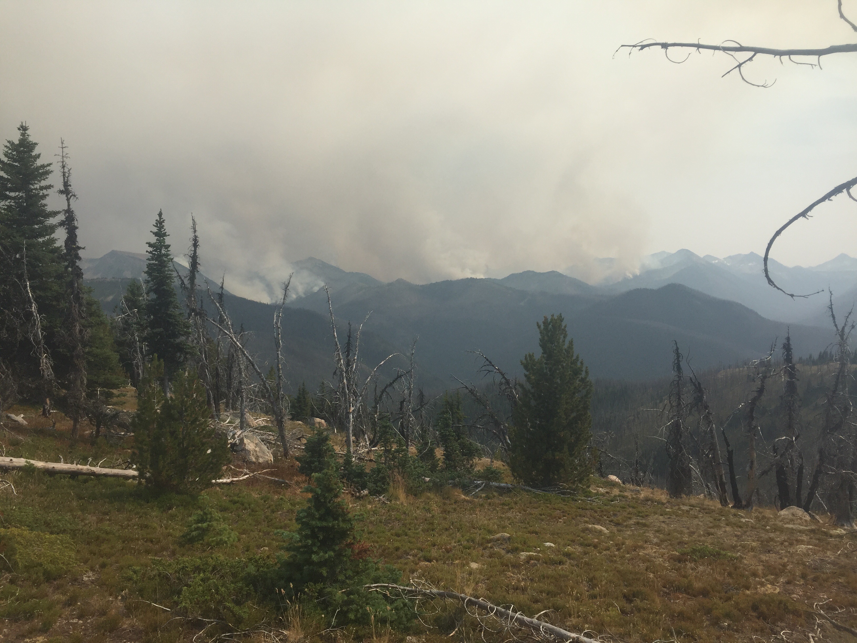
We had a few up and downs today, but a good portion was on a ridge walk. I spotted our first coyote of the trip running downhill into an old burn section. We enjoyed the views from Bunker Hill as we watched the flames of the fire and looked into Canada from the other direction. It was so eerie to watch and unfortunate to know human error caused so many thousands of acres to burn. Don’t have a campfire if you don’t know how to put it out! 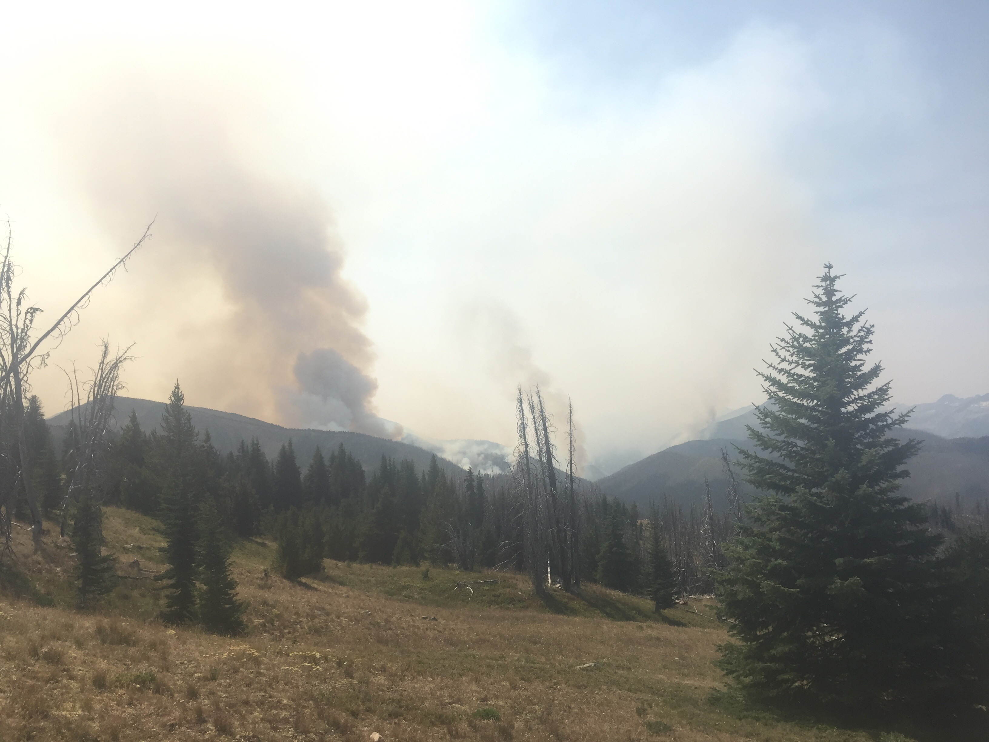
The rest of the afternoon was a nightmare. Our guidebooks warned us of this section. Many years ago a fire raged through this area and the burnt trees are still falling. I’m guessing I climbed over 120 trees today. So many scares and bruises were added along the way. It was slow going and tiresome as the pack jerks around with every step. We took a break together at a stream exhausted and mustering up the courage to continue on. We had no choice since there is not safe place to camp. We did find a few raspberries and blueberries to brighten the experience. We came to the first ford where we carefully walked a fallen tree over the water. Embracing the ballerina in me! We then entered an every crazier section where the trail under the fallen trees disappear. We did a steep downhill bushwhack following others footprints then began stumbling around along the banks of the Pasayten River. 

We had enough of wandering around in the brush and down trees so we headed towards the water. We found a sandy beach where we took off our shoes to ford the river. The hope was there would be a campsite right on the other side. The water felt wonderful on all the scares on my legs. We were disappointed to find just more downed trees and no campsite in sight. It was about 8:30 and the sun would be setting soon. We ran into a trail maintainer who led us in the right direction, but we choose to camp before the bushwhack ended. We did not have the energy to climb any more trees. We camped between fallen trees along the Pasayten River. I was too tired to even cook a meal so I just had a few snacks and relaxed. It has never felt so good to lay down then it did tonight.
