Pasayten River to Ross Lake

*Part two of our hike out of Oroville to Ross Lake, Highway 20 at East Bank Trailhead where we hitched 54 miles into Winthrop*

Aug 12
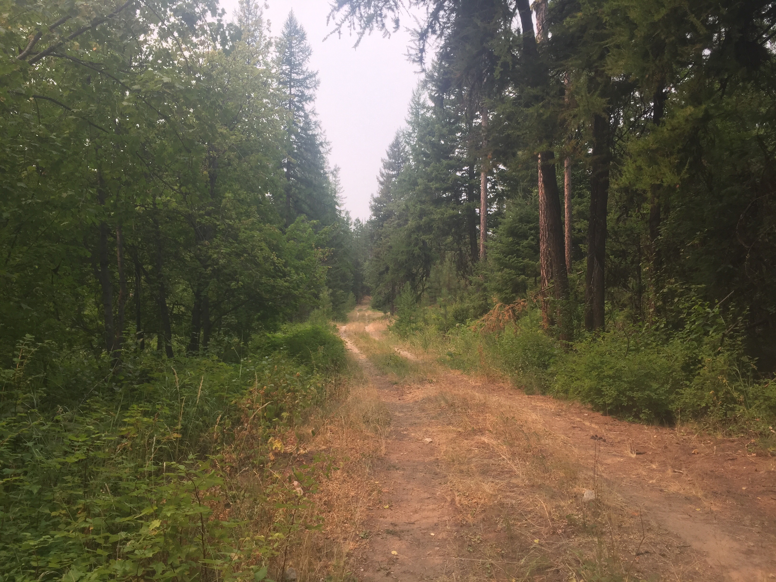
We were exhausted this morning like usual after a long section and heavy carry. Our morning started out with a bushwhack again. We had to find our way back to the trail. It took over half an hour and some big steps, but we made it back to the newly maintained trail. Thank you to the trail maintainers for all the hard work you do. We cruised along admiring all the recently cut trees. We laughed because in four days the section that was a nightmare yesterday will be cleared too. It’s all about timing! We were a bit off this time.

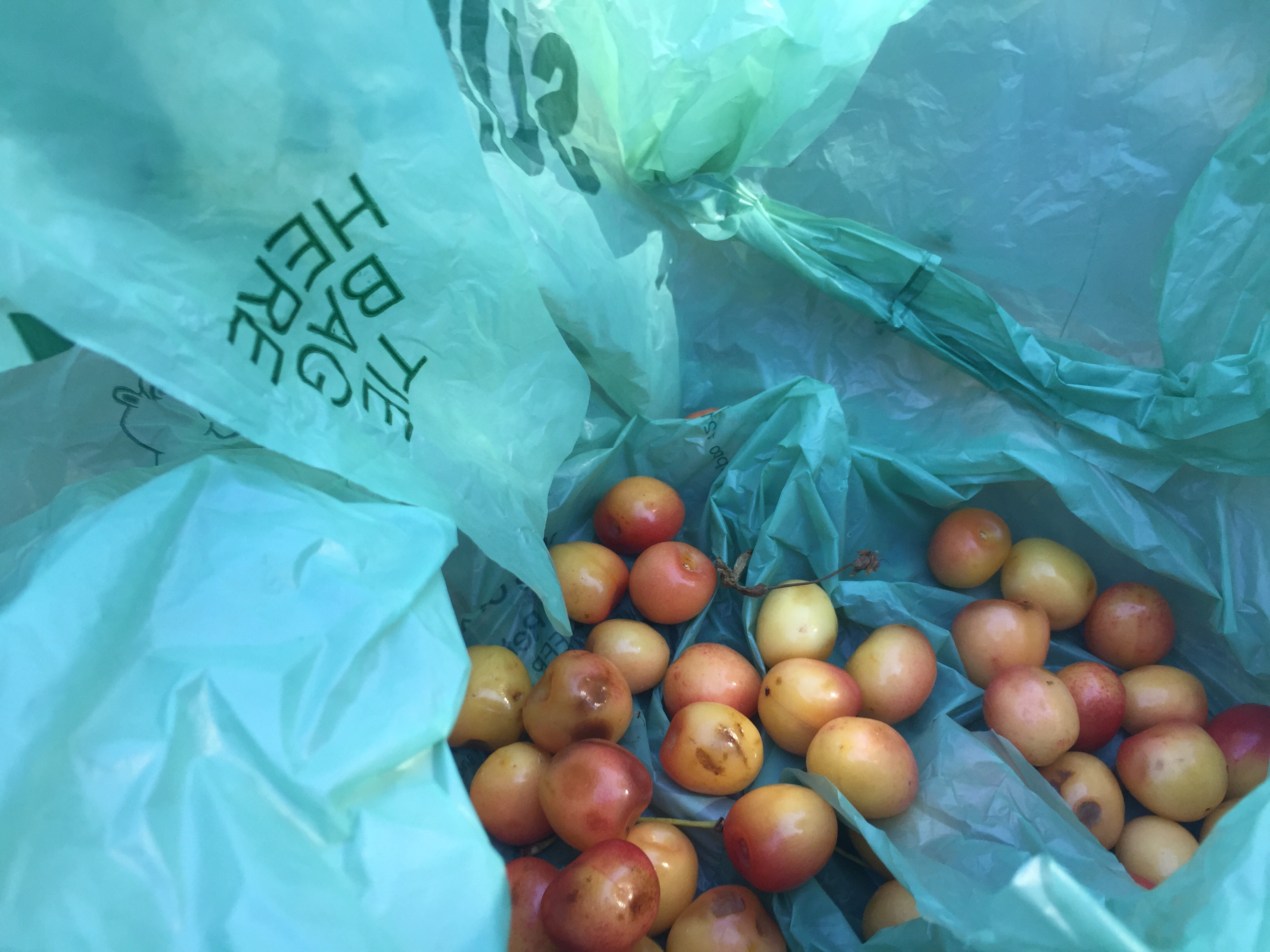
We took a morning at Soda Creek before rock skipping across it. The trail climbing uphill a bit and passed through the Pasayten Airstrip. We both zoned out to our Podcasts and I ate so many thimbleberries, blueberries, and huckleberries! We were in the forest most of the early afternoon and only had to jump a few down trees. We walked past Deadmans Lake which I thought was a funny name.

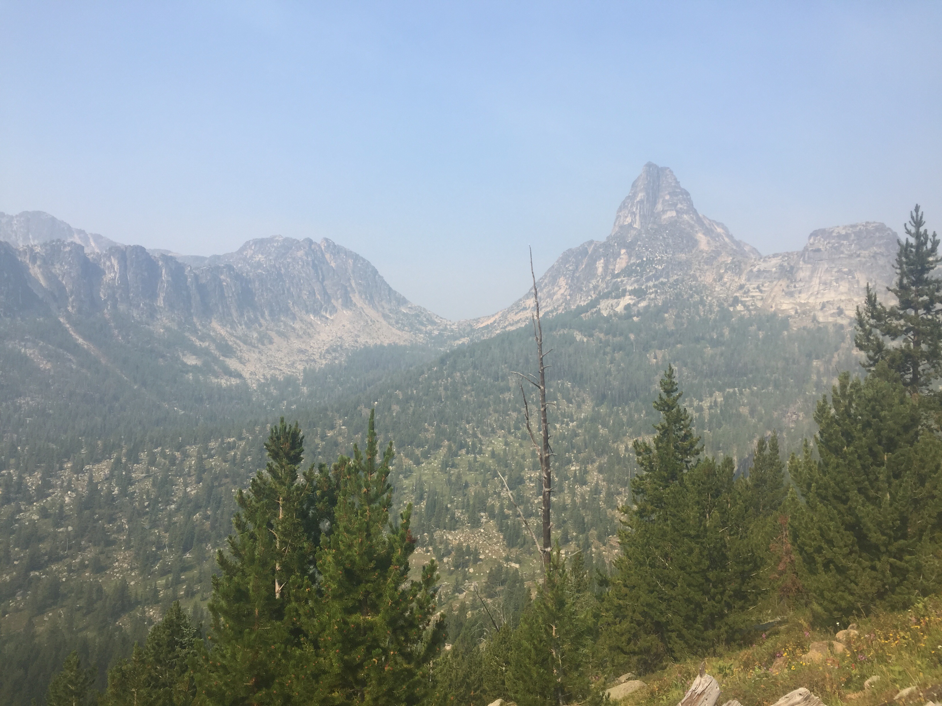
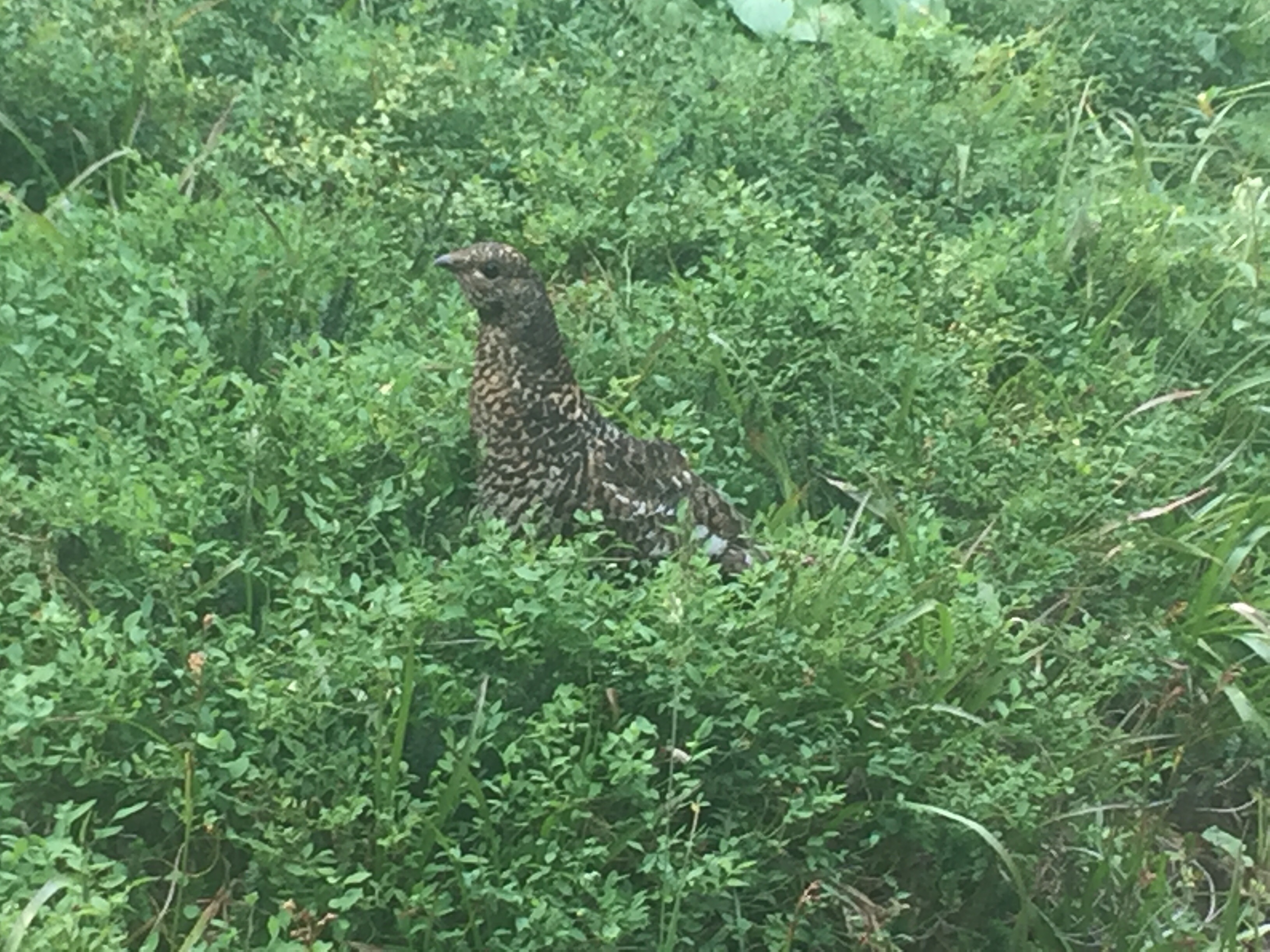
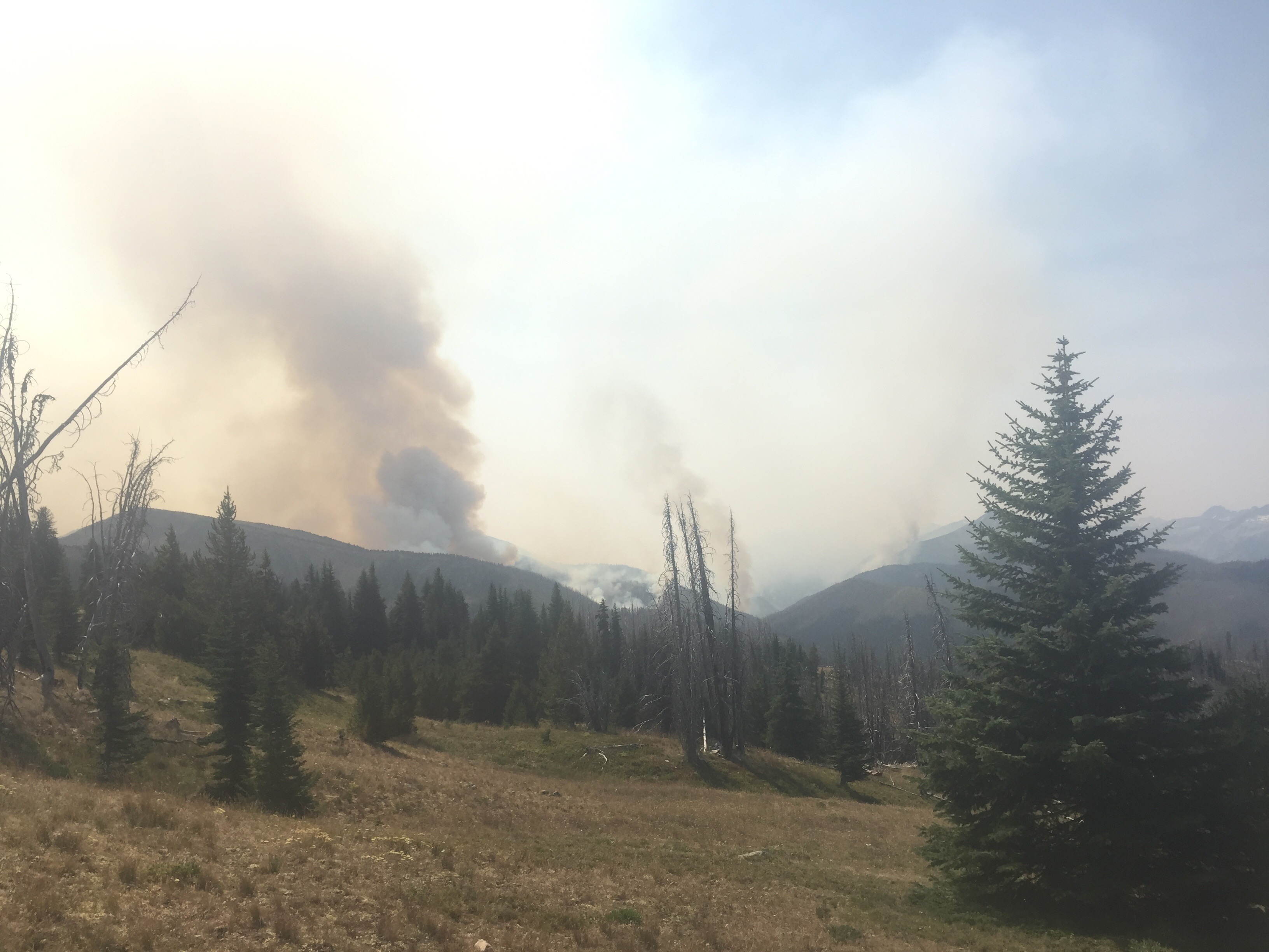
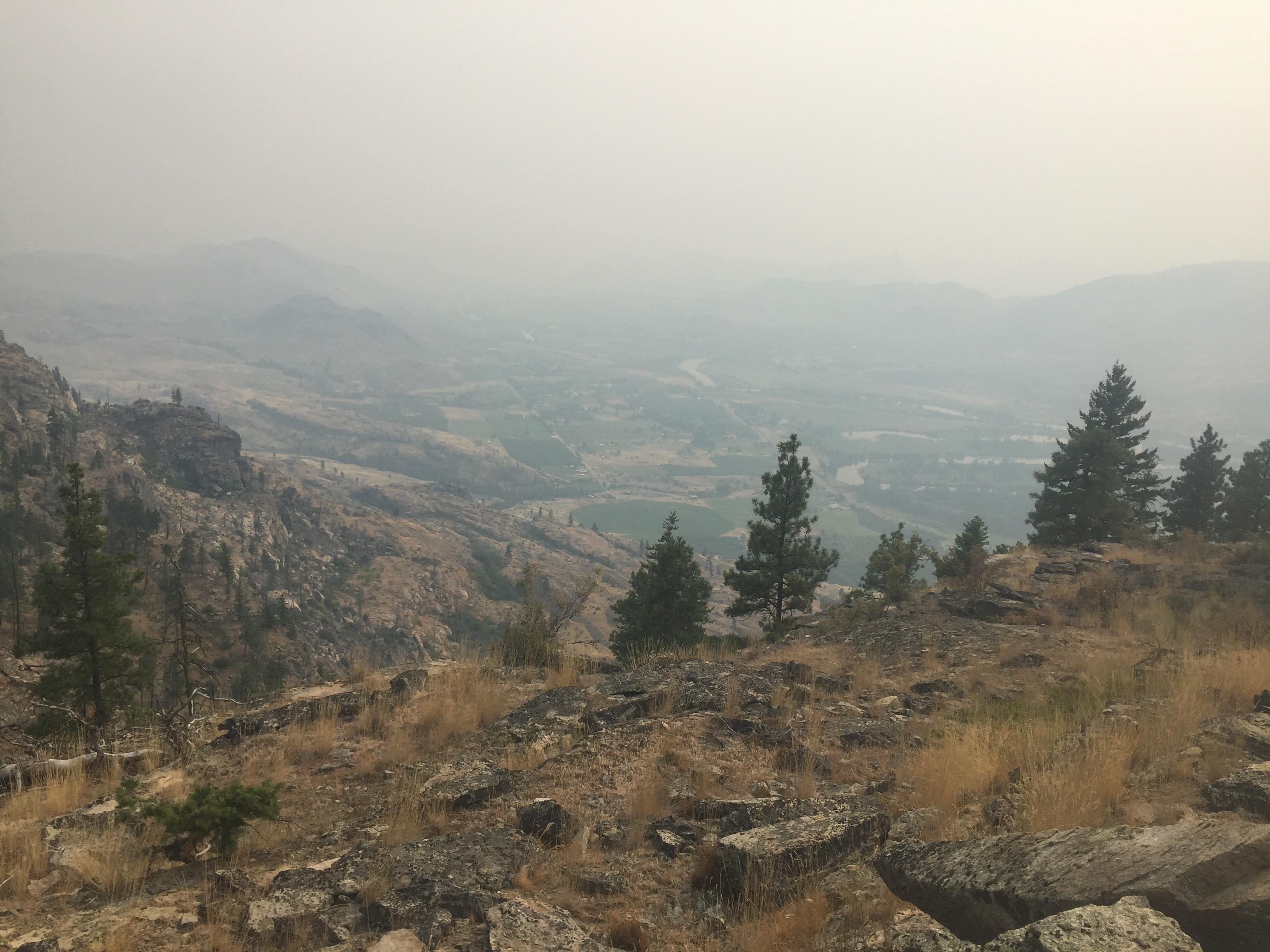
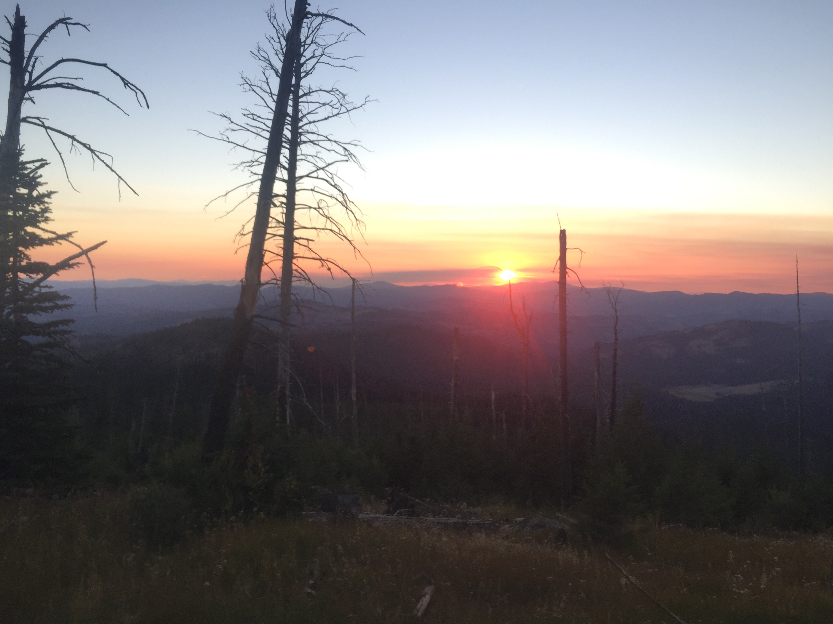
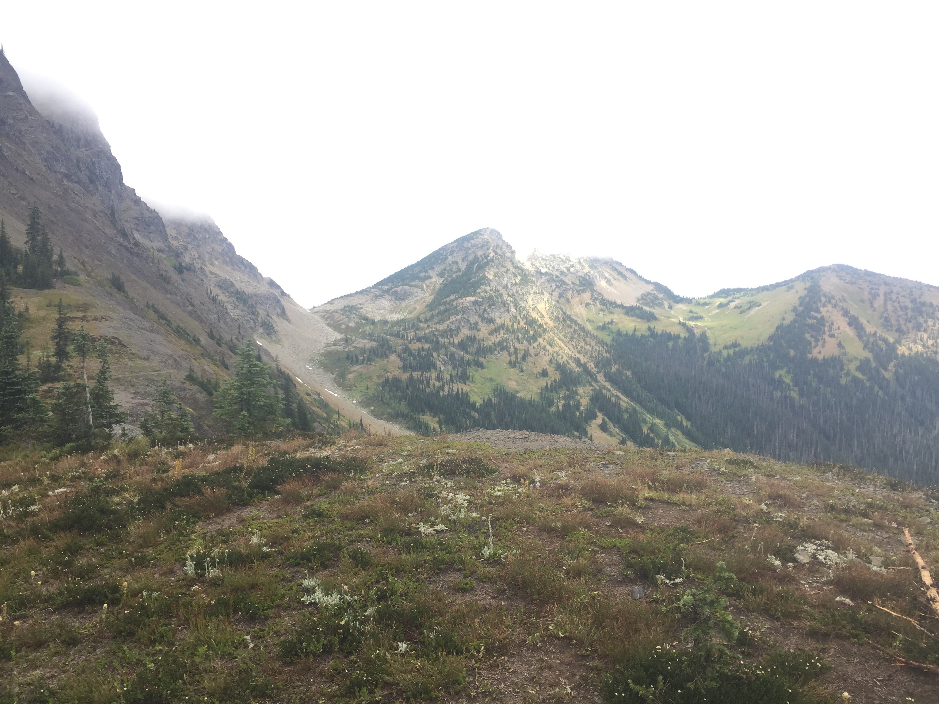
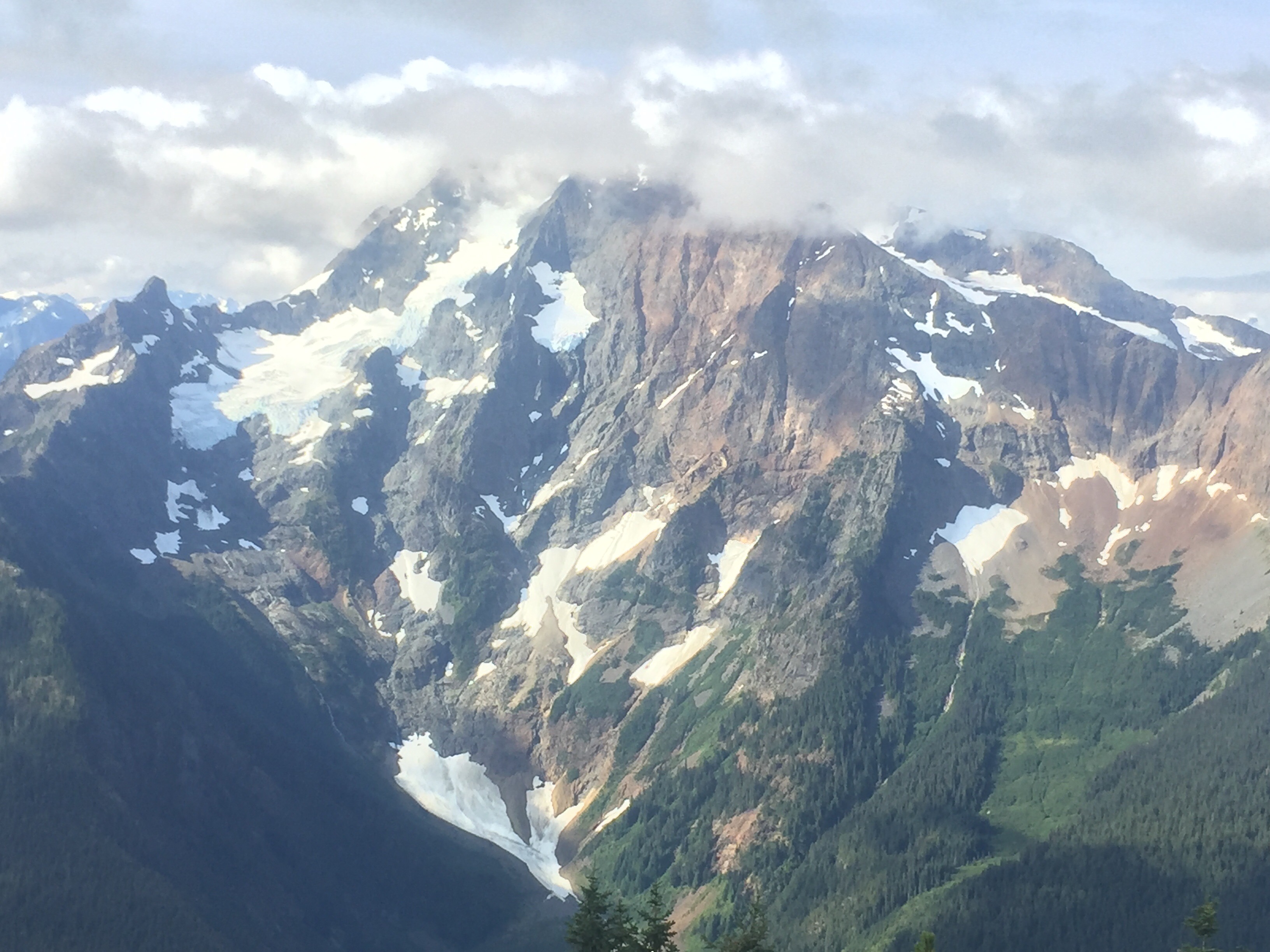
We followed many nicely graded switchbacks up to Frosty Pass. I love Washington! The trail climbed up to the ridge and rewarded us with huge views that I had been so close to on the PCT, but had never seen. As we looked at a mountain, we saw two bears munching away on berries. One was a black bear for sure and the other was more blonde. The second bear was farther away as we tried to see if it had a hump on its bad. We couldn’t tell, but it might of just been a sun bleached black bear. This makes 6 bears for me and 7 for him! 

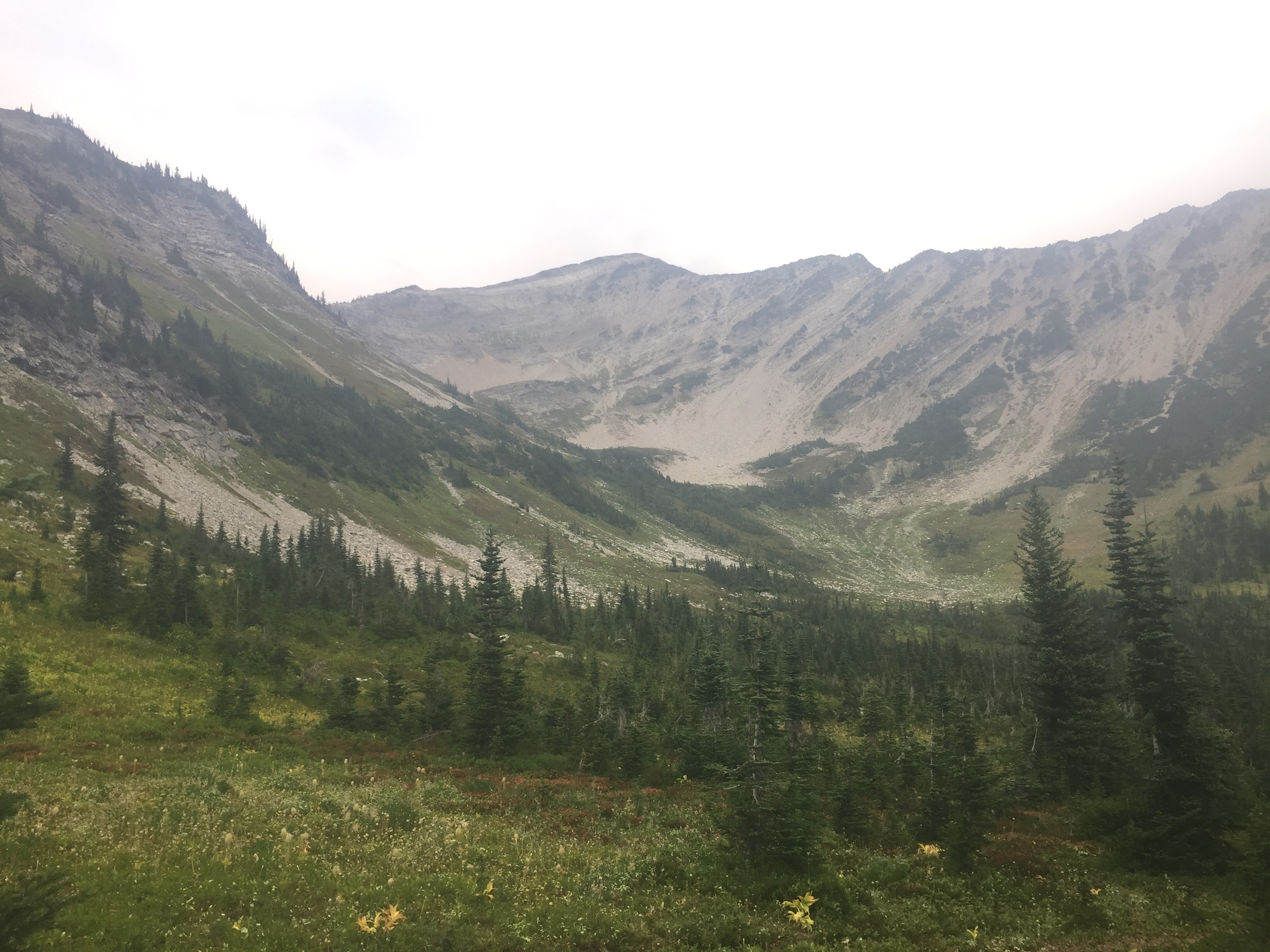
Two bears in the photo above…

We crossed the pass and took a quick break. I noticed my fanny pack was wet and smelled like Deet. I had a small bottle of it in my pack and it had leaked. I forget to change the zippy bag out. It had leaked through the fanny pant and was eating away my spandex shorts. It was a mess! So I spent this break cleaning up everything in my fanny pack and trying to get the Deet off my leg. Yuck! 

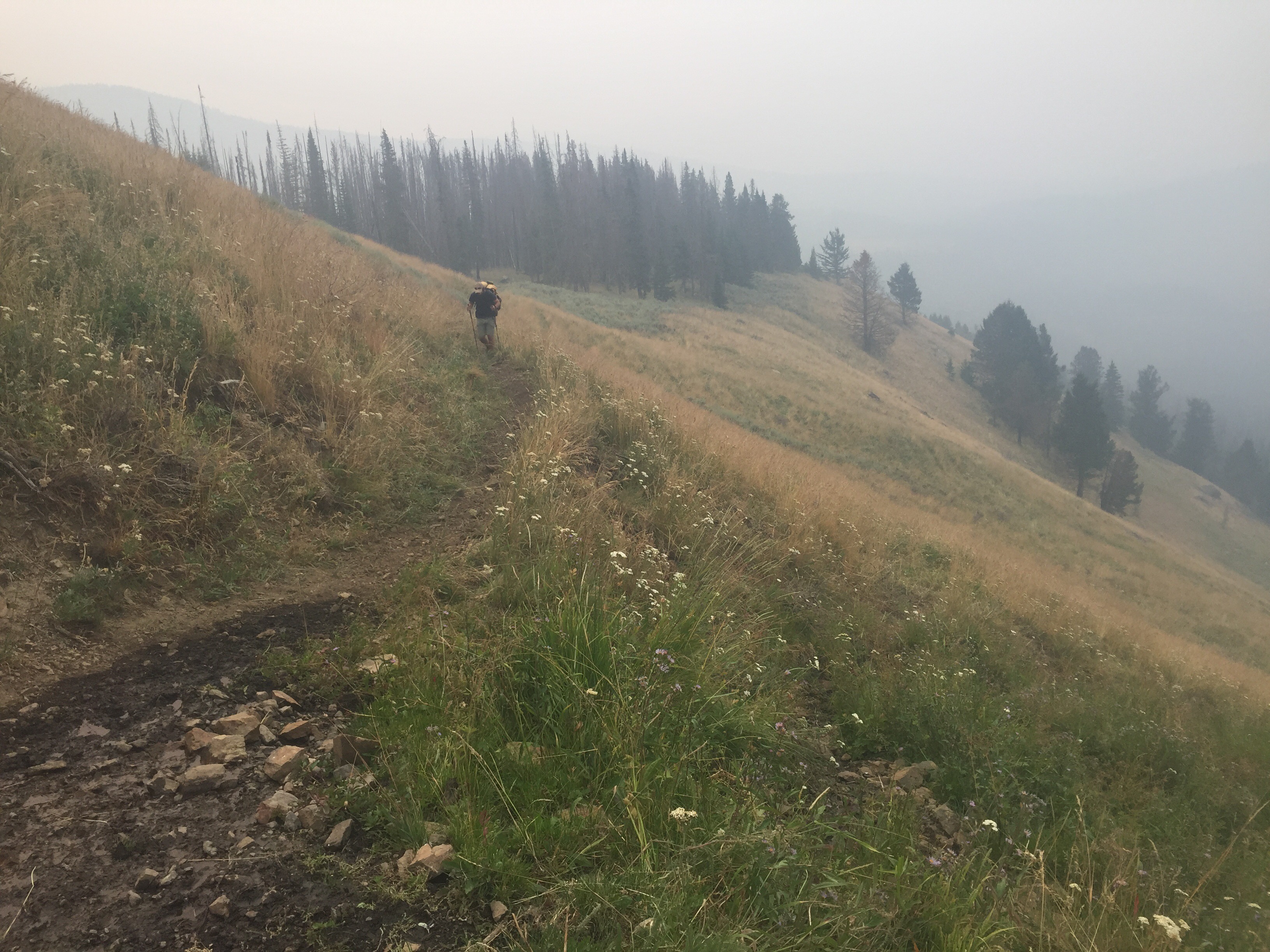
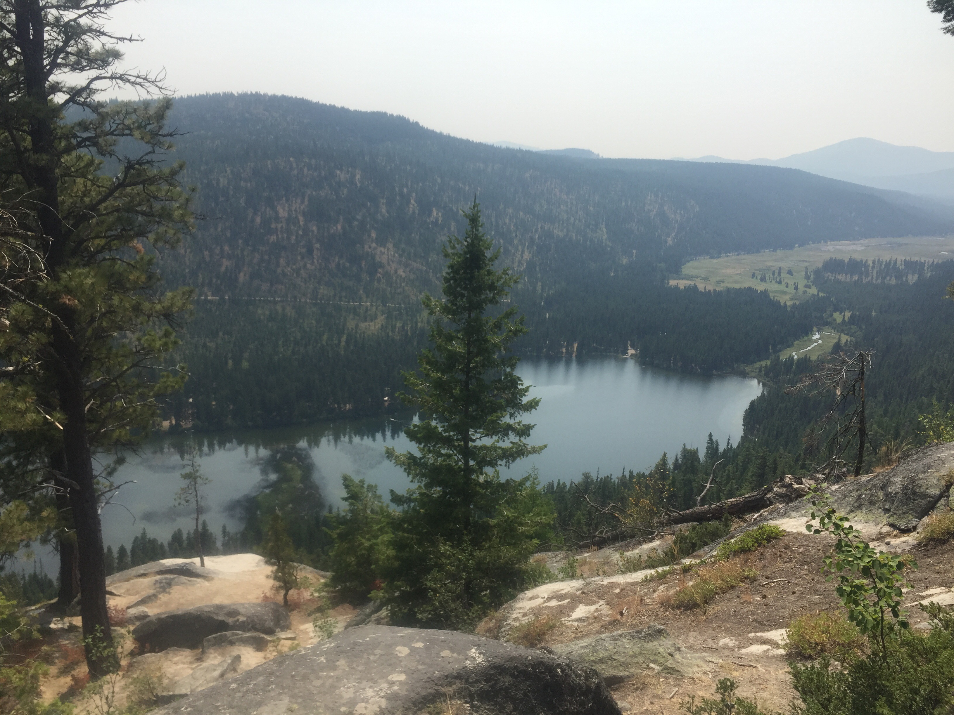
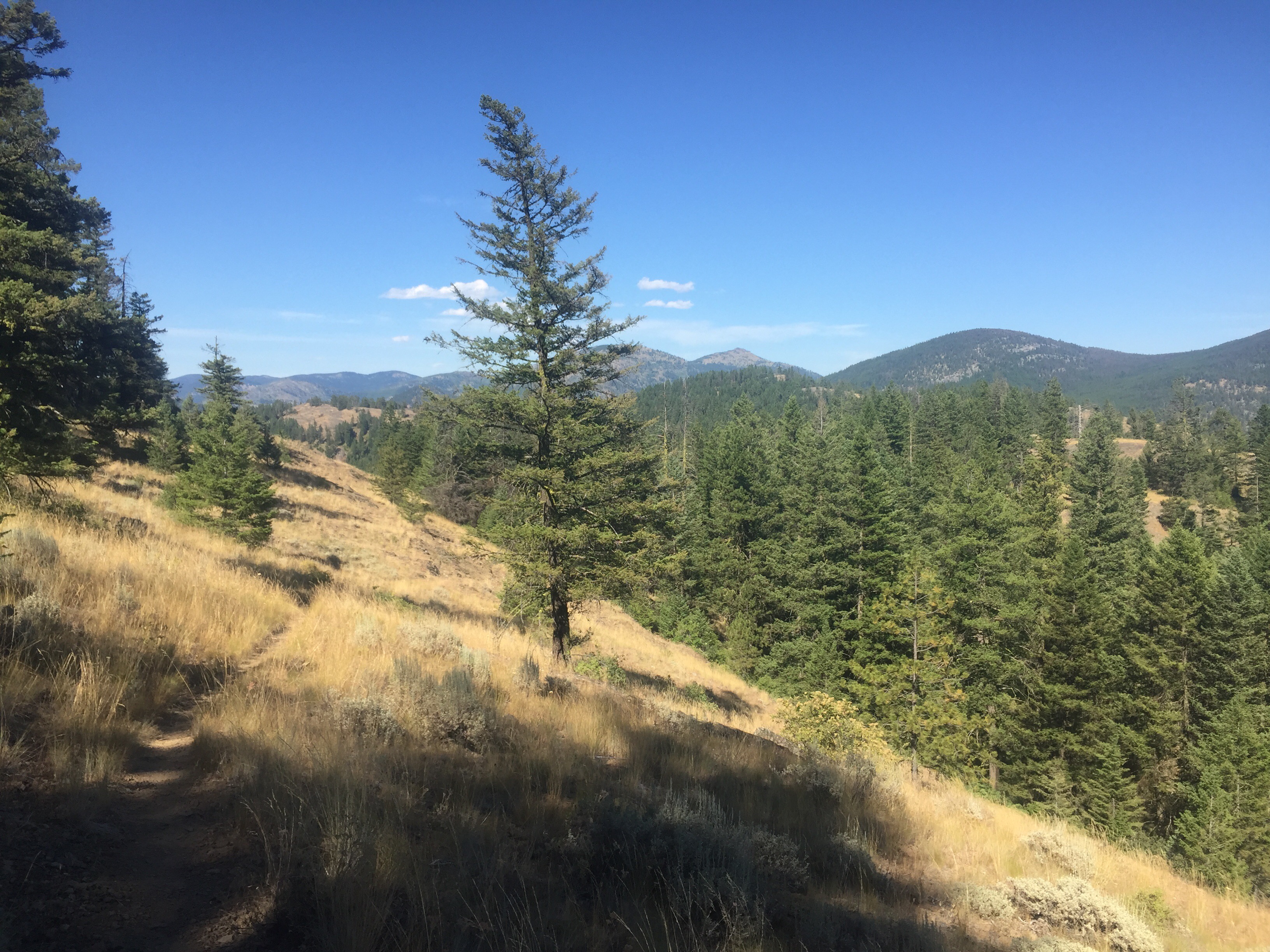
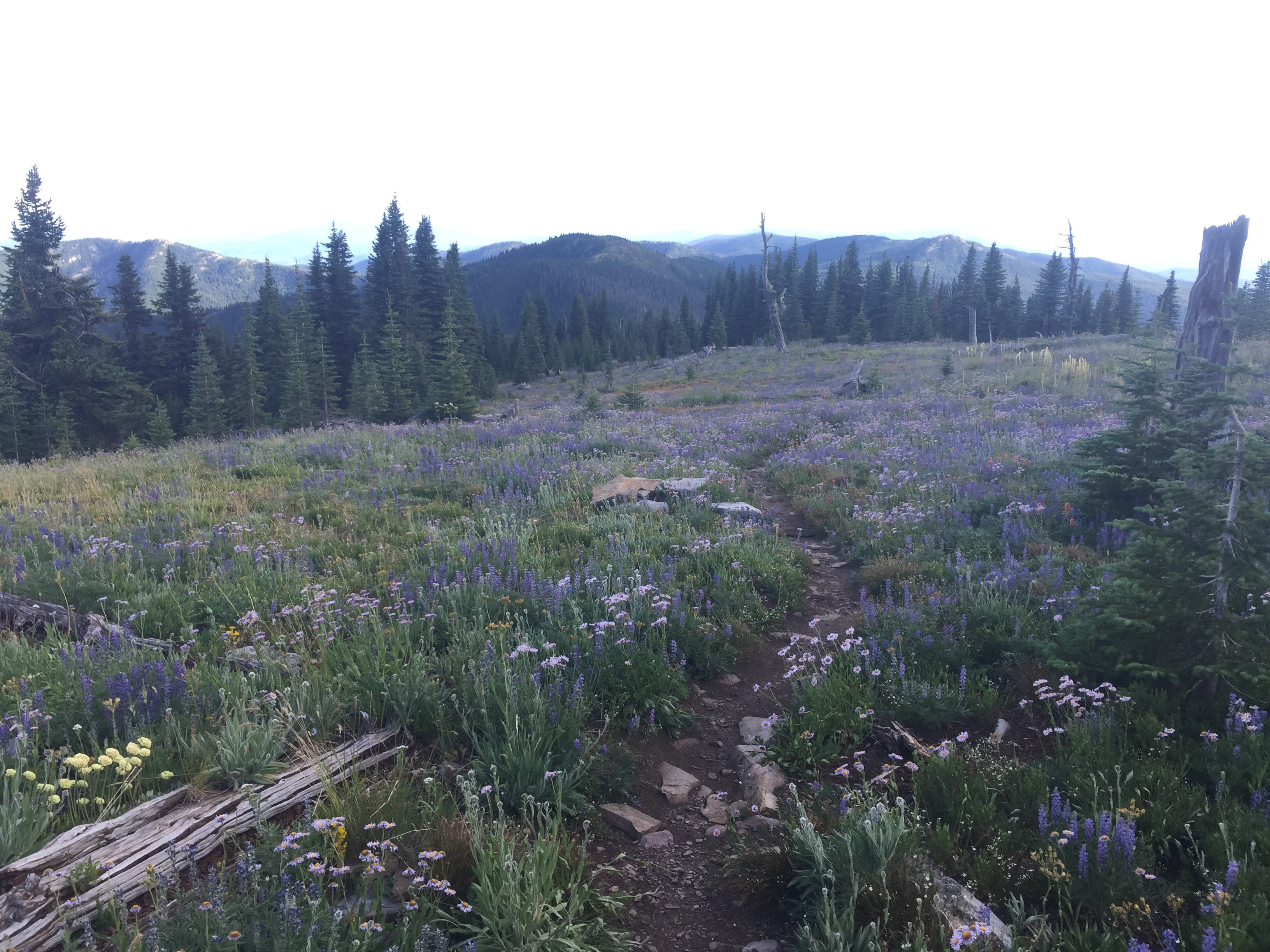
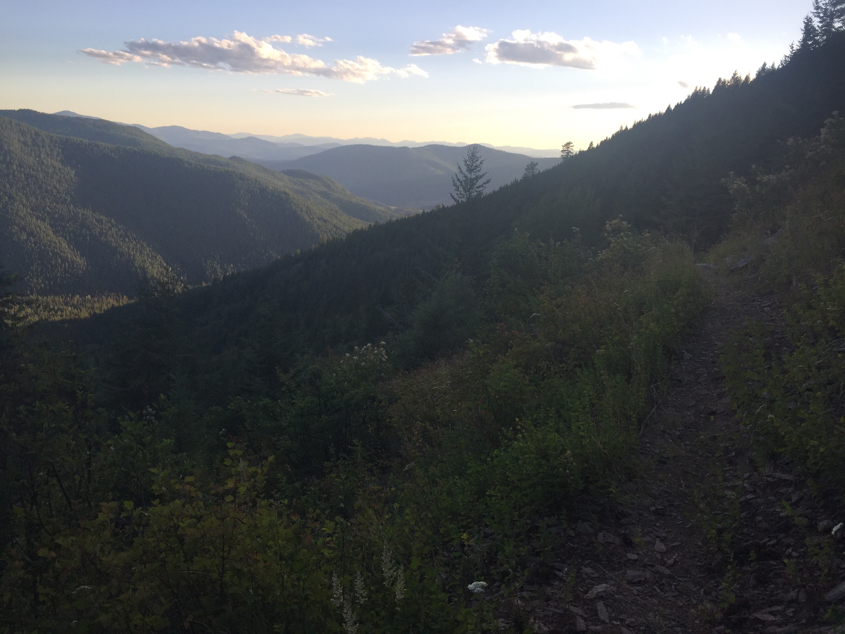
The rest of the afternoon was better as we dipped down from Frosty Pass heading to the PCT. We hike 13.5 miles along the Pacific Crest Trail on the PNT. We connect at Castle Pass which is just a little over 3 miles from the Canadian border. I had so many emotions running through my body and mind. Tears rolled down my eyes as I was so happy to be on a trail that brought me so much joy and personal growth. I’m so happy to share a small piece of this trail with Paperweight. He still has to hike this trail someday and I think I might just have to join him. I ate my first PCT Washington blueberries. I hiked this part of the trail on October 2nd 2015 as fall was beginning. The views were breathtaking as always. We loved the graded, groomed, and well maintained trail. I had so many flashbacks of memories and people today. I felt at home! It was a indescribable feeling. I tried to convince him to just continue Sobo on the PCT, but we have unfinished business on the PNT.

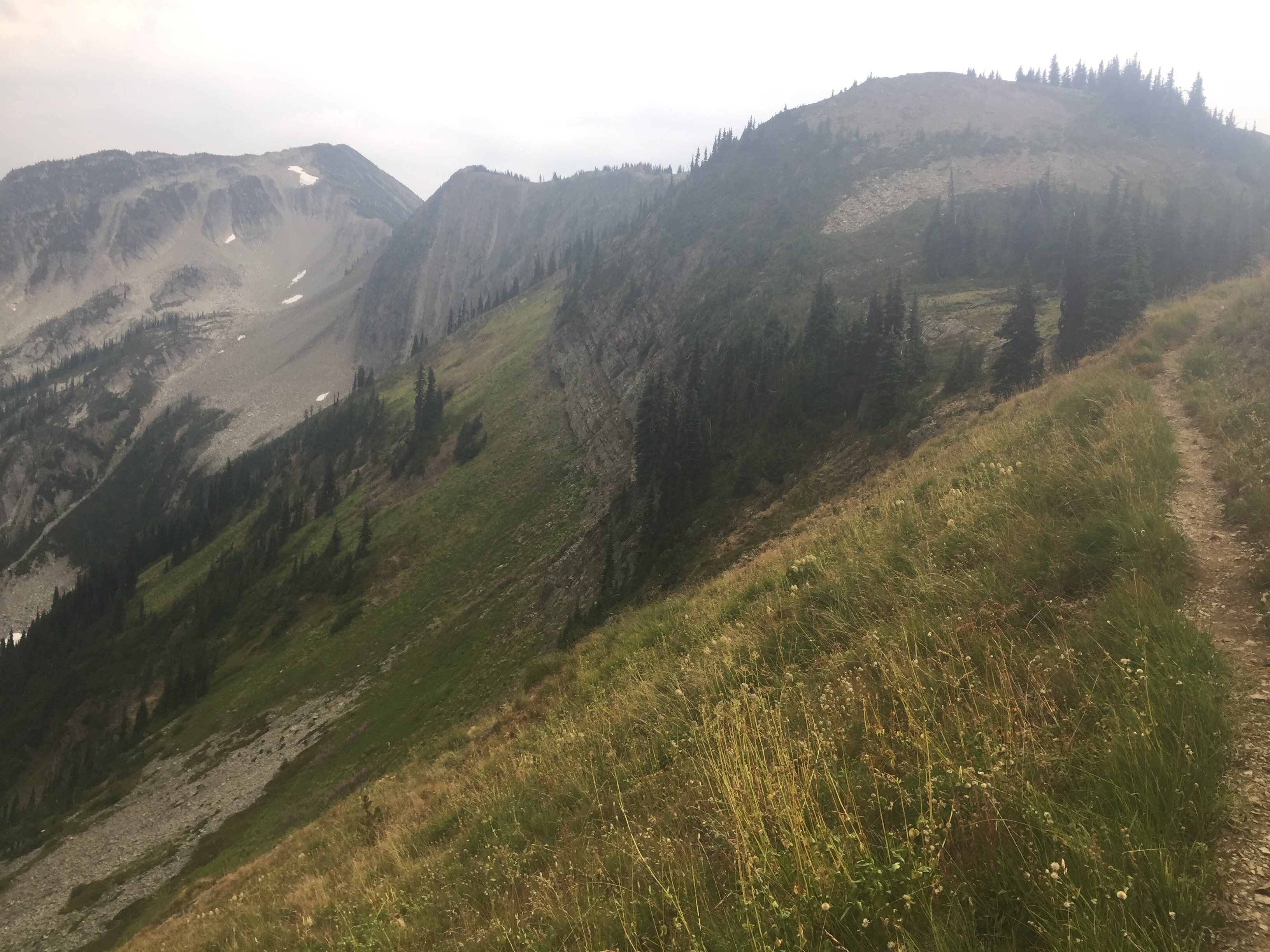
We came to the junction to Hopkins Lake. I requested that we camp here since this was my last campsite on the PCT. It was even more beautiful than I remembered. We camped in a spot I didn’t know existed. There were over 8 tents already at this campsite when we arrived and most people were already inside around 7. After we were done eating, Sogood joined us. He is a 19 year old college student on his first thru hike. A wonderful person and we enjoyed his company. We took a late stroll to the lake to grab some more water as I couldn’t stop smiling. Our time on the PCT this year is short, but I’m so happy to be out here again.

Aug 13

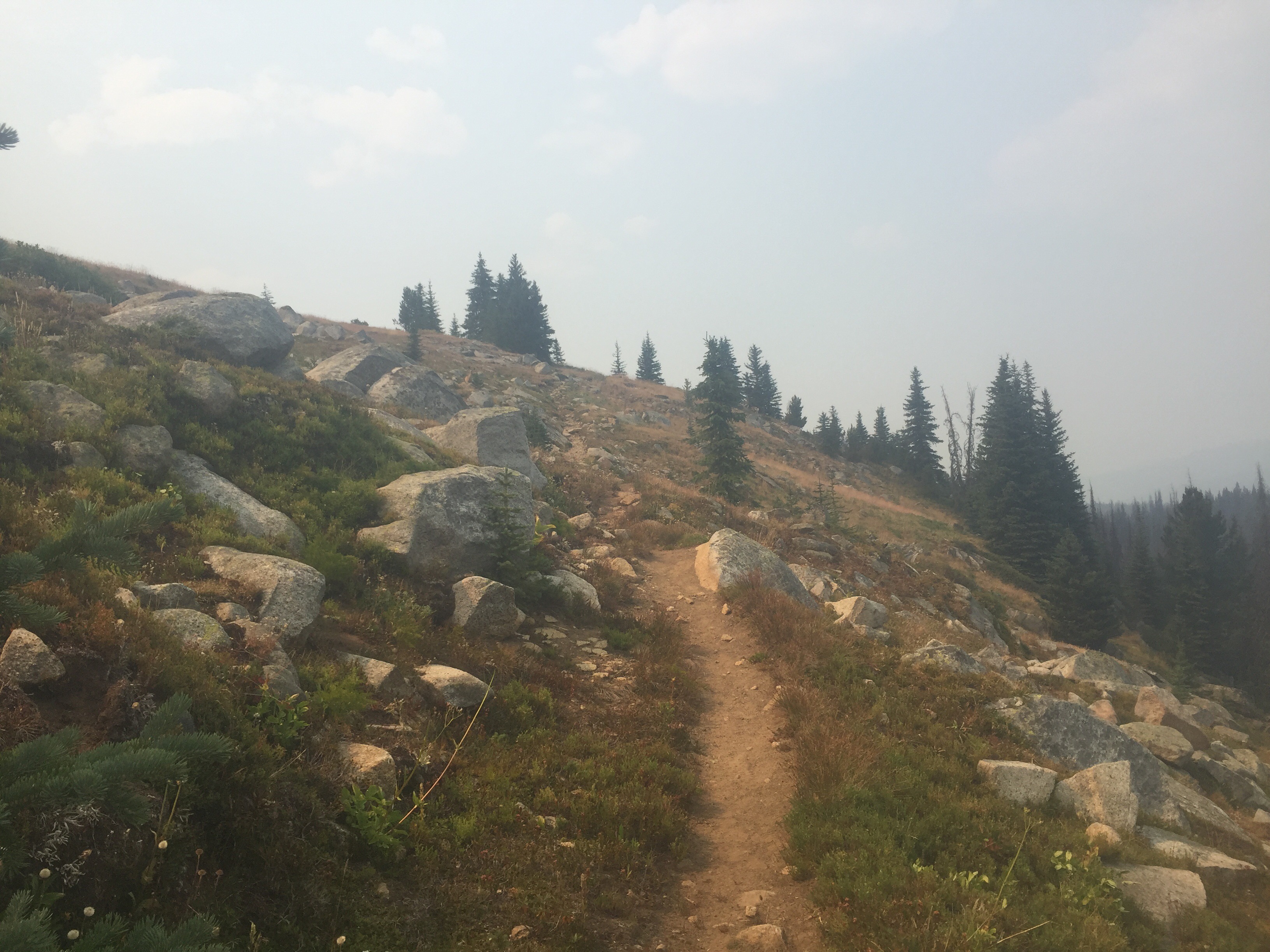
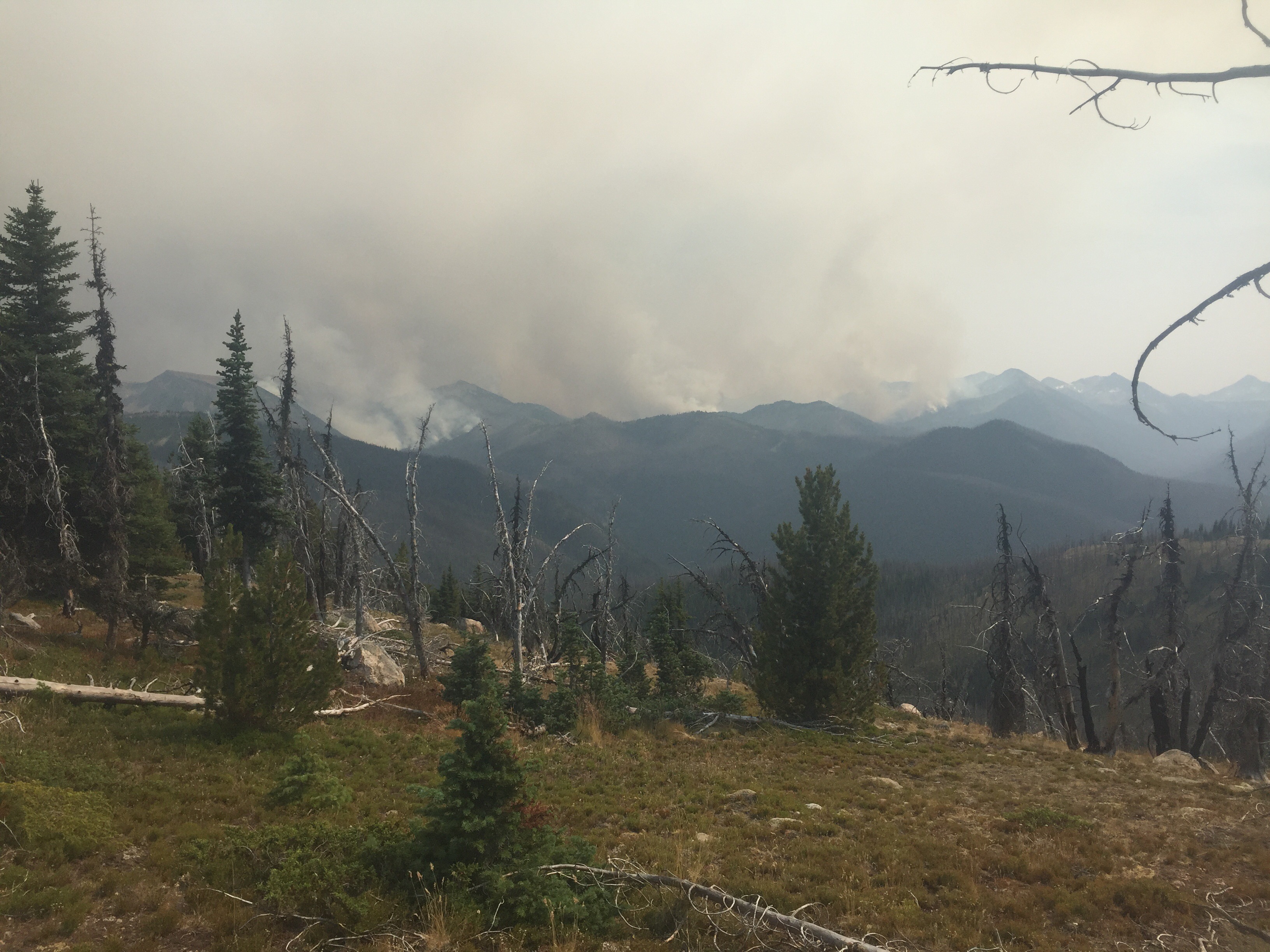
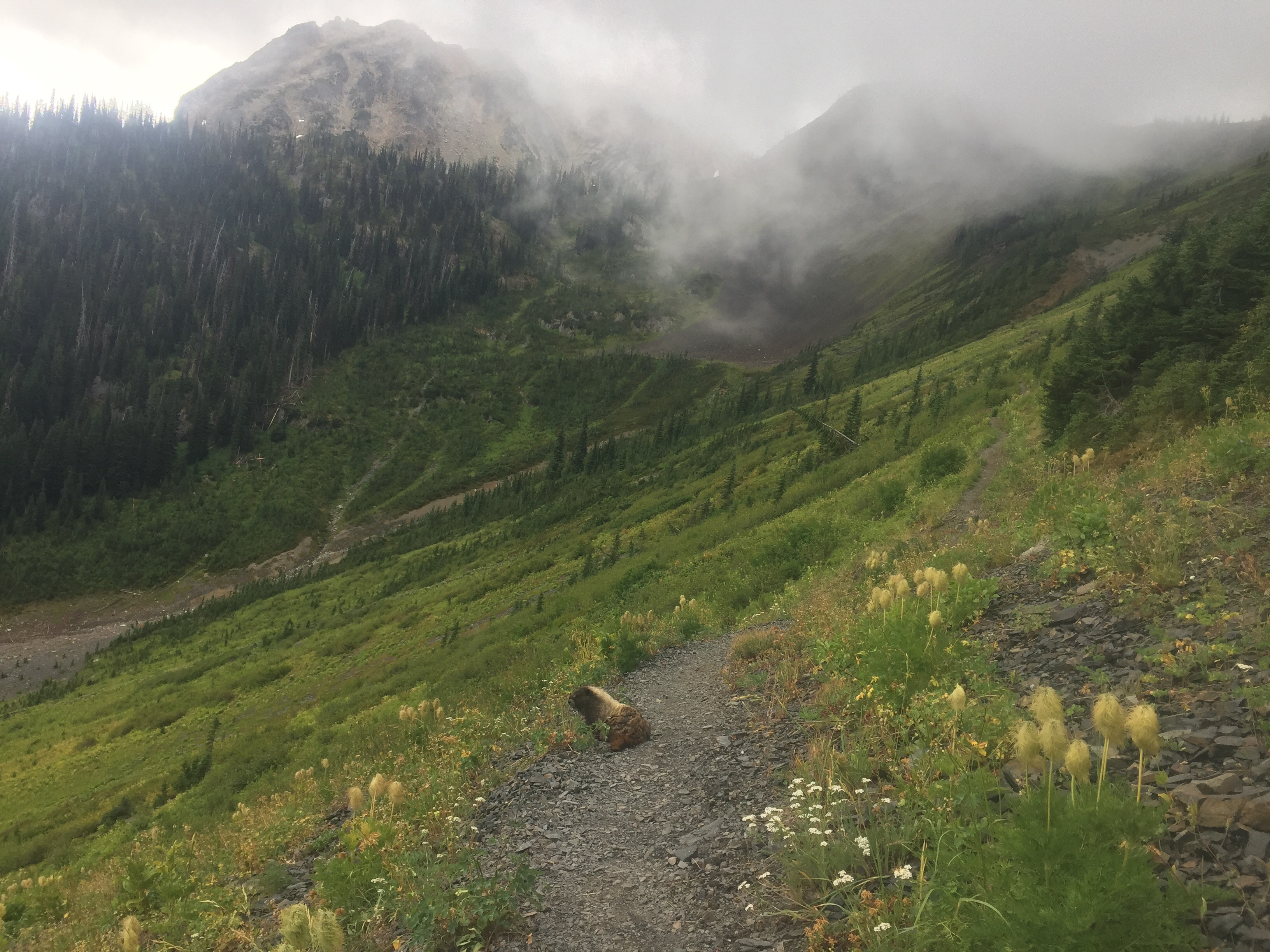
It was a chilly and rainy morning on the PCT/PNT. It’s strange hiking southbound on the PCT. It is a different perspective for sure. Unfortunately, the rain clouds blocked some of the views. I wore my rain jacket for the first time on this trail. We climbed up the tight switchbacks named the Devils Staircase. Last time I flew down them. It was a morning full of emotions. We met over 15 hikers headed North most doing a section or jumping around due to the high snow year and fires. We saw dozens of huge marmots and little pikas all over the trail. Sogood joined us for a nice break where we admired Washington and watched the clouds begin to break up. We conquered Woody Pass and Rock Pass along the way as the sun came out thankfully. We will be back here again someday!

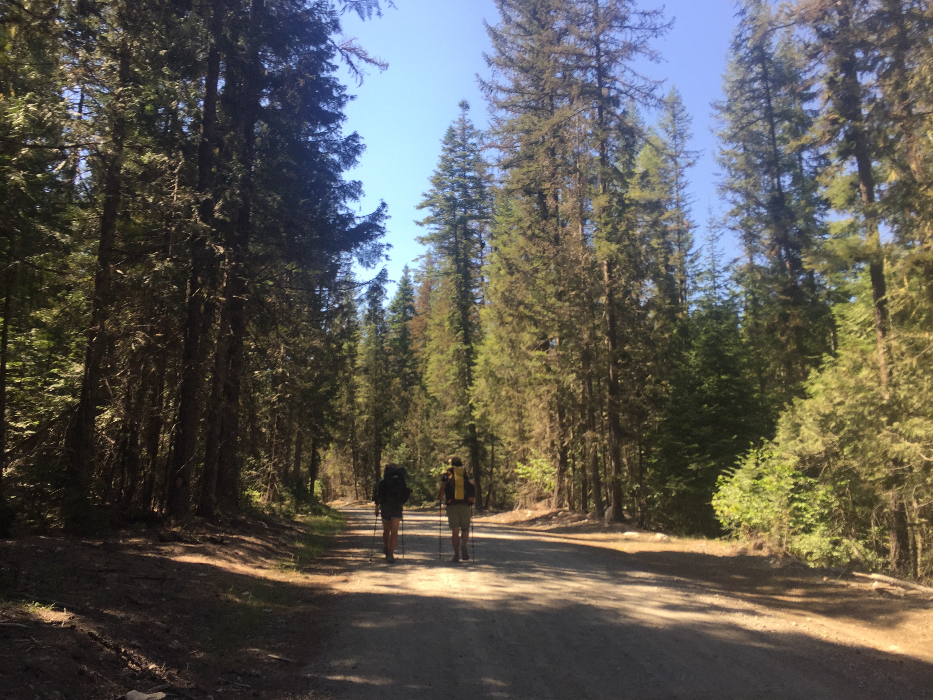
Holman Pass is where we turned right leaving my favorite trail for good. So it was back to PNT hiking and the 700 mile mark. It didn’t take long before we were climbing logs and getting beat up by the overgrown trail. The three of us just laughed saying “welcome back to the PNT!” Sogood had to part ways with us at our lunch break since he does much larger miles. We hope to cross paths again.

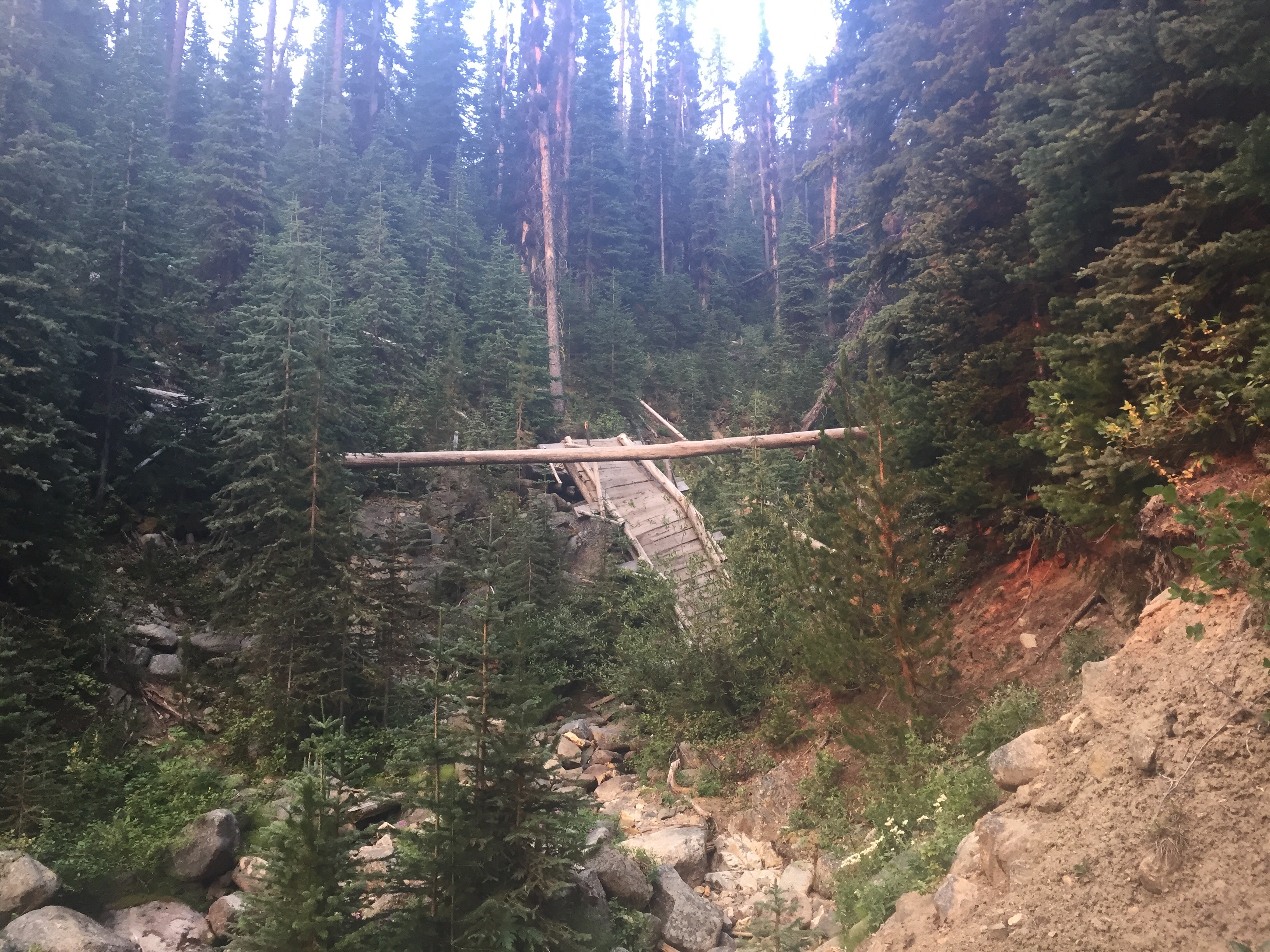
It was time to climb Pilot Pass which was steep with many berries to much on. We then found ourself at Deception Pass with lots of old bridges over a swampy area. We climbed back up to be rewarded with snow covered mountains and eye popping views! Wow!! We ridge walked together in search of water and a campsite. It was chilly at 6,200 feet as we found a spot protected by the trees. We ate dinner in all our layers watching marmots playing on the rocks and screeching at each other. We were sure we would have a visitor tonight, but they never arrived.
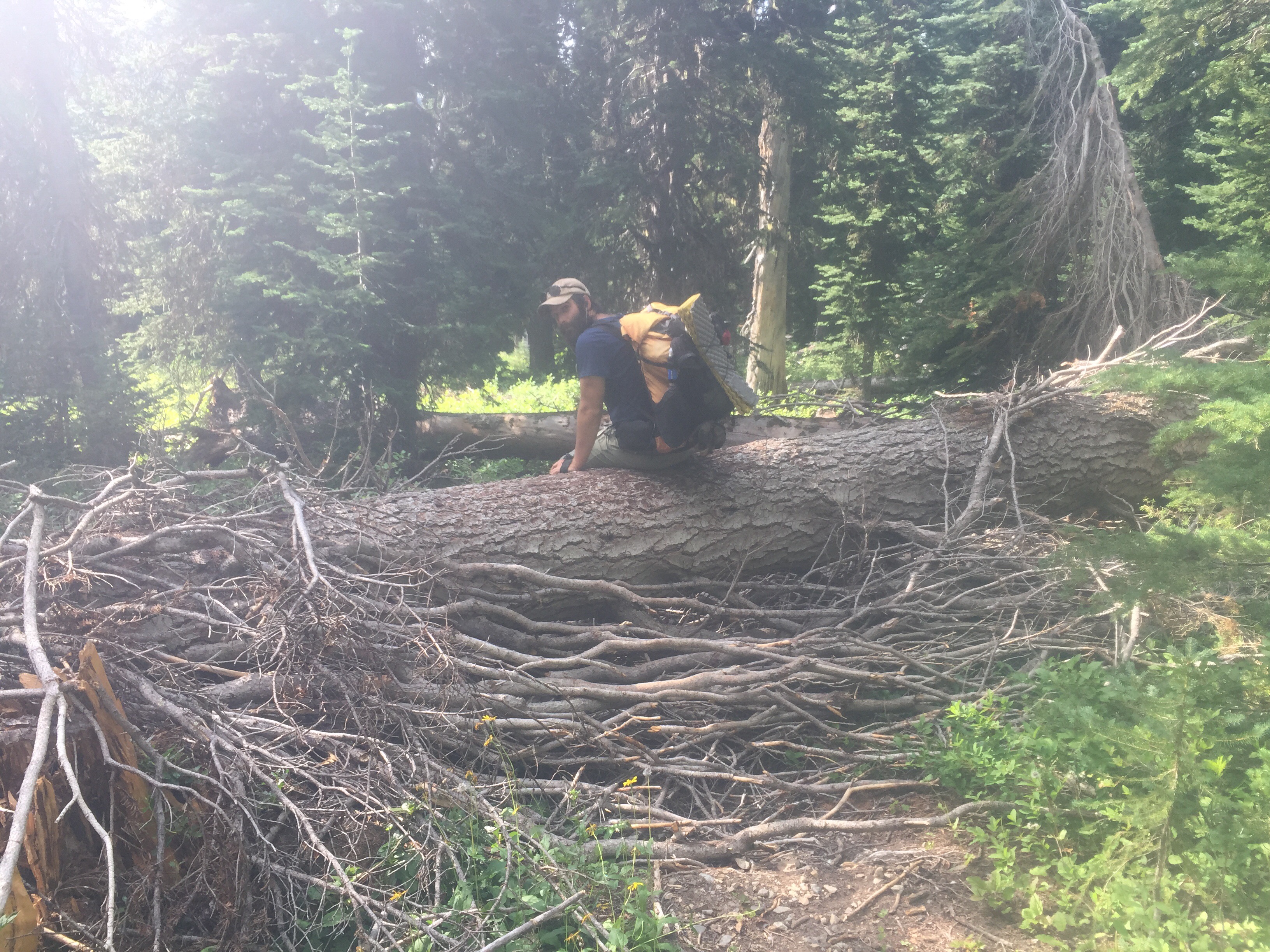
Aug 14

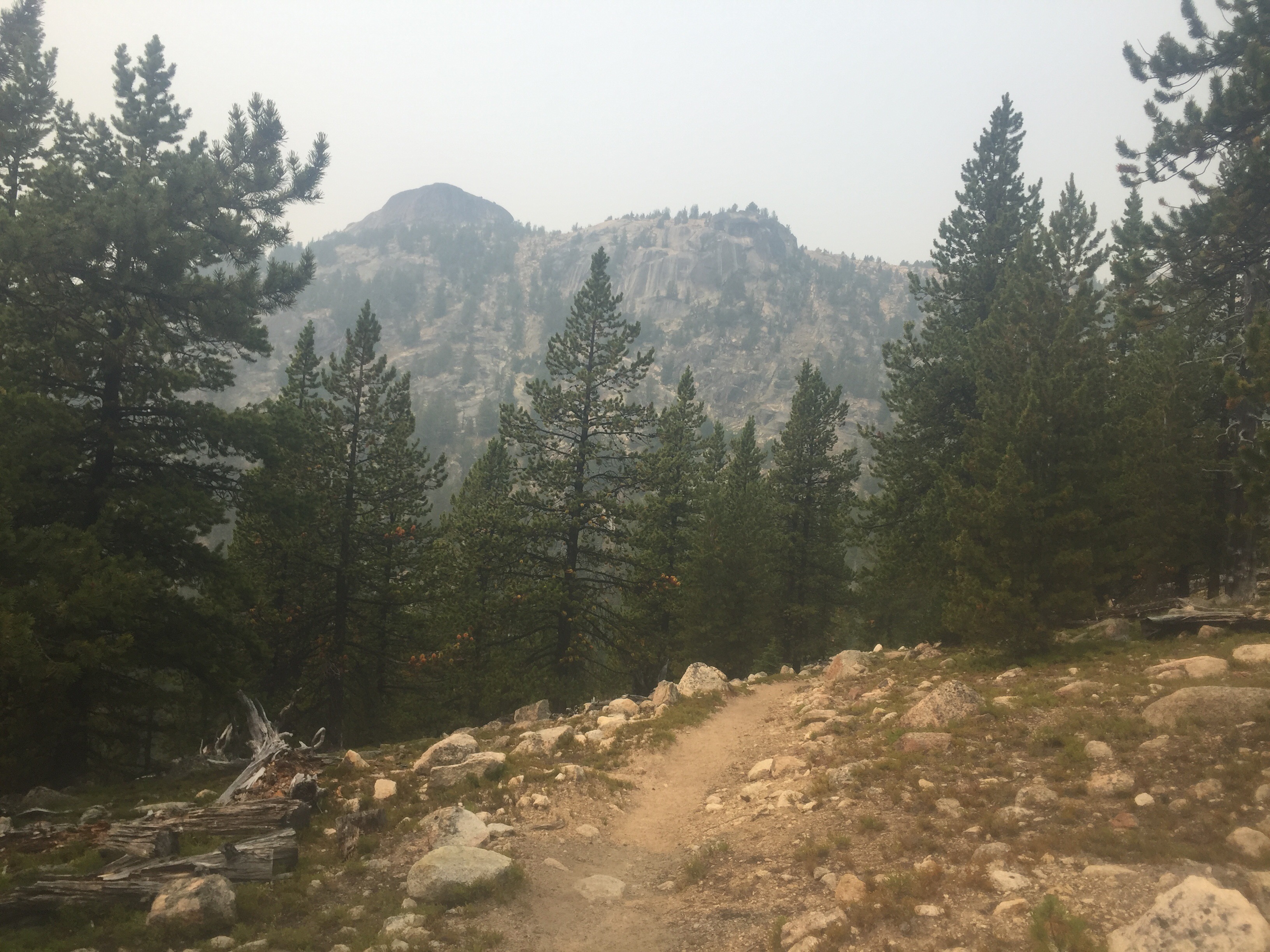
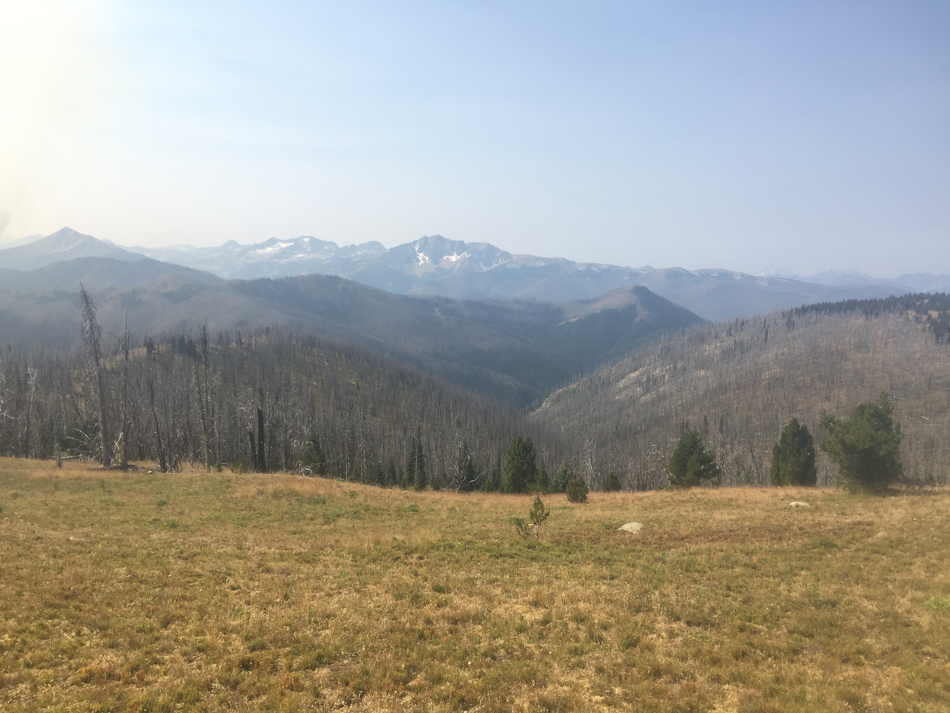
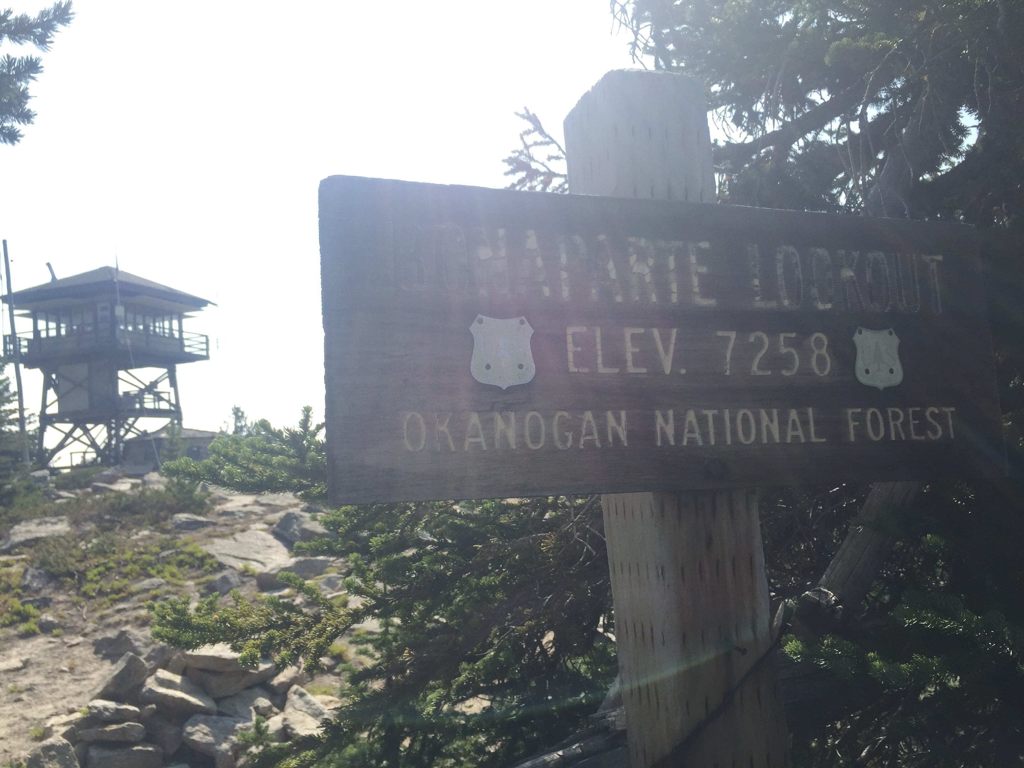
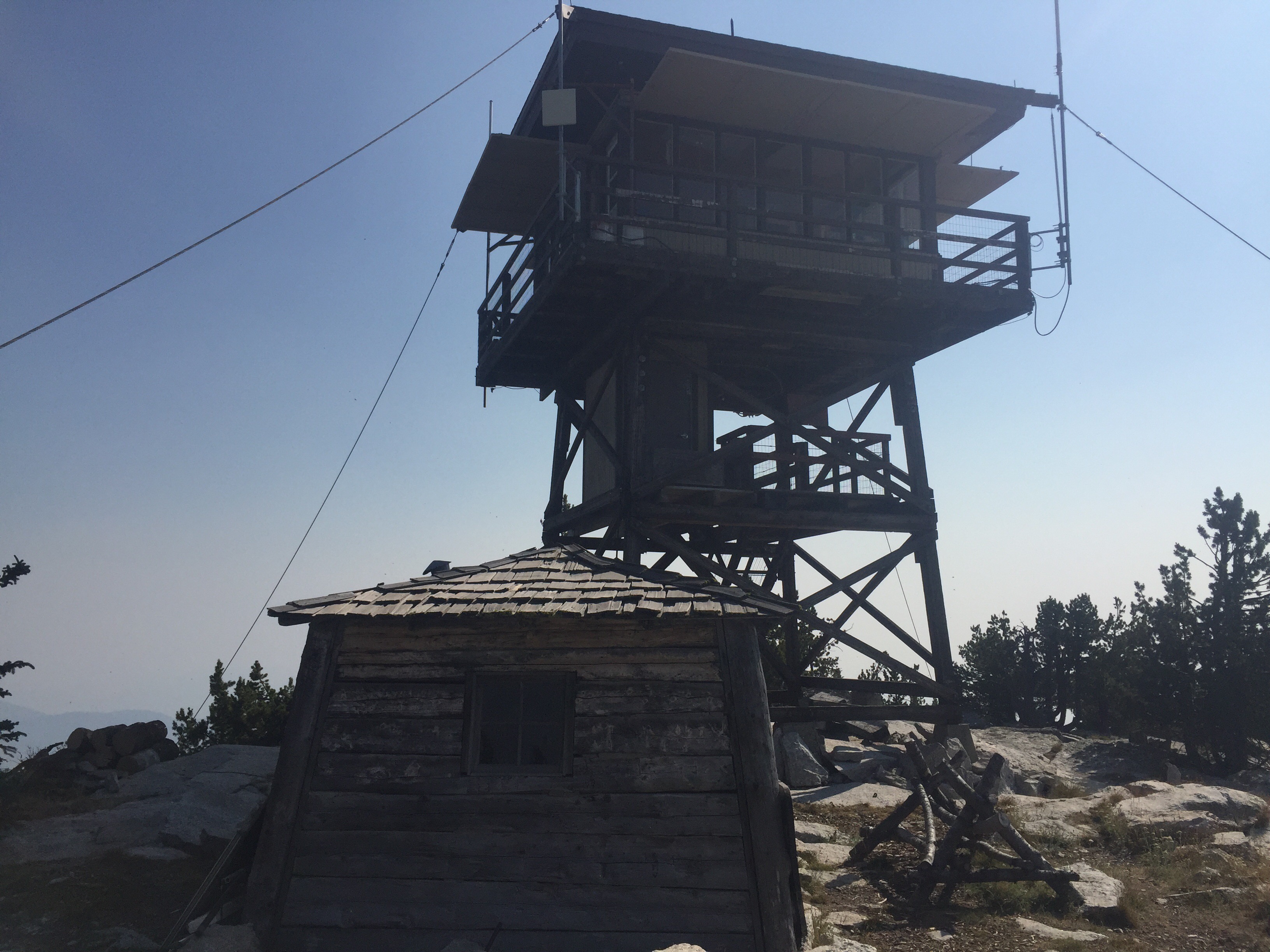
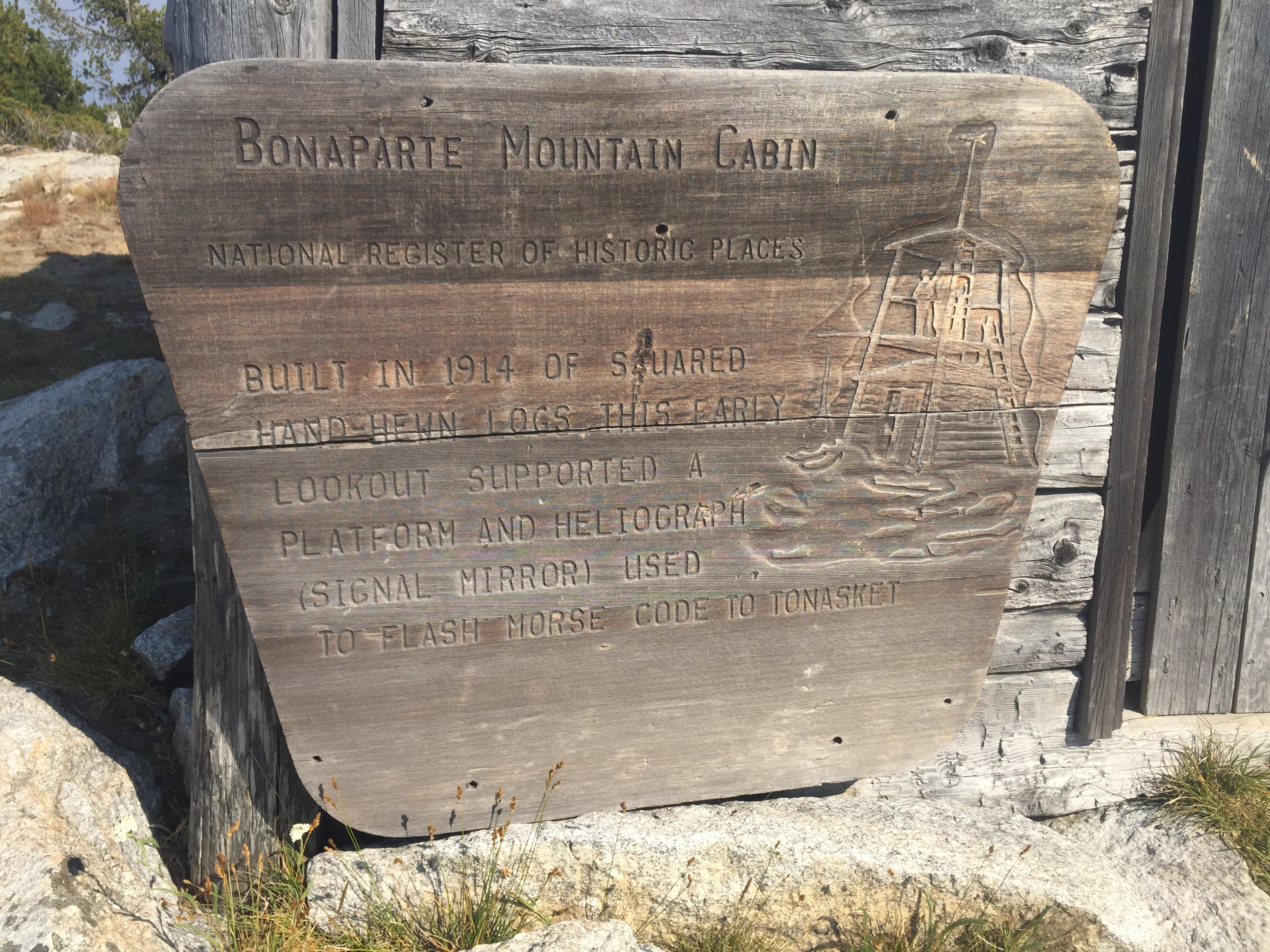
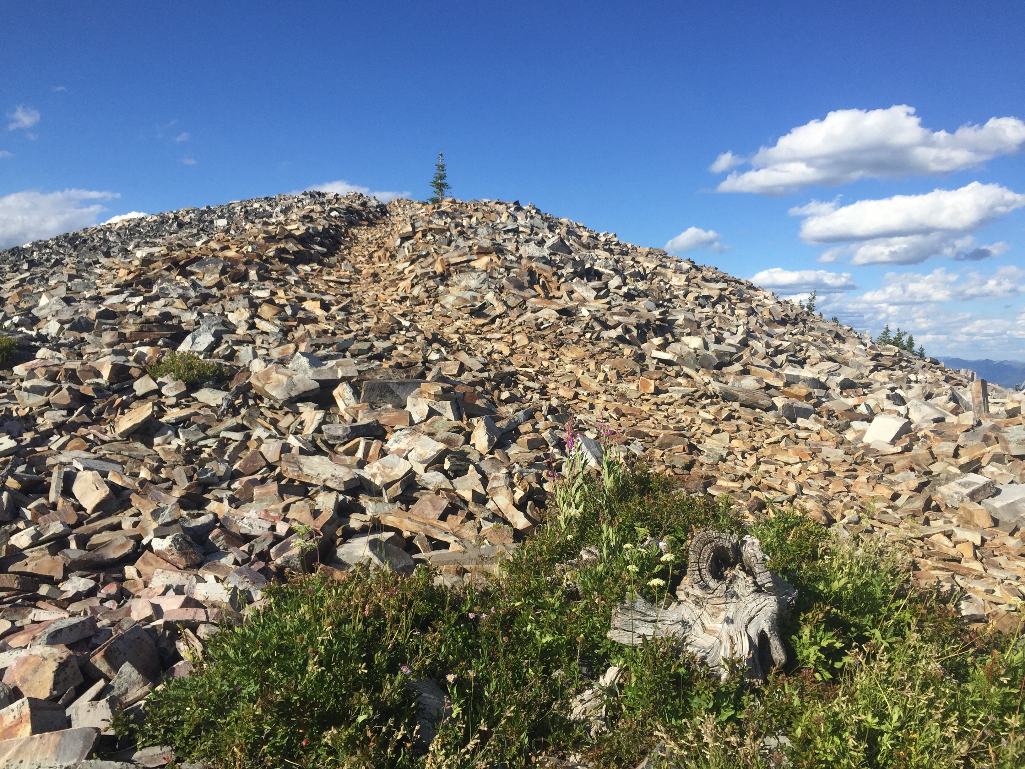
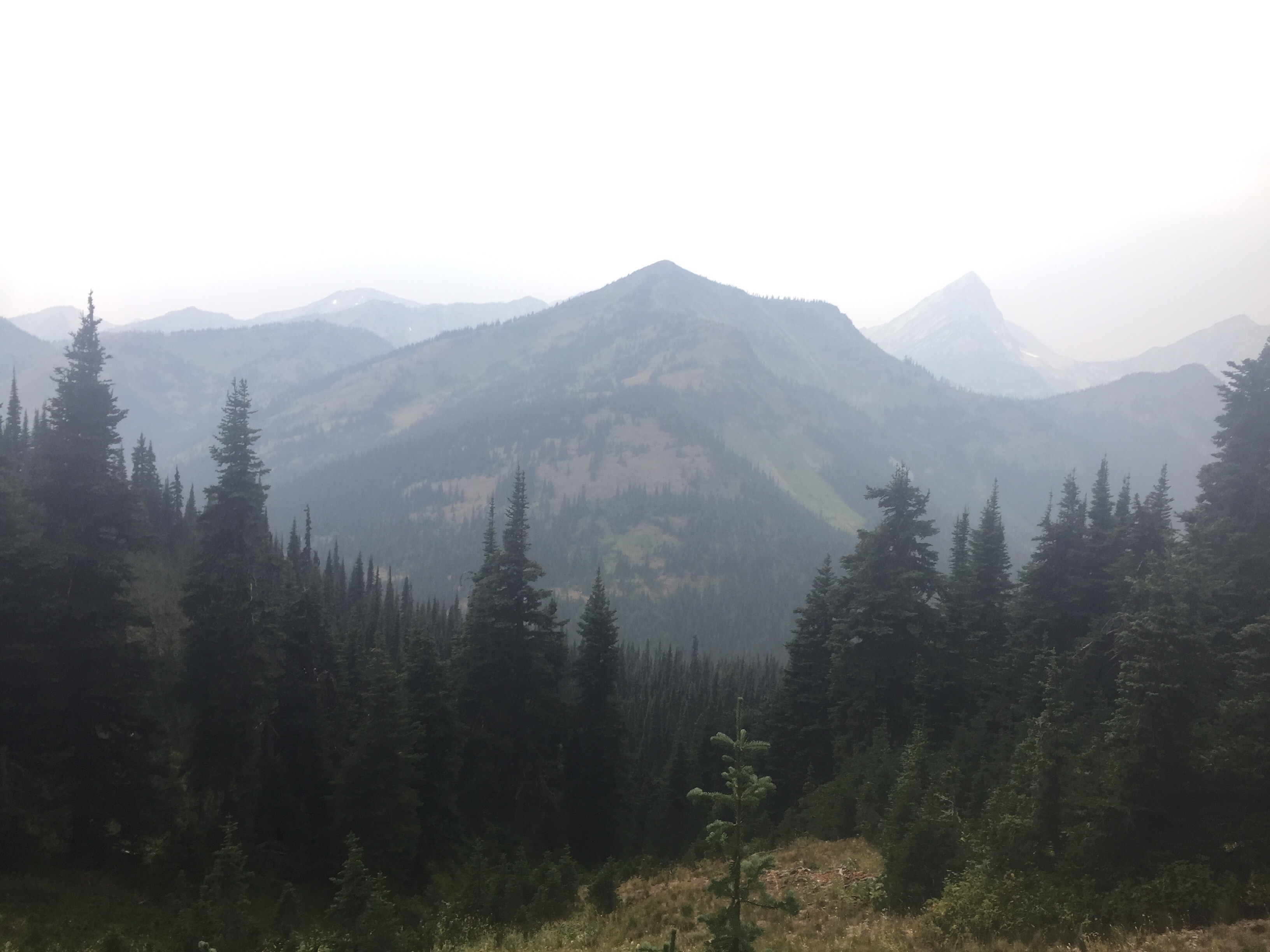
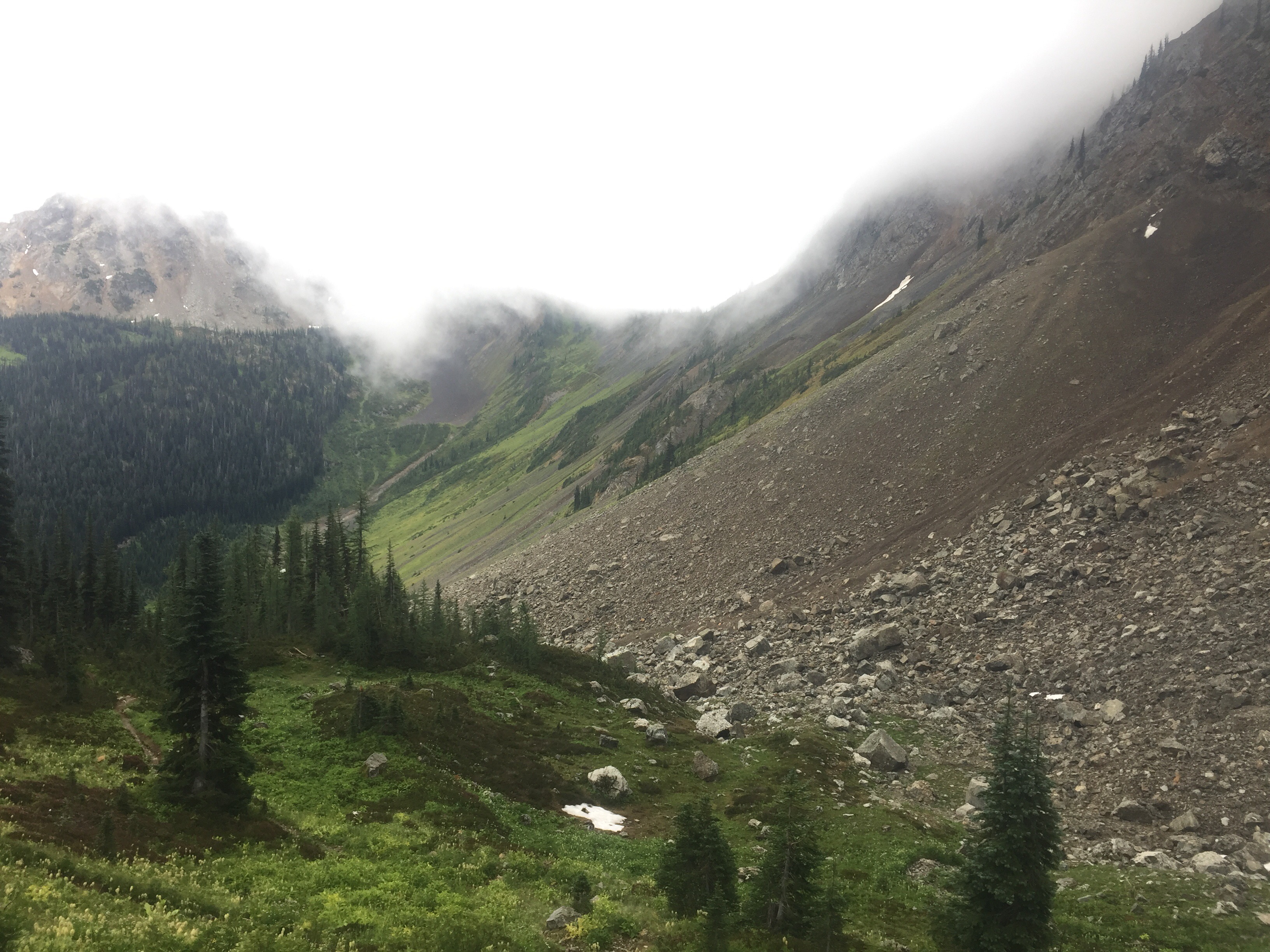
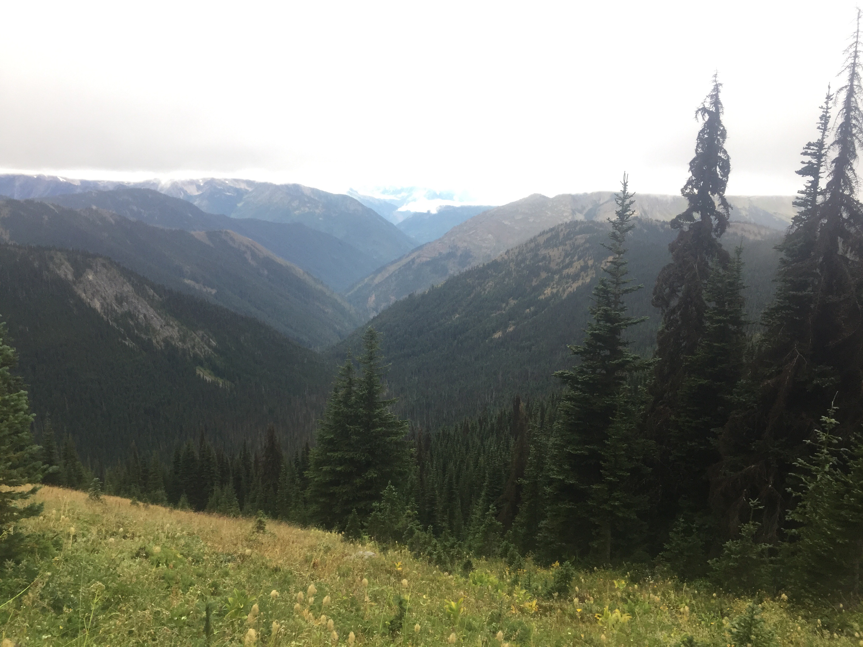
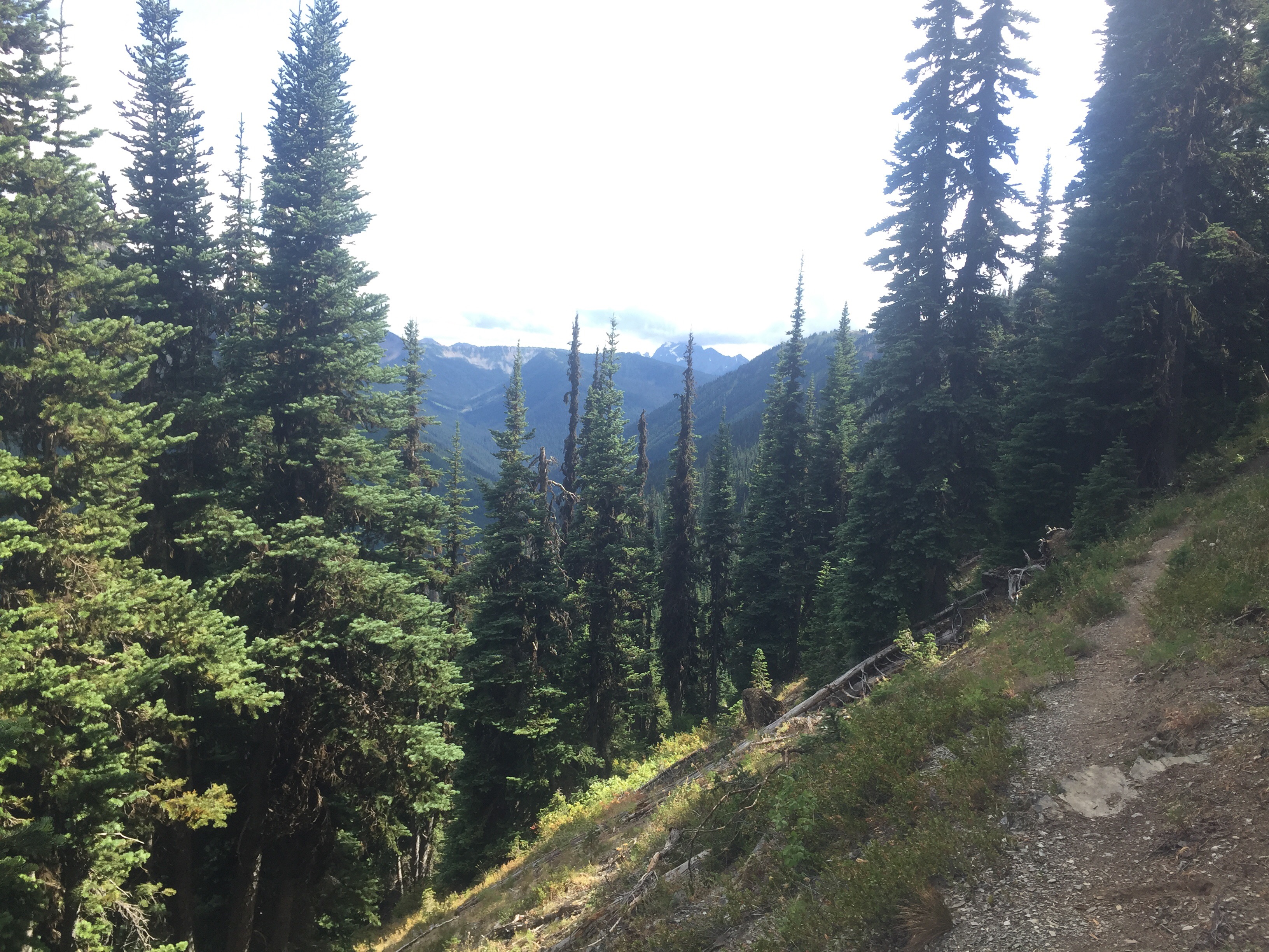
It was a cold night and morning. I did not want to get out of my sleeping bag at all. It’s funny though because within 10 minutes of hiking I’m warm and delayering. Our trail did not disappoint! We passed Devil’s Pass and began climbing towards Devil’s Dome. This is one of my favorite sections so far on the PNT. We climbed to the top to see Nohokomeen Glacier on Jack Mountain! There is a Loop hike here that we plan to come back to hike. Washington and the North Cascades is some of the best hiking out West!

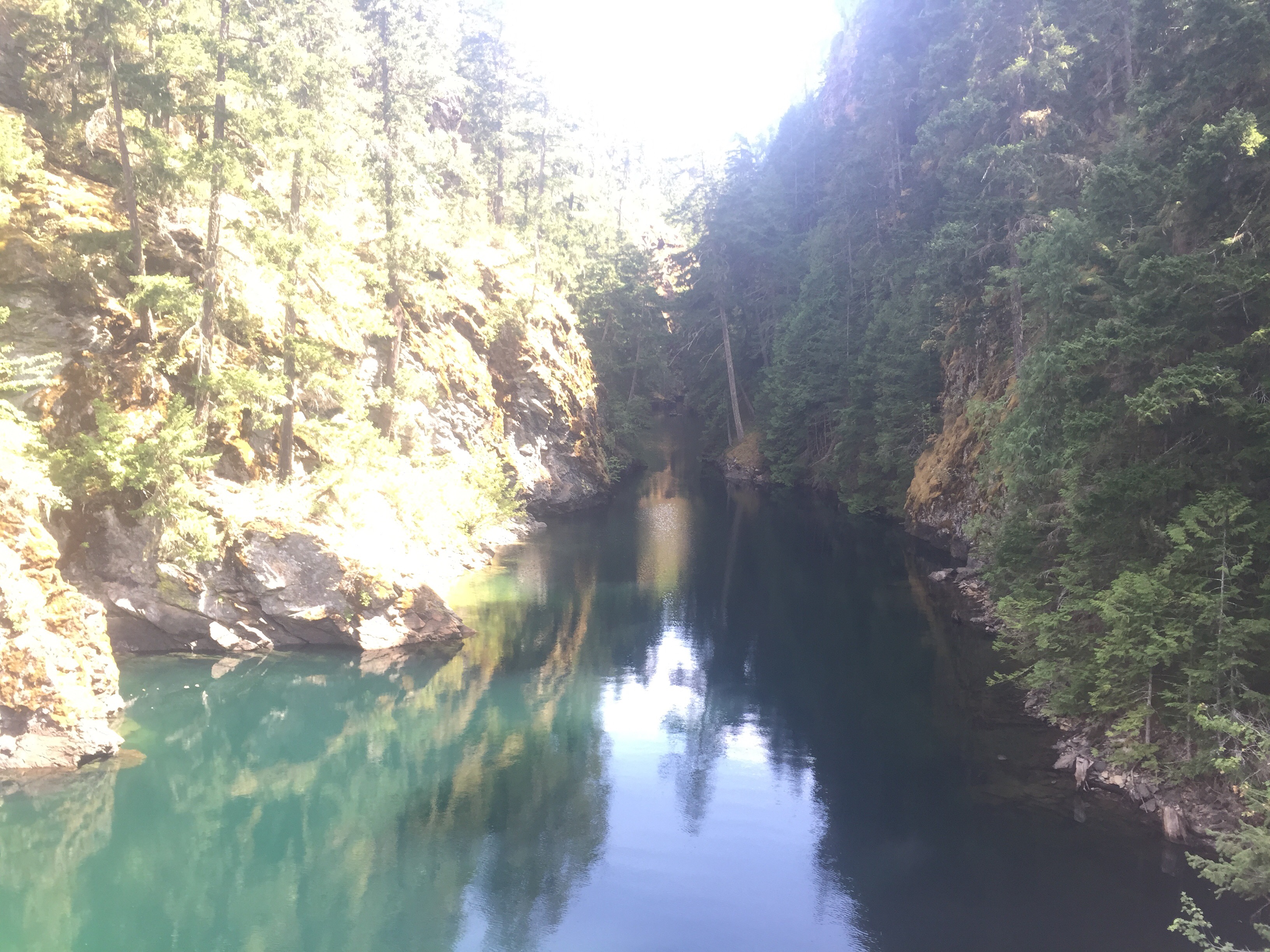
The rest of the day was downhill towards Ross Lake. My knees felt the burn and my body craved more berries. Hiker hunger has hit hard now! The hike downhill was pleasant with views for half of the way before entering the trees. The trail brought us down to Devil’s Creek campsite. We began a nice walk along the banks of the lake. I loved the bridge over Devils Creek where we had a snack break and watched people boating below us. It was pleasant walking with views of new snow covered peaks. We were in awe!

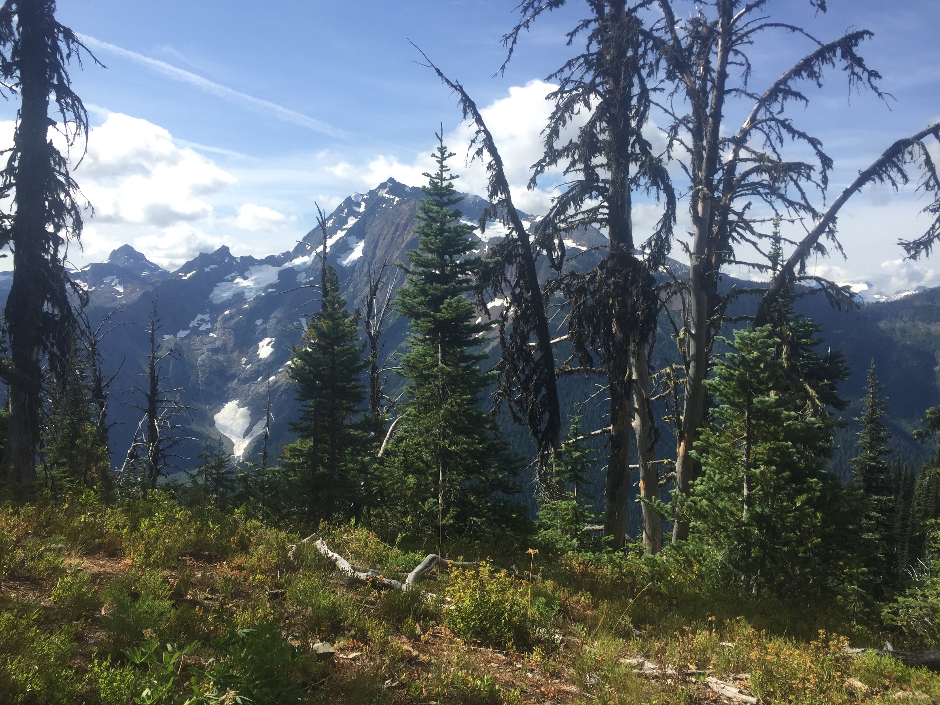
It was a lovely day of hiking as we headed towards our reserved campsite at Ruby Pasture. We had walked along the East side of the lake all afternoon and walked off trail to camp near Ruby Creek. Tonight marks eight nights out of town. We have hiked 160 miles complete of epic trail. Such an enjoyable section. I have three granola bars left for the 3 mile walk to the road. Not bad! We love being out in the wilderness for long periods of time, but it makes us appreciate town even more. We are craving pizza, ice cream, vegetables, and meat! The best part is that more of the North Cascades await us. 

Aug 15

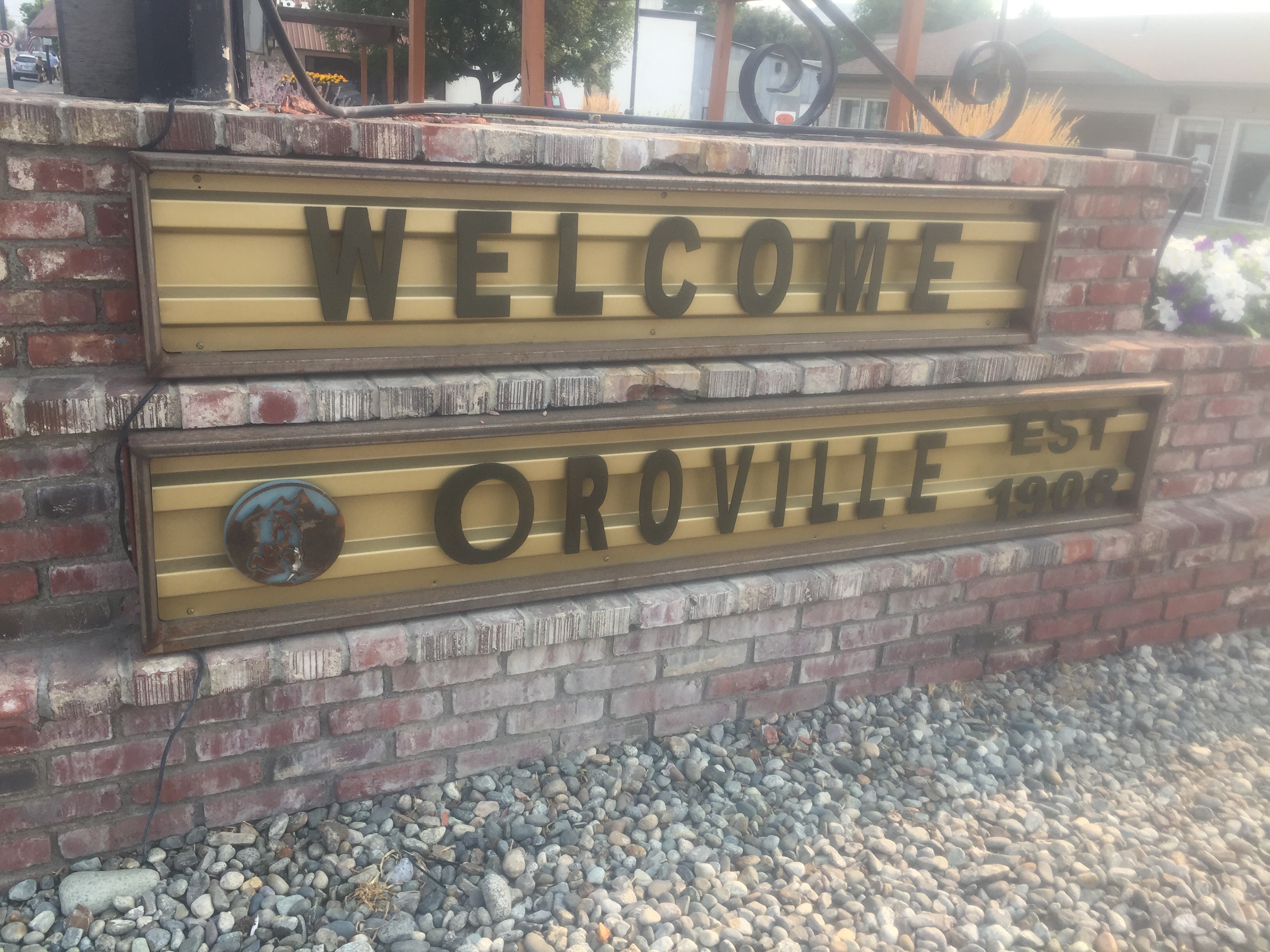
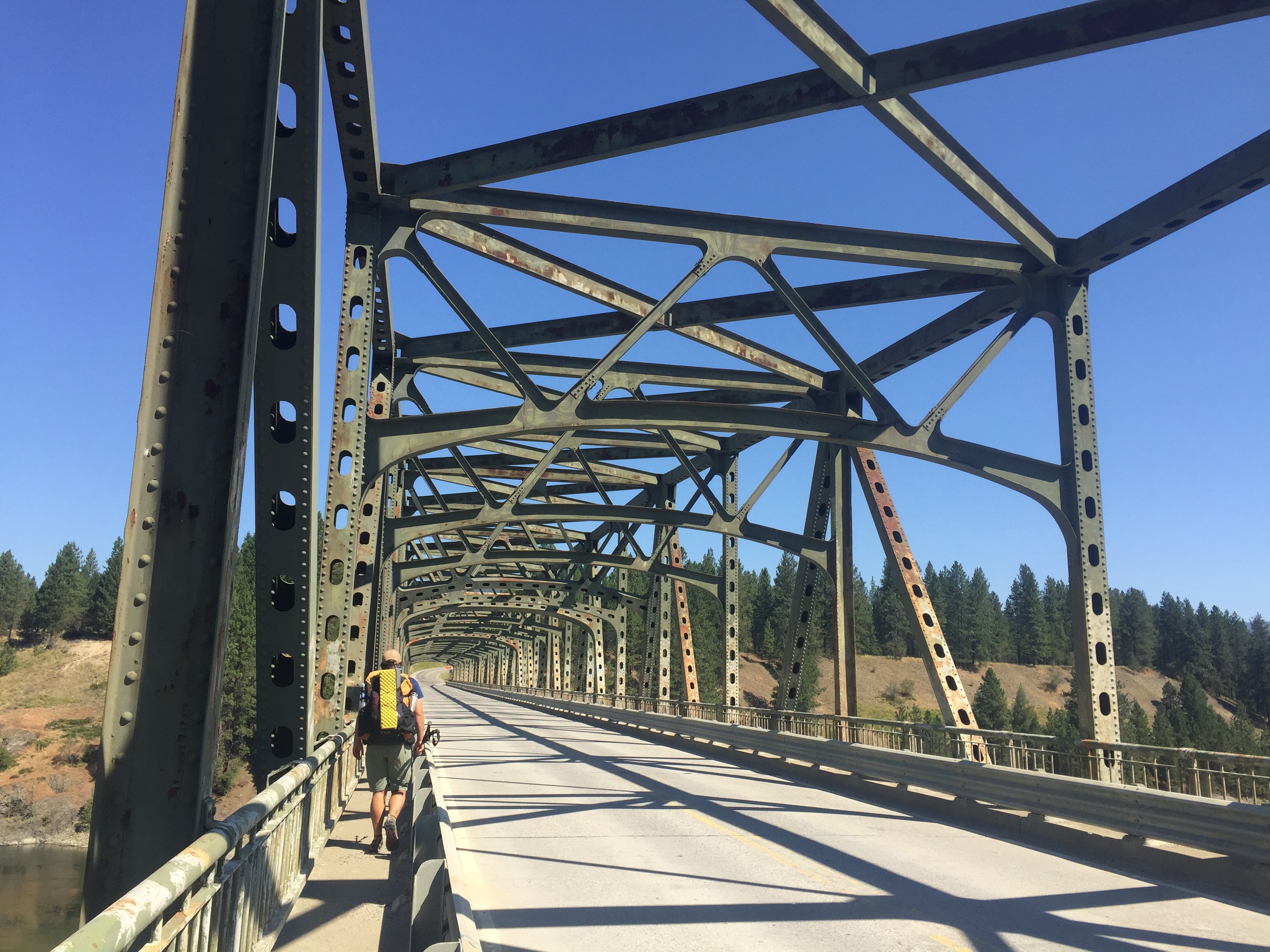
We slept in a little bit today being only about 3 miles to Highway 20. The hiking was easy as we could hear the highway since our campsite it seemed to be right there. We crossed an old wooden bridge that swayed a bit too much. We climbed the last 200 feet to the highway where we dumped our trash and began to hitch. We hiked 158 and haven’t been in town for 8 days. We made it!

Well we made it to the highway with hopes of a 52 mile hitch into Winthrop. We got discouraged for the first two hours as cars zipped by and one guy shook his hand at us. Everyone seems to be a tourist in fancy rental cars exploring the scenic drive. As I always say, it only takes one. Finally, a woman stopped to rescue us. She works for the forest service doing trail maintenance in the summer. So she knew about the PNT and we shared stories. She was heading to do a few nights on the PCT so she only could drive us to Rainy Pass. At rainy Pass we ran into a section hiker the PCT who is heading opposite direction towards Seattle. We chatted to and from across the highway as we are both trying to hitch in different directions. Luckily we got picked up first. I kind a man instead he drove us all the way into Winthrop and shared some stories with us.he was quite the character and also works as an Uber driver in Seattle. So when we get to Seattle we might just call him for a ride.

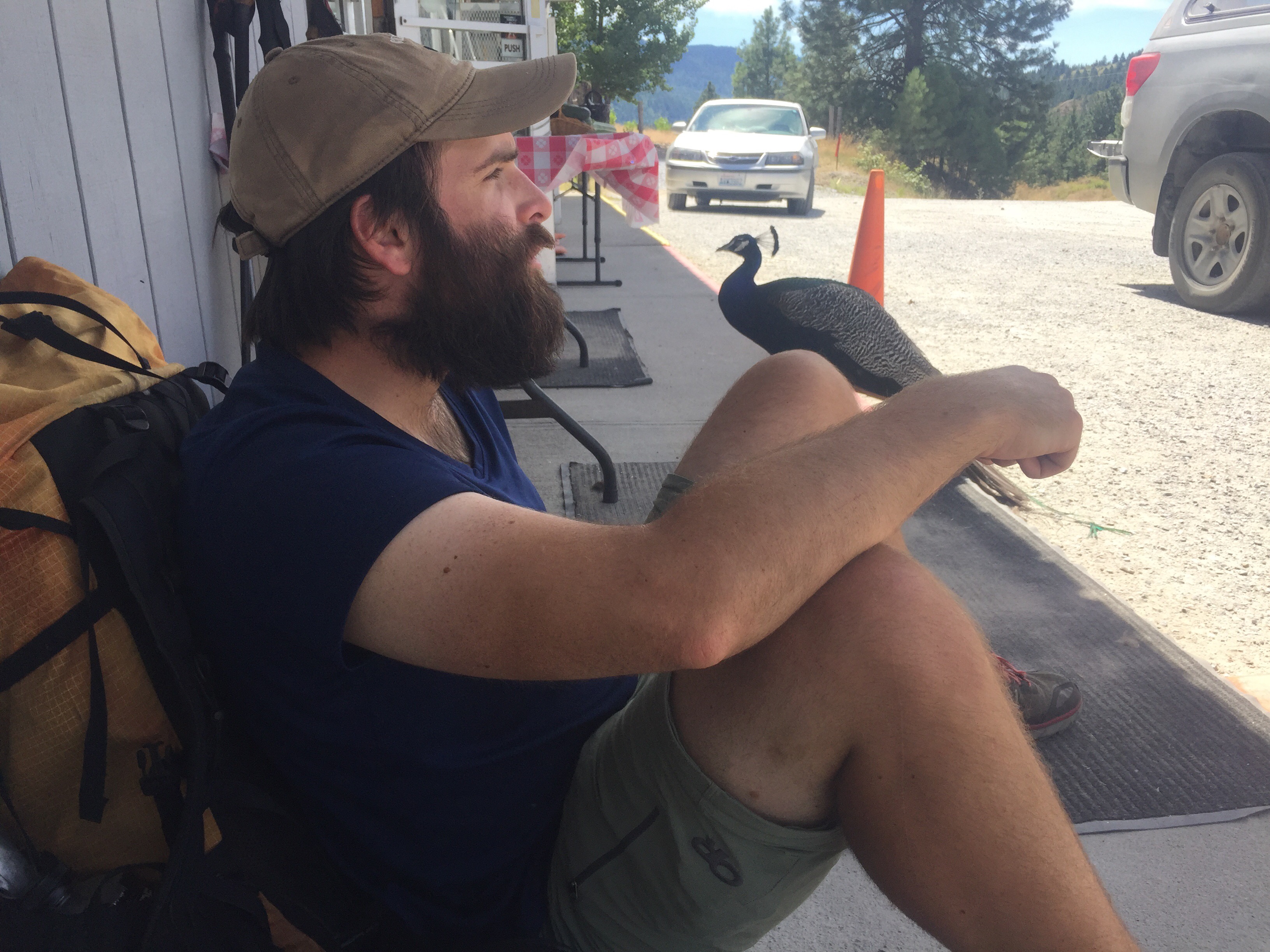
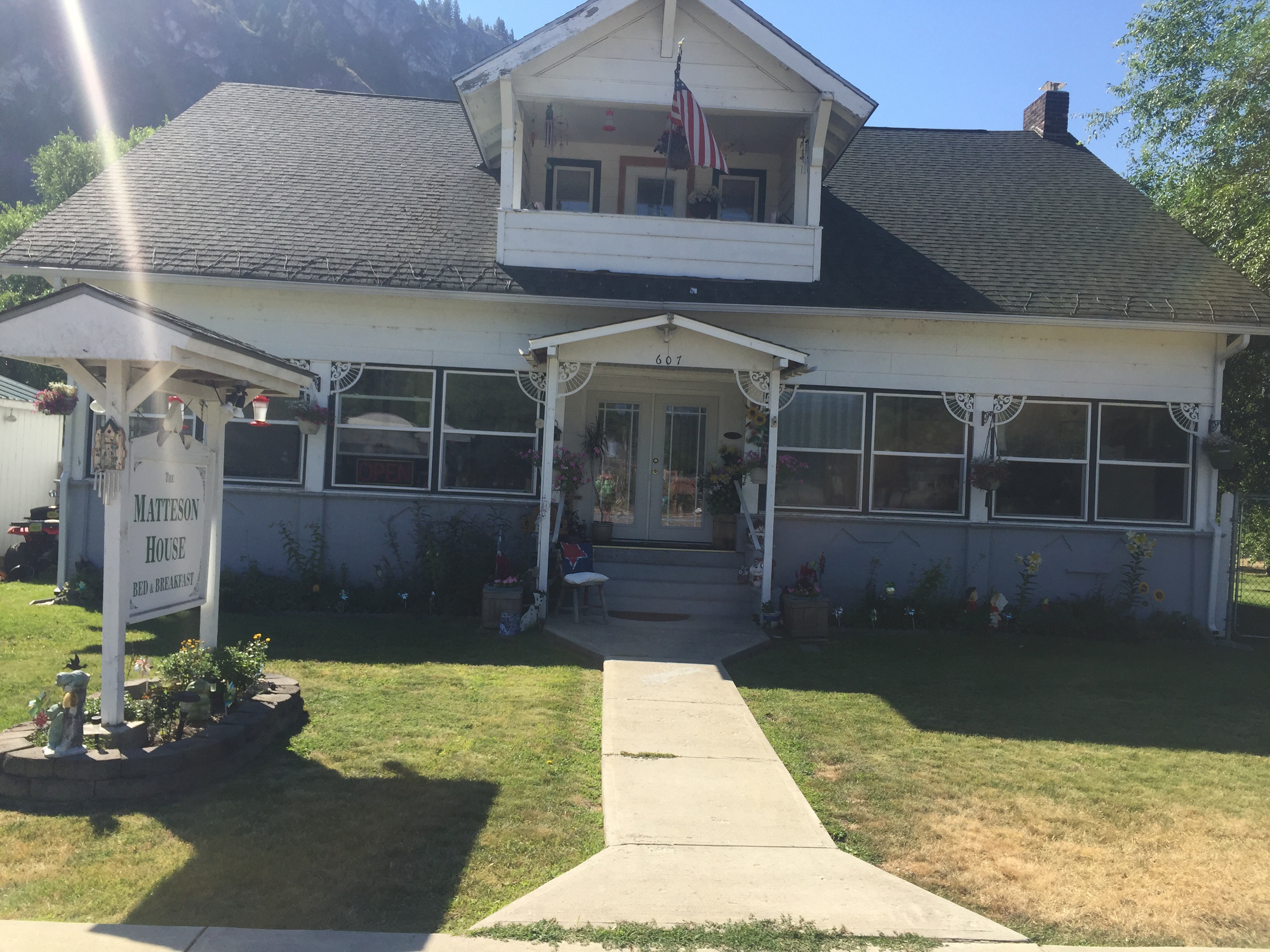
We were dropped off at the grocery store where we checked out hotels online. We have Newtown math or any guide information on the tourist town of Winthrop. We lucked out because right next to the grocery store was the Virginia resort. We checked in a bit before 11. After eight days on trail our first priority was not a shower but food. We went back to the grocery store and I would soon devour a orange marmalade chicken skewer, a container of potato salad, a cold fruit punch Gatorade, a Cobb salad, a few pieces of a chocolate Carmel bar, and began munching on a bag of potato chips. Then I decided to shower. The rest of her day was spent lounging in bed and going back to the store to grab some beer and dinner. The downtown areas where all the good restaurants are but we were too lazy to walk the mile into town today. You forget how much you love pillows, blanket, and a firm mattress. We really deserved this hotel after 160 miles. It was a perfect day.

Aug 16

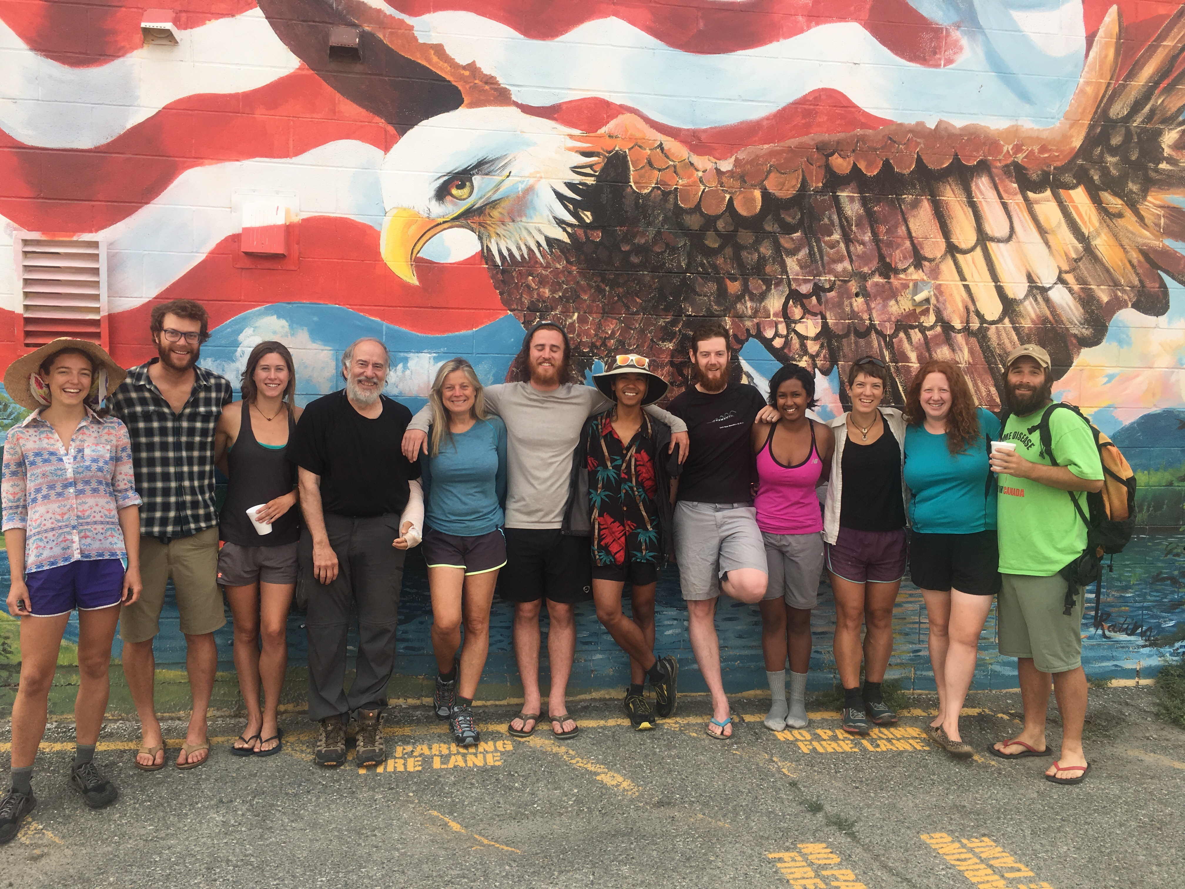
We caved and took a zero day in Winthrop. The trail is waiting for us, but we do not have a deadline so we can take our time. We spent some time downtown. We did our laundry then walked around past all the stores on the wooden boardwalk. The town is a busy place with lots of tourists. It was a gold mining town in the late 1800s and into the early 1900s. It’s a fun place to visit. Paperweight was able to buy a new hiking shirt and trade in a pair of Darn Tough socks. Lifetime guarantee! Some businesses allow you to trade them in. We both like this little town and the feel of it. We checkout the the real estate in most towns and here it is about 60,000$ for .2 acres. It’s a little too expensive for our taste.

We walked back to the hotel where we spent the rest of the day relaxing after resupplying at the grocery store. I have a new pair of Salomon shoes for the next section. I also switched out the frame of my pack. When I sent my Osprey in to be repaired last year, they sent me a brand new frame for free. I love Osprey’s customer service and their packs. I’m a lifetime customer! 

We also spent at least an hour looking over our maps and town guides. This trail has so many options and it is tricky to decide what to do. For example, you can walk a rail trail and cut about 100 miles total of trail. You can also skip walking around Baker Lake by doing a short road walk. Like I said, we don’t have a deadline. Neither of us enjoy being on roads or next to a main highway. We will stick to the trail for now and see when we finish our hike. I’m excited to explore more of the North Cascades. Life is good!

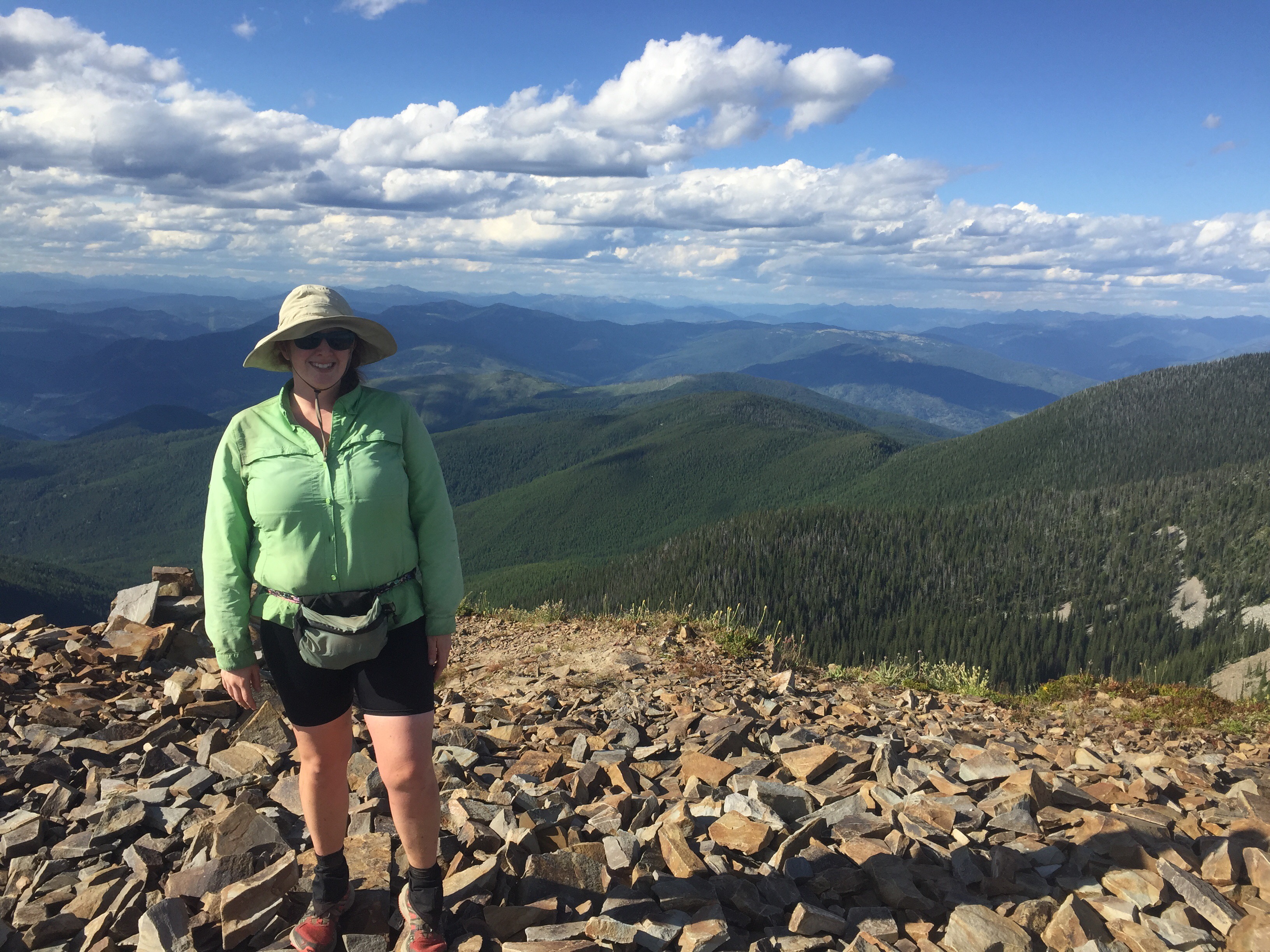
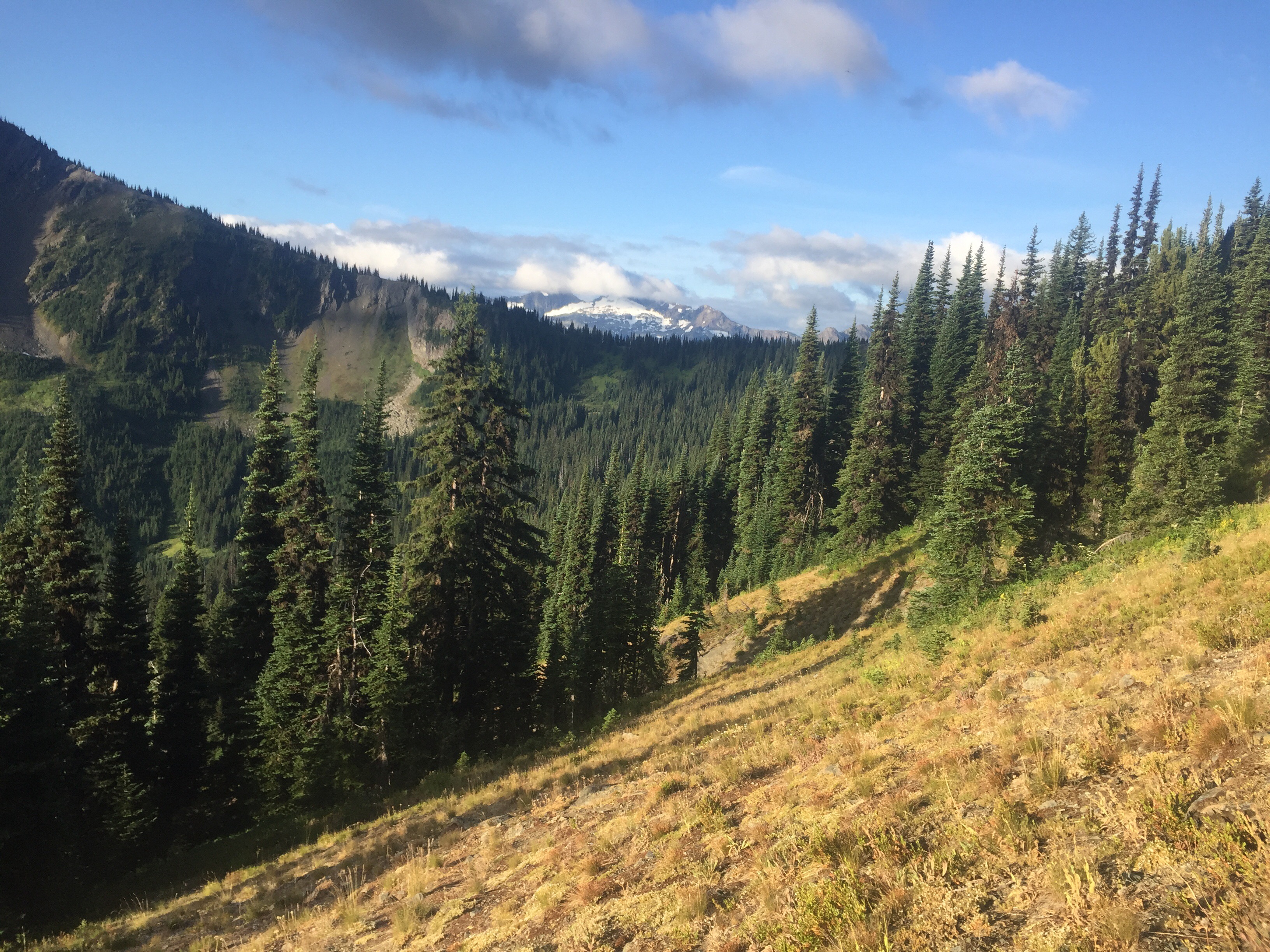
Two more photos of me on the PCT/PNT!

Advertisement

Oroville to the Pasayten River

Here is the first part of our 158 mile section from Oroville to Ross Lake. It was a few long exhausting days…

Aug 7We both slept in as usual in town. We slowly made our way to a restaurant for breakfast then packed up our things. We began walking out of town a bit before 11. We really enjoyed our time in Oroville and the kindness from the owners at The Camary Motel. 

We walked a short bit on pavement to reach the Similkameen Trail which follows an old railroad bed. It was a nice flat grade along the river. After 1.5 miles, you come to a paved road junction, but we just kept walking along the rail trail. We crossed over the river and admired a huge log home on the other side. We saw 3 bald eagles soaring above and had stunning views looking down the canyon at the water. When we came to the end of the trail trail, we were greeted with a gate and no trespassing sign. We had screwed up as we were supposed to begin the paved road walk at that previous road junction. So we added an extra 4 miles round trip. We knew better and should of been looking at our maps. But we both enjoyed our detour taking a break in the shade to cool off before walking the road.

We both have 8 full days of food and an extra half day in our packs. My pack has not been this heavy in some time as I’d guess it weighs over 40 pounds with food and 2 liters of water. The paved road led us past a golf course, lots of sage fields, a few homes, and lots of activity on the water. We have never seen people searching for gold along the river banks. We could hear motors roaring from below and walked past many RV and tent sites right off the road. The sun was brutal and in the 90s. We had to take 3 or more breaks just to cool off. These road walks are tough at around 1,000 feet elevation. But this is what makes this trail so difficult. It is mental at this point. You focus on the steps and ignore the heat. Many hikers hitch hike this section missing one of the many reasons this is a difficult trail to thru hike. I was so happy when we found a piped water source right near a barbed wire fence where we grabbed a bit of cold water.

We passed more cow land and alfalfa fields. There were not many cars on this road either, but the ones that passed always waved. We still see border patrol cars on our road walks. There were also lots of dead snakes on the road. We walked through the small town of Nighthawk. There is a population of 7 people here, but it was a much bigger town during the mining era. We crossed the bridge after reading about the town on an informational site. A man from the first house on the right stopped us to have some cold water. Scott told us all about the town and his partners family that has lived here for many generations. The cold bottled water, comfy chairs, and two dogs made my afternoon. Scott was wonderful and his kindness made me so happy. All I needed was some cold water a little break to feel much better. We bid our farewells and keep walking. Thanks Scott and I’m sorry we didn’t get to meet Wendy. 

The evening miles led us past a mine and high desert landscape. We passed an old mine sight and a few abandoned buildings. We saw over 40 deer including some gorgeous bucks. As we walked close to the river, he pointed out a large black bear. What an eventful evening!

We had hiked 22 miles total by the time we arrived at camp and remember 4 were bonus miles. Our backs were very sore, we were sweaty, thirsty, and hungry. It was grueling and exposed road walk. We came to Palmer Lake and set up near the water. People were riding boats by the lake and an RV had a generator roaring until 10pm. We rinsed off a bit in the warm water before eating dinner. The sun appears to be on fire since there is smoke in the air. It wasn’t the most ideal campsite, but it worked out fine being right off the road. We were both exhausted today after 22 miles after 11. 

Aug 8

We woke up at 5 this morning in hopes of beating the heat. We crushed some pavement miles walking along the quiet road in the morning hours. On older man putting mail in the box said “you two are up early” as we walked by him before 7. We passed a mile or more of orchards. I couldn’t even identify some of the fruit, but I was craving a few of those apples. We hit 600 miles before stopping at the boat ramp area. We filtered more lake water, ate a snack, and used the privy before more road walking. The sun peaked over the mountain and our time of sweat free road walking ended. We passed more ran land before turning down Toates-Coulee Rd. We had to climb over a barbed wire fence and get down to the stream. It is likely contained with fertilizer run off, but we needed water. It didn’t taste too awful. We walked another two miles to the point where we turned off of a paved road. By the time we reached this point, we had hiked 27ish miles of pavement. Ouch! 

We turned onto Chopaka Grade Road which Scott had warned us about. We climbed a very steep and steady grade uphill in the hot sun. We kept saying “look how far up we came.” The smoke in the sky affected the view back to the valley and we couldn’t make out Palmer Lake, but we knew where it was. We passed lots of cattle in this area. The trail guide tells us we climb over a gate marked “no trespassing” but it is DNR land. We simply opened the gate and passed many new signs as well as a recent gate. We just continued onward hoping this is still DNR land. 

We had a long lunch break before beginning a climb. The trail was steep up to the cow trough which had bones of some small animal in it. Luckily, we got filter water from the pipe flowing into it. After this water break, I managed to get us off the trail. The guidebook warned that there were many cow trails and we sure took one. It took us a long time and some thorny plants to get back on the trail. The trail climbed steeply on loose sand as we were both exhausted from all the climbing and 7 days worth of food on our back. We came to the gravel road and wished we would of just walked the road instead of the “trail.” 

The road lead uphill to the Cold Springs Campground. We even passed a Christmas tree decorated with lots of found objects from the woods. We finally made it to the highpoint of the day and onto a trail. We crossed two newly built bridges of streams and dipped into a burn section. We ran into some forest service crew out with horses and doing some trail work. We found a campsite near a stream surrounded by small dead trees. We hiked about 22 miles today and our bodies are sore again.

Aug 9

This morning we were treated to a recently groomed trail. It was steep to start and led towards Goodenough mountain. Yes, I love that name. The trail followed what seemed like cow paths along sage brush. We even scared a few cows in the sage brush fields, but most didn’t seem to mind us. The suns is a bright orange today due to the smoke in the air. 

We crossed into the Pasayten Wilderness. We found where the trail crew had stopped working. They appear to be building fences soon to keep the cows out of the wilderness area. We are in a large burn section so we had to jump a few down trees. We were pleased to find a maintained trail again a bit after this point so it was smooth walking. It is eerie to see hundreds of dead trees standing all around and know at one point they will all fall down. The crew even chopped down a few big ones that hadn’t fallen yet. Thank you!! 

We came to Horseshoe Pass after some beautiful high elevation field and meadows. I feel like I’m on the PCT again as we were surrounded by big mountains that are unfortunately burned. We passed Rock mountain, Hagie Mountain, and Teapot Dome along the way. Cruising at a good rate thanks to the recently groomed trail. Scheelite Pass was unimpressive as we began dipping a bit lower. The black flies have been awful today as I killed at least thirty at each break. Have you ever taken the time to really examine bugs? I’ve been doing this a lot on the past few trails. There are so many species and strange looking ones. I watched a hornet tear up and eat a horse fly that I killed. I’ve watched hornets fight each other over dead bugs. Sometimes we get too busy looking at the mountains to examine the ground creatures.

We made our way to the location of the Tungsten Mine. There is a small cabin and a large living quarters still standing. Wolframite Mountain peaks out behind the camps. We spent time some time reading a few typed pages about the history of this mine from a personal account. It is difficult to imagine the struggles the men endured simply getting up to the mine from town. We tossed a few horseshoes, toured the old bunnies that are infested with mice and a big bunny. We decided to back track and camp at a nice site near a stream a bit before the mining junction. We are hoping the smoke clears us soon. 

Aug 10

The smell of smoke still catches me off guard every morning. We stopped by the mine site to use the privy and toss a few horseshoes. The morning started with a climb towards the pass. We hiked together talking about our options for next summer. There is so much left to see and a few more hikes we would like to conquer, but who knows where life will take us.

The sky was beginning to clear out as we climbed higher towards Amphitheater mountain and Cathedral Peak where we watched two rock climbers scaling the peak. We neared closer to Cathedral Pass and was rewarded with stunning views including looking down towards Upper Cathedral Lake. Now this is my type of hiking! We took a short break at the top before crossing to the other side of the pass. Beautiful!

We passed by the lake and enjoyed walking a nicely constructed trail with little elevation change for the first bit. Pieces of ash from the fire were floating about in the sky landing on the flowers and the many berries. It seemed like a slight snow storm, but was actually ash. We dipped downhill for miles and miles as my knees began to ache a bit.

We came to the old shelter that has a white Blaze on it. The only way it resembles an AT hiker is that is similar in design, but trust me all the AT shelters are much better maintained. I certainly wouldn’t sleep in there. There we some night campsites here, but we thought we could ford the Ashnola River tonight and camp on the other side. I put on my crocs crossed the water and searched for a campsite. Nothing looked as nice as the other side. So we forded again and set up away from the shelter.

We went down to the river to take a bath. Before I lost my nerve, I was in the water past my stomach. Our clothes are drenched in sweat making them crusty. My legs were filthy and a bath felt wonderful. I rinsed off cleaning my clothes and myself. I also think someone will walk by as I’m naked on the river bank, but not this time. I put on my sleep clothes and returned to the tent to dry out. The bugs were awful so we both jumped in the tent to review the maps. It was still early so we waited a bit to cook. The flies didn’t get any better so he let me eat in the tent. Today was a nice 15.5 miles of hiking, sleeping in, and having time to relax at the end of the day. 

Aug 11

This morning may have been the coldest yet. It still smells like smoke and our tent was covered in fine ash. We are in the canyon near a river so that had something to do with it. I actually got some use out of my down jacket. We ate then headed down to ford the Ashnola river. It was cold, but I expected worse. My toes were numb as I struggled to put on my socks and shoes. I threw off my jacket and began the uphill with goosebumps and little feeling in my toes. Thankfully I was sweaty and thawed out quickly thanks to the uphill towards Pevee Pass. Part way up the climb we came to a sign that said “Bridge is out” as we took the steep downhill and did a short rock hop. The former bridge was evident as it hung above the water. The note on the other side said “bridge is gone.” The uphill continued as I forced him to go first to clean out the spiderwebs. 

The packs are feeling lighter, but those few long days still have me a bit tired. I zoned out to a podcast as we climbed. Once we reached above tree line we could see smoky mountains in the distance. After another turn, we could see a clear mountain. We could watch the smoke moving over one of the peaks and looked ahead to clear blue skies. We may be escaping the smoke soon. 

We had a few up and downs today, but a good portion was on a ridge walk. I spotted our first coyote of the trip running downhill into an old burn section. We enjoyed the views from Bunker Hill as we watched the flames of the fire and looked into Canada from the other direction. It was so eerie to watch and unfortunate to know human error caused so many thousands of acres to burn. Don’t have a campfire if you don’t know how to put it out! 

The rest of the afternoon was a nightmare. Our guidebooks warned us of this section. Many years ago a fire raged through this area and the burnt trees are still falling. I’m guessing I climbed over 120 trees today. So many scares and bruises were added along the way. It was slow going and tiresome as the pack jerks around with every step. We took a break together at a stream exhausted and mustering up the courage to continue on. We had no choice since there is not safe place to camp. We did find a few raspberries and blueberries to brighten the experience. We came to the first ford where we carefully walked a fallen tree over the water. Embracing the ballerina in me! We then entered an every crazier section where the trail under the fallen trees disappear. We did a steep downhill bushwhack following others footprints then began stumbling around along the banks of the Pasayten River. 

We had enough of wandering around in the brush and down trees so we headed towards the water. We found a sandy beach where we took off our shoes to ford the river. The hope was there would be a campsite right on the other side. The water felt wonderful on all the scares on my legs. We were disappointed to find just more downed trees and no campsite in sight. It was about 8:30 and the sun would be setting soon. We ran into a trail maintainer who led us in the right direction, but we choose to camp before the bushwhack ended. We did not have the energy to climb any more trees. We camped between fallen trees along the Pasayten River. I was too tired to even cook a meal so I just had a few snacks and relaxed. It has never felt so good to lay down then it did tonight. 

Republic to Oroville, Wa

Aug 2

We slept wonderfully at the Klondike Motel. We ate breakfast in bed and relaxed debating to take a zero or not. His ankle is still sore, but he wanted to hike on. Around 11, we left the hotel and walked out of town. We got off the main road and stood with our thumbs out for maybe 10 minutes. A couple about to celebrate their 42 years of marriage gave us a ride back to the Sweat Creek Trailhead.

An appropriate trailhead name as within a few minutes of the uphill I sweating. But I still smelt pretty good thanks to two showers in town. I always feel guilty at the hotel because after one shower I still leave dirt marks on the white towels. The uphill was steep and dusty. My shoes looked white most of the day. At times, the trail would pop out into a clearing looking back at the hills with a smokey haze. The scent of forest fire is not present today, but the sky and air quality tell a different story. We climbed uphill and split up at one point. He was behind me a saw a cub in a tree. I’m guessing I scared him up there. We took a break at a spring for over an hour. We ate town food- a pizza slice and deli sandwich. Yum! Always treat yourself the day out of town because you made it out. 

We couldn’t walk behind each other because of all the dust each of us kicks up. The trail is very steep for a few hundred feet in both directions. Lots of afternoon dips! I managed to lose the trail due to all the cow paths crossing ours. We walked across loose rocks and desert terrain downhill before hitting the trail again. We finally saw our first cow drinking out of Cougar Creek. He was scared and hid in the bushes while we drank some water next to the creek. We passed some private property near the forest boundary then started looking for a place to camp. We have a small section of NFS land before entering private property and ranches for miles. We found an old road and a flat spot. We ate another deli sandwich and relaxed after a quick 9 miles out of town. We camped just inside the forest boundary. Around 7:30, the closest property owner started up his generator and was jamming out to tunes. I read my book and worked on my blog for some time before my eyes got too heavy.

Aug 3

The alarm buzzed at 5, but we didn’t really start packing until 5:30. Surprising, we were hiking by 6 and it was chilly. I even wore my down jacket during breakfast. The temperature will be in the high 90s this afternoon. We walked by the first home to have an angry dog barking at us and follow us down the road. It was easy dirt road walking past dozens of no trespassing signs. Lots of old homesteads and trailers parked on both sides of the road. We then hit the paved road which climbed uphill for a few miles. Many gorgeous horses roamed land in this area and only a few car passed by. We watched a gravel operation for some time lucky to not be walking down that road. A huge boulder was pushed down and will likely be crushed somehow into small stones. The gravel trucks flew down the road towards us. 

We turned off the paved road and back to dirt. We passed some mucky water holes and got swarmed by mosquitos. It was awful! It was like the arcade game whack a mole! He has short sleeves so I was slapping his right arm while he watched his left. We couldn’t fight this many especially after slowing down to cross a cattle guard. We used our Deet for maybe the third time on trail and it truly made a difference. We were happy to come to a hill near a pond where we could take a break. It was only 8:40 and we had hiked 7.7 miles! The temperature was still pleasant as we ate and watched ducks swim and land on the water.

We made a mad dash towards the Lake Bonaparte Resort. We had two options to go by trail and never saw the official route. The dirt road turned to paved and around 10:10 we were chatting with the old guys out front. They told us that we just made it in time for breakfast. 11 miles down and time for a warm breakfast and of course a couple of cups of coffee for my man. He will certainly be flying up that mountain now.

We crossed through a campground where we filled up on water and tossed our trash. There were lots of people out fishing in Bonaparte Lake which is the most diverse lake in the state with many species of fish including crawfish. The climb starts on long gradual switchbacks. He spotted a huge frog that was the size of my palm on the trail. I have never seen one so big before on a trail. Then you join a forest road for a short time before the climbing is much steeper with over 100 feet gained every .1 miles. He was flying up the climb with his caffeine boost. I just took my time being drenched in sweat. We stopped at a nice spring to hydrate then continue our climb. It wasn’t too bad as it leveled out for over a mile. I ate the best huckleberries so far on the climb. Yummy! The last bit of the climb is steep on a rutted old ATV road. The trail is so dusty I kept my distance from him to inhale too must dust. We were soaked, but I insisted we climb the last .5 to the very top.

Of course, the view was ruined due to all the smoke, but it felt great to be on top of the 3rd highest point in Eastern Washington. We checked out the old cabin that was built in 1914 and the newer lookout tower. The views from this mountain would be spectacular without the smokey haze. There were thousands of ladybugs flying about as we took a break on the top. The next four miles brought us downhill. A few years ago micro bursts brought down lots of trees. Most have been cut up, but every year more fall. We climbed over, under, and around quite a few trees before resting on a bridge and filtering water.

We passed by an old cabin that is caving in, but I was impressed with it. I still dream of building a little cabin in the woods one day. We finished up our day by coming to a road junction. It doesn’t appear anyone has drove this road in a long time. We set up, ate dinner, talked about our next adventure, and then retreated to the tent. This is the first year I have packed out a paperback book… it’s nice to read at night, but I’m choosing to read instead of blogging. Oh well they will both get done at some point. 

Aug 4

We slept in a bit longer today not starting the trail until 6:40. The sky is even more smoky then before so we are getting concerned about the next section. The trail is a closed down road that is marked for cross country skiing. We crossed many cattle guards before finally hitting the paved road. Lots more “no trespassing signs” along the roads. We turned onto a nice dirt road for a short amount time passing farm land. Then we made a wrong turn up the wrong the paved road for almost half a mile before turning around. We walked about 6.1 miles along the paved road while listening to Podcasts. We passed a damed lake and lots of little cabins and retreats. I find it enjoyable looking at all these homes, the old cars parked on the lots rotting, the various no trespassing signs, and the lack of much traffic. A woman stopped to talk to us for a bit. She’s talked to a few other hikers over the past week and even gave one guy a ride. By lunch time, we had hiked over 10 miles and were back on a trail that at one point was a forest service road.

We followed the old road that was overgrown with grasses for almost three miles. It was so pleasant to be on a trail again instead of pounding the pavement. We followed former Road 100 which is now Trail 100 for the rest of the day past a locked gate meaning we shouldn’t see any cars. The trail gave views of the mountains in the distance. Also, it is a very rocky landscape with lots of thimbleberries to eat along the way. You come to a scenic overlook of the town of Oroville. You should also be able to see the Pasayten Wilderness, but due to the smoke from the wildfires you can only make out the outline of the mountains. 

We heard something off to our left in the trees making a lot of noise. We both yelled and it started to move quickly. We searched for it spotting the black bear’s butt as he ran up and over the rocks. I think we were eating some of his berries today. That makes 3 bears and 4 for him in the last week. I love bears. The next animal we encountered is my least favorite. I was playing music out loud and before I could register what was happening. There was a coiled large rattlesnake right off the trail to my left. I screeched and moved quickly up and off the trail. It was rattling so large and perched up meaning it could of easily struck me. I yelled “rattlesnake” as he watched it continue to rattle, but move away from the trail! I was no expecting that! I joked that now I no longer want to live in Washington. I have been expecting bears and maybe even a mountain lion. But not a rattlesnake. The last mile I was looking very closely along the trail for another one. We set up while being attacked my mosquitos. We both wore a piece of our rain gear to keep from being attached while we ate dinner. We hiked 22 miles today and were eating dinner around 6. We have a little less than 6 miles to town. So we had plenty of time to relax and listen to the buzz of mosquitoes, strange bird sounds, and other unknown sounds.

Aug 5

We slept in a bit, but we were walking by 6:45 towards town. We only had 6 miles to go and we were moving quickly. The sky appears a bit clearer as we walked through the Whistler Canyon. We turned a corner to find a full view ahead and the town of Oroville. We are in desert land with sage, tall grasses, flowers, and some ponderosa trees all around. We continued switchbacking downhill toward highway 97. We came to a large apple orchard that we walked next for a few minutes before hitting the parking lot. On the way out, we walked by the largest PNT sign yet, but unfortunately it had fallen over. 

We began a 2.6 mile road walk along the highway. Humans are disgusting as we saw chicken bones, dozens of cans, bags of trash, and other unspeakable things. It’s sad to be walking by beautiful mountains and rivers while being surrounded by trash. The traffic was flying by quickly, but there was a large shoulder. Before 9, we were in search of breakfast. The one place was closed due to a family emergency, the other only had pastries, so we walked a bit farther and ate a delicious meal. 

The next stop was the Camary Hotel! We caught up with the big group of hikers we have been around for a while. It was a nice day of catching up and eating good food especially Mexican from a food truck. We hung out at the Brewery and got to know Beads who we just met. 

Aug 6

Today was a pure zero day! Everyone left and we just relaxed. We chatted with Shutterbug and Sogood who just got into town today. We are preparing for a 158 mile section so a zero day before is essential. 

Here is our hiker bubble minus two other hikers. Everyone got a ride out of town so they will be three days ahead of us when we leave town tomorrow. We are staying “true to the thru” as Crocs would say. Connecting all of our steps from Glacier to the Pacific Ocean. 

Northport to Republic, WA

July 26The best part of a B&B is the breakfast I learned this morning. Bert cooked up some homemade sausage gravy and biscuits along with fluffy eggs. She also had a huge pitcher of OJ. We had a nice meal chatting with her and the other hikers. I felt so at home here and hope to visit her again.

We each picked up a sandwich and a cold soda for the walk out of town. The trail walks out of town and over the Columbia River on the sidewalk over the bridge. We had to jump the guardrail on the other side and walk carefully on the shoulder. Then the trail turns onto a dirt road. So began another long dirt road march. We passed the race track and began climbing gradually out of town. They are repairing part of the road so many trucks came by kicking up dust, but the spray truck came by too making it a bit less dusty. It was easy walking at a steady pace. We stopped to hide out in the shade along a river for a nice lunch break. Mermaid caught up to us and chatted for a while. Everyone else had hitched out of town and as far up the dirt road as possible.

My stomach isn’t too happy with me so I walked slowly as the two of them got ahead and talked. The heat also still effects my hiking. It is so humid and in the high 80s at this elevation. We did take a short water break where I cooled down and felt better as we hiked on. Mermaid went off to camp at Elbow Lake. As we passed above it, it was not a nice swimming hole like she had hoped. As we had a water break she came by deciding to put in a few more miles. We also saw Iceburg again. He had started with two guys he met on a PNT forum and they are now both off trail. This is his first thru hike and he is a wonderful guy. 

We hiked on together for a while even taking a wrong turn having to backtrack. We caught up and shared stories. We all camped in a grassy area near a fire ring after the dirt road. This spot looks like a hunting camp. Iceburg had packed out 12 beers this morning and shared with each us. A semi warm beer tasted pretty good today. We all chatted until it started to get dark. It was another nice day on the PNT walking a dirt road. 

July 27

We woke up early to beat the heat. Around 5:00, we could hear logging equipment in the distance. We walked across the operation about a mile past our campsite. We had to wait until they noticed us to pass by since there was heavy equipment on the road. One guy asked “why the hell we were doing this?” I said we were going to the ocean. The rest of the morning miles on this road involves jumping off the road to let the trucks filled with logs by as they kicked up lots of dust. They do not spray the roads. We came across six other hikers packing up. They had all got rides a few miles or more out of town so we did not see them on trail yesterday.

At one point, there was six of us walking together down a road. This road was not the loggers route, but the locals still kicked up some dust. The two of us took a snack break since we were already 8 miles or so into the day. We came to the spot where you have two options. You can hike the Kettle Crest trail or head into the town of Orient. This section of trail is still closed on the NFS website, but Billie talked to someone on the phone that said go at your own risk. So that means it might not be maintained so we took the town option. They told us a few days later that it was maintained, but poodle dog bush was everywhere and made Bessie feel like she had an awful cold. I learned a few days later that I react to that awful bush as well so I’m glad we choose the other option.

We took a dirt road towards the small town of Orient. We crossed over a bridge as dozens of high school football players wrestled in the water. The town has a small store, a restaurant/bar, a few churches, and that’s about it. I did love the “town hall” which was a tiny building right off the road that I had to take a picture of. I enjoyed a cold root beer and some Italian Ice in front of the store. We also resupplied a bit fairly cheaply in this small of a town. The woman told us that we had to go for a dip in the Kettle River. Lots of people float down it 5 miles during the summer. We took a nice bath in the river dunking our entire bodies and washing our clothes. It was so peaceful as people often came by to float down the river. As we were drying off, the football team came back to ruin our quiet. I did enjoy watching them dive off of the rocks and have a tug of war. Oh to be in high school again.

Around 3, we were dry enough and off to the bar to join the other 8 hikers. We were the main customers for the lunch service and it was a fun place to hide out at away from the hot sun. It’s nice to be around other hikers in town since most of them hitch hike this is the only time we see them. We had a few beers and of course a burger.

Around 6, we started making moves back to the trail. We had an uphill paved road walk that would lead back into the National Forest. Even though it wasn’t too hot, I was dripping in sweat. We found the trail which is an old forest road. Iceburg was setting up above the trail and we just set up right on it. We hiked almost 20 miles today while swimming, eating at a restaurant, and resting for many hours. Thru hiking can be so tough some days. 😉

July 28

As we were finished up packing, Beacon and Mermaid came walking down the road. They stayed behind at the bar to hear Epic sing karaoke. It seems like he pulled his hamstring last night so him and Iron Eagle are off trail. So from the 16 of us that were at Polebridge on July 4th, only 8 remain. I told Paperweight that means only 50% are going to make it. Which one of us is out next? 

The first few miles the three of us walked along an old forest road together talking the miles away. We took a few breaks today for water together. I let them get ahead as I was feeling a bit off and couldn’t keep up. As the road joined an exposed road walk, I pulled out my umbrella to help with the heat. Another day in the 90s. Yuck! It did make a big difference as I listened to a podcast. The day was spent walking then drinking lots of water to rehydrate. Luckily, my shirt dries out quickly, but it only takes a few minutes to be drenched. 

As we turned the corner, we saw Beacon and his car. He rushed out of the car with his cooler. He handed me a cold fruit punch Gatorade so I sat down, took my shoes off, and sipped away. The four of relaxed in the grass at the trailhead until hiker midnight which is around 8 these days. I still had some daylight so I read a bit of my book. Mermaid came over with grapes as I ate in our tent for maybe the third time since we have had it. It was a nice relaxing evening after a quick 18 mile day. 

July 29

We realized after walking for a few minutes that we weren’t at the trailhead. We found a privy and the sign for the old highway. The trail follows “Old State Trail” which was the original state highway originally built in 1892. It was later abandoned after a safer and easier route was established. I tried to envision wagons traveling this route over 100 years ago. The trail connected back to the Kettle Crest as we climbed to the top of Copper Butte at 7,140 feet. The views were fabulous as always. The trail went pass Scar Mountain, Wapalossie Mountain, Jungle Hill and Columbia mountain climbing up and down. 

We ran into a few groups of horse back riders that chatted to us and lectured us on how to keep their horses calm. We made it to Sherman Pass to find Beacon and crew. Everyone is heading into Republic today from the east well we are going to headed in from the west in a few days. All of them are planning to skip the section of trail so we might see them again. Billie and Bessie just left town so will be seeing them for the next few days. We said farewell and crossed the highway. The trail climbed up words and after a few miles were awarded us with sweeping views. The section of trail is beautiful. It’s nice to spend the whole day on trail. 

The afternoon is full of even better hiking as we really enjoyed ourselves. We had a goal in mind but didn’t make it as far as we’d hoped for. We ended up walking along the ridge before dipping down on tight switchbacks as the sun was setting. My legs were shaky and the downhill wore out my knees. It was a tough end to the day, but the sunset was gorgeous. Without being a burn section, it would not have been as breathtaking. We finished the last bit of downhill and found a faint trail that would dip into the bushwhack. It was a bit after 8 and there was no way we were going to enter that situation before dark. We found a spot next to some other trail with a horseshoe marker. I was too tired to eat much so I just sat outside snacking while he cooked. It felt wonderful to lie down on my sleeping bag. I was exhausted and quickly passed out as an owl hooted nearby.

July 30
We both slept in a little later than we had hoped to this morning. Our morning started off with a bushwhack. It is all about picking the easiest route which is easier said than done. We had some tree hopping, overgrown bush swatting, and slow progress. Luckily, we made it to the old forest road then the gravel road. We took a water break at the road before busting out the next few miles listening to his music.

The PNT then joins the 13 mile trail. About a mile in, I spotted the first black bear of the hike running away from us. Billie and Bessie had scared it up a tree maybe half an hour before we saw it. We ate lots of berries today from blueberries, huckleberries, and thimbleberries. Sorry bears hikers need berries too! We took a break sitting in a berry patch just snacking away. The trail provides. The hiking was wonderful as well this afternoon and reminded us a bit of the AZT. 

We camped at the 13 Mile Trailhead. When we got there, Billie and Bessie were having dinner. We joined them at the picnic table enjoying their company before they hiked on a bit farther into the darkness. We did our chores and even threw stuff away in the trash can next to the toilet. We had the entire campground to ourselves tonight. Something was wandering around in the bushes, but it didn’t seem to want to bother us. So we were quickly asleep in a random campground in Washington.

July 31
Today was a usual PNT day in Eastern Washington meaning lots of road walking including some paved. After the campground, we had a little over 3 miles of paved road. We realized we had camped in the Indian Reservation due to a sign on the road. We jumped off the small shoulder as logging trucks came quickly down the road. We made it to the closed down campground. The privy smelled foul even from a far distance. We both filtered some water and prepared for the only bit of trail today.We had 2.2 miles of trail to hike. You climb quickly from the trailhead up on long switchbacks. The trail was rocky as I took my time not to slide off the edge of the trail. Lots of birds are singing this morning as smoke fills the sky. I was soaked in sweat quickly. It was in the 80s at this elevation this afternoon. We finished the trail part of the day and began walking dirt roads again. We both zoned out to Podcasts before meeting up at a road crossing with a flowing stream.

After lunch, we walked together for almost 3 miles on a paved road with few cars. Then we turned back onto a dirt road where no cars traveled. This area is a burn section so we both used our umbrellas for shade. The heat on this trail has been present most days. I haven’t used any of my warm gear recently and doesn’t zip up my sleeping bag at night anymore. 

We made it to spring where we lounged in the high grasses across from each other. After twenty minutes, I heard a noise across from us on the road. I was shocked to see a bear running uphill away from the room. Who knows who long he had been there maybe this whole time. We have been in bear country for so long and it is a nice surprise to see two in past two days. He let out a loud sound as the bear ran faster uphill.

After leaving our break spot, we entered the Okanogan National Forest saying goodbye to Colville National Forest after spending many days there. The hours seemed a drag a bit this afternoon as we neared our possible campsite. We hit 500 miles today as well. The water we planned to camp at was dry so we were happy we had packed up extra just in case that happened. We set up just off of the gravel road under some tiny ponderosa trees. This area was logged a few years back. I enjoyed my second cook meal on this trail before relaxing in our tent. We can hear many critters around the campsite tonight. I fell asleep listening to something outside being noisy and Paperweight snoring.

Aug 1

We fell asleep listening to some animal wandering around nearby. Around 5, I could hear a much larger and closer animal lurking. The alarm was set for 5:30 so I didn’t drift back to sleep for long. We were finishing up our dirt road march by 6:25. We are early risers on town days. We had a little over 6 miles to go.

The road was empty as expected except for the occasional deer and herds of cows. We made good time and enjoyed the cool temperatures. The sky is still smokey and we are eager to read up on the wildfires. By 8:30, we were standing on Highway 20 with our thumbs out. A support vehicle for a bicycle tour turned around and took us into Republic. We grabbed a bite to eat at Knotty Pine which was delicious and had huge portions. We met a thru hiker named Sogood as well. The owner of the Klondike Motel got a room cleaned for us early and by 10 I was in the shower. What a perfect way to start out a nero day. We had showered, relaxed a bit, clean all our gear, did laundry, resupplied, and were lounging by 2:30. The only other time we left our room was to pick up our pizza and breadsticks. It was in the mid 90s outside and smoky so we rested up in the AC. We had gone a whole week without a shower or bed so it a was a nice treat. Republic treated us well.

Metaline Falls to Northport, WA

July 23It felt so nice to be cuddled up on the firm bed with a beautiful quilt covering us. We were smart choosing the room with the AC and slept great. I did not want to move an inch and it took some convincing, but I was able to sleep in a bit longer. We then had another breakfast at Cathy’s with Mermaid. Then we packed up quickly and began walking out of town.

The trail crosses the Pend Oreille River on a bridge that even has a sidewalk. The guidebook points out you can climb 400′ near the power lines to cut 1.7 miles of paved road walking. So we went for it, but it was a big mistake. We had barely made it up and I was drenched in sweat while getting beat up by branches. I was staying to the left of the power lines when I felt something poke my left leg. Then I felt it over and over again realizing I was being attacked by hornets. I swatted them away, but the damage was done. I had four visible stings as they were bloody and the pain was unbearable. I jumped back from where I was attacked and began to shake as tears streamed down my face along with the sweat. I’ve never been stung by that many hornets at once. It took me a few minutes to gain my composure before we struggled back uphill. We found a well traveled trail finally that slowly lead us to the top. So I would recommend staying to the paved road. Ouch! We stopped in the shade in someone’s driveway as I took a Benadryl and cleaned the wounds. 

We finished up our paved road walk and joined a forest service road. I felt a bit off today as my panic attack due to the bee stings took a lot of energy out of me. We took a break at a stream to rehydrate and have a snack before continuing uphill on the dirt road on many switchbacks. Today we will be climbing a vertical mile up and over Abercrombie Mountain. Paperweight got ahead of me as I took my time walking along the road listening to Podcasts. 

I made it to the trailhead to find him chatting with Bessie and Billy. I took a quick break here as well before we began the last four miles of climbing to the top of the mountain. I am feeling myself again and the climbing was wonderful. The trail was well maintained as flowers were blooming and berries were ready to be picked. We stopped half way up at a spring to fill up our bottles before busting out the last bit to the top. The higher we got the better the views. This mountain is the second highest in Eastern Washington. It is only one foot behind the largest peak in this part of the state. We could see the wildfire that we had to avoid last section burning in the distance. We could see for miles and miles. The Selkirk mountains, Canadian mountains, and many other ranges all around. The trail dips down .2 miles from the very top, but we busted up the last bit to the peak. Well worth the side trip! The last bit was along rocky scree that involved careful steps. Wow! This is why I hike! I live for these moments. It’s so rewarding to hike out of town to a hike peak in one day. We soaked in the views before heading back down.

The trail descended quickly and steeply heading back towards the trees. We scared lots of birds along the way that zipped out in front of us. Today is one of those memorable days on trail. We dipped up and down for a bit before hitting the switchbacks that would lead down to Silver Creek Trailhead. We hiked until 8:50 making the total miles over 23. It was a tough and rewarding day. We had a lovely campsite with a picnic table all for free. 

July 24

We both slept in until 7 this morning. We enjoyed breakfast at a picnic table and using a pit toilet. We walked 3.6 miles along a forest road chatting along the way. We then hit the paved Deep Lake Boundary Rd which is 19 miles long and leads into the town of Northport. The original trail was changed this year after a new owner refused access through his property. So all road walking today. Maybe 4 miles into the road walk I was checking out some of the homes and stepped on a branch the wrong way. I did something to my ankle and it ached the rest of the day. 

We took a break off the road at an old entrance to private property. He went downhill to get us water since my foot hurt. A truck drove by, turned around driving by again, and then pulled over. An older couple were worried if I was okay. I told them we were just having a lunch break and she brought me some fresh picked cherries to much on. Then my nicely bearded boyfriend climbed up from the water as her husband told her it was time to get going. She was such a nice woman and the cherries were delicious.

We continued onward as I hiked our first hobbling a bit on a few of the parts. I was shocked to turn a corner a see a general store. We were greeted by a large peacock at the front door we had to avoid. I had a cold soda and strawberry shortcake. We sat out front with the peacock and chatted with a local. Then it was more paved road. A car stopped and it was Beacon!! What a nice surprise. Our plan was to go only 5 more miles to a campground instead of the last 10 to town. My ankle was too sore to make it all the way in on the road.

We checked into the campground then went for a swim in the Columbia River. It felt nice to soak my ankle and my swollen leg from all the hornet stings. We were drying off on the beach when Mermaid and Beacon came walking towards us. They stopped in town to grab some beers and then joined us for the evening. The four of us had a lovely time at the picnic table chatting for hours. Another good day on the PNT.

July 25

We have only 5 miles left of a paved road walk into the small town of Northport. Most hikers take hitch hikes along the road walks. We still believe in connecting all of our footprints. The road climbed uphill more then yesterday then dropped us down. We busted out those last few miles singing to music and talking. We were rewarded with a scenic overlook of the river and the bridge. We did not think any restaurant in town served breakfast, but we walking into the Mustang Grill to find Bessie, Billy, Davinci, Mermaid, and Beacon finishing up breakfast.

Days spent in town always go by too quickly. After breakfast, we made our way to the Matterson Bed and Breakfast which is owned and operated by the lovely 71 year old Bert. She has 9 children, 45 grandchildren, and her 25th great grandchild was born that night. She was heading out for the day so she quickly showed us our room and bathroom letting us know there was beer in the fridge. We had a lovely bedroom decorated in sailor theme. It was cozy and exactly what we needed. We showered, looked at our maps, and lounged around. Mermaid’s husband, Johnny, came to visit. The four of us had a late lunch together at the Grill in town. We also spent time chatting with the other hikers in town. There were 14 hikers in town today! Only 4 of us did the brutally hot paved road walk to connect our steps.

We relaxed at the bed and breakfast for most of the afternoon. This is the first bed and breakfast I have ever stayed in and for $60 it was a steal. Around 7, we wandered down to the bar Kuks which has been open since 1888. It was taco Tuesday so only $1.50 for two. We also split a pitcher of IPA. We hung out with Nive and Charlie who live in London, but are moving to Boston in November. Then it was back to our quaint bedroom where we slept wonderfully!