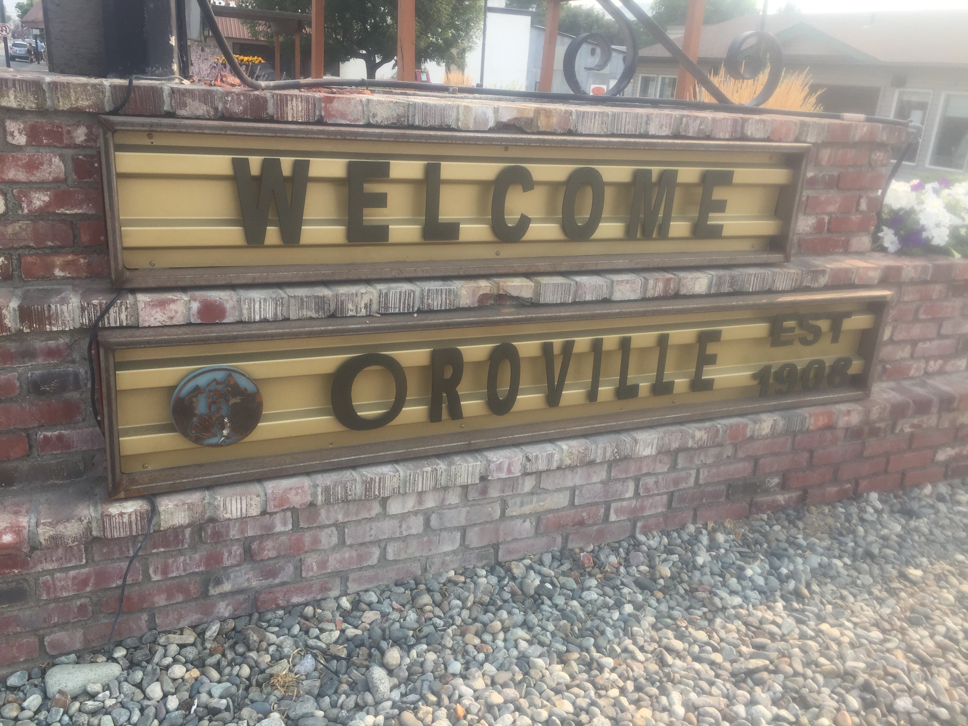
July 10
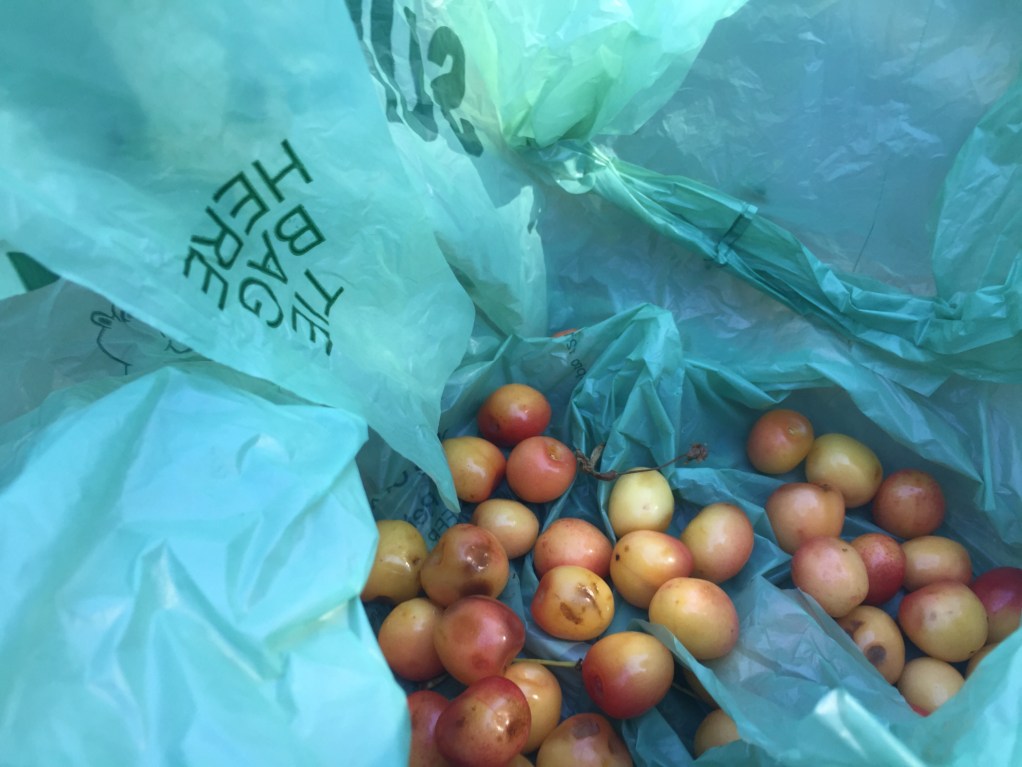
Neither of us slept great last night as the AC was noisy and we would wake up sweaty then cold. We both prefer the tent. I had to do a walk down to the post office to pick up my resupply. It was about 1.2 miles as cars zipped by on the road. I grabbed my 12 lb box and attempted to hitch back to the hotel without any luck. By the time I made it back to the hotel, I was sweaty and my arms were sore. I spent the next hour and a half going though my box, organizing my food, packing, taking a cold shower, and watching one of the 15 tv channels.
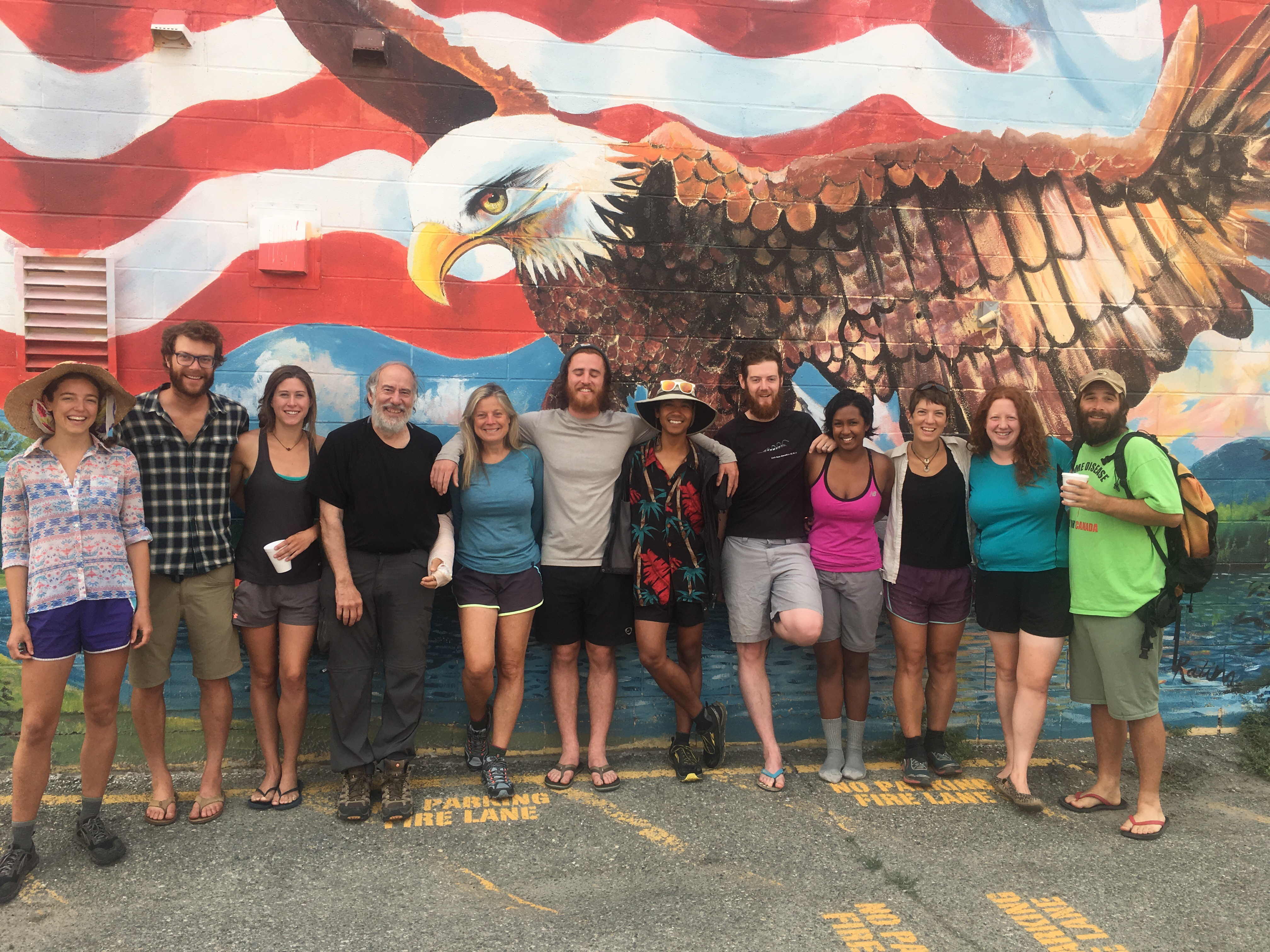
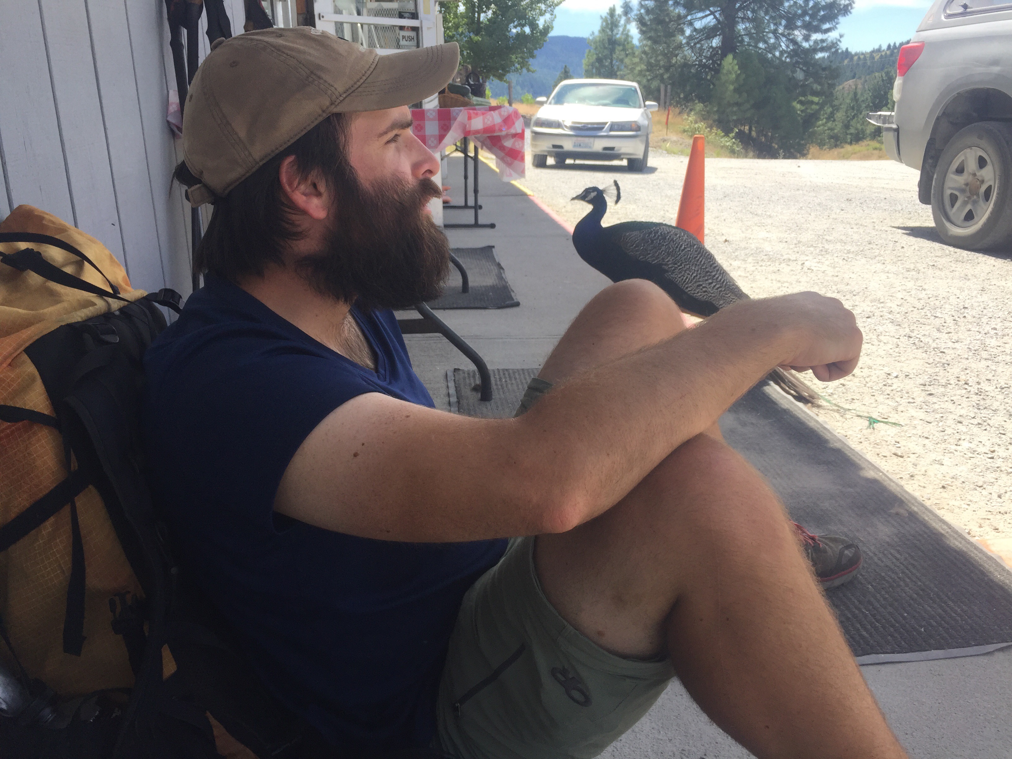
Paperweight, Turtle, and I took the short walk to the pizza place for the 11:00 lunch buffet. I had three helpings of salad, a few slices of pizza, and some fries. Not too bad of a deal for just $10. It was sad to say goodbye to Turtle who has been dealing with tremendous foot since the start of the hike. I truly enjoyed getting to know her and look forward to crossing paths again. Paperweight and I have been so happy to meet so many fellow thru hikers this year. We joke that we get sick of just talking to each other. A bit after noon we said goodbye to Turtle and the father and son.
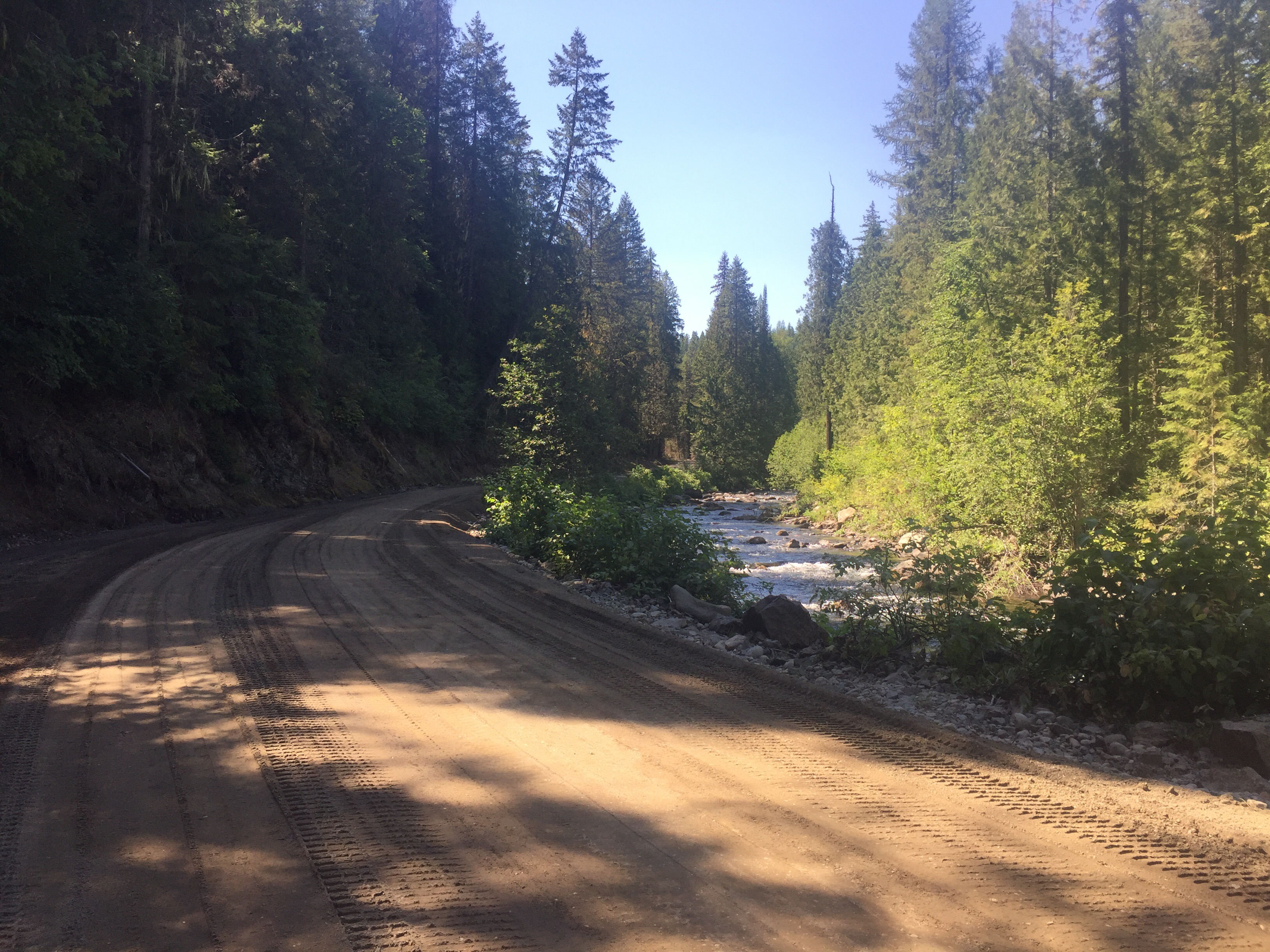
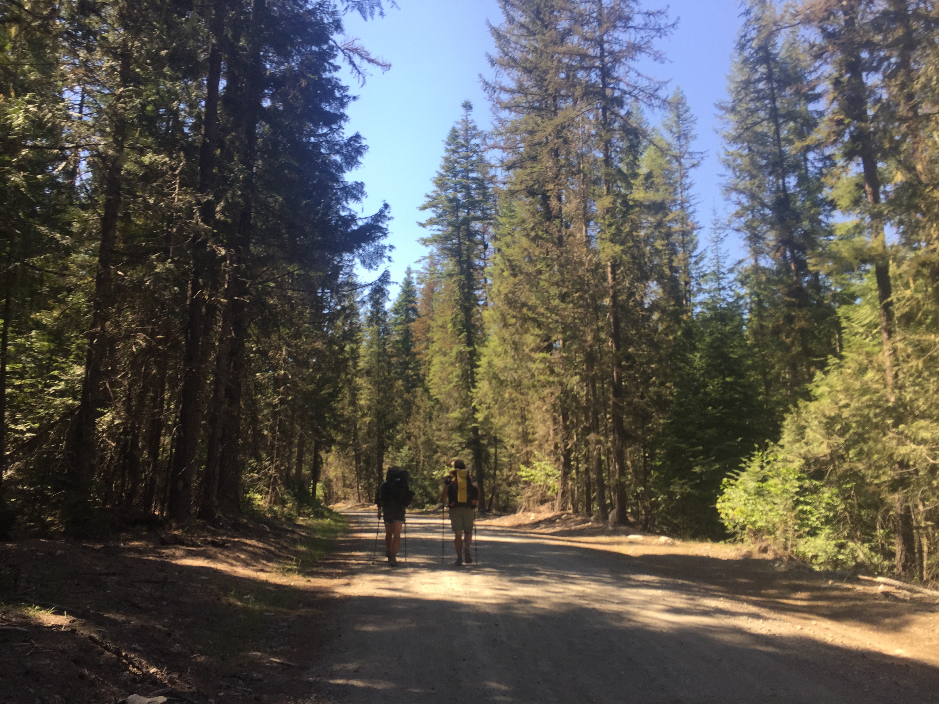
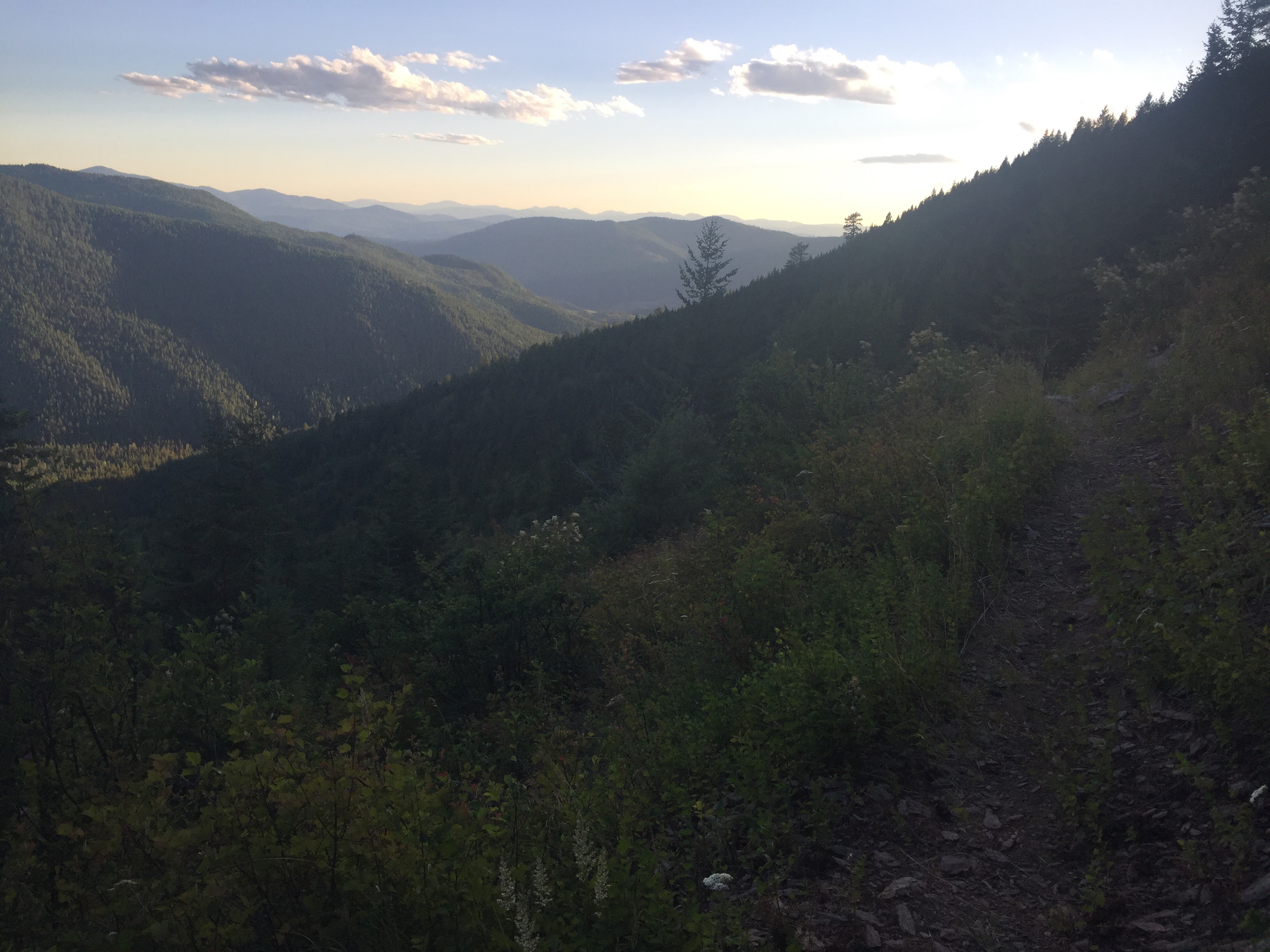
We decided to take the bike path out of town. It was a much safer option and allowed us to zone out into podcast land. I enjoyed all the quaint cabins along the walk. We dropped down from the road and under a bridge to join a rail trail. We found ourselves walking along a stream in the sand. It was very pleasant walking and a nice breeze. We ended up getting off the trail through since there were many paths. So we backtracked and joined a nicely oiled dirt road which rejoined to a dirt trail in the forest for a bit. After a quick discussion, we decided to just jump onto the paved road to make navigation easier. The trail would of joined the road shortly anyways. It was the typical paved road walk. Cars flying by, garbage tossed out of car windows resting for years along the side of the pavement, mile marker signs for me to know exactly how many minutes a mile I was doing, and the smell of the vehicles.
We found Beacon a little ways up the road trying to get a hitch to the bridge. We continued onward and it was pleasant since there was a lot of cloud cover. The rain came quickly as we both put on our pack covers and grabbed our umbrellas. It rained on and off for the next hour or so as we stayed dry. The temperature also dropped even more making the evening miles pleasant. Our feet were sore and we knew we had to dip down from the road to get water. We walked along the guardrail then took a steep rocking route down to the water. We were sitting under a bridge along a highway filtering water and eating dinner. Four years ago I would of laughed at the thought of it. We each grabbed a bit over 3 liters for the next stretch before climbing up steeply back to the road.
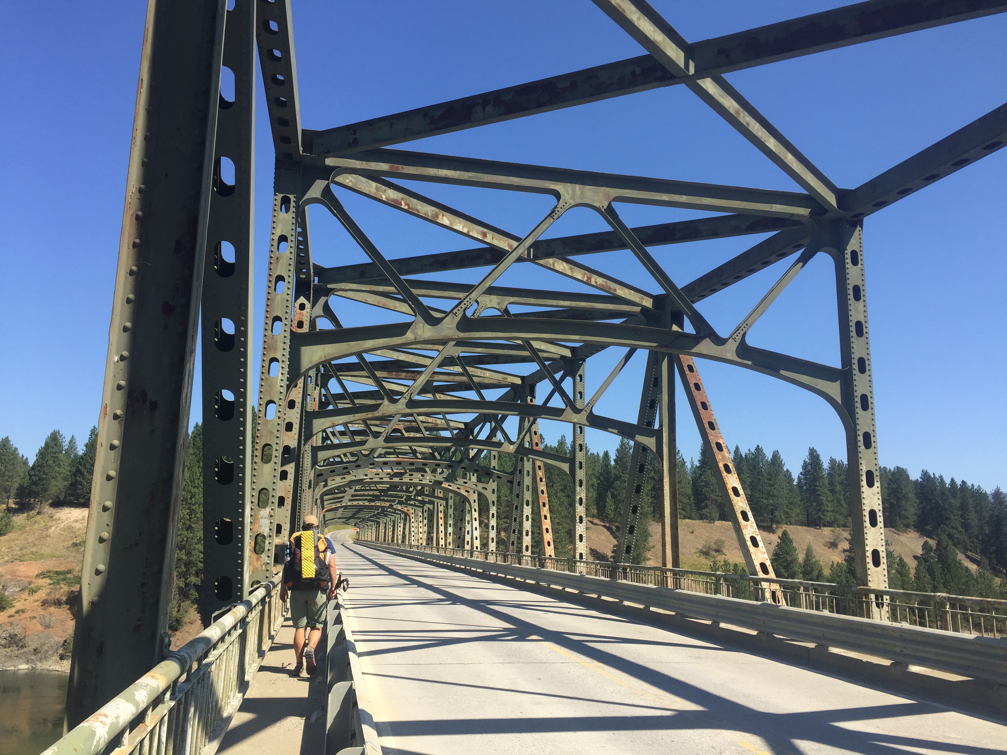
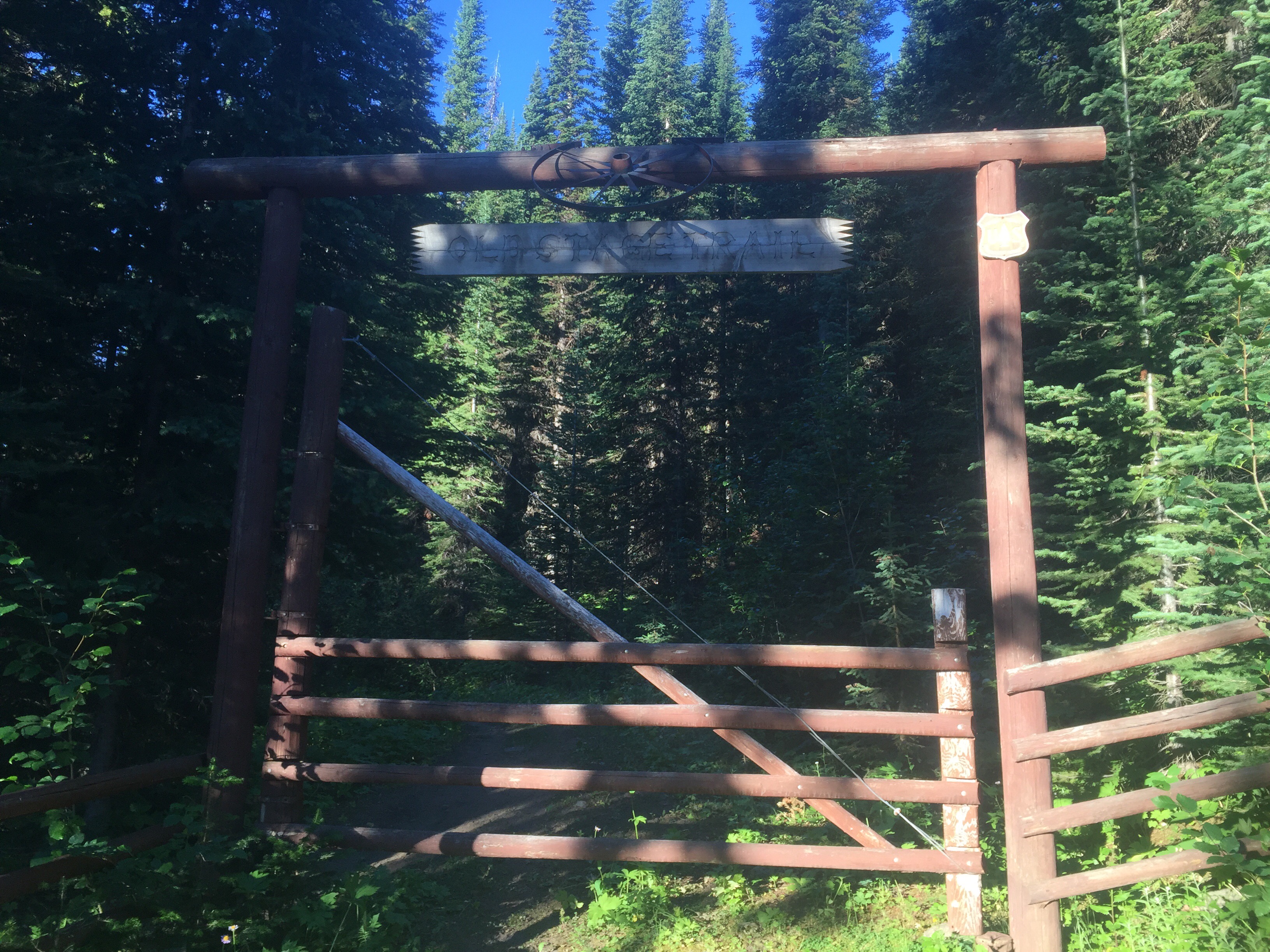
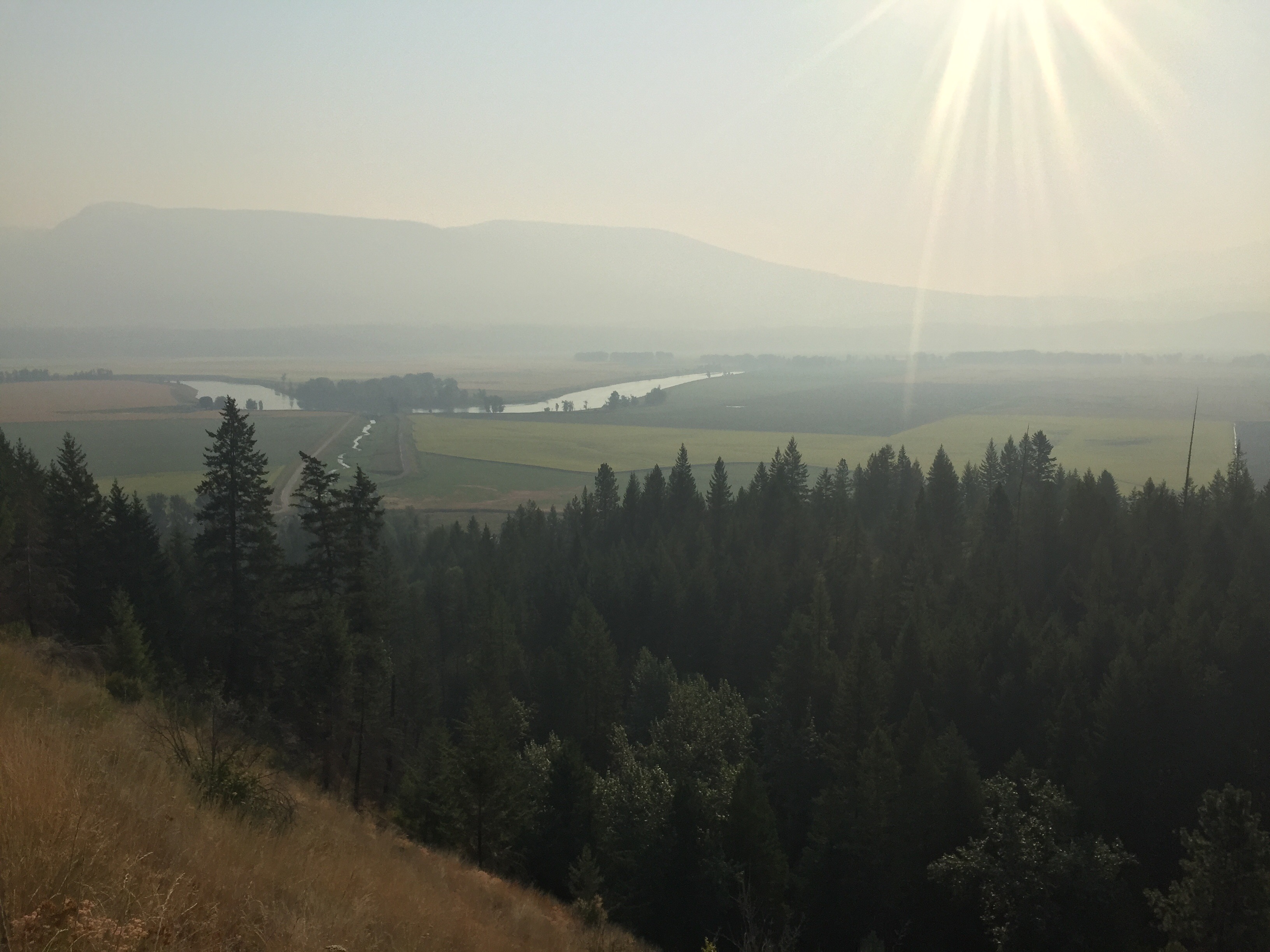
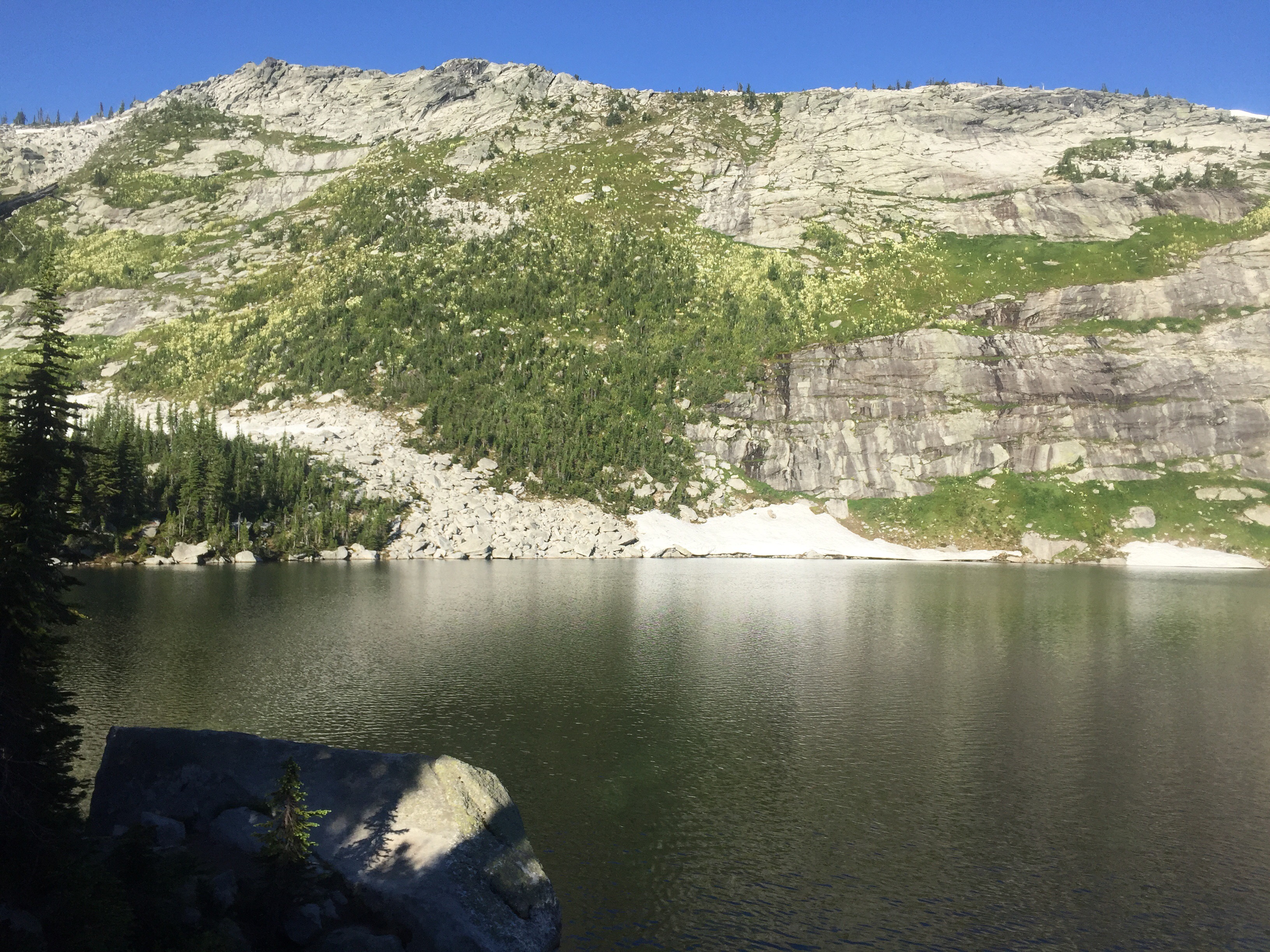
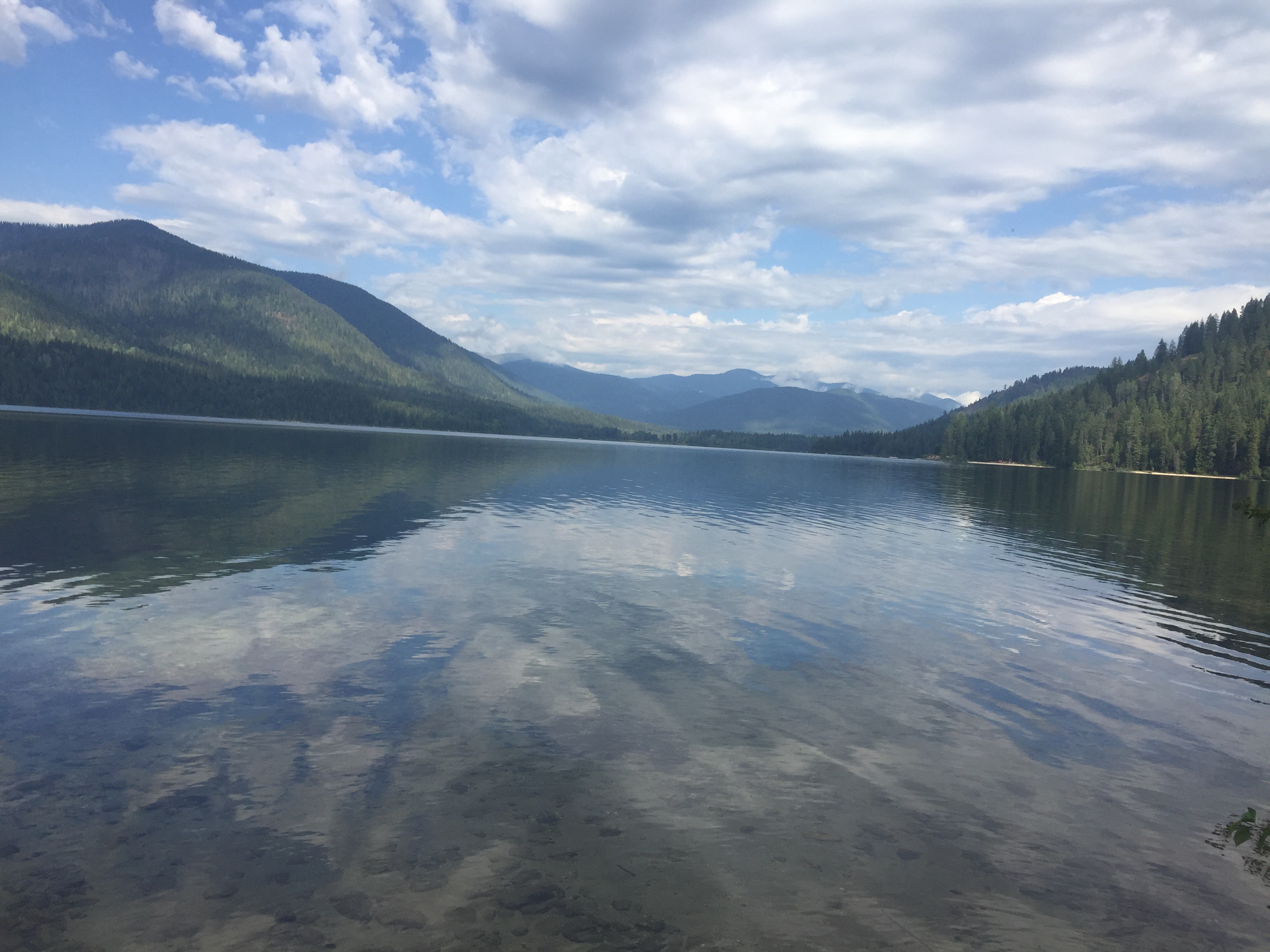
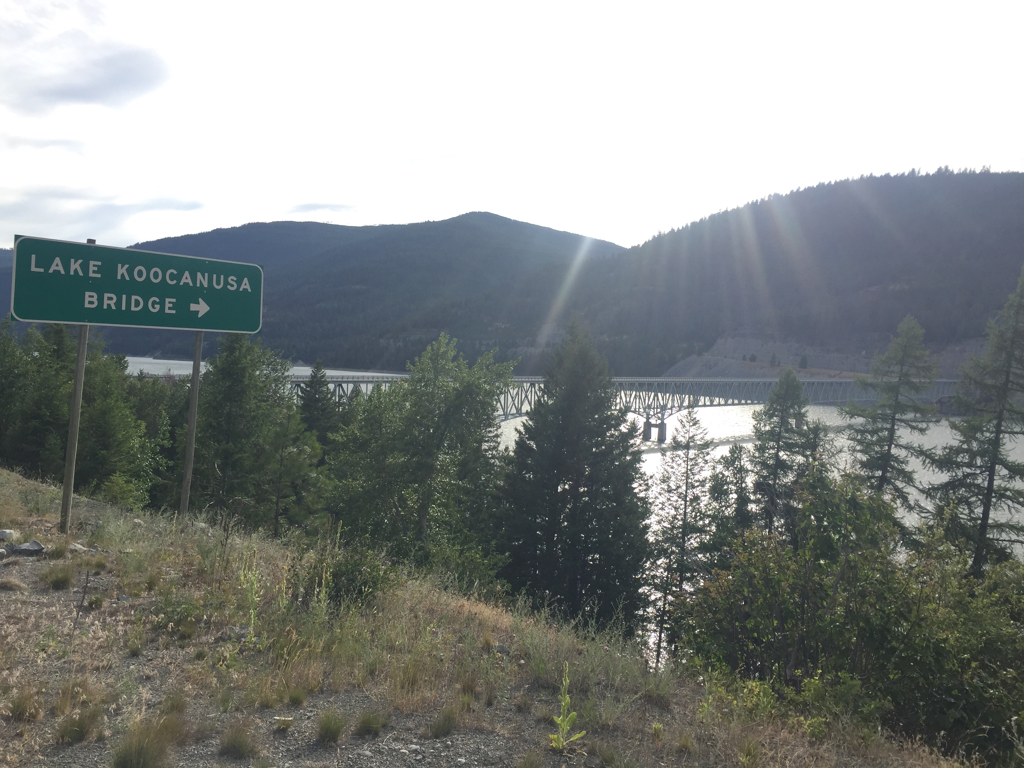
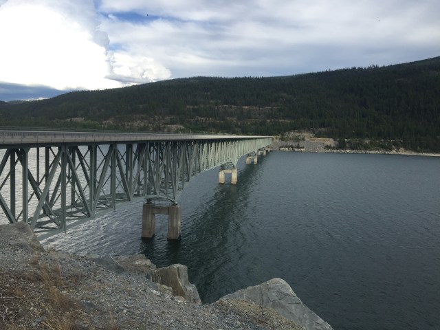
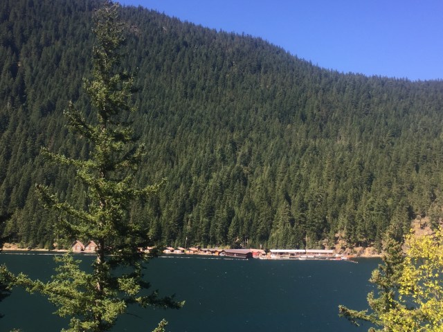
We have slowly been waking closer to The bridge over Lake Koocanusa. This is the highest bridge and longest in the state of Montana. It is a beautiful bridge and even had a sidewalk for us to use. It is .4 miles long and the breeze was spectacular. I took my hair out of its braid and let it blow in the winter. I have done this on most hiking and it is such a freeing feeling. I loved this part of the road walk. We then joined a forest road climbing uphill towards our trailhead.
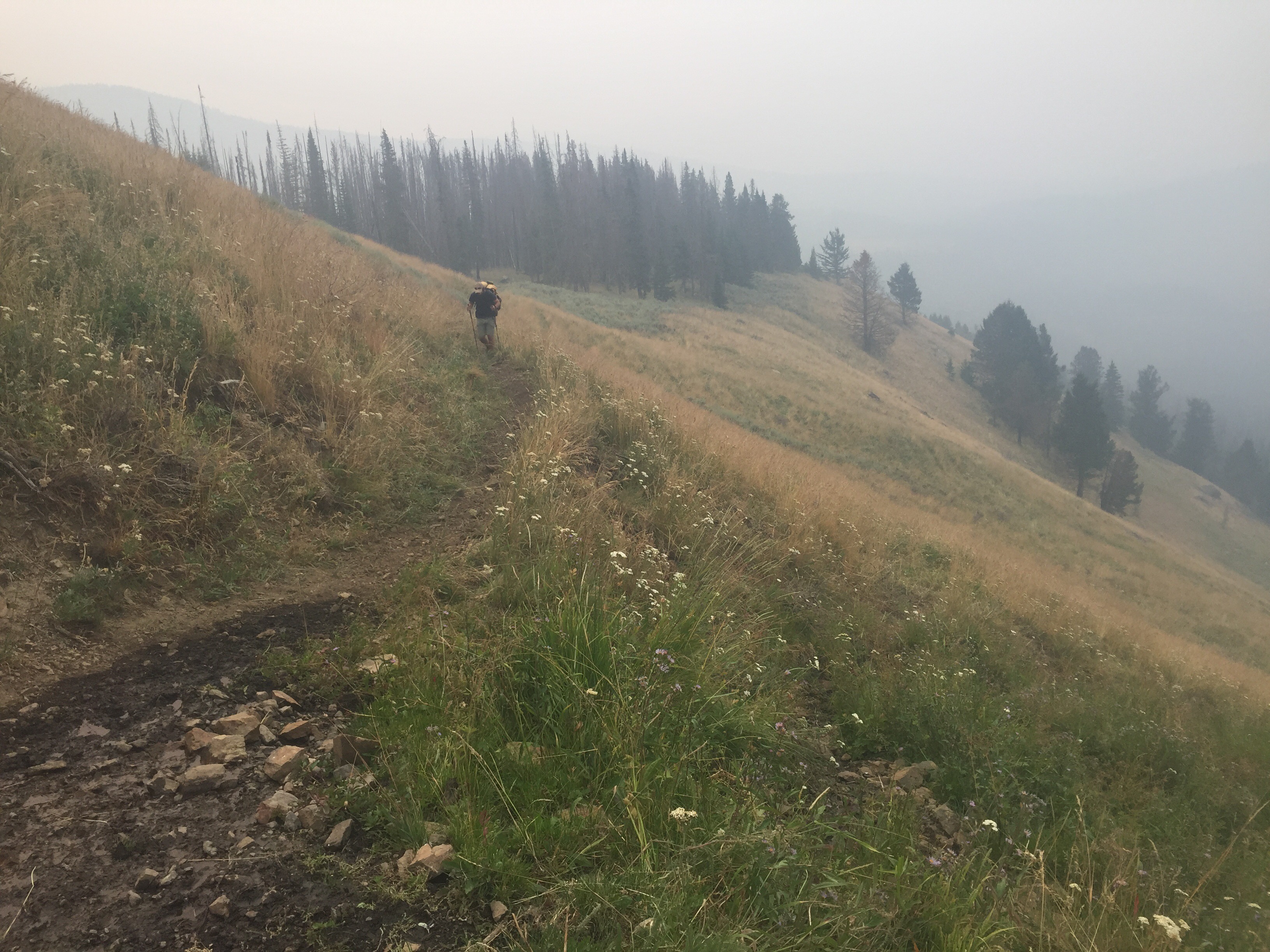
We finally left the road beginning the climb to Mt. Webb. Our guidebook told us where the first campsite was so we climbed uphill towards it. We found Beacon and Mermaid relaxing there. They had yogied some drinks and had saved us each a Bud Light. So after we set up our tent, we joined them as we drank a warm beer. What a day! We figured we did a little over 15 miles starting in the afternoon. I was exhausted and climbed into the tent to quickly fall asleep.
July 11
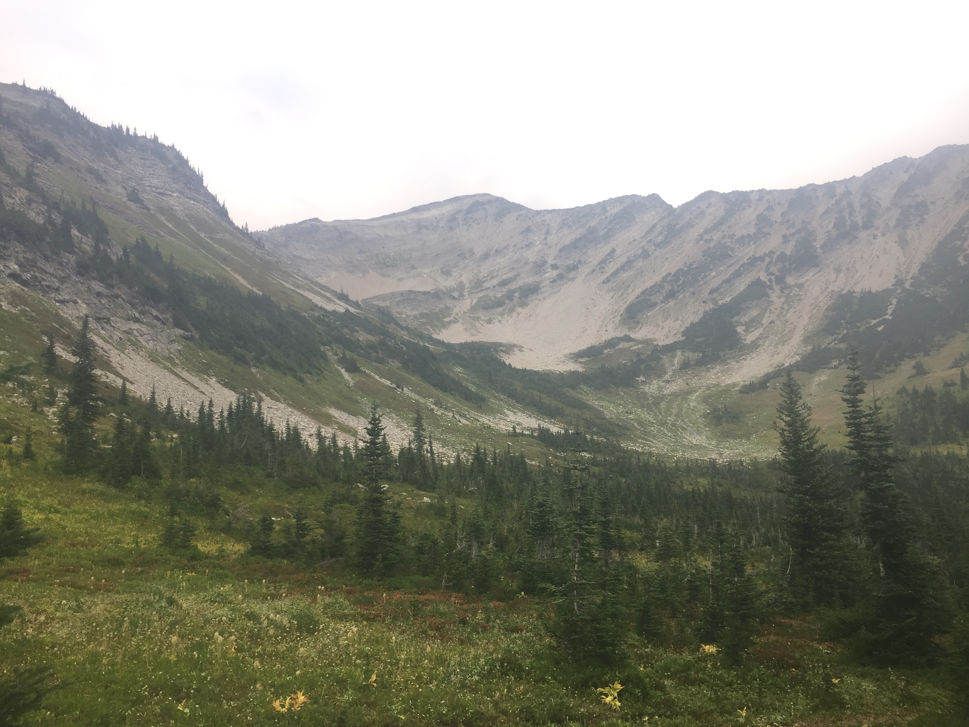
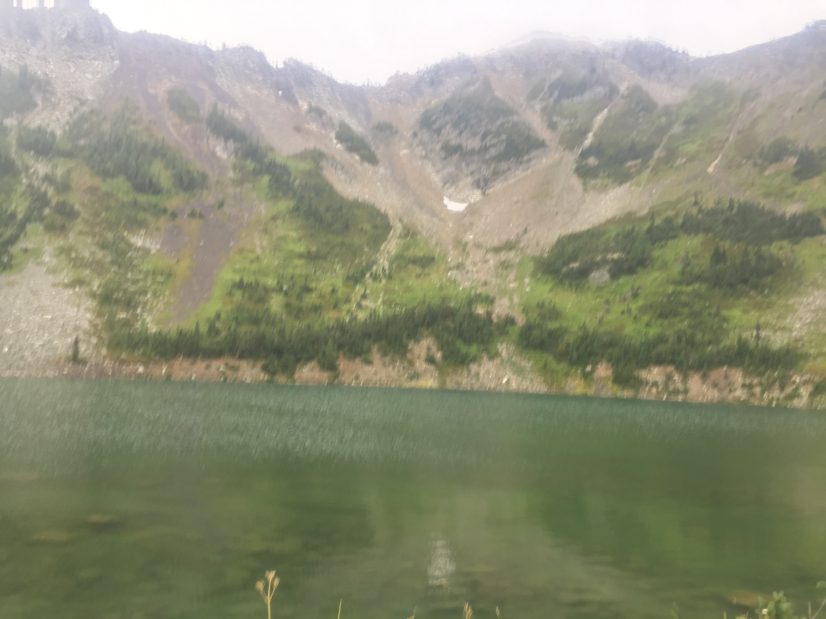
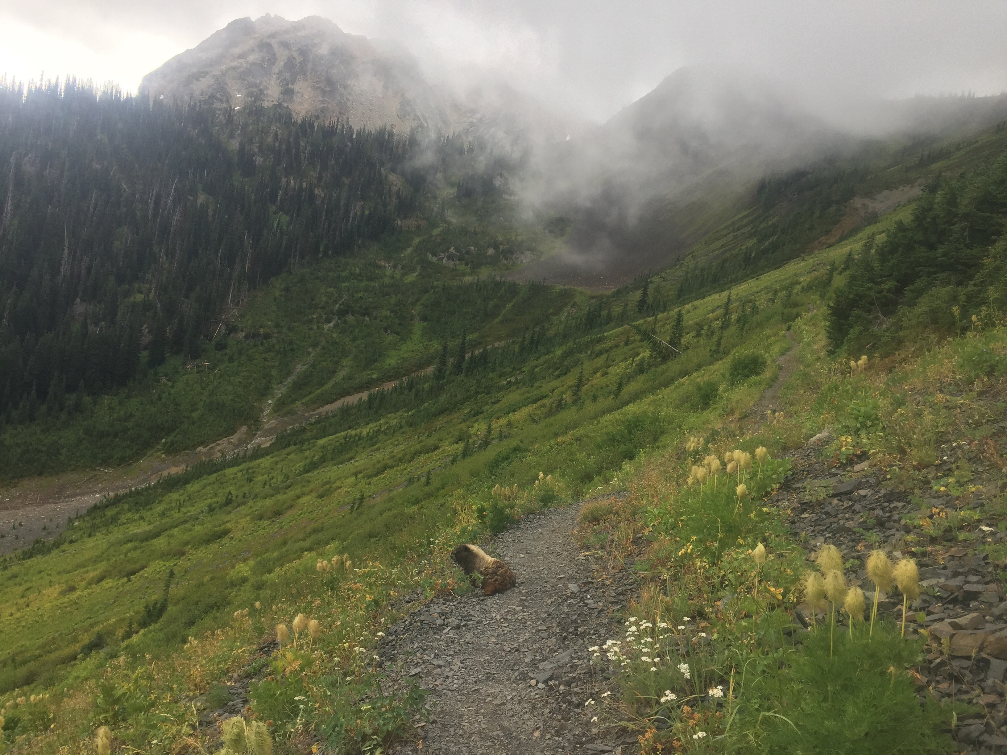
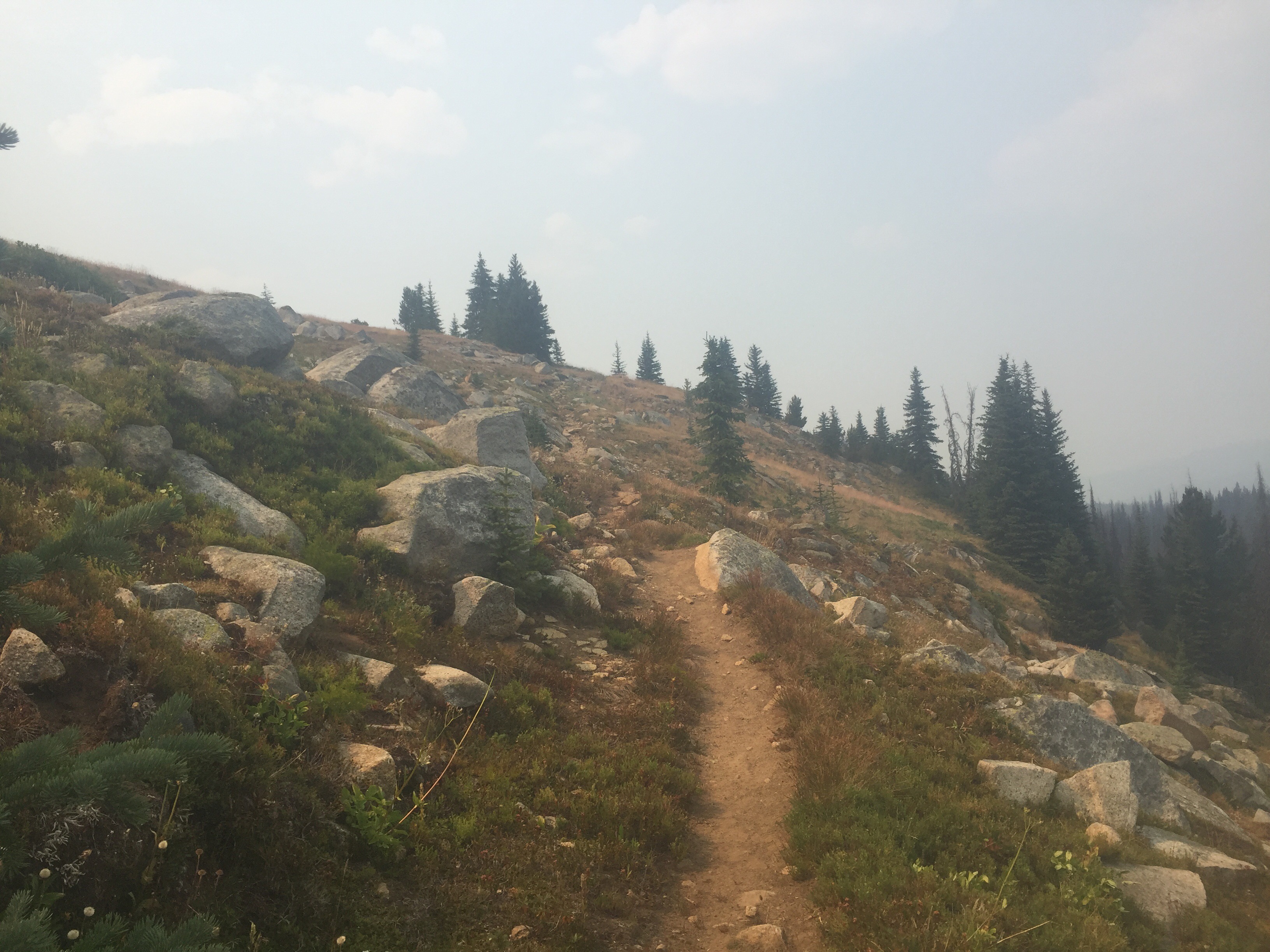
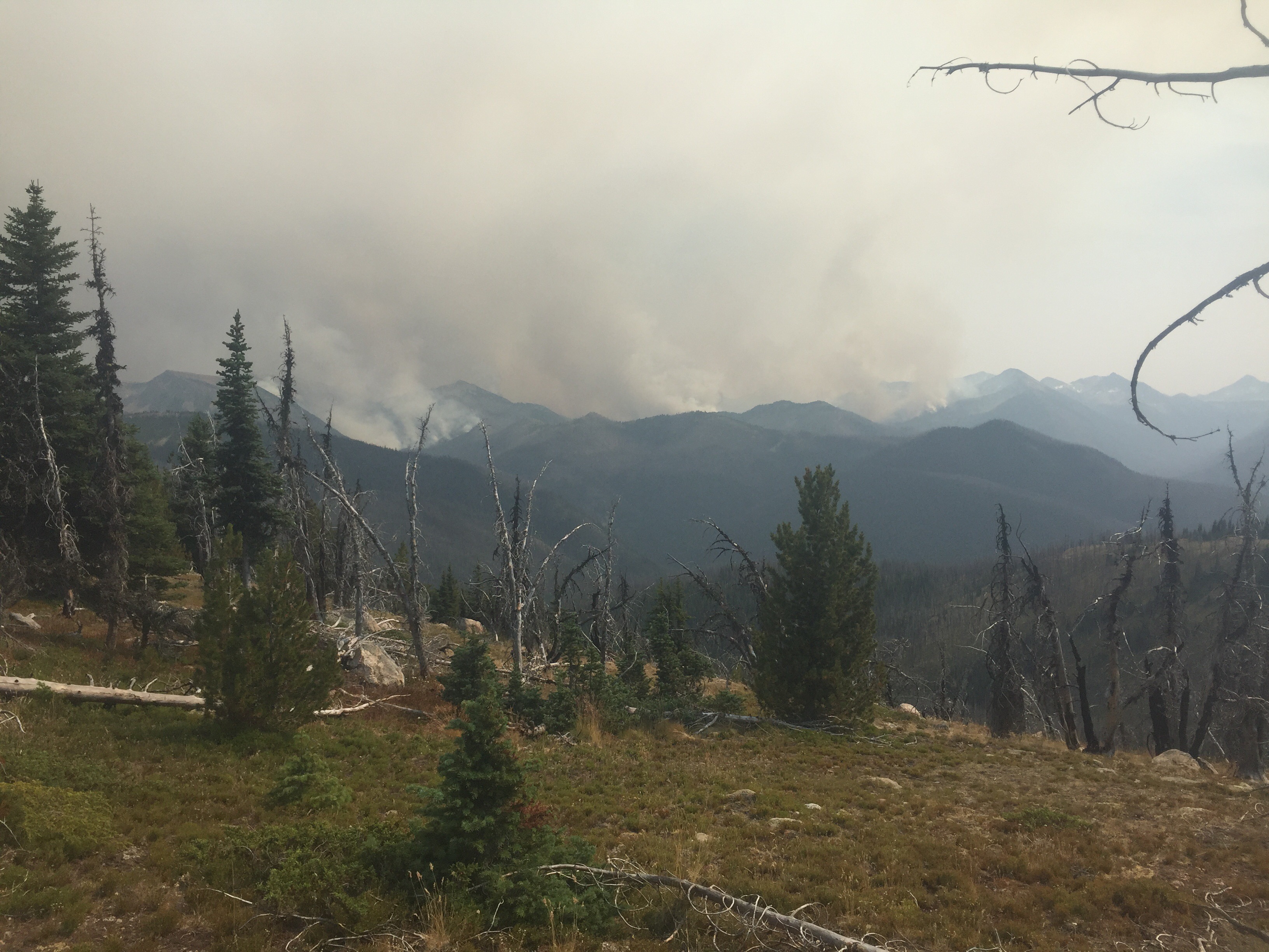
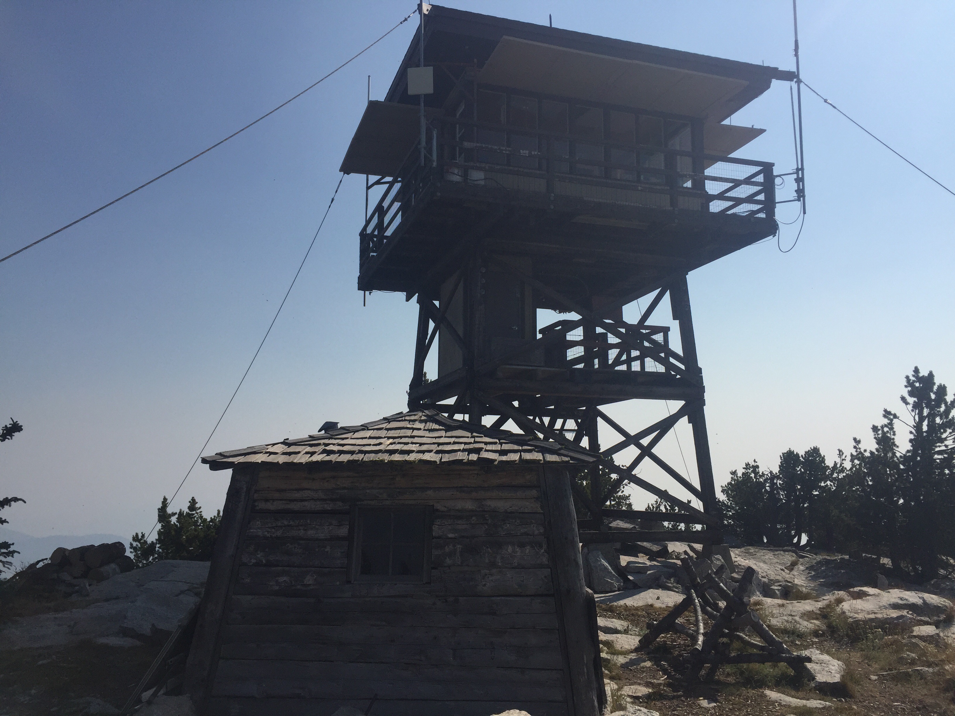
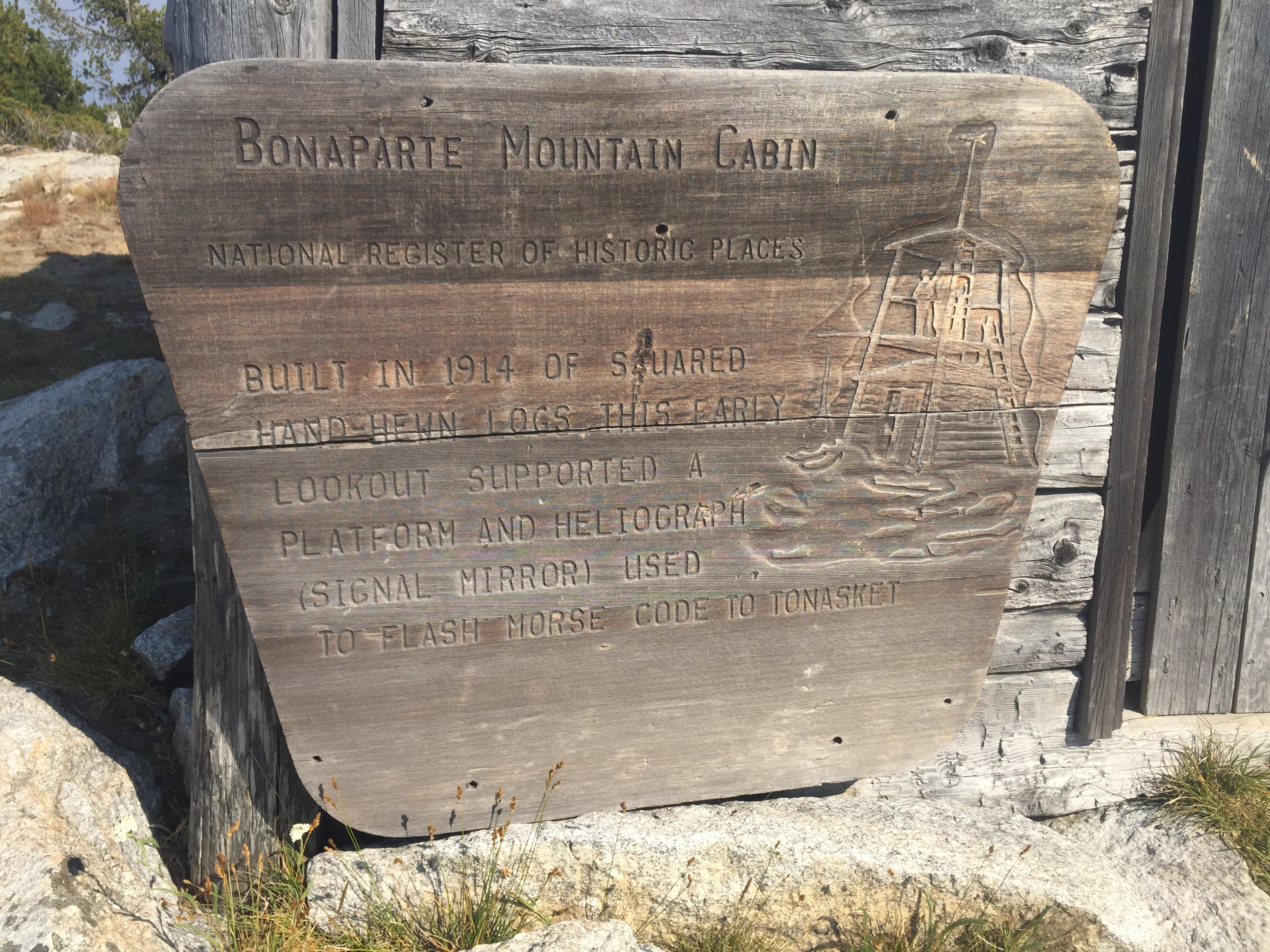
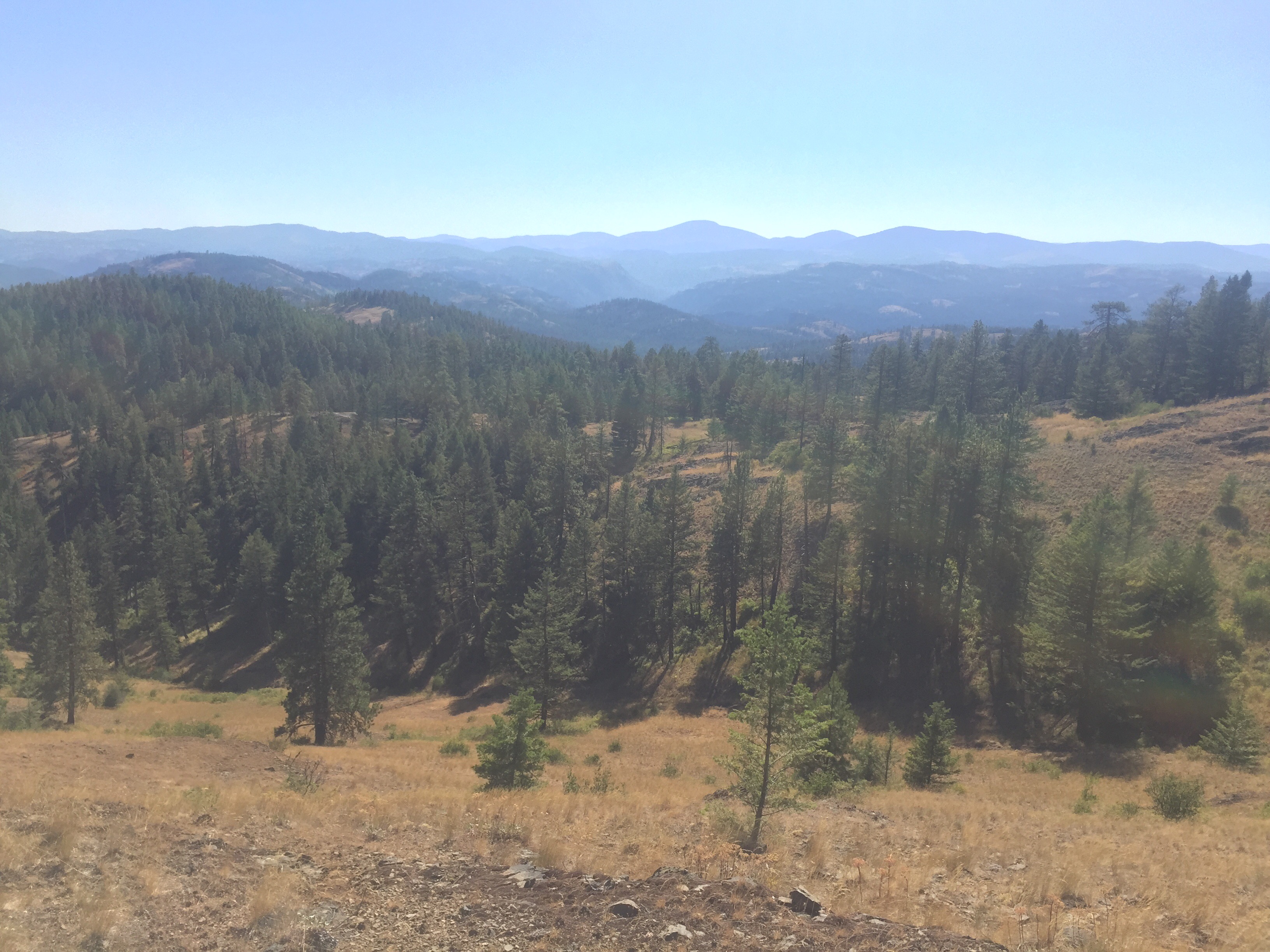
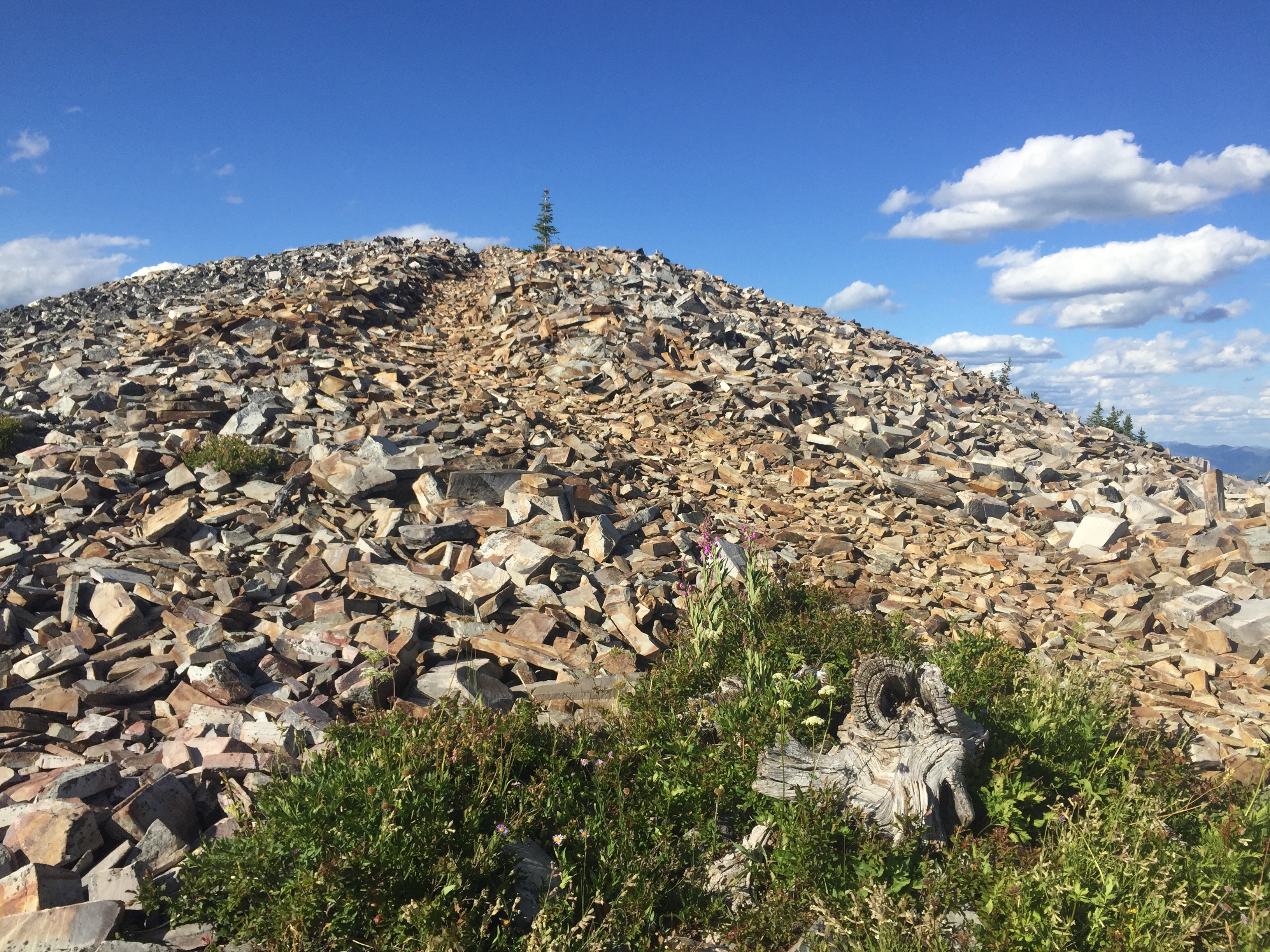
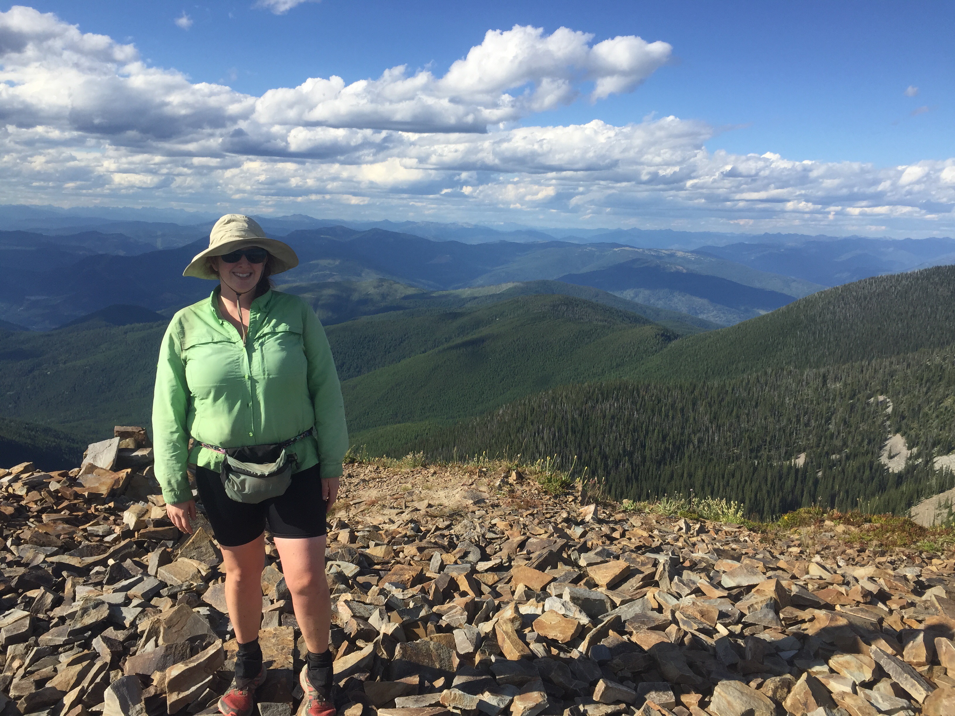
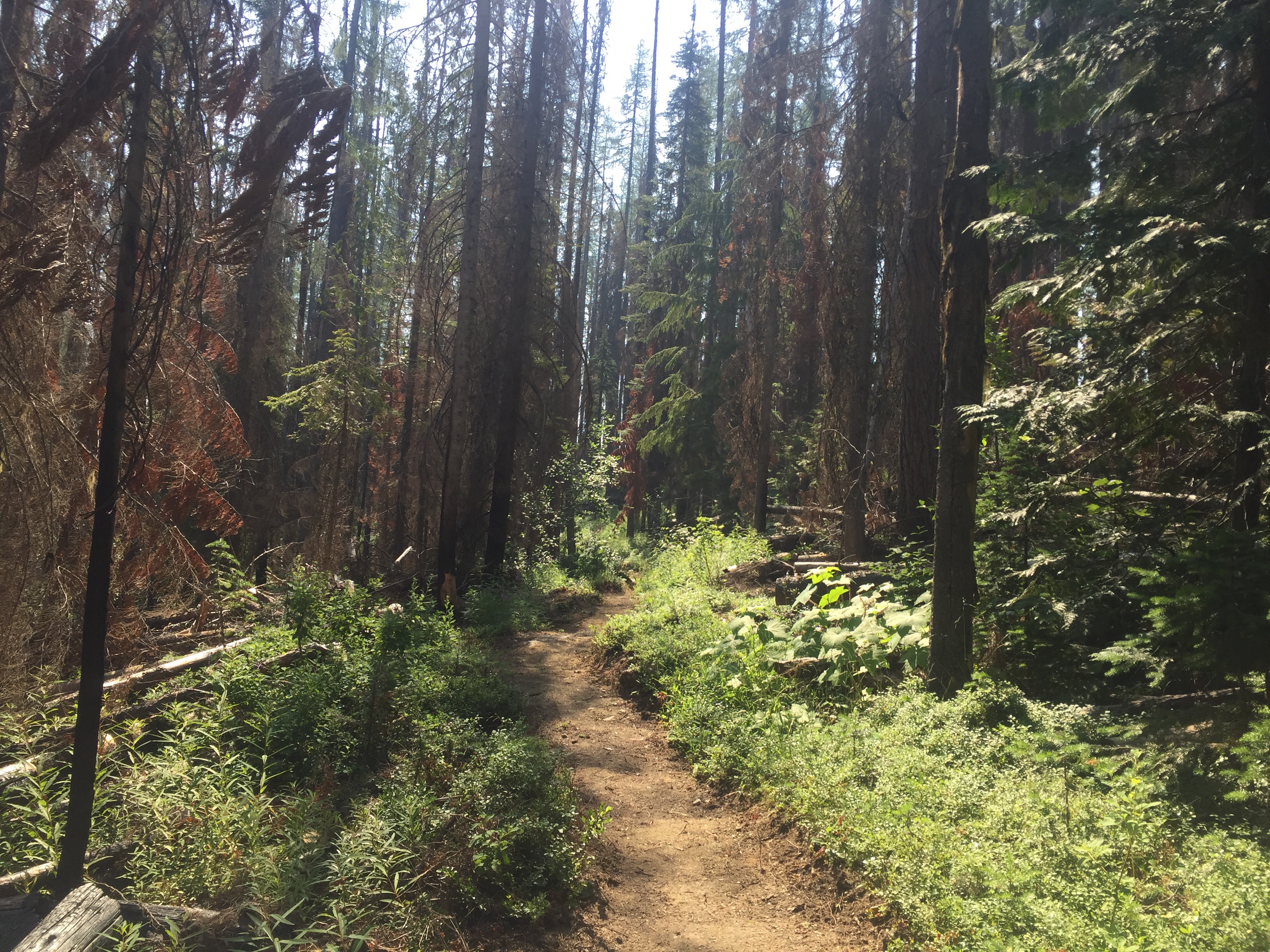
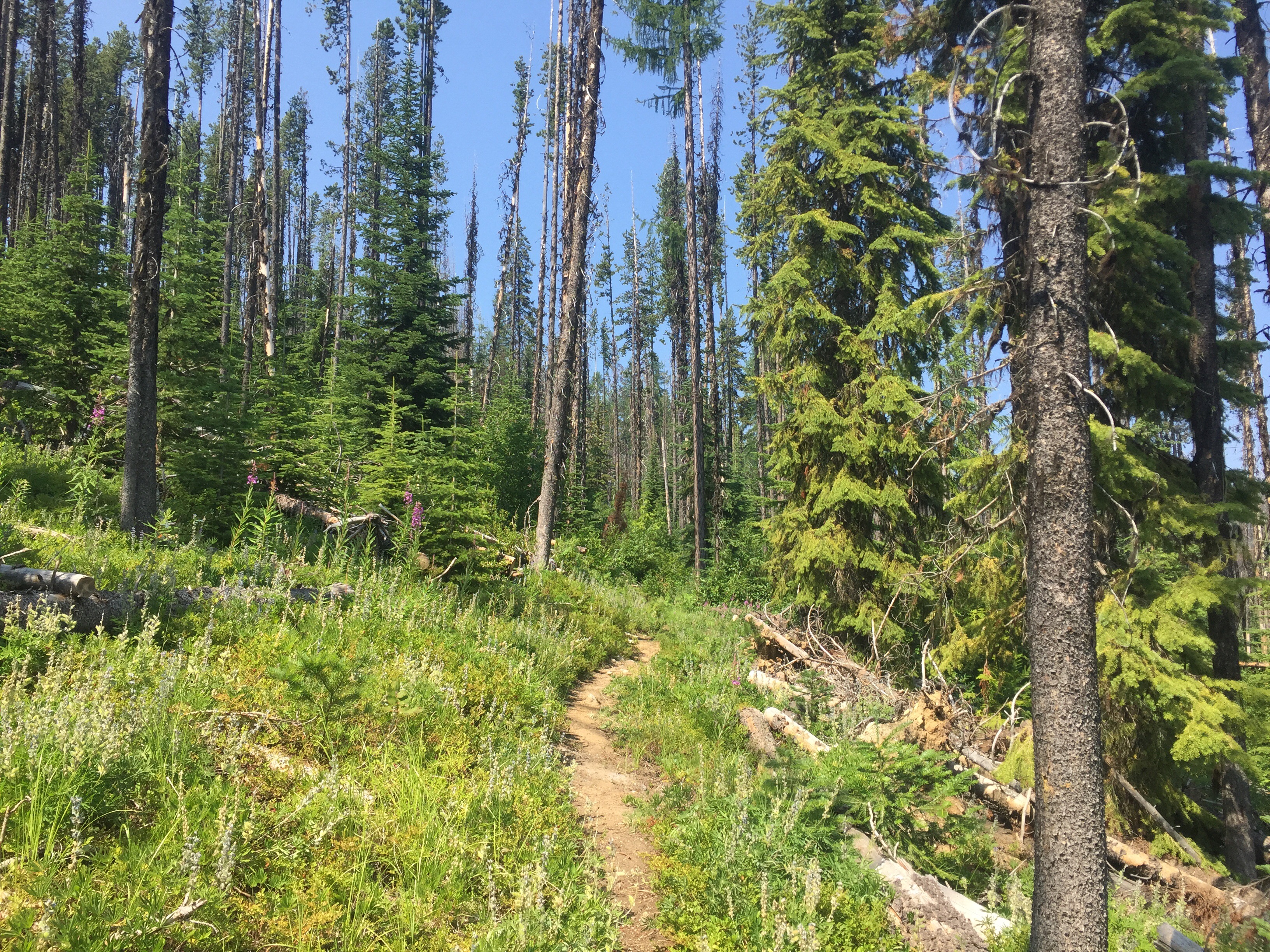
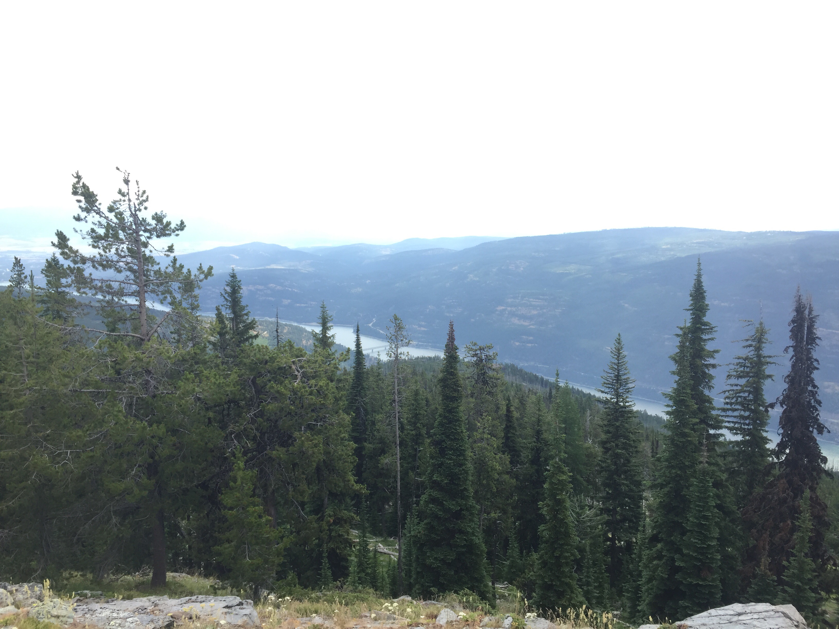
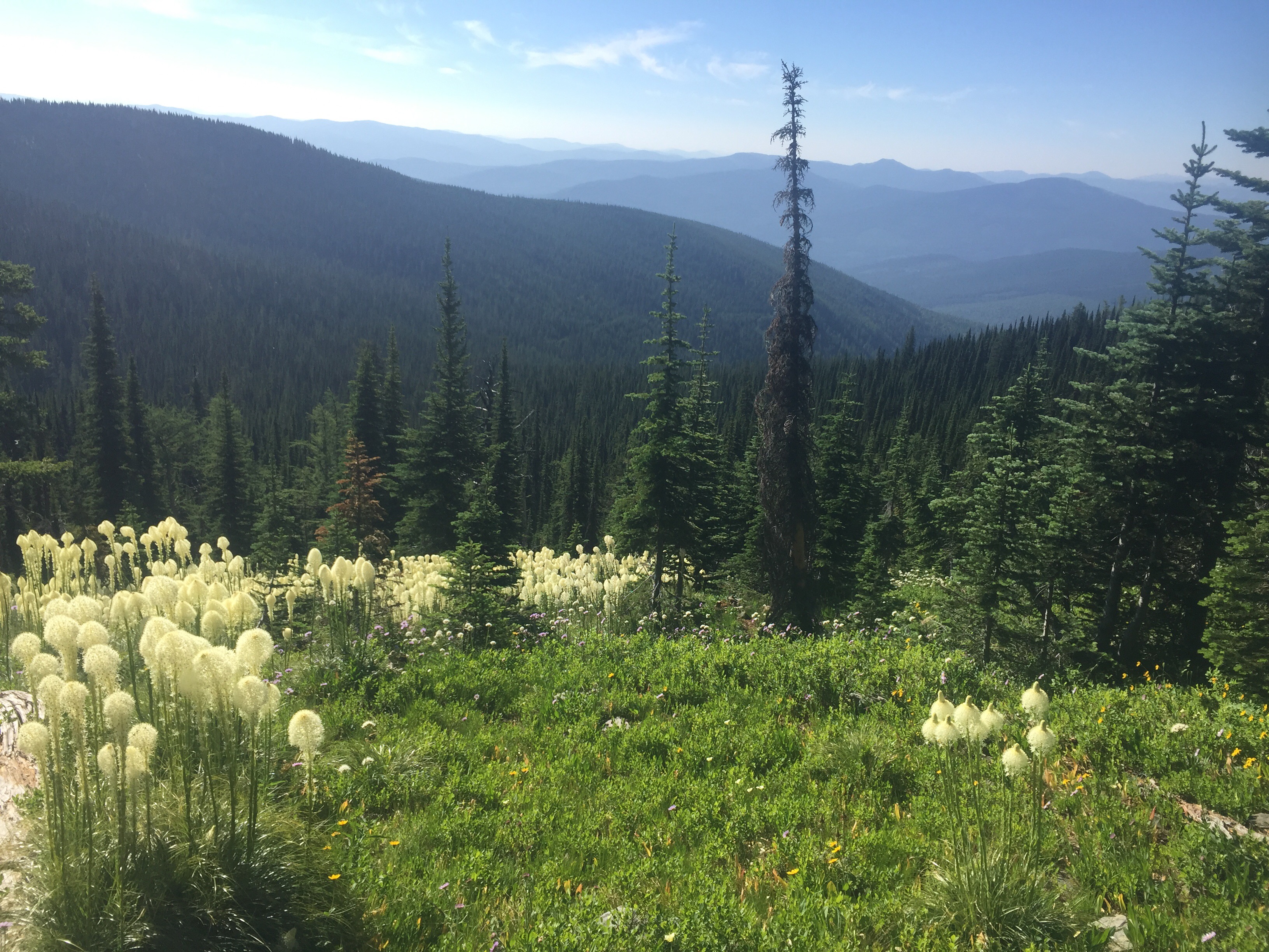
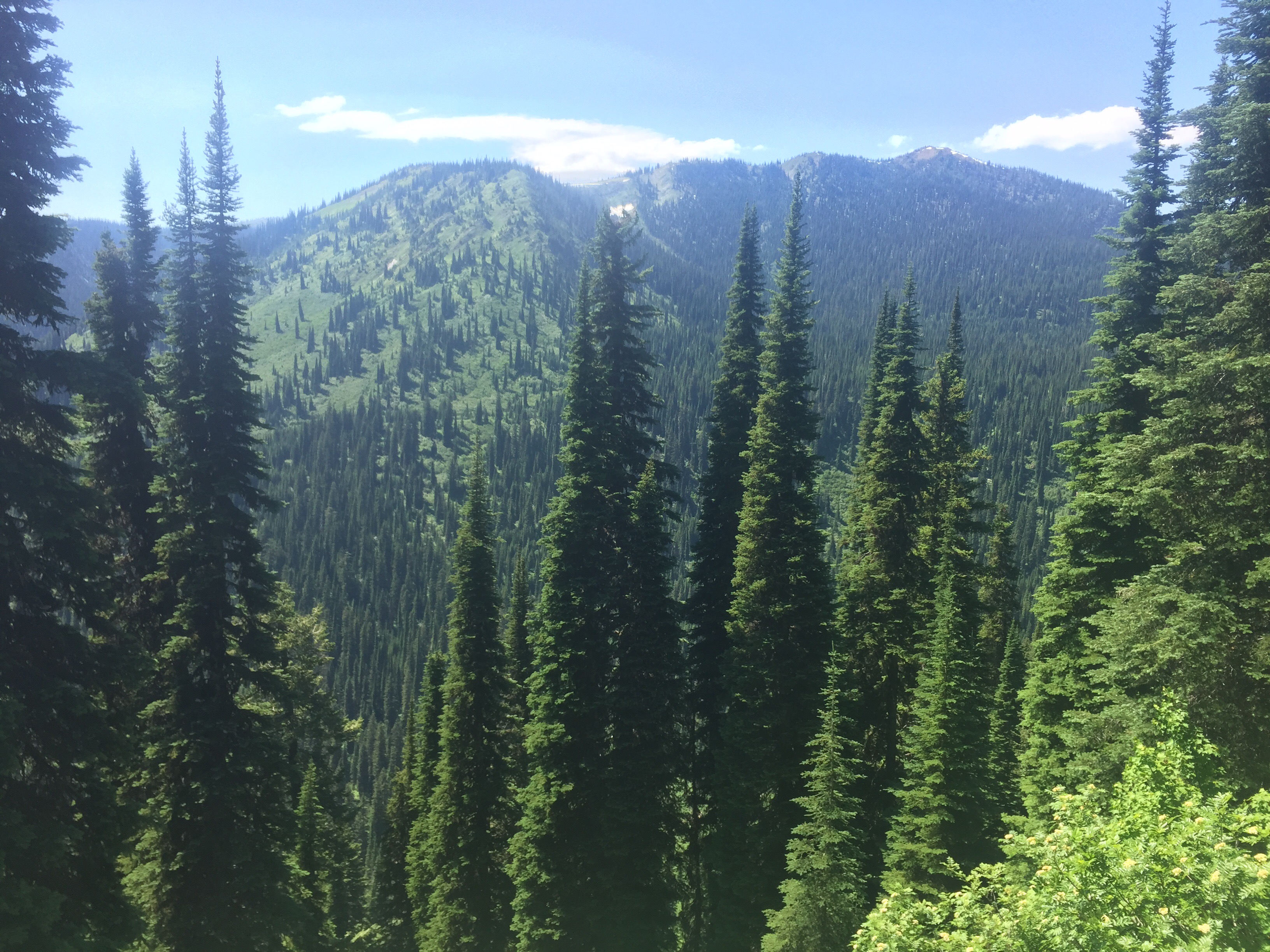
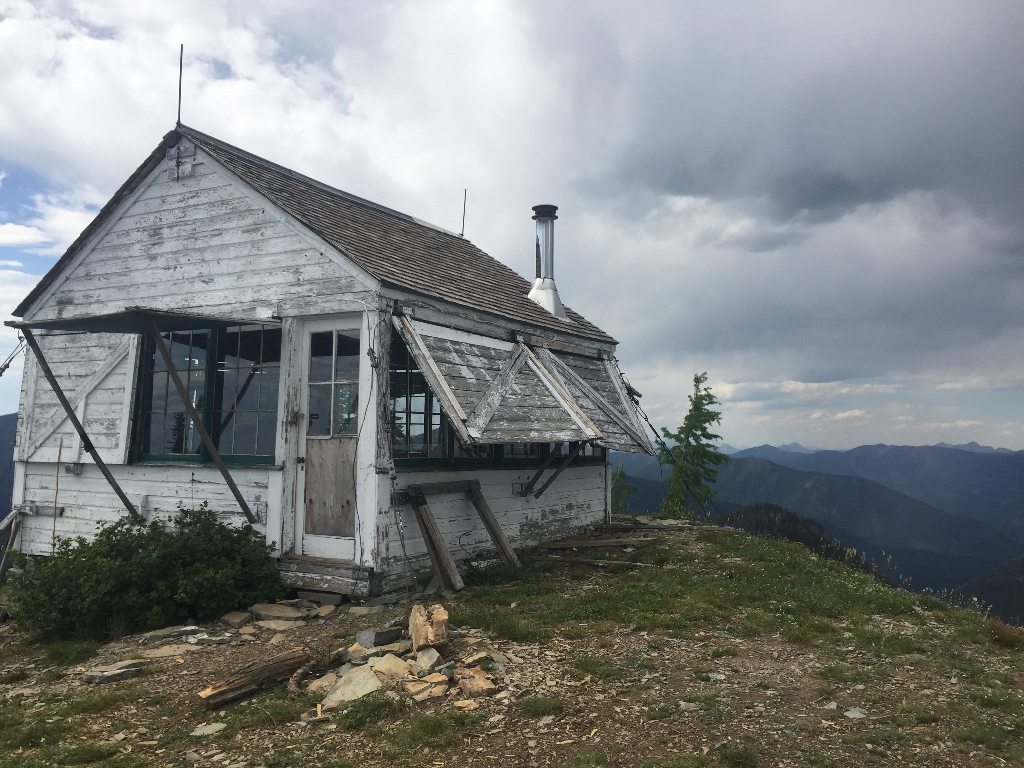
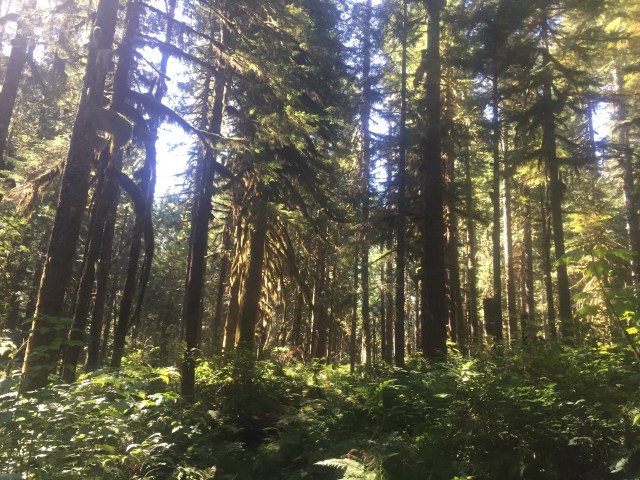
We all woke up around 2am to hear something running around the camp. I remember saying “it’s probably a deer” then falling back to sleep. In the morning, we had over 3000 feet of uphill to the top of Mt. Webb. I left last and took my time. There are a few ripe huckleberries so picking season is coming soon. The trail switch backed uphill for close to five miles as you get a better view of the large lake. I was dripping with sweat by the time I made it to the top. I peered into the windows of the lookout cabin and enjoyed the views from the porch. It was windy and I got cold quick as the sweat was still drying. We all had a nice snack break before getting back to the trail.


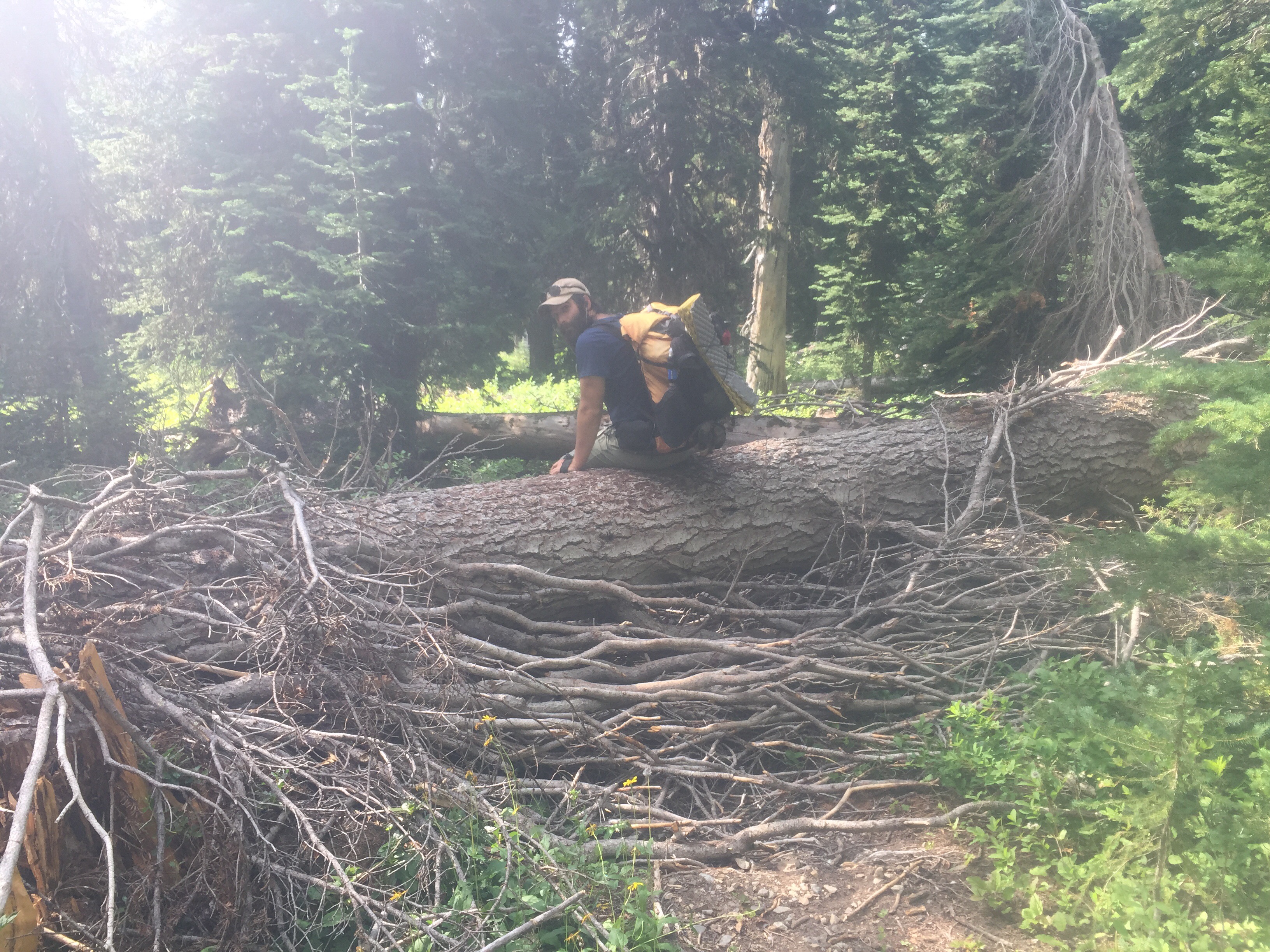
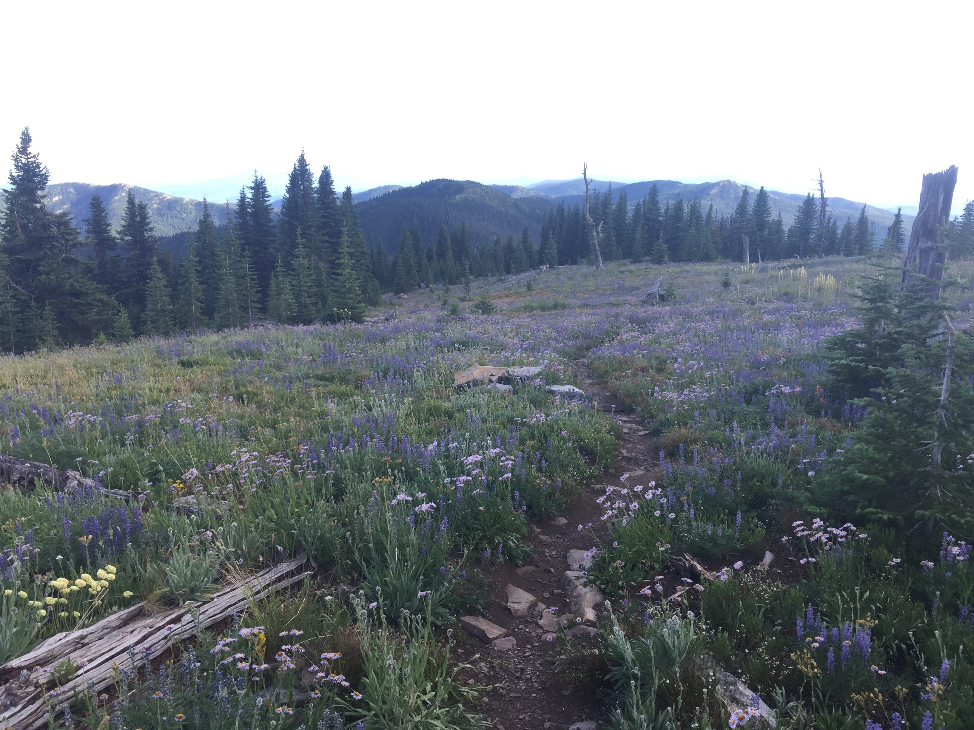
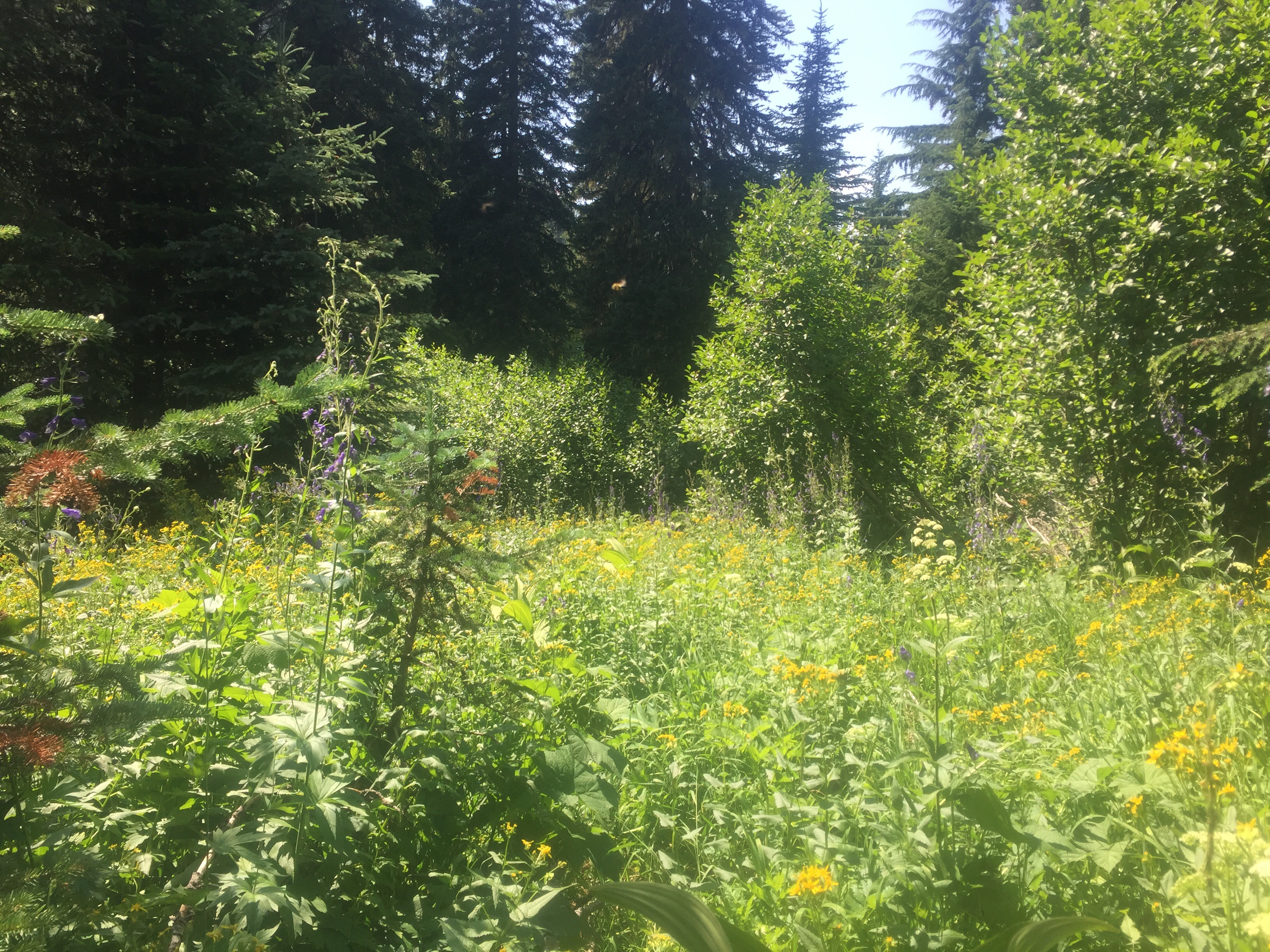
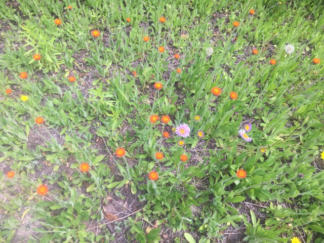
So many flowers are blooming! Along this path I counted 6 different types of flowers. The forest is colorful and berries are starting to ripen. We crossed a dirt road and walked a snowmobile path for a bit before stopping for water. We ate in the shade near the stream. The next part of the day we began climbing. It is a dense forest with tamaracks and spruces. The trail sent up then back down a few mountains. We calculated about 6500 feet of elevation gain today. At our next water stop, mermaid caught up to us. Beacon had grabbed a ride into town. There were lots of frogs in this water source as I counted five. The trail then had us climb straight back up followed by another steep down. We also did some log jumping as trees fall all the time on trail. 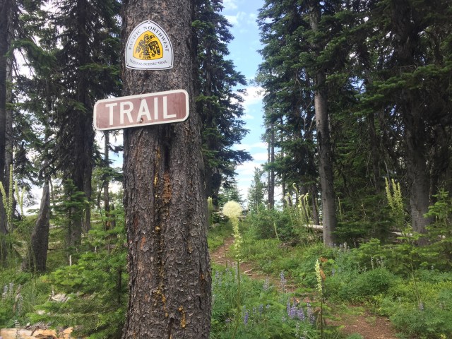
We ended up finding a semi flat and not too overgrown campsite to set up. It was another tough day of hiking. We set up, ate dinner, and then slept the best nights sleep in a long time.
July 12
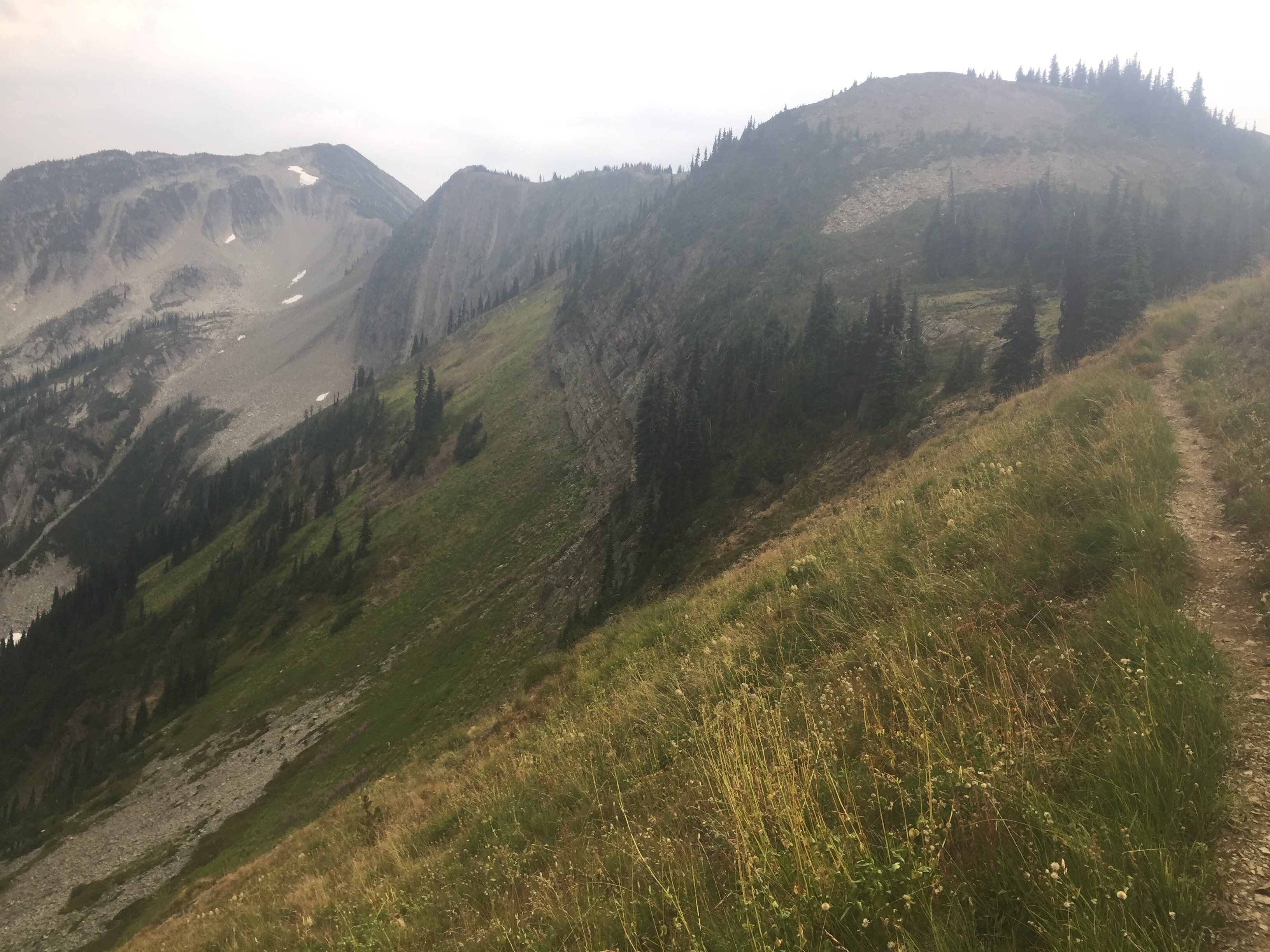
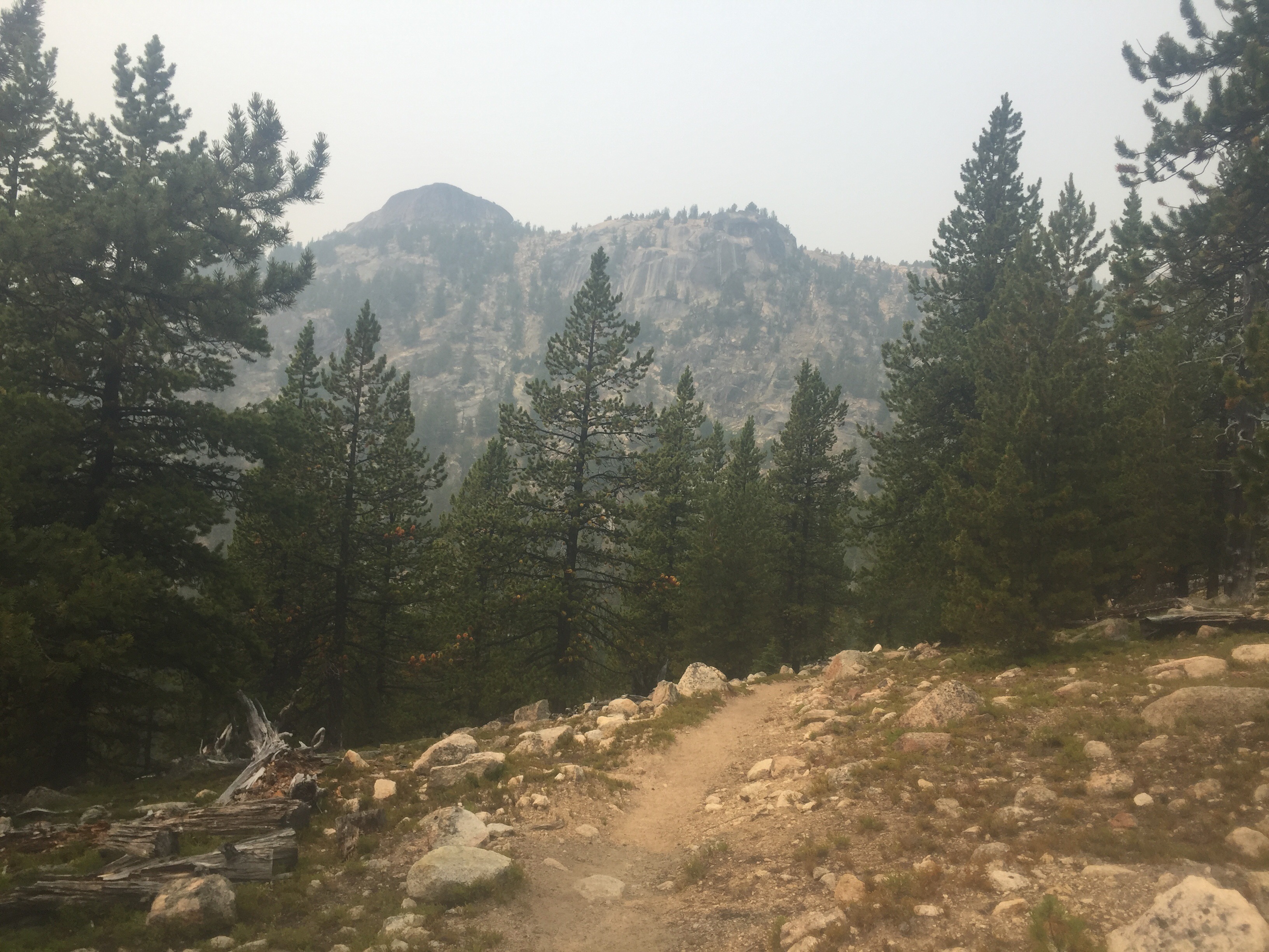
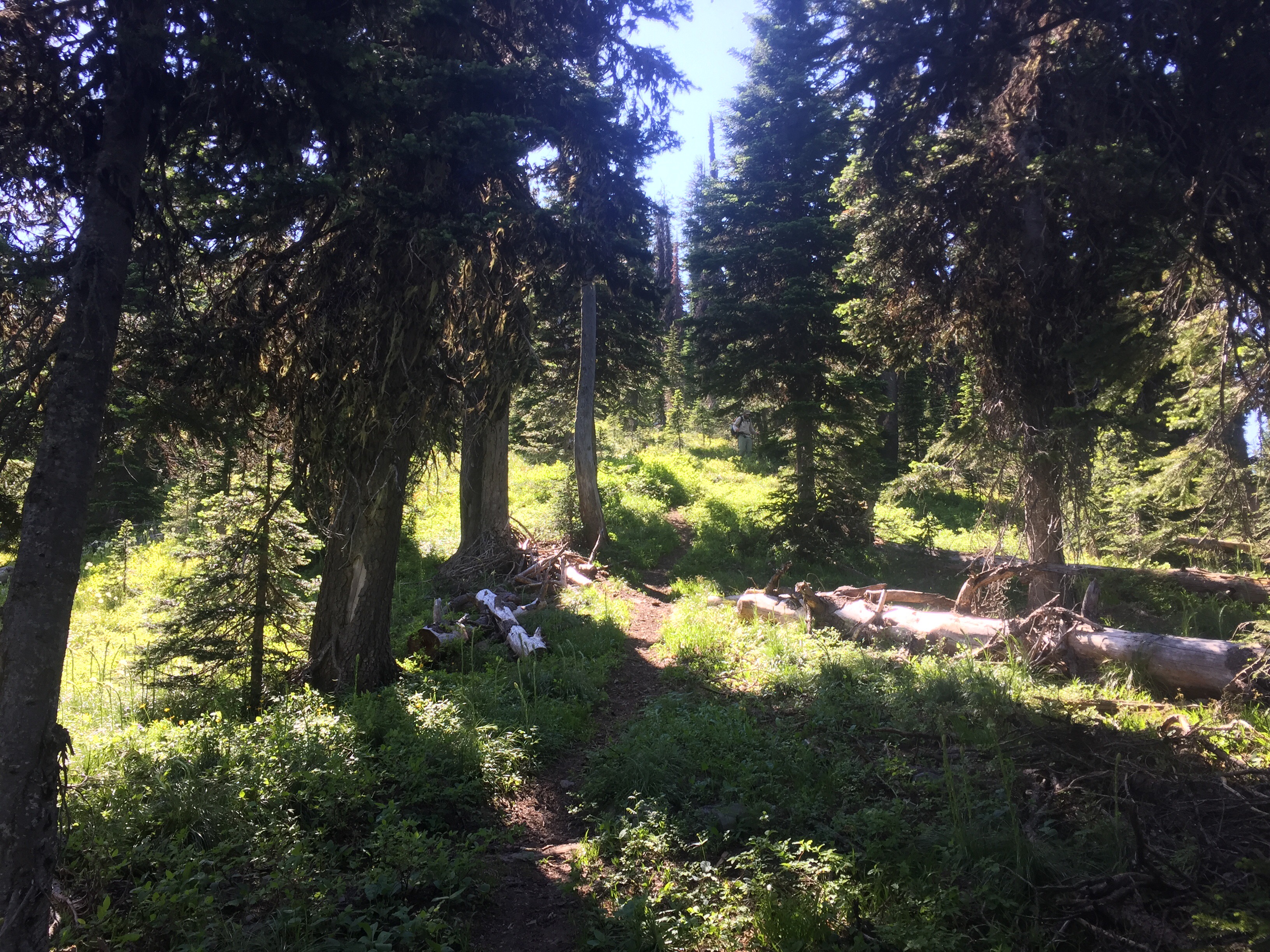
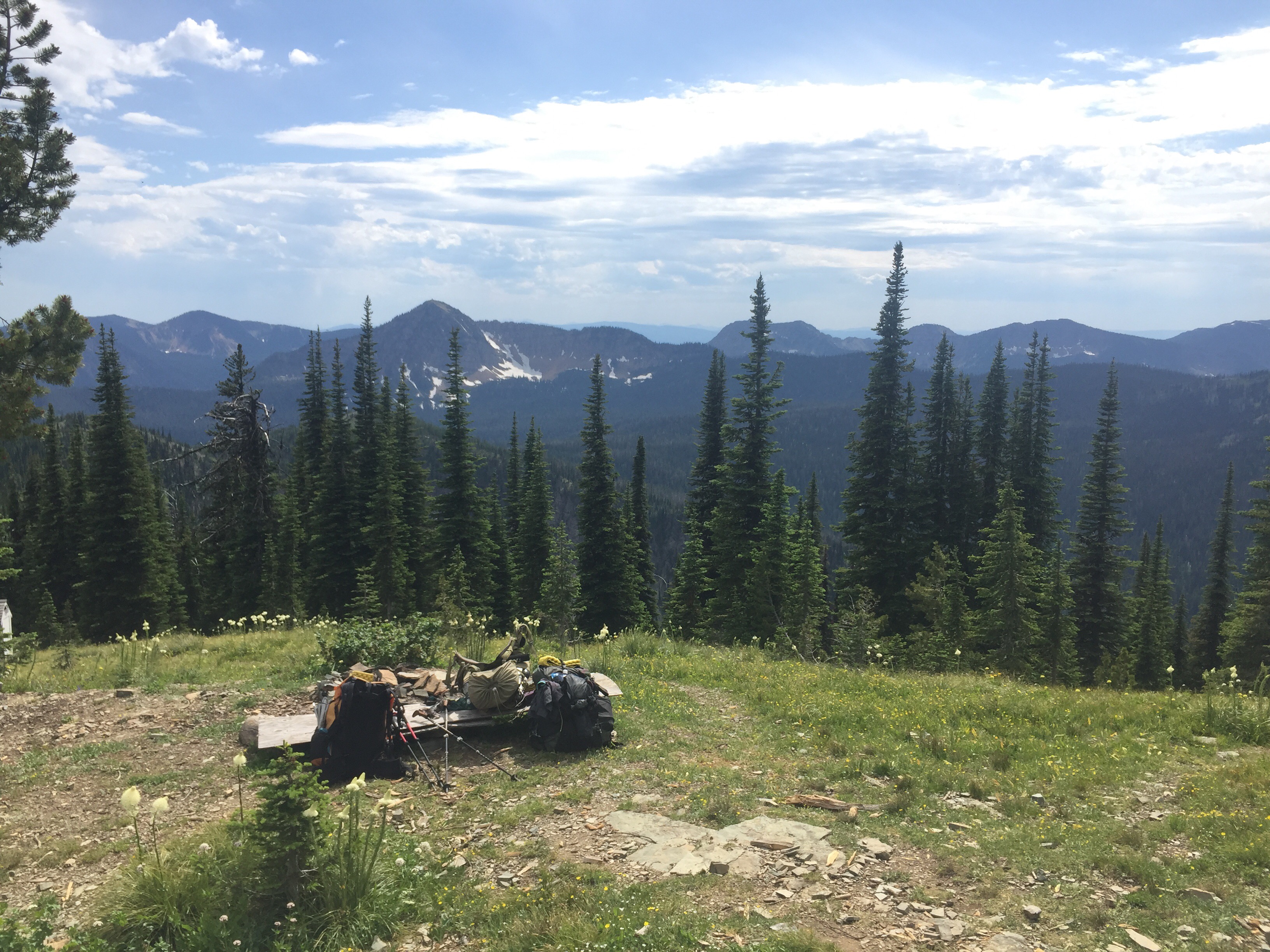
The morning started with more uphill towards Mt. Henry. I love forest walking. We choose not to do the side trail to the top and took a ridge route options. Nice views along the way then the steep downhill. The downhill was at times on loose rocks dropping to Turner Creek. I took my time and felt some soreness in my legs this morning. When we made it down to the bottom, we sat on some rocks to filter water and eat breakfast. Iron Eagle and Epic slept in and came over to join us for breakfast. They are heading into Yaak today and we choose to skip it and hike 113 miles to Bonners Ferry, Idaho. Mermaid joined us as well as two USFS employees. The first guy was in charge of the chainsaw and were cutting down trees on our trail and other ones. We thanked them and chatted for a bit as they had a snack break with us. They said it’s nice to see people hiking this trail and they now cut down trees once a year after the snow has melted. We took a long two hour break here. Whoops!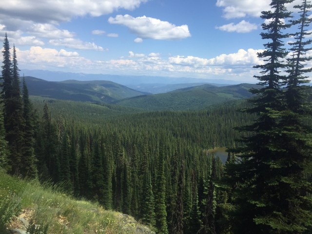
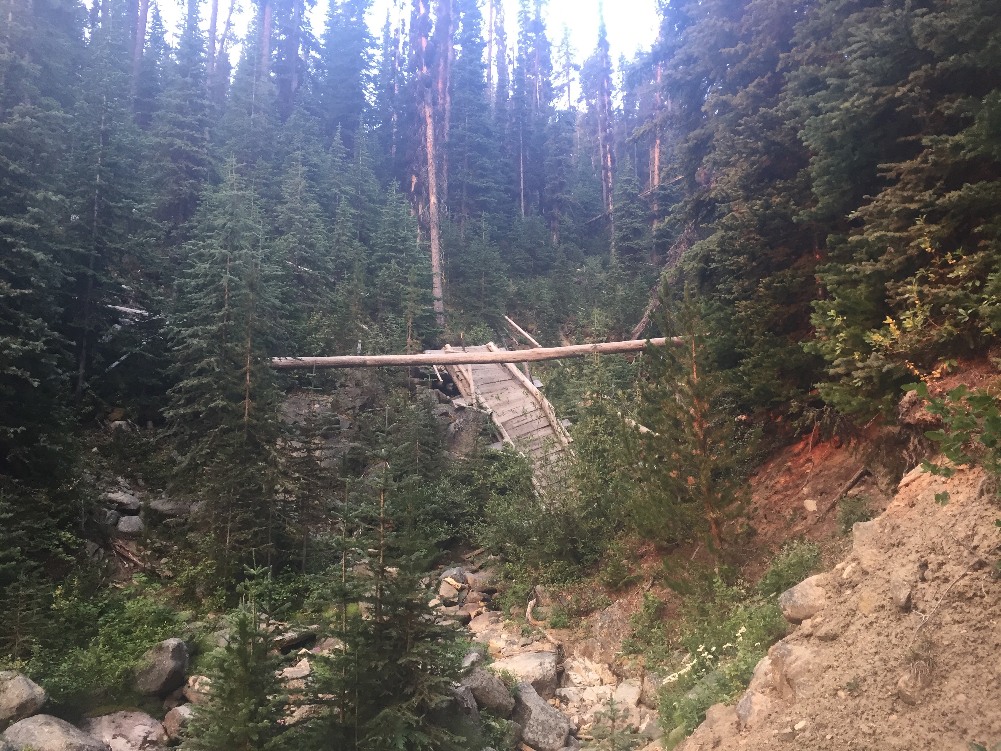
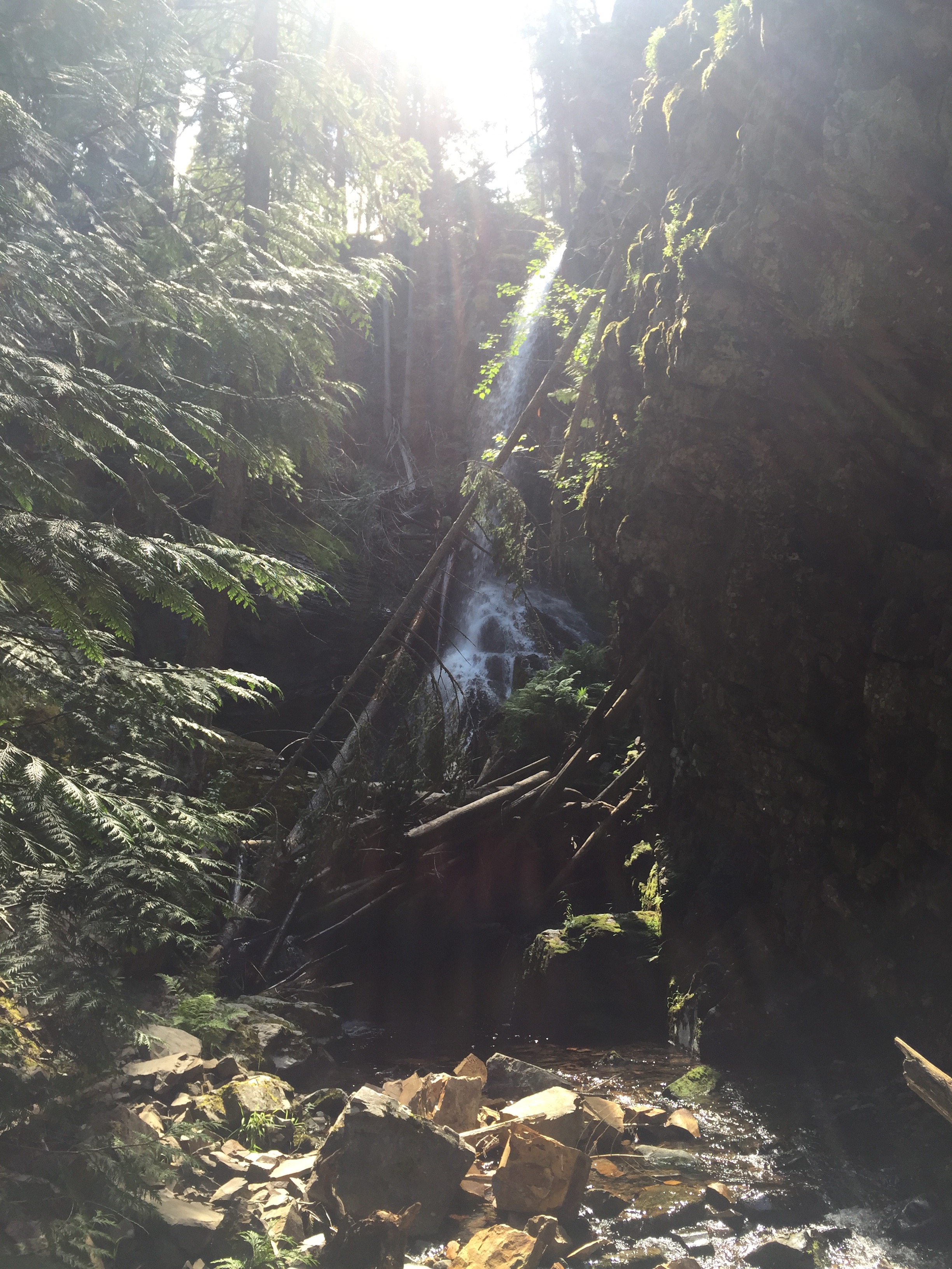
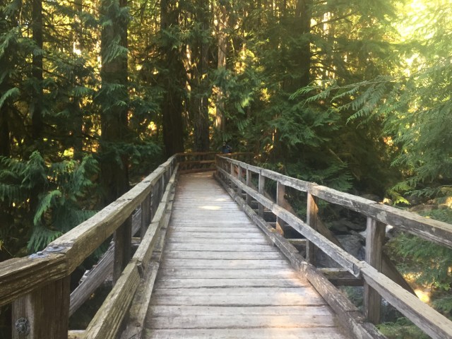
The guys recommended we check out Turner Falls which was a short side trail. Wow! The water was falling down onto a pile of rocks almost creating two waterfalls. Gorgeous spot. The guys also recommended skipping the next PNT section to hike along the creek. The other part climbs uphill through a burn section where 6 foot trees surround you. We took the creek walk and crossed lots of nice wooden bridges. The sound of rushing water and the bright green plants was perfect. Also, the workers were ahead of us so no down trees to hop. The Montana section of this trail had been nicely maintained and better marked then I expected. Thank you to the forest service for all the work you do on this trail. 
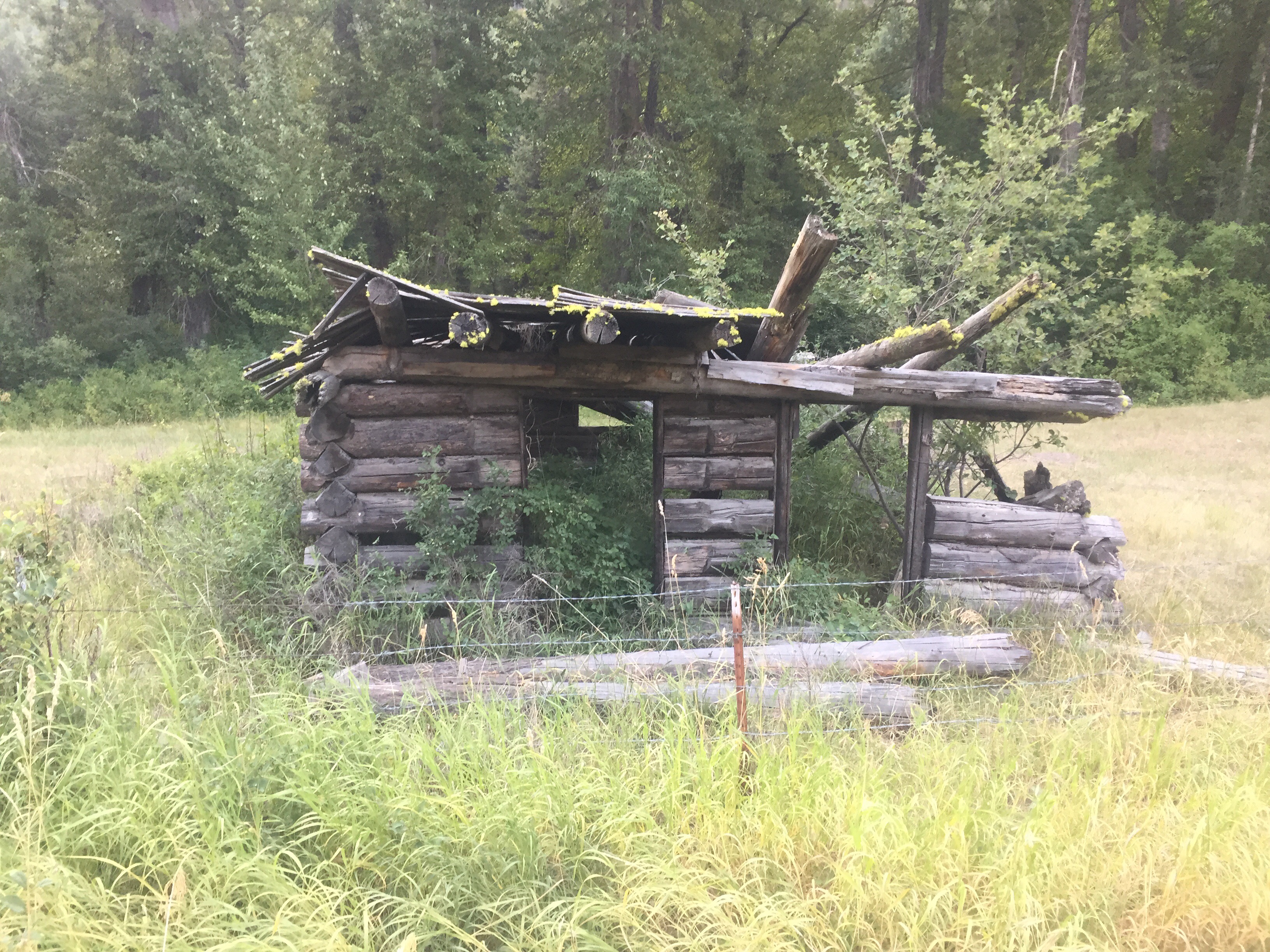
The rest of the day was road walking for hours. We did take a late lunch along a stream as a few cars passed by us kicking up dust. The road was paved for a bit and this was the spot where we could of hitched into Yak. We wanted to save a little money and be out in the woods longer. Town is fun, but we live for the camping lifestyle. We passed lots of cute cabins and hunting properties. I noticed one for sale sign. We chatted to a man in a truck saying he was going out bird watching. It’s called “Yaak TV” to him. We slowly climbed uphill towards our next campsite.
We came to the bridge and West Fork of the Yak River where we planned to camp. We saw a lovely campsite with firewood right over the bridge, but then we saw the truck. So we debated what to do before we took off our packs and went down to the river. I filtered some water and got ready to go for a dip. I went in with my shorts and sports bra. It felt nice to rinse off and clean out all my cuts and bites on my legs. We both cleaned up as Mermaid came across the bridge. The three of us set up camp a little way from the bridge. Paperweight and I spent most of the evening looking at our maps, guidebooks, and discussing our options. Before we knew it, it was past 10 and still light out. We drifted to sleep!
July 13
Neither of us wanted to get out of the tent this morning so hiking didn’t start till 7:30. I left first since Mermaid and Paperweight still needed to grab some water. We are still following a dirt road so it is easy and quick walking. The trees allow for a mostly shady walk. Around 4 miles in, I saw a large hawk flying above me with a dead bunny or maybe a squirrel in it’s claw. I have never seen that before. I have zoned out to Podcasts most of the morning as the miles fly by. I carried out 2 1/2 liters since we are unsure if some of the tributaries are dry or running.
Mermaid and Paperweight joined me as I took a water break at a tributary. My man and I started walking out together and heard a large crashing noise. It was a tree off the road crashing to the forest floor. We walked together until we zoned out to our Podcasts. We came to the junction to the lookout tower where we took a water and snack break. We are back to a trail for 3.4 miles to the next water and lunch break. We walked together talking about life adventures. The trail went up and down slightly through a lush green forest as lumpiness were blooming. The last bit was a steep downhill on rocks. We ran into a hiker coming East who started in Northport. We asked him a few questions about water and such before parting ways. We also ran into Heather who is doing her thesis on the PNT trail. The three of us took a nice shoe off lunch break in the shade. We crossed into the 200s today meaning less then a 1,000 to go.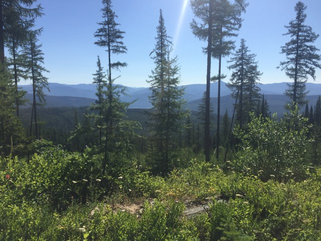
The next five miles continued on a forest road and was easy walking. A 3 mile per hour pace as we both listened to our own podcasts. We came to the Yaak River which is a little bit off trail. It was about 4 and the three of us decided to call it a day. We had originally planned a bigger day, but sometimes a campsite is just perfect. Our spot is on the other side of bridge along a dead end road. You can easily walk down to the water as there is even a hand rail to guide you. I thought about a dip, but decided against it after soaking up to my lower thigh. The water was cold and refreshing. So the rest of the day was spent relaxing, typing up these blogs, and listening to the birds sing and water flowing below us. 
July 14
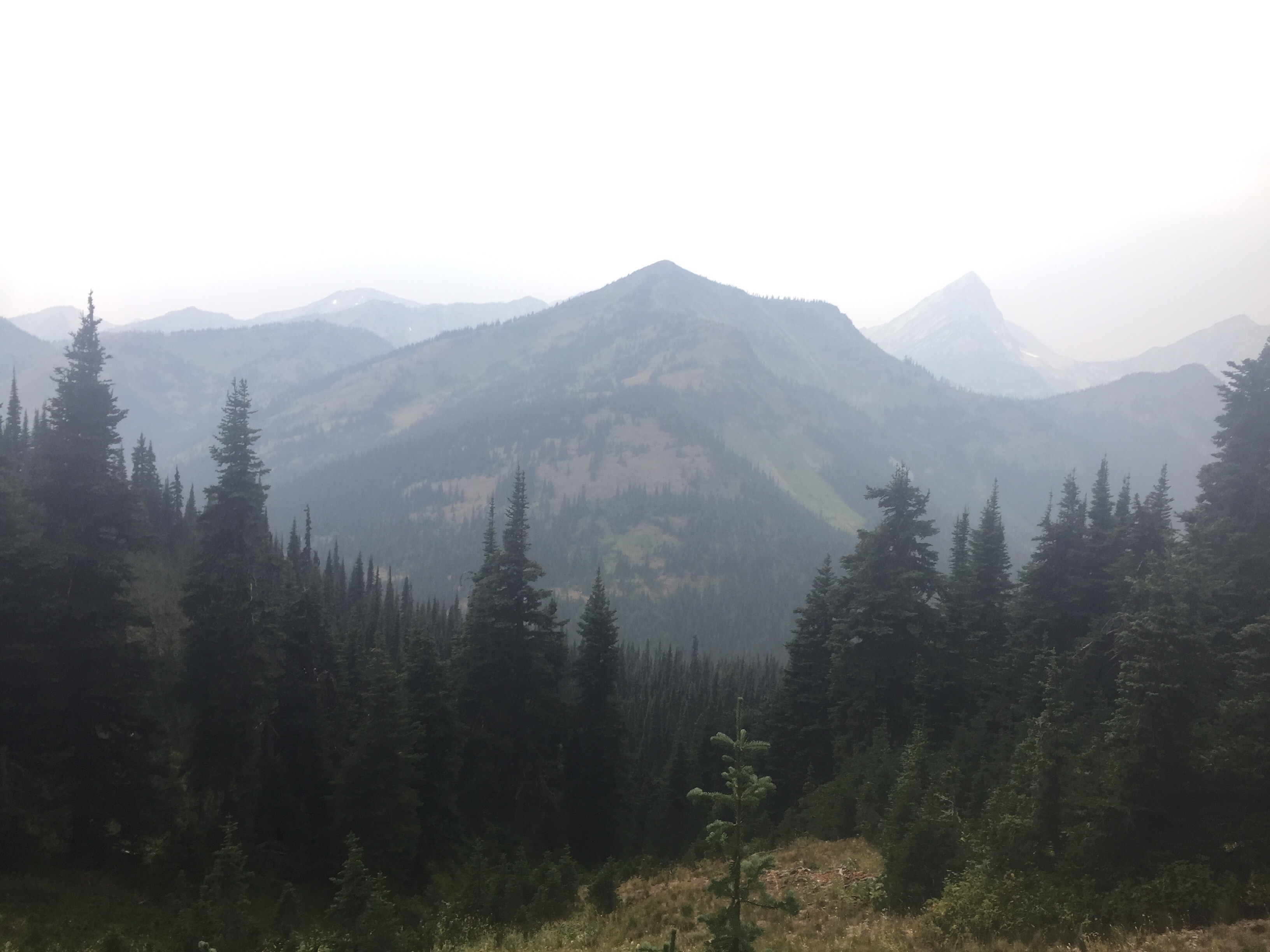
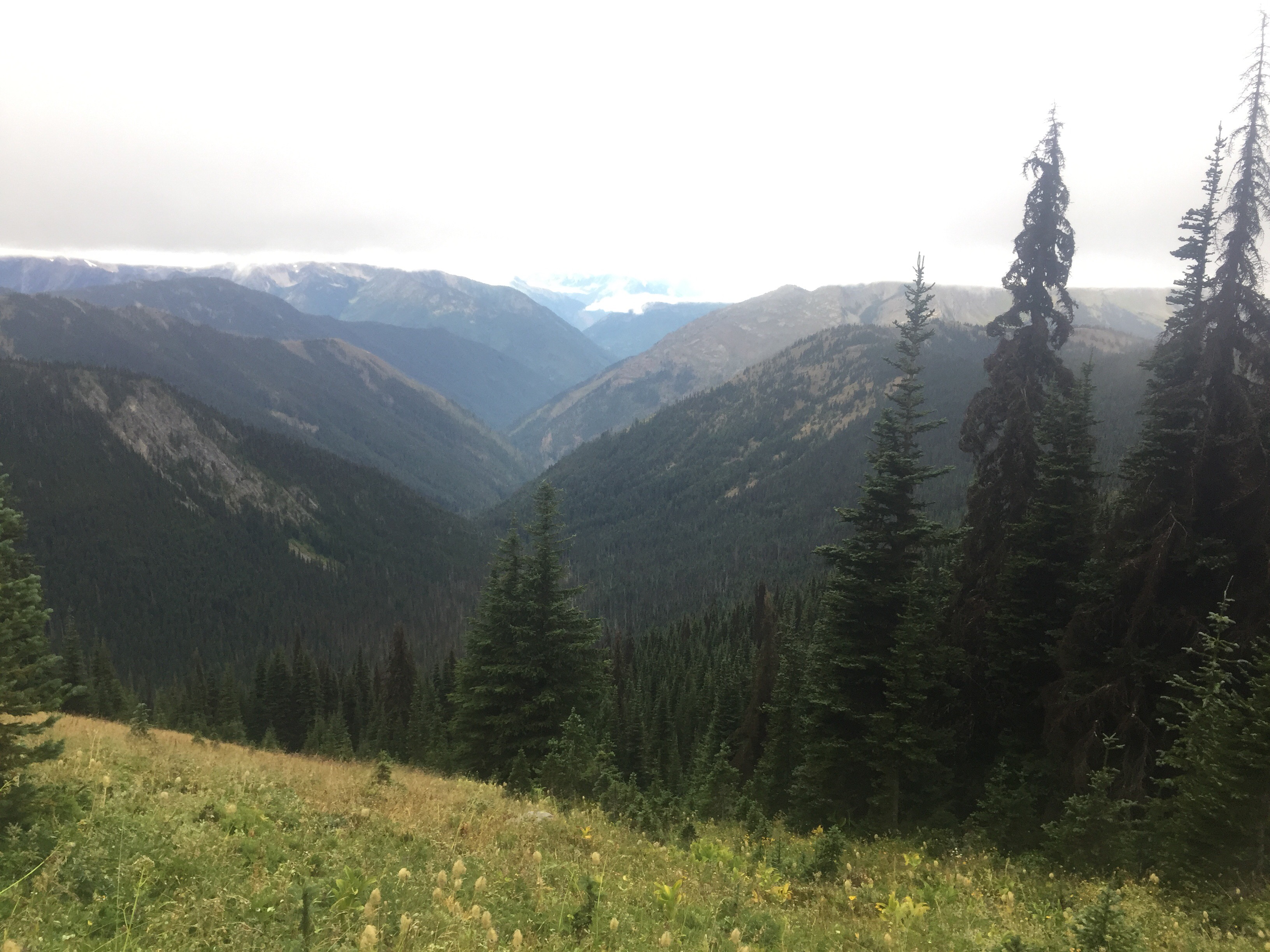
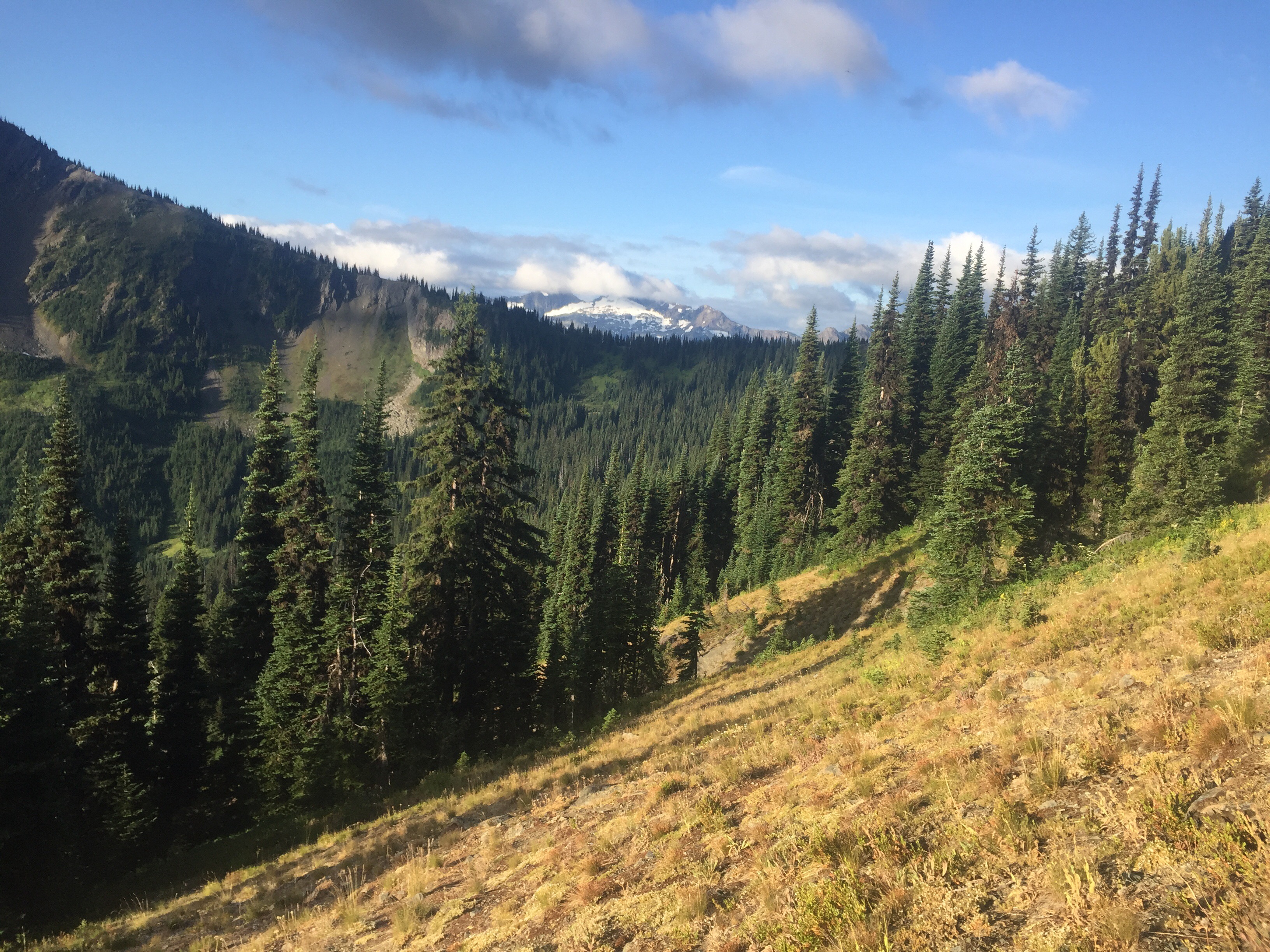
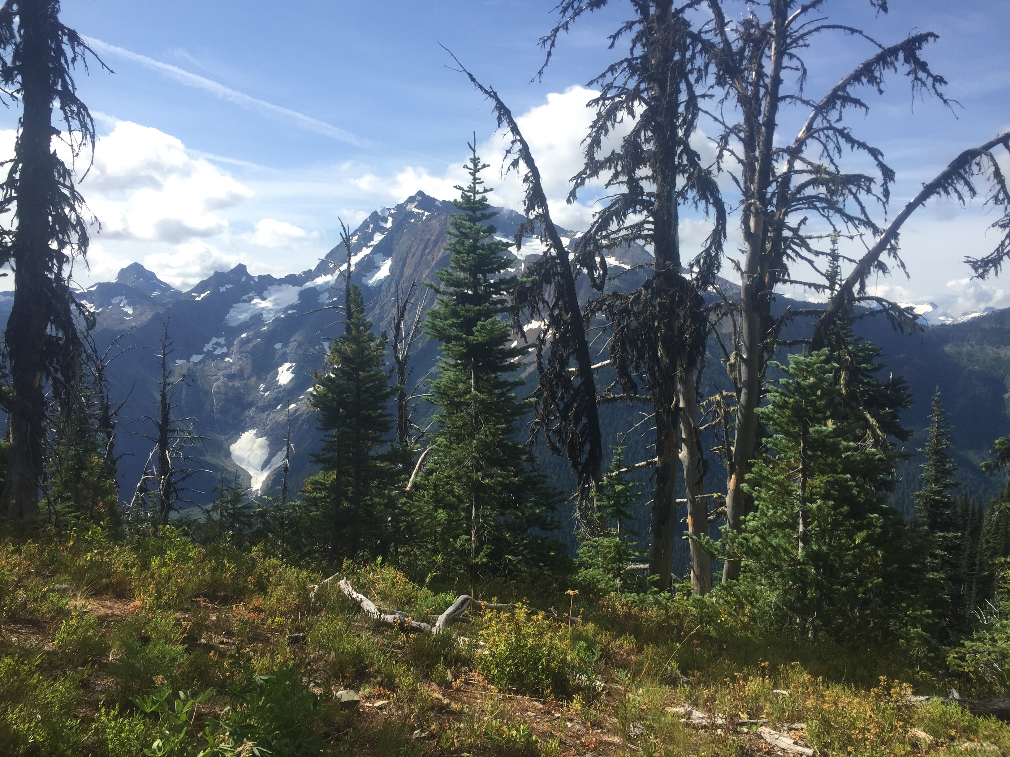
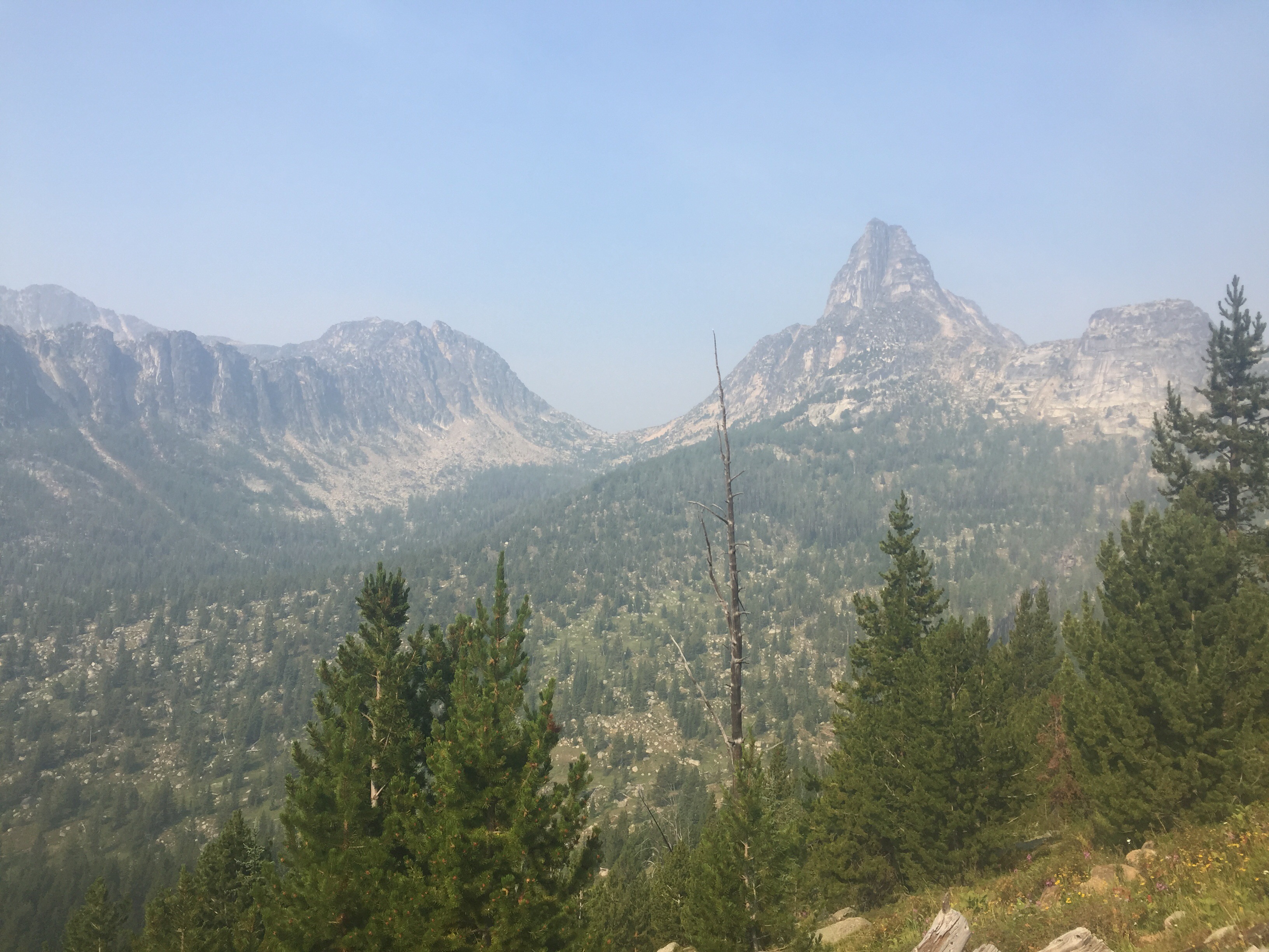
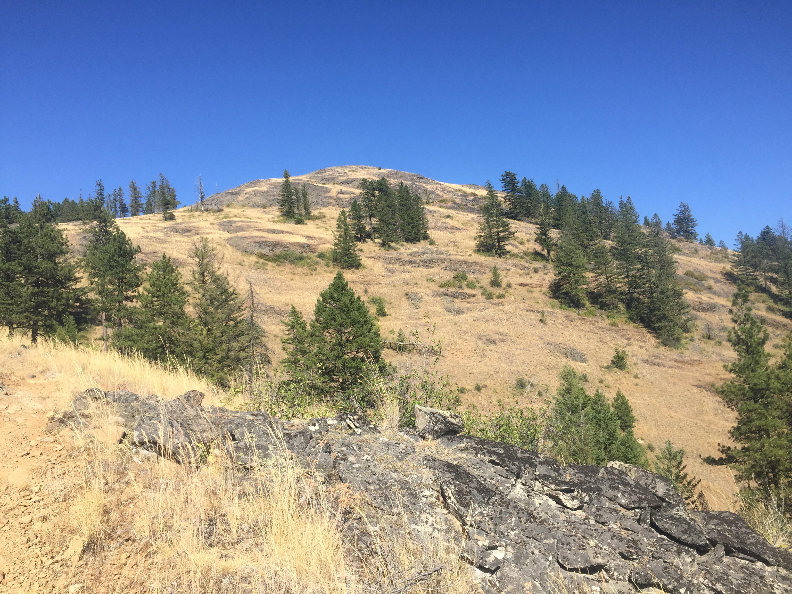
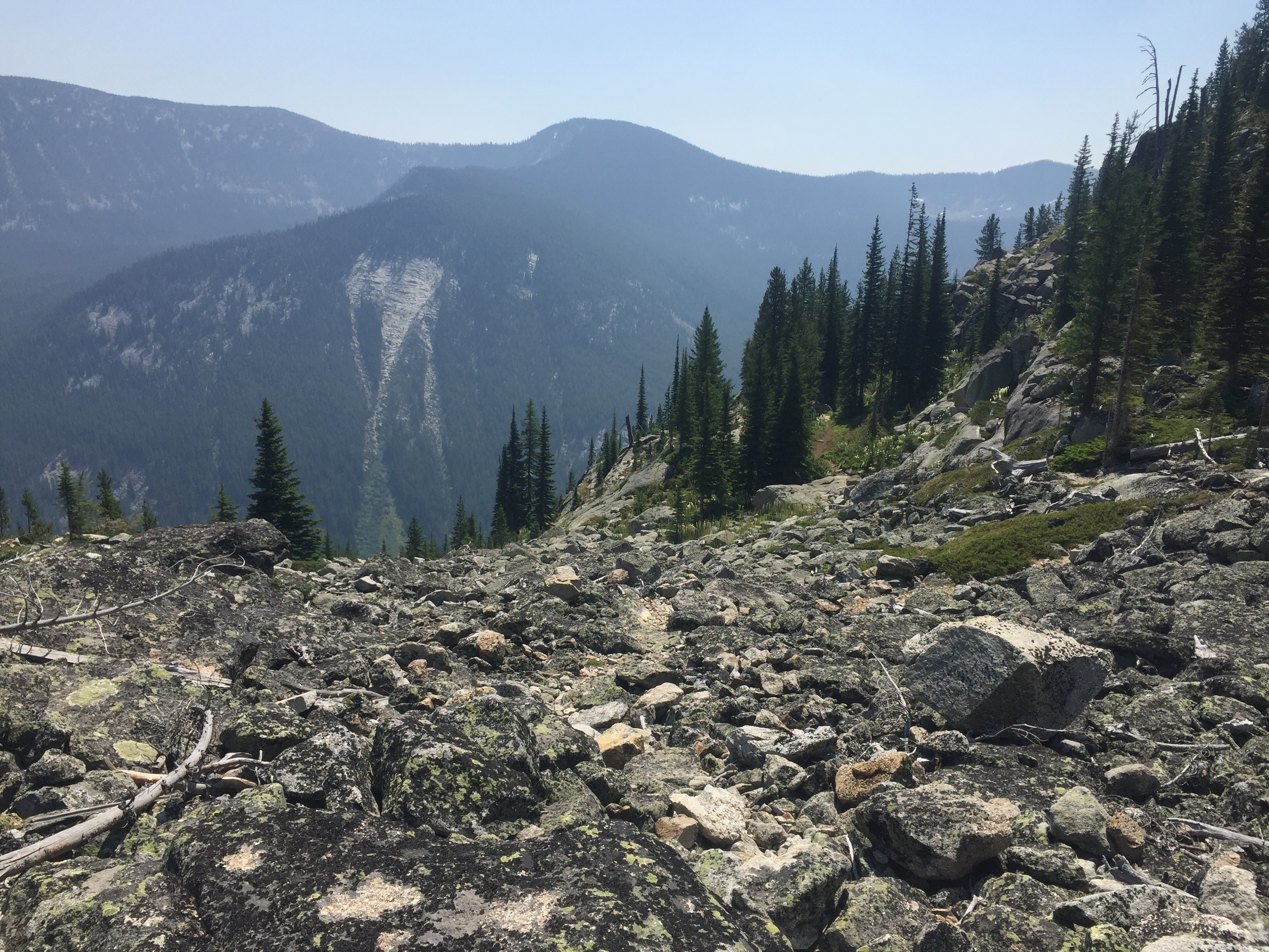
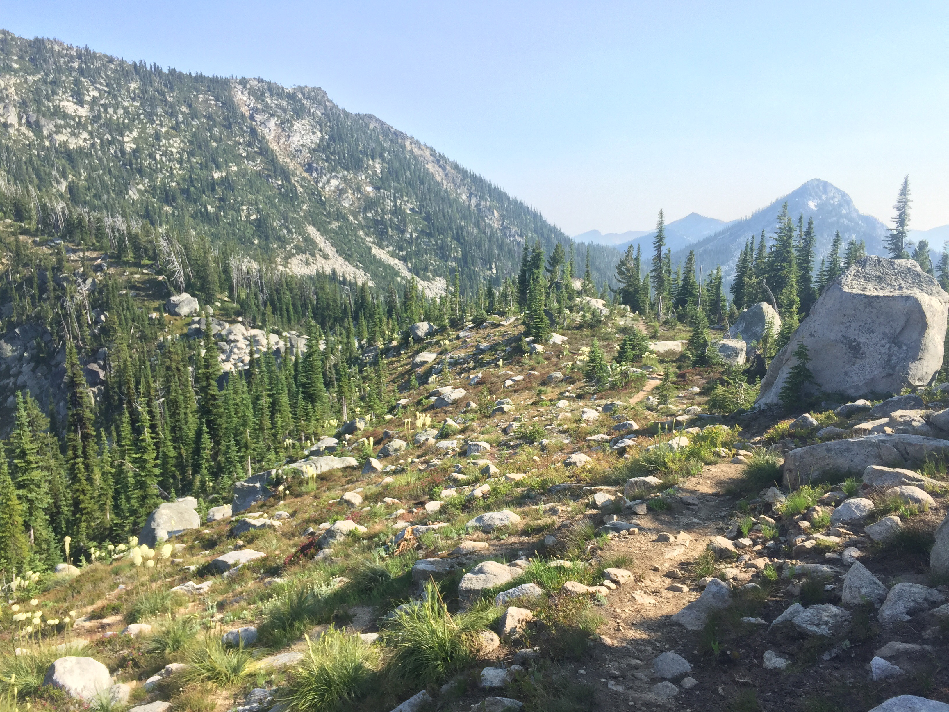
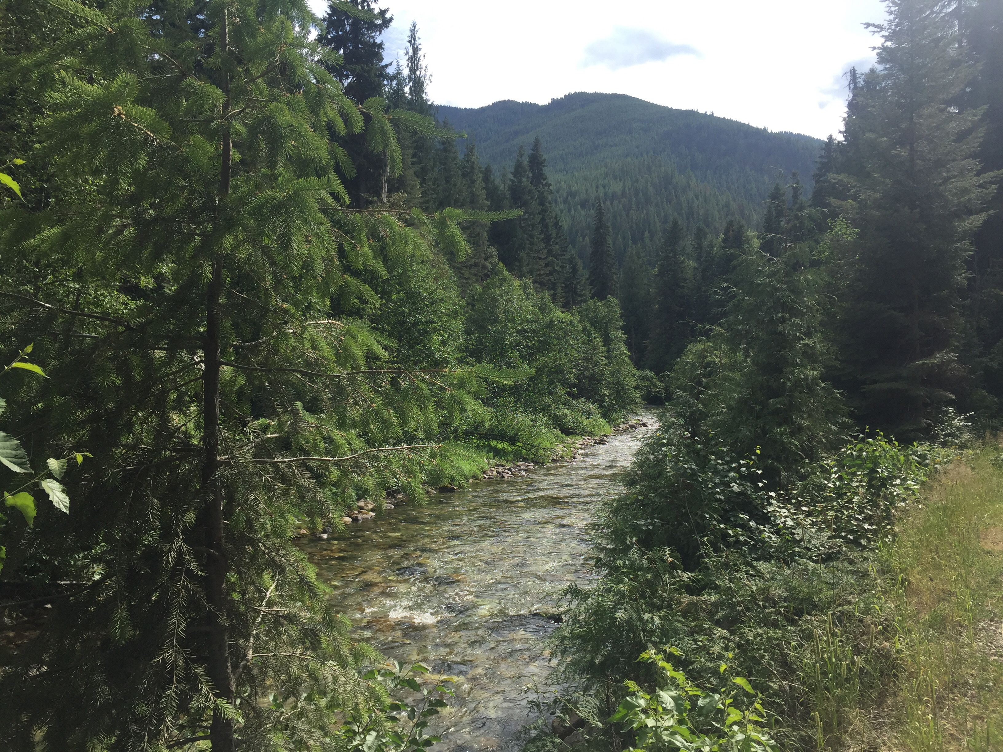
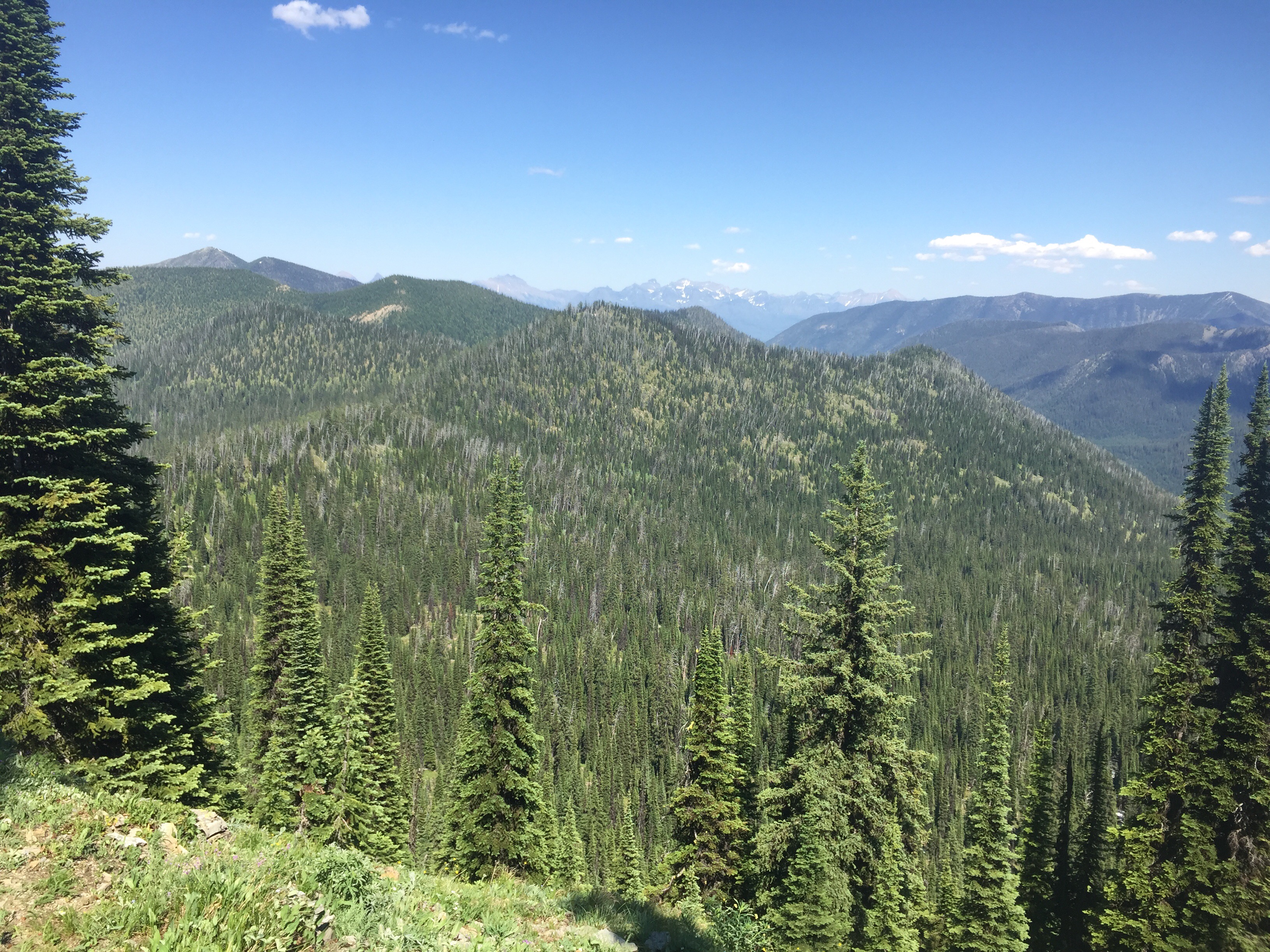
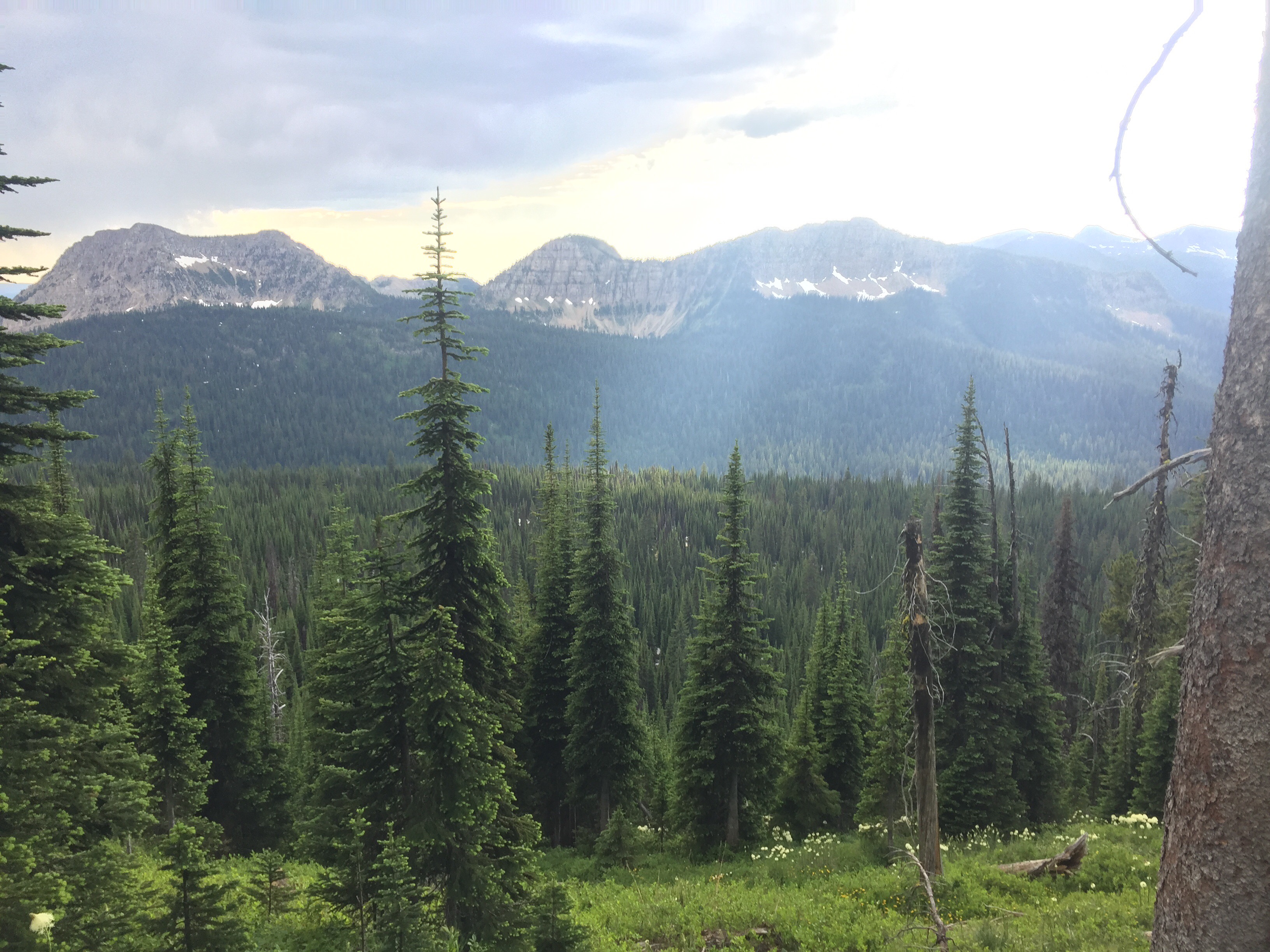
We had planned on getting on trail early this morning, but 7:10 wasn’t a bad start. We each packed out three liters since it about 18 miles without a reliable source. The hiking started out very steep in a dense dark forest. It seems as though we were in a horror movie taking place in the woods. It was beautiful. The sun began to shine in through the trees the higher we climbed. We crossed a few bridges and nice running water. Things are reliable this time of year thanks to the snow melt. We continued pushing uphill as we came to a ridge with expansive views including a huge snowy peak out in the distance.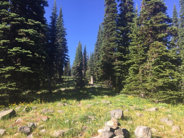
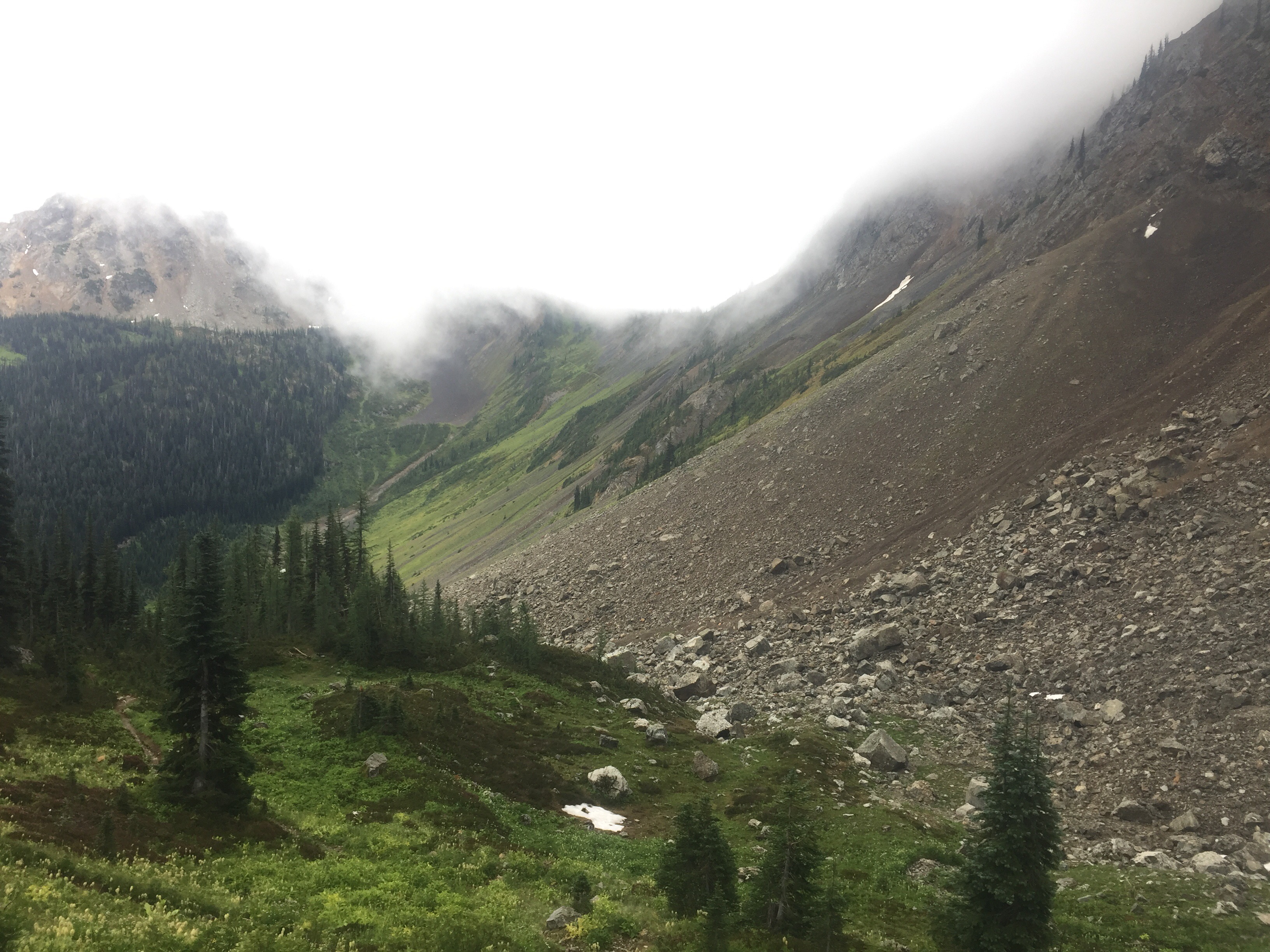
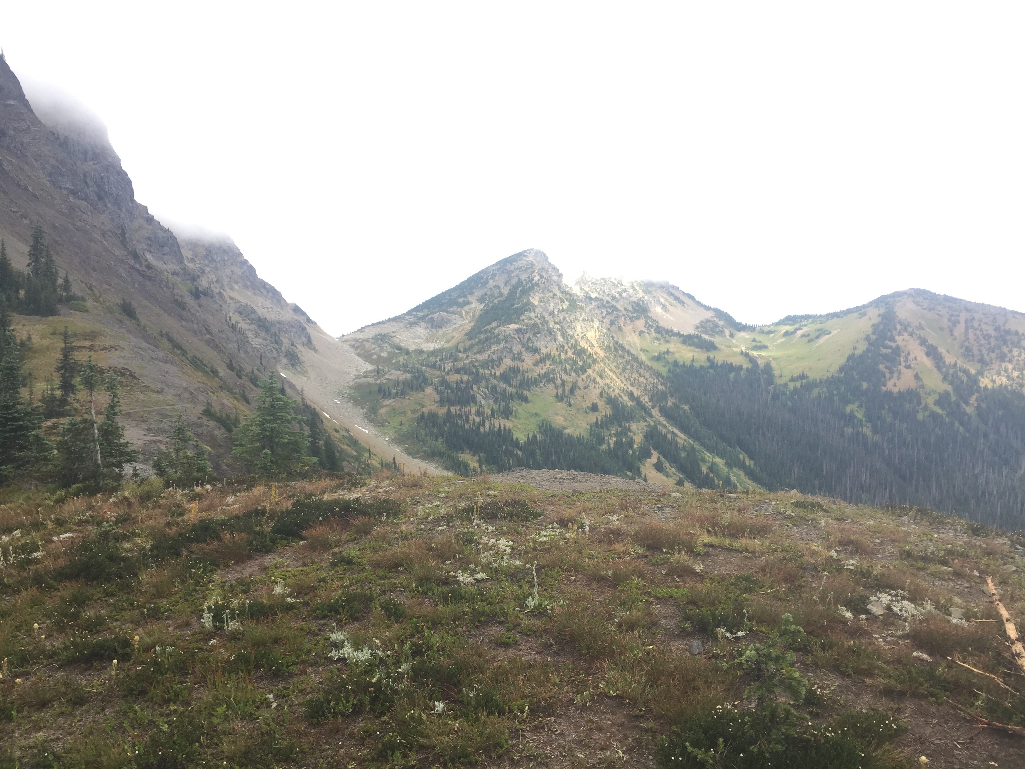
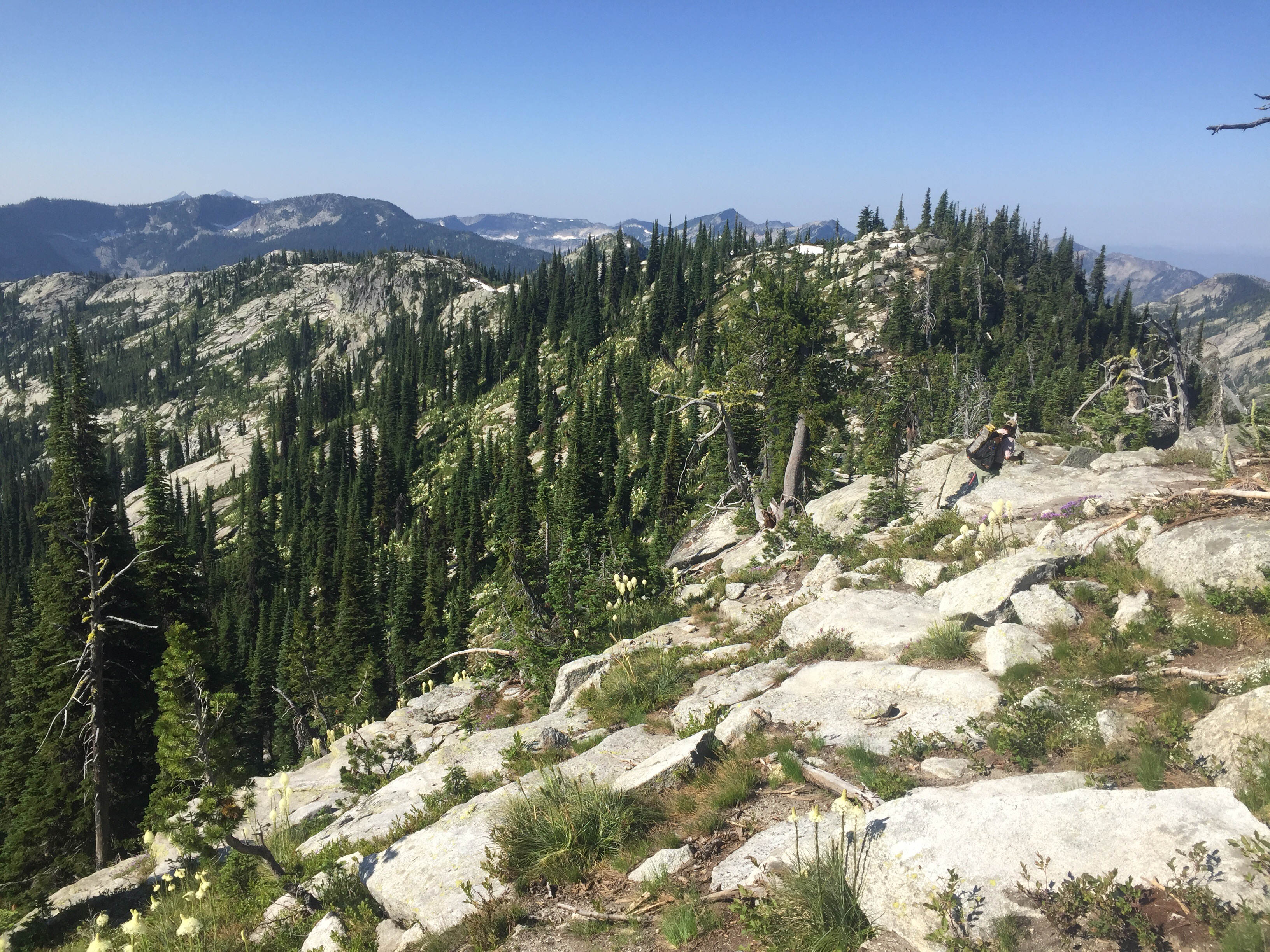
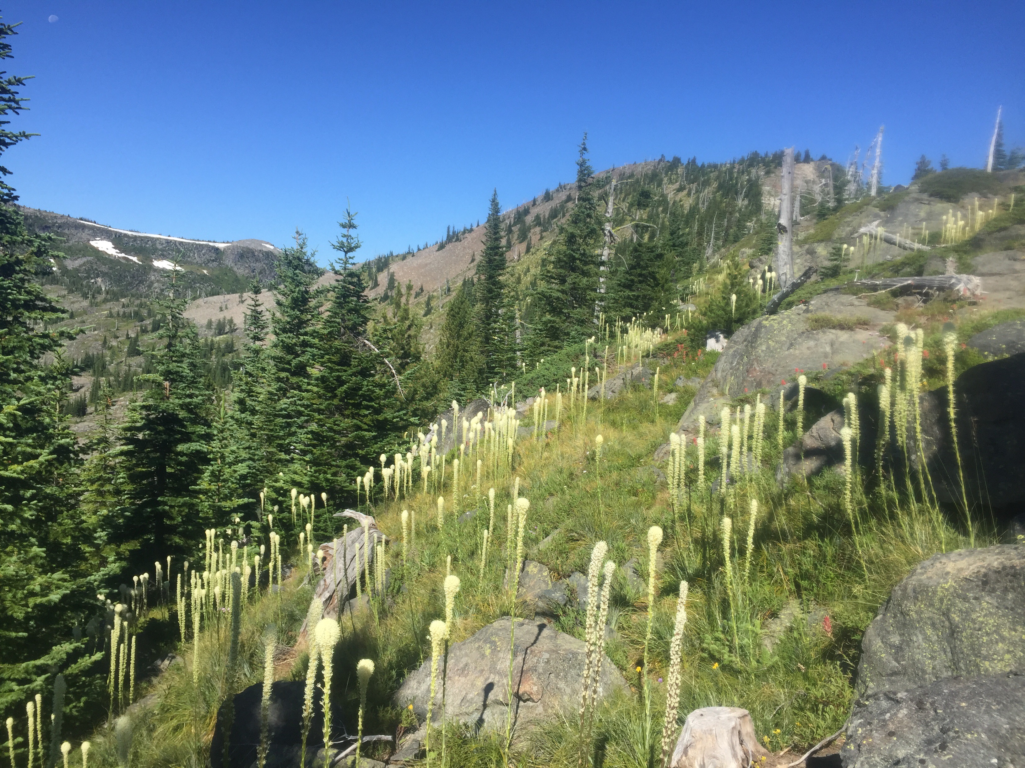
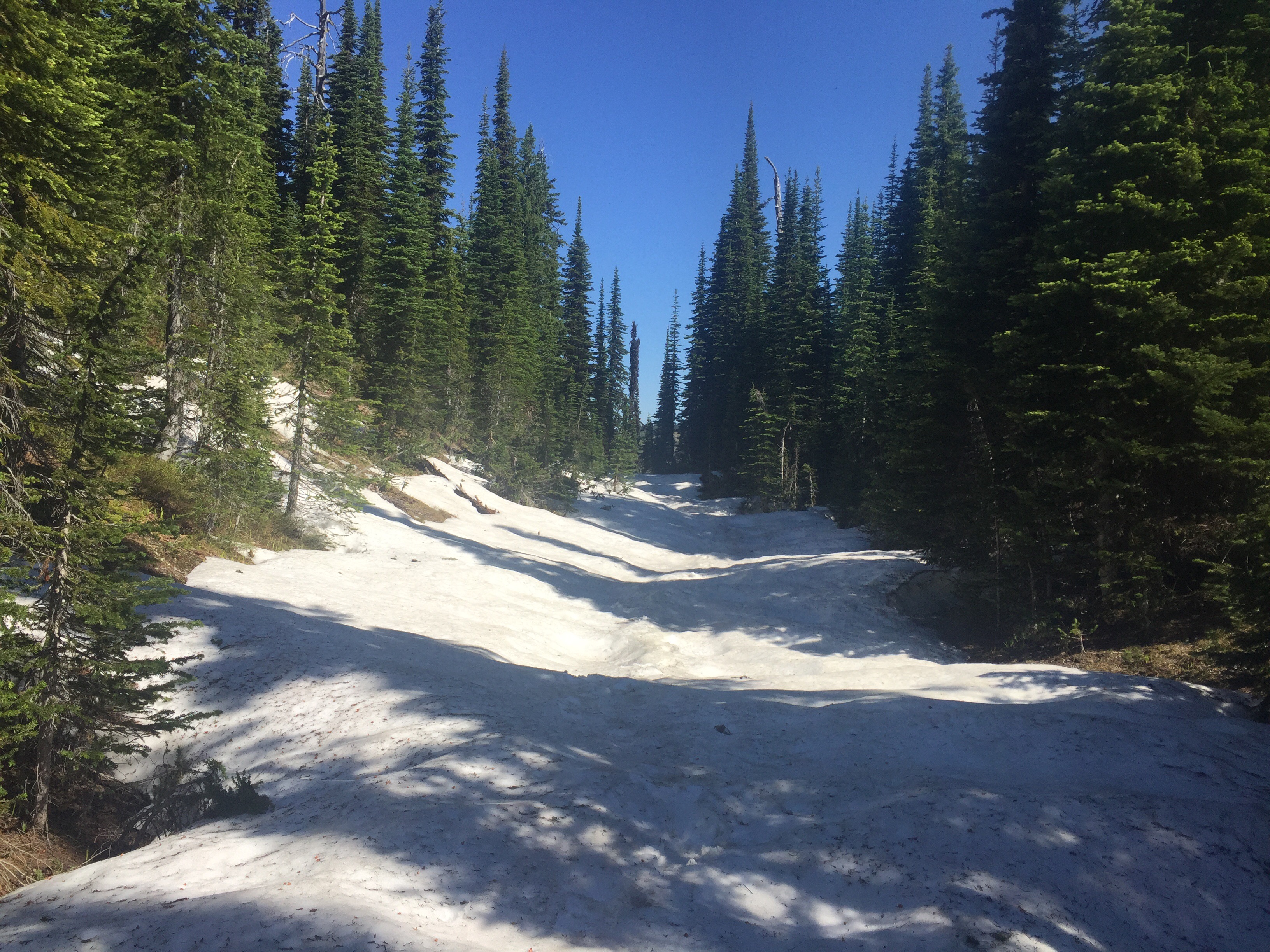
Next thing we knew it we were dropping down from the saddle back into the forest. Oh the PNT is full of ups and downs around every corner. Our next climb began as the trail turned more into a path. Soon we were out of the large trees and walking carefully over rocks. Rock cairns marked the way as we crossed a few patches left of snow. What a gorgeous area! We grabbed a liter each of snow melt water and made the last uphill push to the saddle which is our highpoint. The flowers are blooming as patches of snow still lingers. The marmots were screeching and bugs buzzing all about. This is my type of hiking! This is what I live for. High elevation, ridge waking, mountain views, snow, flowers, and a destination in sight. We took a nice break in the shade along the saddle snacking and drinking water. 


The downhill was marked as a bushwhack, but we were pleased to see a well traveled trail. I rubbed up against hundreds of bear grasses covering me in pollen. The worst part is when you are talking and inhale some pollen. Yuck! We cruised downhill and came across the first log book on trail where we signed in. 6 days ago 11 hikers signed in so I guess we are in between the bubbles. The “bubble” is used to describe a large grouping of hikers.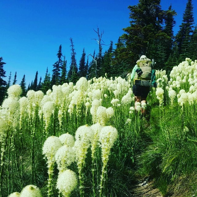
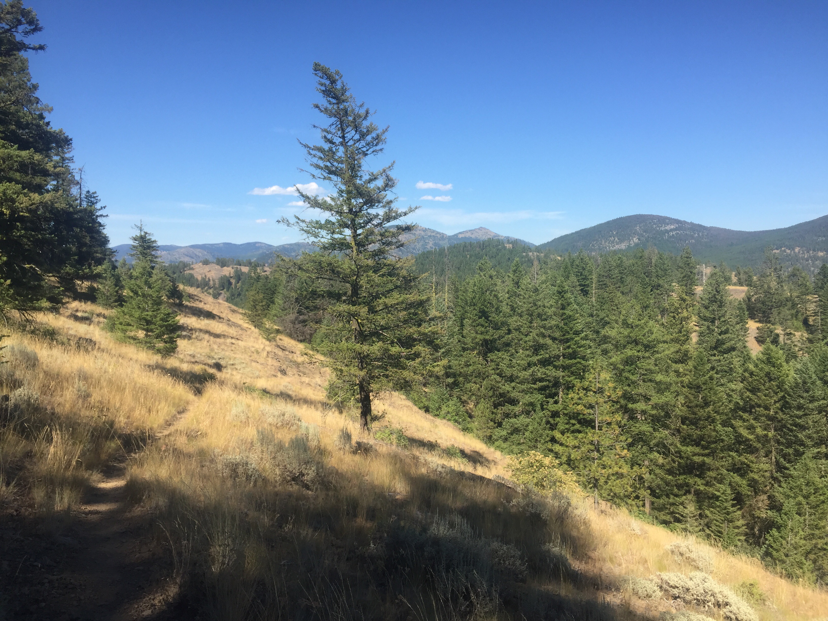
We continued onward walking many miles before taking lunch in a new state. We crossed into Idaho finding no sign and a similar trail. We gained an hour today as we crossed a time zone so we ate lunch at 2:00 instead of 3:00. The trail seemed to be much more rocky in this state and we found no PNT markers the rest of the day. It was nice hiking as the miles passed quickly. We came to a road intersection to find Beacon. He treated us to a cold beer and fresh fruit! What a treat. After Mermaid arrived, we all decided to push another 8 miles to total 24 for the day to go to the Fiest Restaurant.
So we were off moving quickly along the trail. A few spots were pretty rutted. The best part was the huckleberries and blueberries. If I wasn’t in a rush for a meal, I could of laid down and ate hundreds of berries. Our feet began to ache on the last two miles, but we made it down to Beacon and his rental car in plenty of time for dinner.
We all had the salad bar and a meal. I would of been eating oatmeal for dinner since I’ve ate all my other favorites over the past few days. We have really put in the miles and skipped over Yaak to get in more miles. We deserved a cooked meal and a spot to rest. The owner is a trail angel and ended up giving Mermaid a key to a hotel room for free. Thank you so much!!
The four of us found ourselves in a beautiful hotel room with clean towels for each of us. It was close to 10, but we all showered and charged our devices while drinking a cold beer. Mermaid and I shared the cozy queen bed as the guys slept on their air pads. No setting up the tent or having to unpack the pack today made the 24 miles even more worthwhile.
July 15
I did not sleep great last night as I kept waking up and looking at the alarm clock. I got up first and snuck to the bathroom avoiding steeping on the guys who were sleeping on the floor. On the way back, I realized it was getting late and we still had quite a few miles to do until town. So I got on the floor and gave my man a little cuddle. Everyone woke up and we began packing up quickly and eating a quick bite. It was a bit after 7 when Beacon dropped us off at the trailhead. It was sprinkling so on went the pack cover and out came our umbreallas. We walked the road he just drove us on before crossing the railroad tracks. We passed some land for sale, a few ranches and cabins for rent, and saw a young fawn in a field. We came to the end of a dirt road and began the climb up Mt. Bussard.
The hiking continued uphill for a little over 7 miles on switchbacks. There were lots of ripe blueberries and huckleberries to munch on during the uphill. I felt very strong and motivated by town. The uphill trail continued on and on before joining an old road which is not traveled by ATVs and dirt bikes. At the top, we took a break waiting for Mermaid and to have a snack. I tried to dry off as well since my shirt was soaked all the way through. Even though there was lots of cloud cover it was humid. Mermaid showed up and shared fruit with us that she packed out from Beacon. What a treat to have watermelon on the top of a mountain in Idaho. 

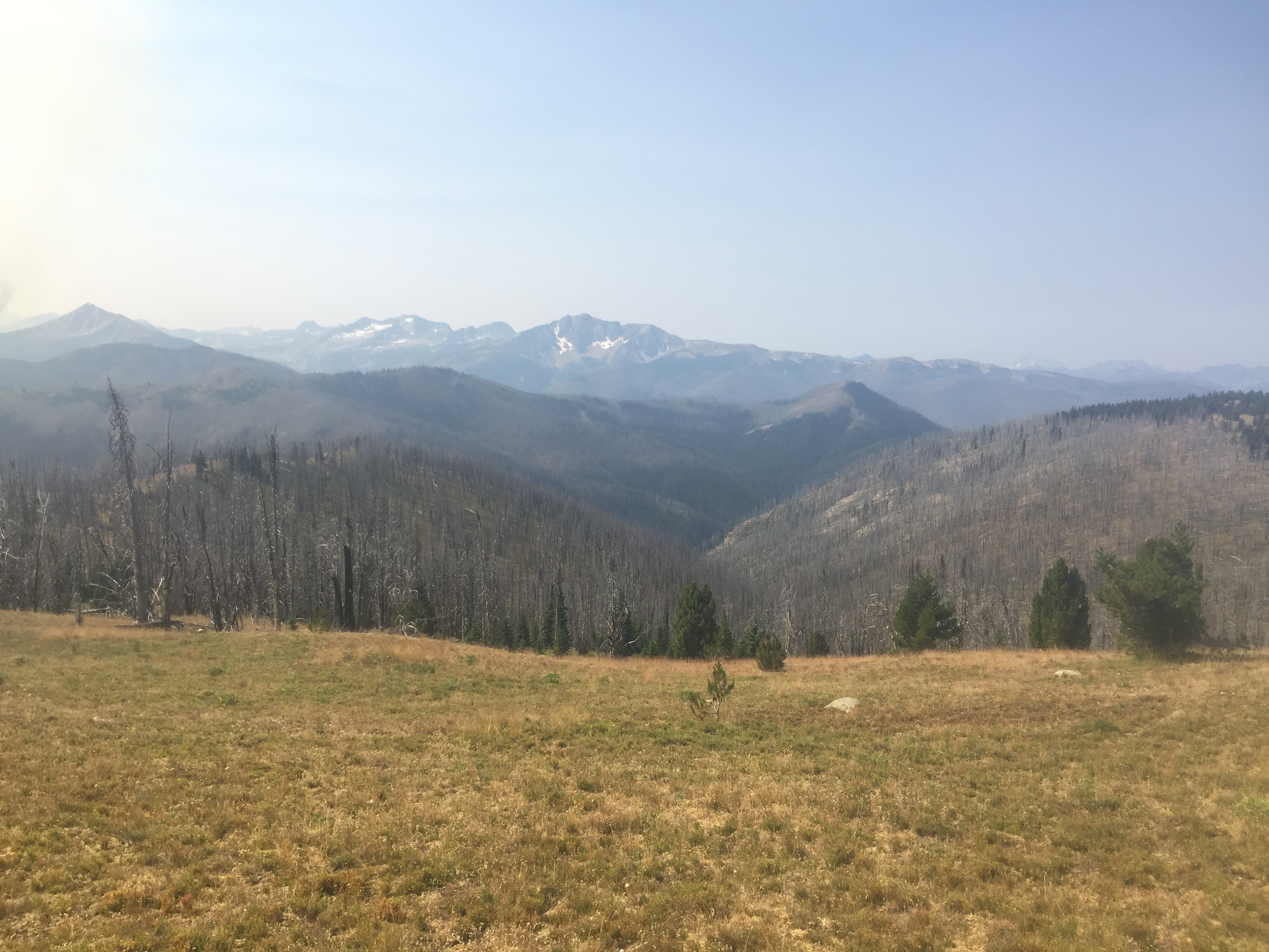
The trail lead downhill to the highway. We traveled a trail with new wooden bridges and concrete slabs in the mucky areas. Then we found ourselves on a steep loose rock slid towards the bottom. There were parts with many rocks and then an old overgrown forest road. We passed a guy sleeping in his tent and lots of people out picking berries when we met a more traveled road. The rest of the day was a one lane dirt road past lots of people out picking. The trail dipped lower and lower into the heat. The official route cuts across Brush Lake, but the guide book says to avoid. It is a tough bushwhack. I did not even see an easy spot to attempt it along the road. I zoned out to Podcasts and walked quickly to get to town and also avoid mosquitos. Beacon was waiting for us at Highway 95 where he whisked us away from the mountains and into the town of Bonners Ferry.


We descended into town passed the old town with a new casino before entering the new town. We headed straight to the Oriental Garden for a Chinese dinner. Yum! Then a quick stop at the grocery store for beer and of course ice cream. Then we were off to the hotel where the four of us split a room. It felt wonderful to shower and clean my gear. We all chatted drinking beers and eating ice cream before bed. Tomorrow we zero.
July 16
Today was a perfect zero day. Thanks to Beacon’s rental car we barely had to do any walking. We did walk to a breakfast spot, the grocery store, and laundry mat, but none of them were more than .1 miles. We decided to get our own room for tonight and was surprised for $5 more at a cost of $64 a night with tax we could get the room attached to the hot tub. She locks the main door at 9pm and we would be the only ones allowed in past that time. Score!! Beacon drove us to the gear shop and we even scored a free hiking shirt for Paperweight in the thrift store bin. So we did all of our chores and checked into our room around 3. The four of us headed back to the other part of town for dinner at the casino. It was a delicious meal with larger portions then I expected.
The rest of the day was spent lounging in the large king sized bed and playing on the wifi. A bit after 9, we took full advantage of our hot tub while drinking a few beers and discussing our future. It is looking pretty bright with many more places to explore.

 family emergency forced them off trail. They live in Burlington and reached out to offer us a place to camp for the night. We had a lovely time with their family. They cooked us a delicious meal and we shared trail stories over drinks! It was so much fun to catch up. They updated us on the group ahead of us and we realized we would never see any of them again since they have car support to skip all the road walks. Looks like it is just the two of us. Again, this trail would be miserable solo since everyone takes the rides over the crappy parts. Luckily, my partner and I have the same style, but if he wasn’t around I might have caved to peer pressure. But most likely I wouldn’t. We stayed up late chatting before we retired to our tent in their backyard for the night.
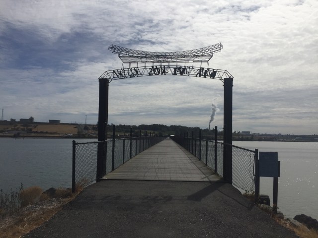
 There were lots of options for food in town. We were craving Thai food so that is where we went. We ate in a tiny restaurant and drank lots of water. One of the harder parts of road walking is finding useable water sources that aren’t too polluted. We did pass a small gas station and store where we grabbed a drink and ice cream.
 The trail was marked trespassing allowing if walking through. It was a very pleasant morning walk that felt gentle on the feet and the smell of the salt water. The trail then turns on a paved road past many cute homes and fields of flowers. One local knew what we were up to and said that we were crazy. The trail then joined a major road as cars zipped by us at high speeds. I easily got sick of counting all the pieces of garbage thrown out of car windows. We passed an ice cream stand that wasn’t open yet before turning onto a much less busy road. We took a break in the shade off of the road. We had a snack and a woman stopped to ask if we needed help. A few minutes later a man drove by us, backed up, and then asked what we were doing. He told us not to camp there or litter as I explained we were just taking a break as it was 10am. It was an odd encounter so we quickly left. I’m pretty sure that vehicle drove by us again 15 minutes later. I just want to be on a trail! Oh wait this is the PNT. We walked around a military base for some time as cars zipped by us again.


 <<<<<
<<<<<

 Aug 18
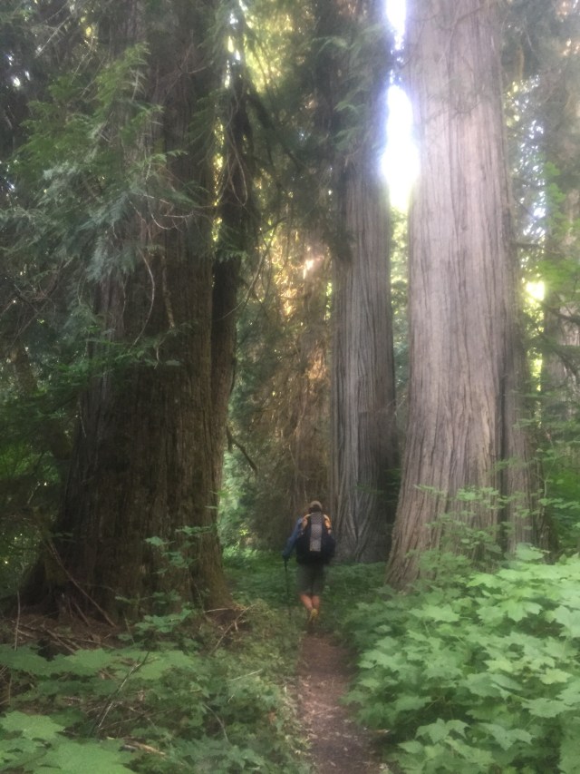
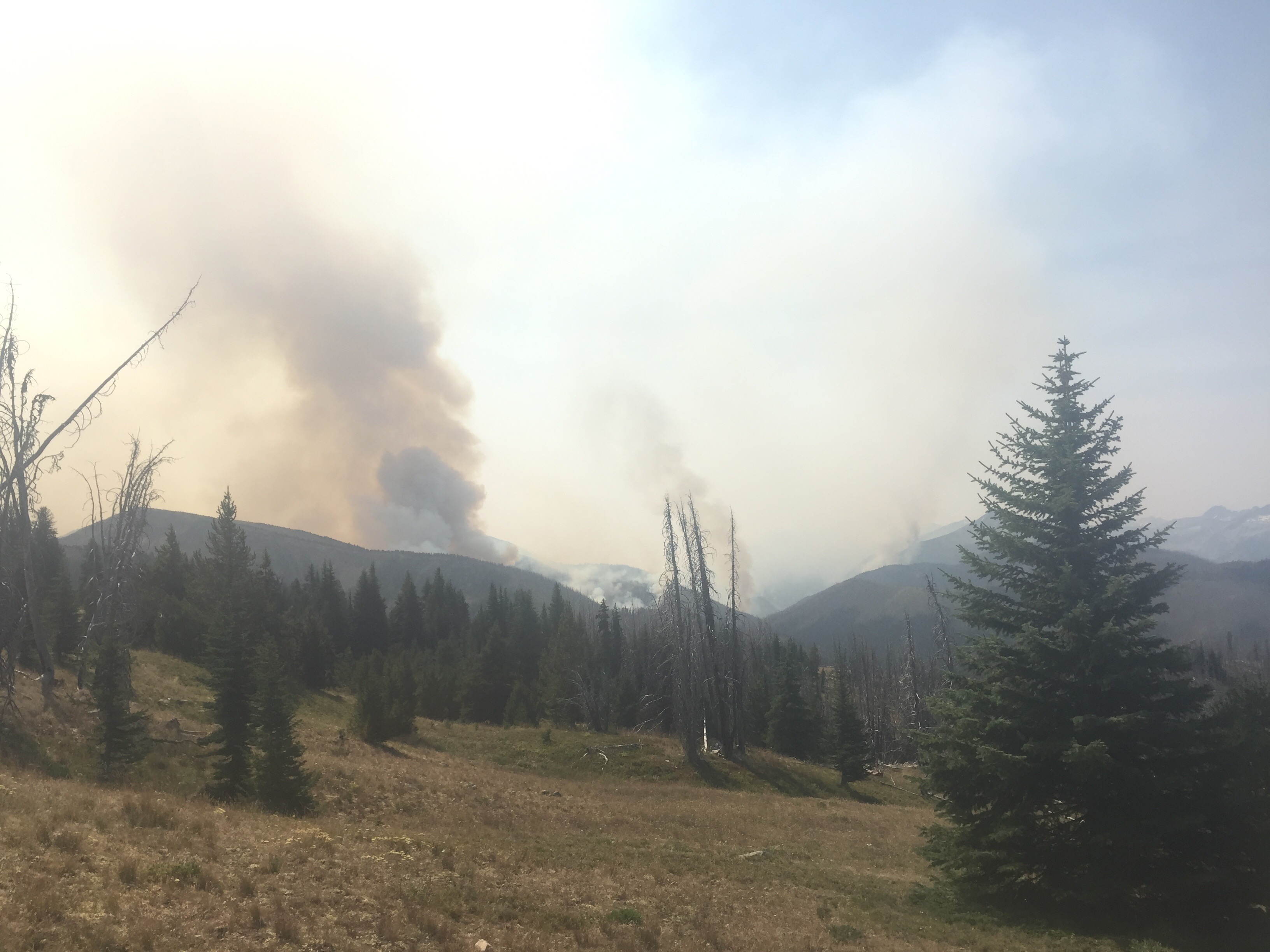
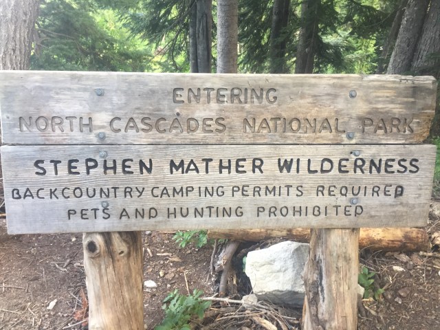
 I managed to fall down pretty hard this morning as well. I just tripped scrapping up my knee. We listened to our Podcasts and ate some berries towards our lunch spot. We stopped at a nice footbridge for a break. Thirty minutes in we hear some rocks falling and one fell down onto the bridge. We wondered if the trail switch backed above us or if a critter knocked them down. Five minutes later he exclaimed BEAR. A black bear was above the trail across the bridge and seemed to be coming down towards the water. I suddenly saw the baby behind her and we made some noise. She looked at us then ate some more berries slowly dropping down. She didn’t run and had no plan to. So we packed up quickly and watched until they disappeared out of sight possible farther down trail. We climbed uphill for a few minutes before finishing our lunch break. The mama bear could of cared less about us as we joked how she is a National Park bear.
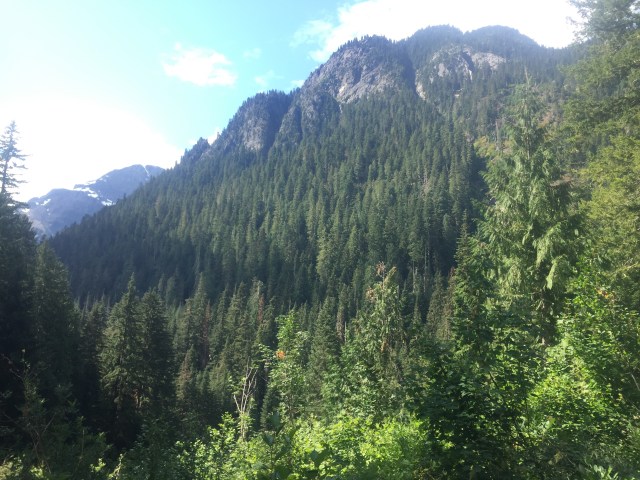
 The last hour was spent walking along the stream towards Twin Rocks Campsite. We were set up and cooking dinner by 6. It was another good day of hiking surrounded by old growth trees and brought my bear total to 8.
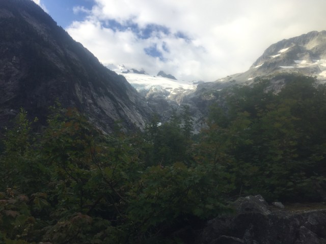
 switchbacks
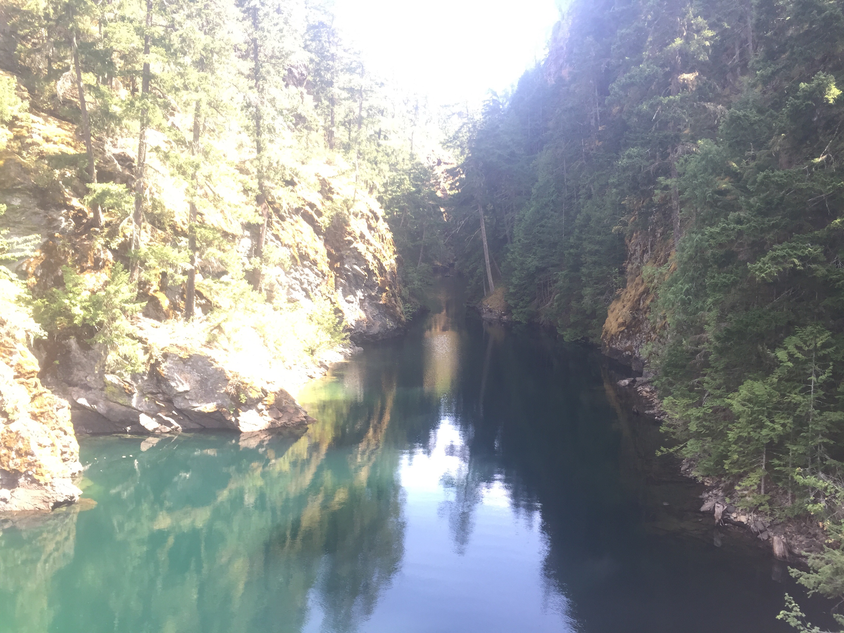
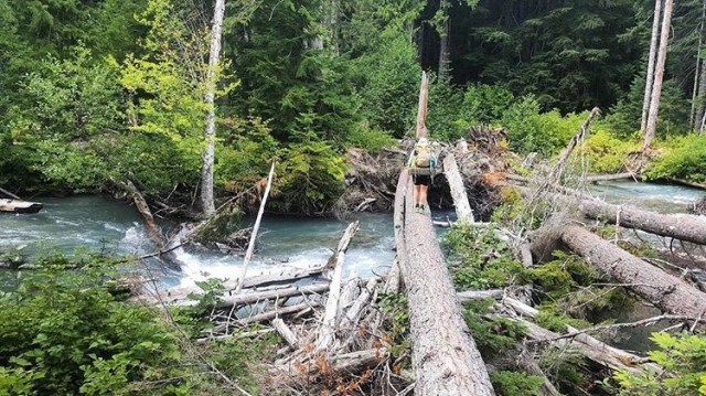
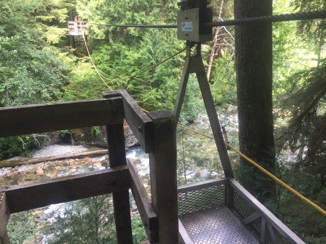
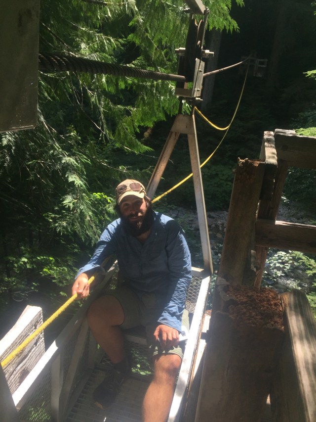
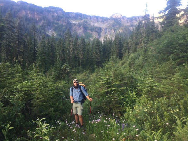
  The downhill always is rough on the knees. We took our time and ate some berries. The highlight of the trip so far is a cable car ride over the Chilliwack River. We both put our gear inside then climbed in. It is a metal cable car with two places to sit across from each other. You then must pull yourself high above the river to the other side. We shared a lot of laughs and my arms got sore. We took a break half way through to take a video. I’ve never rode in a cable car before and looking down below it didn’t seem necessary. There was a horse ford much lower that you can take, but you have to experience a cable car ride at least once in your life. I’m sure in spring the river is raging. We climbed down from the platform back to the forest floor. We took lunch at a stream where we let our feet dry out.
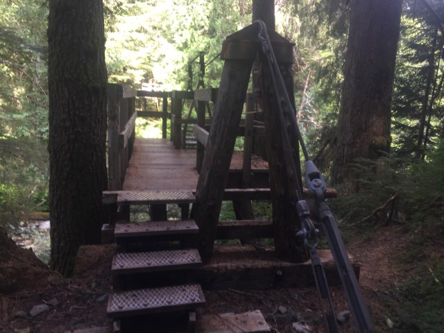
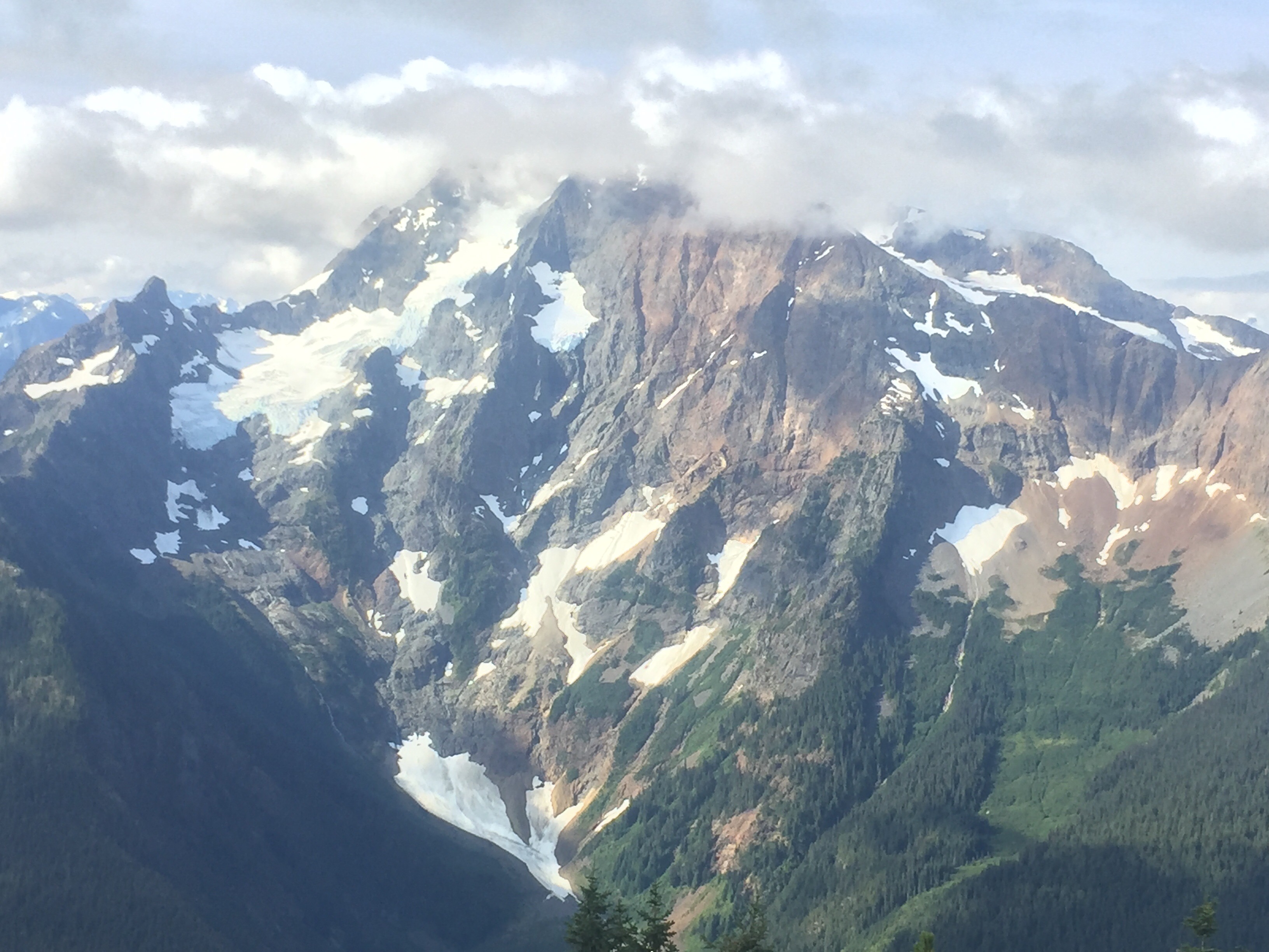
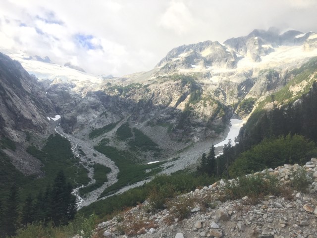
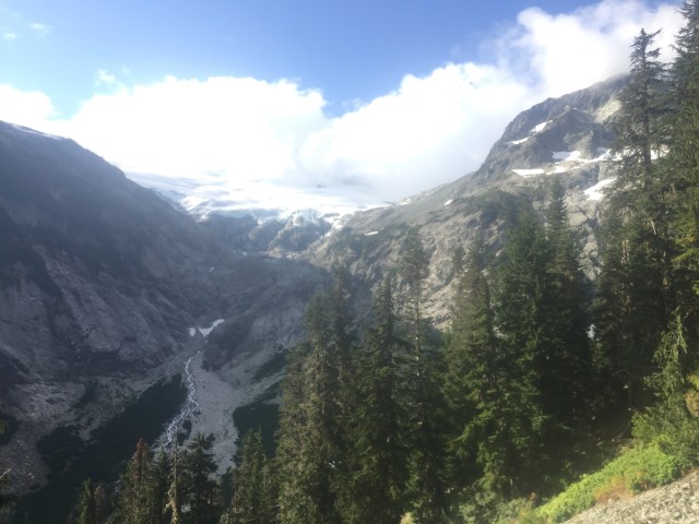
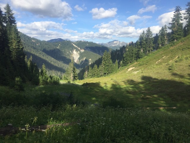
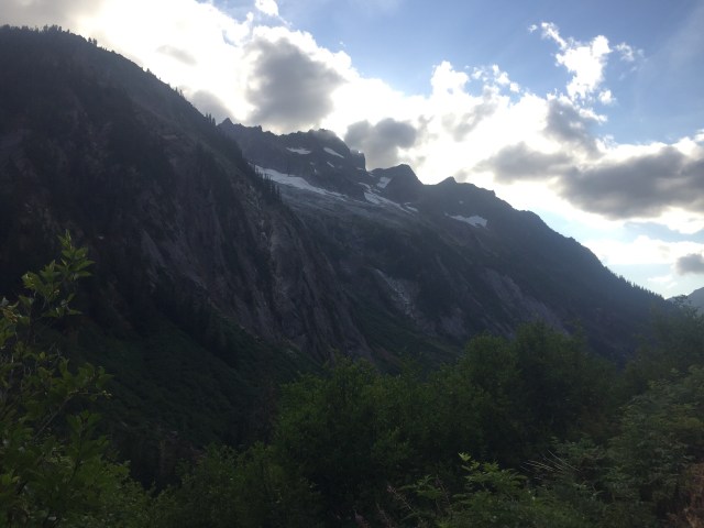
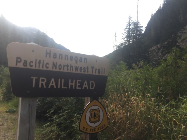
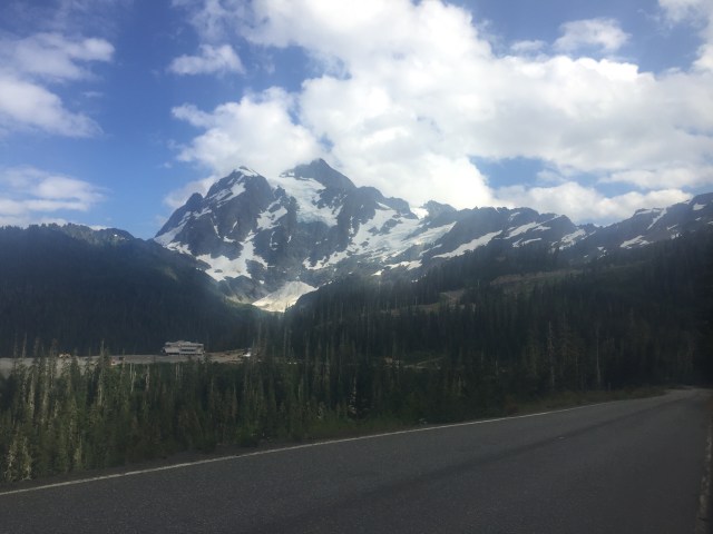
 The next task for the afternoon was to climb Hannegan Pass. We both listened to podcasts as we continued uphill for miles. The trail was nicely made and smooth hiking. This type of hiking reminds me of PCT days. I really enjoyed this climb and the entire day to be exact. We walked together the rest of the day admiring Ruth Mountain and the large glacier on the peak. We love the Nooksack Range! We spent a few miles discussing living in Washington someday. I find this state has everything you could ask for. I would love having these parks in my backyard.

 We made it to the trailhead parking lot in search of a campsite. The lot was full of cars and we found a flat spot near a picnic table. I rinsed off my legs at the stream while filtering water. We were able to throw away trash as well. We enjoyed dinner at our picnic table as a couple from Canada searched for their campsite. They finally asked if they could join us. They sat up nearby instead of one the other three sites. He did ask lots of question as to what we were doing, why we didn’t have a car, and where had we come from. He must of thought we were crazy as he offered us a flashlight since we were sitting in the dark at the table. We headed into our tent getting some rest after a gorgeous day of hiking.
 Aug 20
 We began attempting to hitch into Glacier. It took some time, but a nice woman offered us a ride. She would of taken us all the way into Bellingham if we wanted to. We stopped in Glacier to check out the store before deciding to go into Maple Falls where they have a better selection. We enjoyed our ride and did a quick resupply at a small grocery store in town. The one new restaurant in town isn’t open yet so it was back towards Glacier to grab some lunch. It took four cars for a truck with 3 young guys and a dog to stop. They drove us to the Chair 9 Restaurant in Glacier. They were out exploring and one of them was raised in Maine. It was another good ride as they dropped us off at the restaurant’s door. The food was decent, but way overpriced for the quality. We did enjoy the time resting in a booth, playing on wifi, and charging our phones. It did fill up our bellies too. We hitched out to the right of the restaurant waiting patiently until a friendly Canadian man rescued us. He compared our trails to his saying there just aren’t as many people in Canada for them to build bridges or maintain trails. He loves hiking in this area often, but highly recommends we check out a few spots in Canada. He would of drove us up the next part of trail, but we need to continue connecting our footsteps.
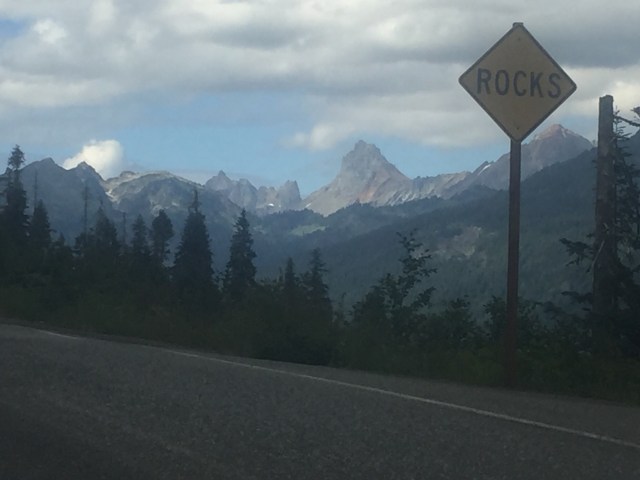
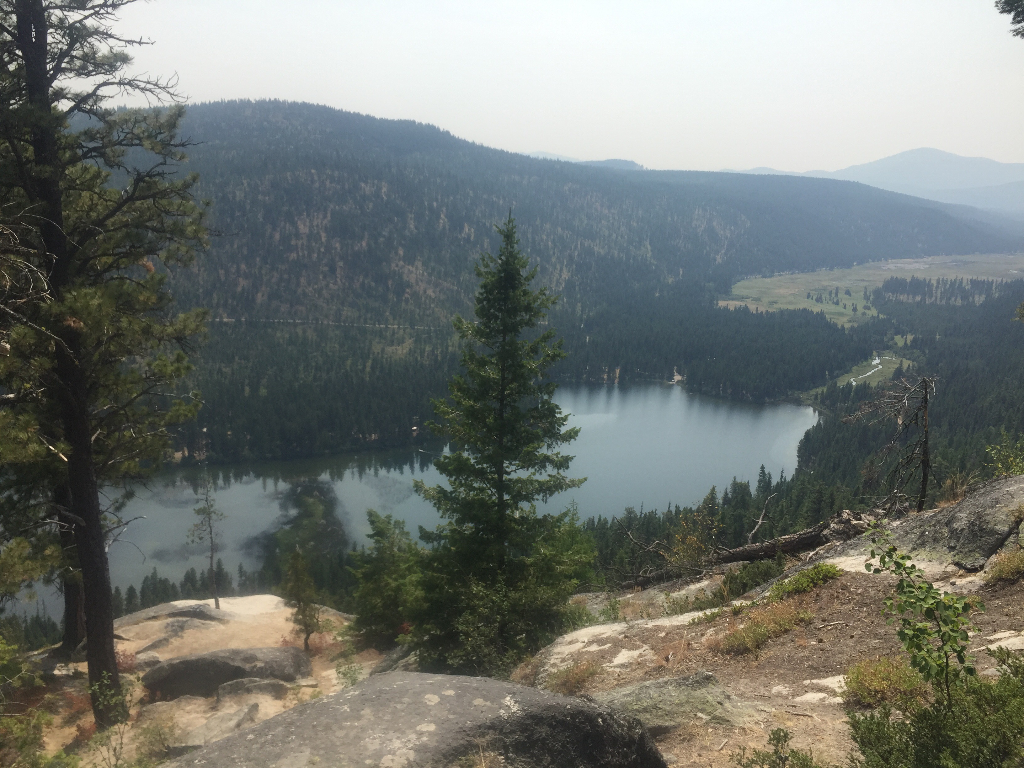
 We checked out the ski map before heading on. This type of skiing is so different then the East coast. We joined the Wild Goose trail for 1 mile. It had large rock steps as we joked the road would of been much quicker. We climbed higher and higher looking down at lakes and the Kulshan Range. We came to Austin Pass where we began a downhill reprieve. It was getting late in the evening as we began hiking a trail for the first time of the day named Lake Ann Trail.
 What a gorgeous hike with more stunning views and no sounds of trail. Our trail turned to the right onto Swift Creek Trail. Our trail was not nicely groomed as our feet were getting wet from the melting snow. It was just us again walking this trail. We were searching for a nice campsite along the trail. We ended up going much farther downhill then we had planned. I wanted a campsite with a mountain view for tonight, but you can’t always get what you want. It was beginning to get dark and I was worried we weren’t going to find anything. Luckily around one of the curves, we found a perfect site as darkness closed in.
 Aug 21
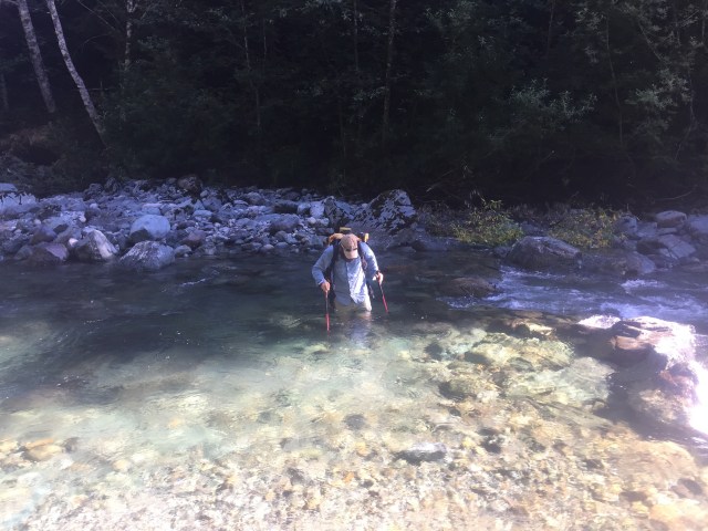
 The trail led us to an old decommissioned forest road. We passed by a dirty diaper as I realized we must be close to a paved road. We had an option to visit Baker Hot Spring, but we choose to stick with the Baker Lake Loop trail. The other option would of allowed us to cut many miles. We were told how beautiful the loop trail is and of the big cedar trees in that area. So we decided to do the longer route which is also the official trail. A paved road quickly turned to a dirt road. We passed lots of people set up along the water camping out. A few cars passed as well. There is also a Campground along the road. The strangest part was an abandoned BMW with busted windows next to the road. We took a break at the trailhead parking lot for lunch. We took advantage of the privy and trash cans.
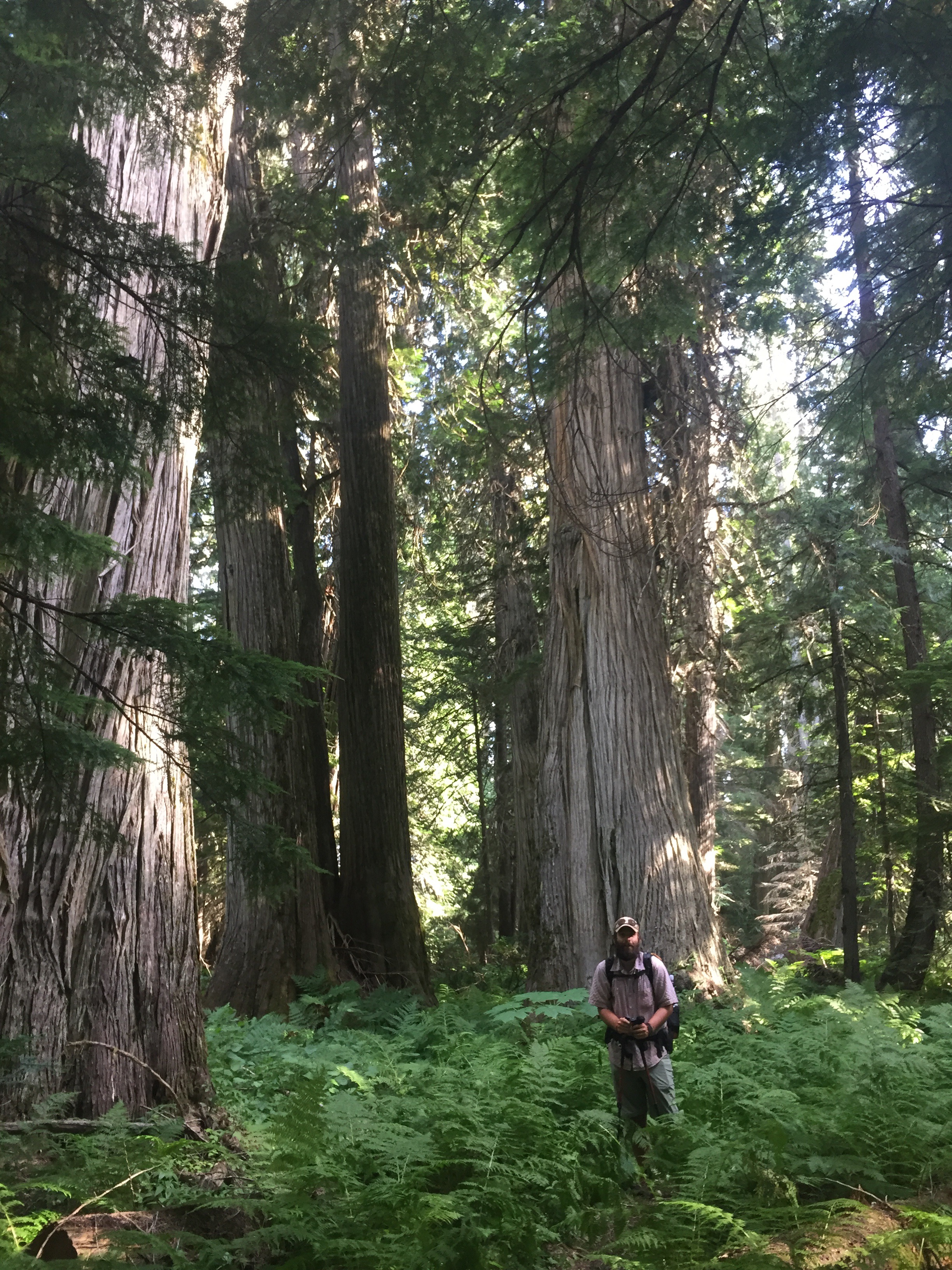
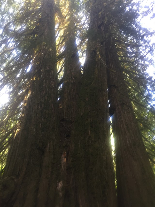
 We began walking along the trail. We walked past many large cedars during this section. Some of the biggest trees I have ever seen. They tell such a story and I like to imagine the thousands of people who have walked by them or lived among them many years ago. Do you ever wonder how many other people have enjoyed that same view of traveled the same footsteps you have? This thought and wonder often arises on my thru hikes. Also, I wonder if I will set foot here again or maybe the next generations of my family will.
  We crossed a huge bridge over a large river and continued hiking along Baker Lake. Our maps appeared to have the trail right along the lake, but the trail was above it most of the way with little access to the water for a quick swim like I had hoped for. The trail also had some ups and downs unlike the map. We enjoyed the serenity and views back at Mount Baker. We came to the first campsite to find a father and young daughter who didn’t seem to want company. So we continued along the trail.
 We are both drained physically as we dragged onward looking for a little spot to set up our tent. 4 long miles later we found a trail that dipped down to a campsite with a fire pit and bench. We watched the sky change colors and bonfires across the lake flicker. We sat outside as the sky got dark cooking dinner staring out at the lake. It was a long day of 25 ish miles. I enjoyed listening to the sound of water splashing on the banks.
  Aug 22
 We looked for campsites off the road to find evidence of a homeless community so we choose not to camp here. There were marks on guardrails that led to nice sites that were littered with garbage. So we made it almost to the rail trail. We were forced to stay at a Campground since it was our only safe option. We paid $20. I enjoyed a nice warm shower and was happy I had packed out a small shampoo. We played with a cat as we planned out the next section at a warped picnic table.
 We took our last break at a bench overlooking farmland. A man was working the field on his tractor. It was such a pleasant morning hike along the rail trail. We passed by a large river with hills that had been recently cut. We made our way into the big town of Sedro Woolley after 17 miles of walking. We found ourselves at a hotel around one. Since we had showered yesterday our next stop was lunch. We walked out our door and a few steps into a Mexican restaurant which hit the spot. We did our town chores of showering, laundry, cleaning gear, organizing maps, and relaxing. We still had extra food since we cut off a day or more by doing the rail trail.